
Travel spots in Lithuania
Natural monuments in Lithuania
Great boulders, river outcrops, eskers, and other Ice Age formations, almost always wrapped in folk legends.
Search covers all 116 places in this category.
This category on the map →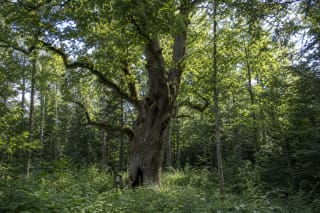
This pedunculate oak in Alkūnai Forest is 30 metres high and 2 metres in diameter, while its trunk measures 6.44 metres around at 1.3 metres above the ground.
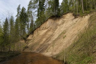
Alovė Exposure is an erosional bluff on the right bank of the Alovė River, south-west of Kaniūkai in Alytus District.
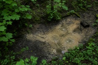
Antončikas Spring, also known as Samardotiškiai Spring and Verduolis, emerges at the foot of the right-hand slope of the Skroblus valley by Kapiniškiai.
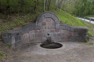
Ariogala Spring is at Pataklėliai by the Žemaičiai Highway, on a wooded slope of the Dubysa Valley.
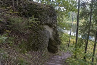
Ausiutiškės Conglomerate is a rare, state-protected geological natural-heritage object on the left bank of the Neris.
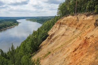
Balbieriškis Exposure is an approximately 40 m high and 1.7 km long geological natural monument on the left bank of the Nemunas in Nemunas Loops Regional Park.
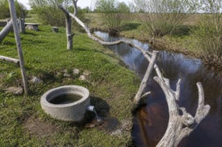
Baltasis Spring is a small upwelling karst spring in a meadow immediately beside the left bank of the Orija in Daujėnai Eldership.
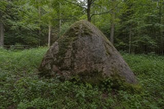
Barbora Boulder, also called the Mackeliškiai Boulder, hides in damp Butleriškiai Forest about five kilometres south of Troškūnai.
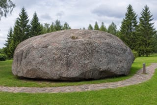
Barstyčiai Stone, also called Puokė Stone, is Lithuania's largest boulder: a roughly 680-ton Ice Age granite brought by a glacier to Puokė village in Skuodas…
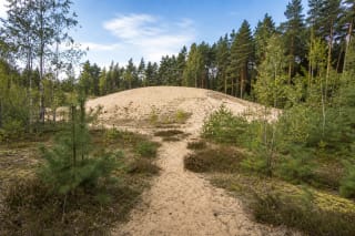
Bartkuškio Dune is an open continental sand hill in the middle of Bartkuškis Forest, in Jauniūnai eldership.
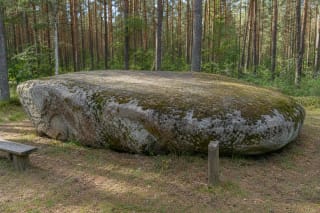
The Black (Love) Stone, also known as Žibikai Stone, Viekšniai Stone, or Great Stone, is a large flat boulder in the Žibikai Forest near Viekšniai.
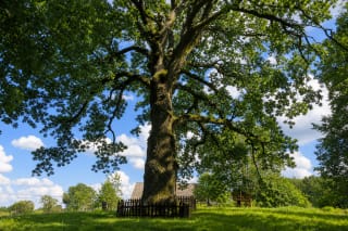
Bradesiai Oak is a common oak more than 500 years old in the southern part of Bradesiai village, in Sartai Regional Park.
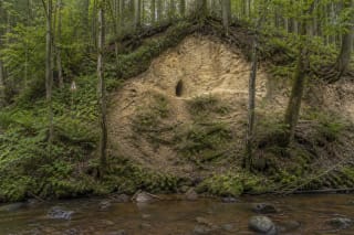
Čiobiškis Cave is a nine-metre erosional cavity with two openings in cemented sandstone on the slope of the Ryna stream.
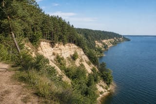
The cliffs of Kauno Marios Regional Park are not one single site but a system of reservoir-shore outcrops, conglomerates, ravines, and viewpoints where the…
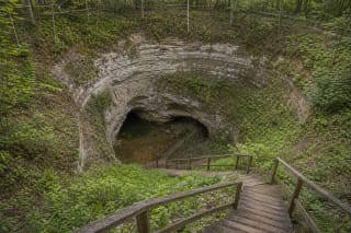
Cow Cave is the best-known karst sinkhole in the Biržai region: an almost circular collapse formed in gypsum and dolomite layers, with an underground cavity and…
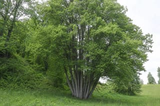
The Dabravolė Multi-Stem Lime Tree grows at the foot of Dabravolė Hillfort in Vištytis Regional Park.
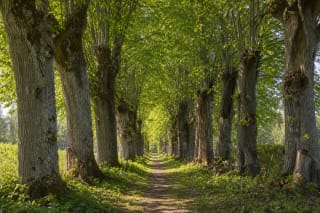
Daniliškis Linden Avenue is the most important surviving planted feature of the former manor park and a state-protected botanical natural heritage site.
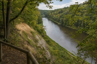
Dauginčiai Outcrop is a Minija-eroded cliff up to 22 metres high and 44 metres long, whose sediment layers record the glacial shaping of Samogitia.
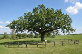
Daukšaičiai Oak is a state-protected pedunculate oak standing in open fields near Budavonė Forest in Vilkaviškis District.
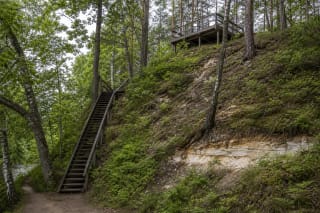
Daumantai Outcrop is a protected geological natural heritage site on the forested right slope of the Šventoji valley near Daumantai village in Anykščiai…
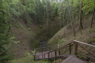
Devil's Pit is one of Lithuania's most striking hollows in Aukštadvaris Regional Park: a funnel-shaped natural monument about 40-42 m deep, with a marshy…
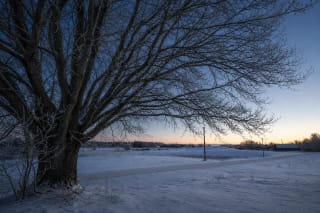
Domantonys Heart Oak is not a wooden heart sculpture or an officially documented natural monument.
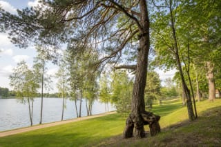
Druskininkai Thick Pine Tree is the exact Google Maps name for the tree now called the Historic M. K. Čiurlionis Pine by official local sources.
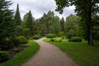
Dubrava Arboretum is a roughly 47.79-hectare dendrological collection near Girionys and Vaišvydava in Kaunas Lagoon Regional Park.
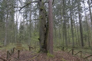
A common oak and Scots pine grew immediately beside each other in Dubrava Forest.
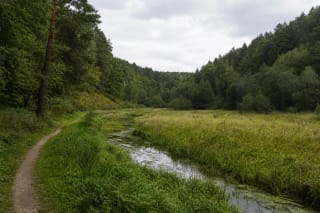
Dvarčionys Geomorphological Reserve protects a pronounced subglacial erosional valley on the north-eastern edge of Vilnius.
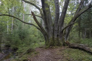
Elmė Six-Trunk Oak grows in Paelmio village, within the Elmė Landscape Reserve and the woodland setting of Anykščiai Regional Park.
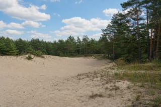
Gaidžiai Dune, also called Klonių Hill, is an inland sand dune in Dzūkija National Park on the edge of Marcinkonys.
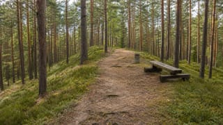
Gairiakalnis, at 96.1 m above Baltic Sea level, is the highest point in Kazlų Rūda Municipality.
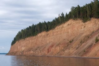
Gastilionys Outcrop is a state-protected geological heritage object on the right bank of Kaunas Reservoir.
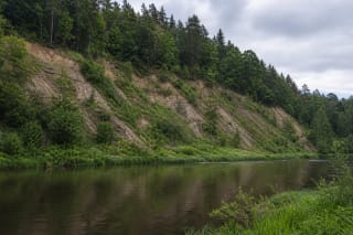
Geniai Outcrop is an active cliff 160 m long and 24-25 m high on the right bank of the Jūra.
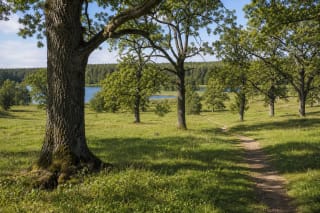
Ginučiai Oak Grove is a relict oak grove between Lakes Linkmenas and Asėkas in Aukštaitija National Park.
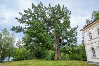
Glitiškės Oak is a state-protected pedunculate oak in the grounds of Glitiškės Manor beside Lake Širvys, in Vilnius District.
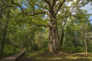
Gražusis Oak in Plauginiai Forest is a state-protected botanical natural heritage object in Dubysa Regional Park, in the woodland landscape by the…
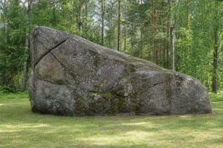
The Great Boulder of Dzūkija lies at the northern edge of Noškūnai Forest, south of Vangelonys.
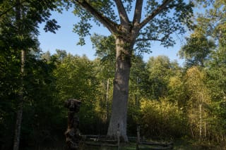
Great Gojus Oak grows in the Verknė forestry near Pakrovai in Stakliškės Eldership.
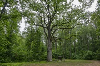
Great Širvintas Oak grows in Širvintas Forest, between lakes Dusia and Metelys in Meteliai Regional Park.
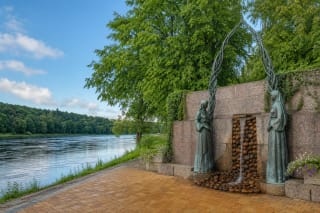
Grožio Spring is built into the wall of the Nemunas embankment in Druskininkai, about 20 m from the river.
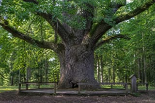
Grybiškiai Oak grows in Nemkamedžio Forest near Poškonys, within Dieveniškės Historical Regional Park.
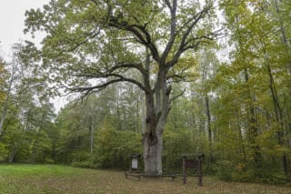
Hollow Širvintas Oak is a state-protected botanical natural heritage object in Širvintas Forest between Lakes Dusia and Metelys.
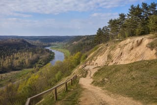
Jiesia Landscape Reserve, 447 ha and established in 1960, protects the Jiesia valley outcrops and erosional slopes near the Nemunas in Kaunas.
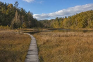
Jūkainiai Geomorphological Reserve in Raseiniai District protects remnants of washed moraine ridges characteristic of the Samogitian foothills.
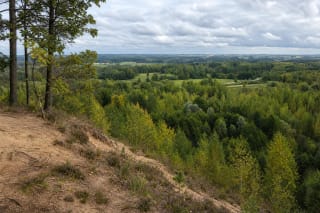
Juodeliai Cliff is a natural viewpoint on a sandy inland slope in Grandai Botanical Reserve, beside Juodeliai village in Kalvarija Municipality.
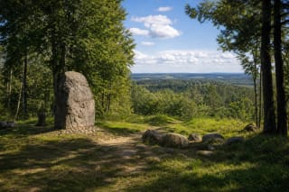
Juozapinė Hill, 292.83 m above sea level, was long considered Lithuania's highest place until nearby Aukštojas was measured as slightly higher in 2004.
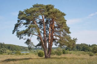
Kalnelis Multi-Trunk Pine is a state-protected botanical nature-heritage object in Kalnelis beside the Nevėžis.
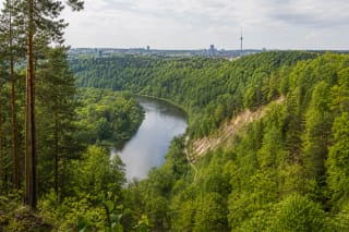
Karoliniškės Landscape Reserve is a 162-hectare protected area of the Neris Valley in Vilnius, opposite Vingis Park.
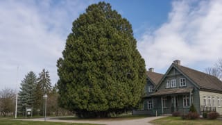
Kintai Great Thuja is a western red cedar (Thuja plicata) growing by the Kintai forestry office, considered the tallest thuja in Lithuania and one of the…
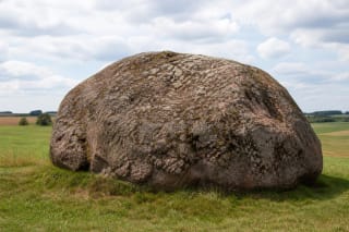
Kriaučius Stone in Vileikiai is Lithuania's third-largest boulder.
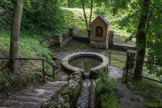
Krokulė, formally Lygamiškis Spring, rises in a damp hollow of the Šventoji valley near Užpaliai.
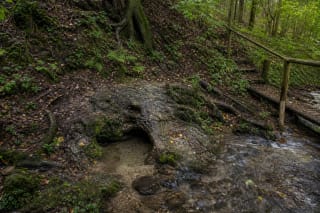
Laumės Pėda is a small but memorable Samogitian spring near Biržuvėnai, where water, a foot-shaped hollow, the Virvytė Valley, and a mythological name meet.
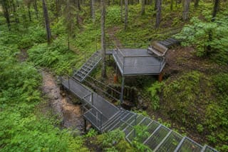
Lekėčiai Great Spring is a permanent erosional spring in a Rūdšilis Forest ravine near Lekėčiai.
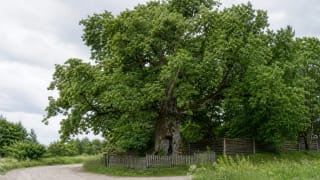
Liepa Motinėlė, whose name means Mother Lime Tree, grows in Braziūkai on the Suvalkija side of Kaunas District.
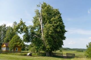
Lietuvio Lime Tree is a small-leaved lime more than 80 years old, growing on a private homestead in Margionys.
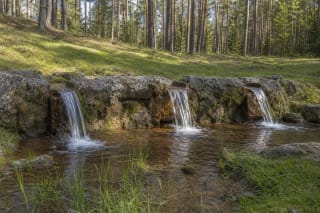
Lino Verdenė Spring emerges at the foot of a pine-covered slope on the eastern shore of Lake Sėtikis in Sirvėta Regional Park.
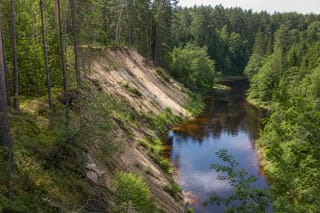
Mančiagirė Cliffs are not one wall of sand or a single viewpoint.
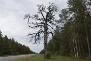
Marcinkonys Hollow Pine is one exact state-protected botanical natural heritage site, officially distinguished by compartment 127 and plot 29 of Marcinkonys…
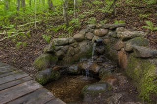
Medžiukalnis Spring rises in mixed woodland on a fluvioglacial hill slope between Lakes Baltys and Dringis.
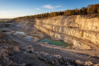
Menčiai Limestone Quarry in Akmenė District is one of Lithuania's most striking places of industrial geology, with Upper Permian limestone outcrops, artificial…
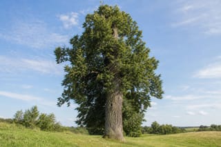
Meškėnai Lime Tree is a state-protected small-leaved lime in Meškėnai village, about 7 km from Marijampolė.
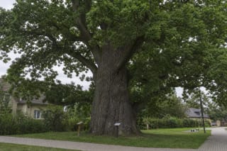
The Mikalojus Daukša Oak in Babėnai is a protected botanical heritage object regarded as the oldest oak in Kėdainiai.
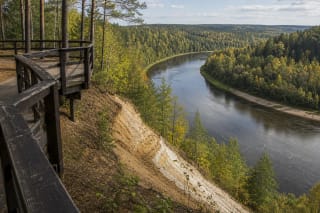
Mikieriai Outcrop, also presented as the Skardis viewing platform, is one of the most scenic places in the Šventoji River valley within Anykščiai Regional Park.
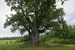
Mingėla Oak is a protected botanical natural monument in Plungė District, listed by VLE among the district's six botanical natural monuments.
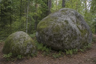
Mokas and Mokas's Son are two large boulders in Šaltupė Forest near Sukiniai, linked with legends about the Mokai family, old memory, and archaeological…
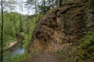
Ožkų Pečius is a conglomerate natural monument on the right slope of the Verknė in Nemunas Loops Regional Park, best understood as a fragile erosional bluff…
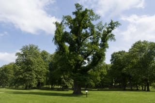
Paežeriai Manor Oak is a state-protected botanical natural heritage object in the estate's 18 ha park near Vilkaviškis.
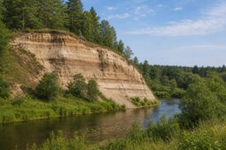
Pagramantis Outcrop is an erosional Akmena River cliff in Pagramantis Regional Park, 29-31 m high and 203 m long.
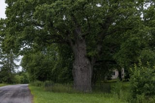
Pagryniai Oak grows beside the Šilutė–Pagryniai road near Stadiono Street.
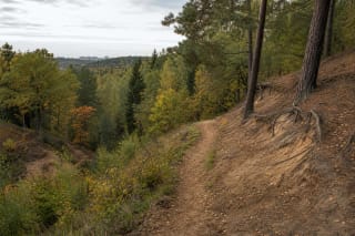
Panerių Erosion Hills Landscape Reserve is a protected area of about 7.9 square kilometres in Panerių Forest in southwest Vilnius.
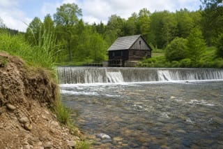
Two very different layers of heritage meet in the Papartynė valley: a watermill documented from 1867 with its dam, and an outcrop known for Jurassic fossils.
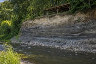
Papilė Outcrop by the Venta is one of Lithuania's most important geological natural monuments.
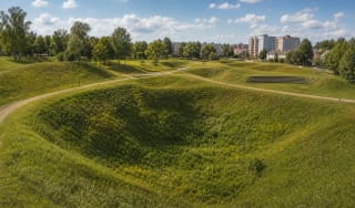
Pasvalys Sinkhole Park is an 8 ha town park begun in 2004 and opened in 2009 in the former Avižonis Pits.
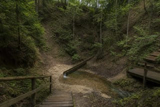
Pinyklos Mythological Spring rises at the end of a forest ravine near the Velniakampis Loop in Neris Regional Park.
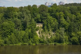
Plikakalnis Outcrop is a 58 m high geological natural heritage object extending for about 650 m around a bend of the Neris in Karoliniškės Landscape Reserve.
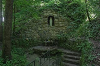
Plokščiai Grotto, commonly called Šventaduobė or the Holy Hollow, is a devotional site beside a natural spring in a wooded ravine of the Didžiupis valley.
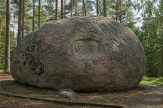
Puntukas Stone is one of Lithuania's most famous boulders: a glacier-carried rapakivi granite near Anykščiai, known for its Darius and Girėnas bas-relief and…
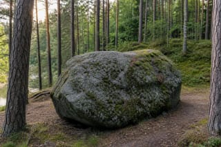
Puntukas' Brother, or Pašventupys Stone, is a large glacial boulder on the right bank of the Šventoji in Anykščių šilelis.
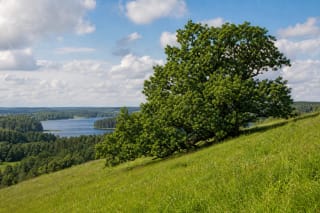
Puziniškis Oak is a solitary common oak at the southern edge of Puziniškis village, on a steep slope beside the isthmus between Lakes Asalnai and Asalnykštis.
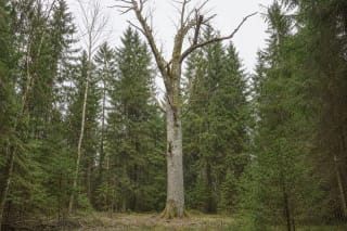
The Queen of Oaks grows in compartment 25 of the Dūkštai forestry district, in Drebulynė Forest within the Neris Regional Park landscape.
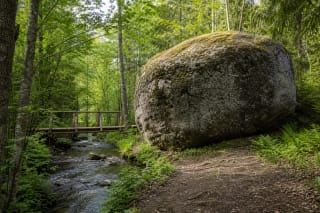
Rapolas Boulder is a large nature monument on the right bank of the Linkava in Krekenava Regional Park.
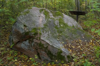
Red Stone stands in Norūnai Forest, near the top of a high wooded slope in the Balkasodis pine woods.
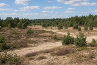
The Rūdninkai Forest Continental Dunes are not one sand hill but a broad landscape of postglacial wind-blown relief, heath, and open sand.
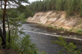
Sakiškės Bluff is a wooded Neris Valley outcrop near Skirgiškės, with a view towards the small Šiaučiai rapid.
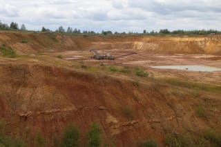
Šaltiškiai Clay Quarry is an active 127-hectare open-pit deposit near Draginiai, about 7 km northeast of Papilė.
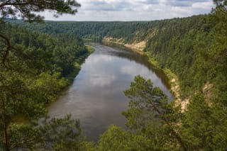
The scarps of Neris Regional Park form a system of river loops, terraces, outcrops, conglomerates, ravines, and viewpoints between Vilnius and Kernavė.
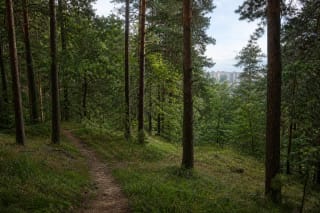
Šeškinė Slopes Geomorphological Reserve is a 28-hectare protected area in Vilnius, established in 1996 to preserve a fragment of the Neris valley's…
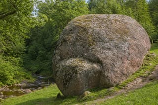
Šilalės Kūlis is one of Lithuania's largest boulders, a rapakivi granite stone in Skuodas District beside the Šakalė stream.
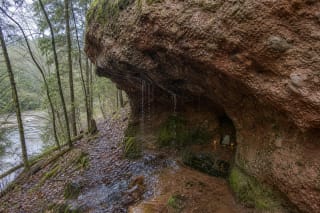
Skališkiai Rock is a rare conglomerate rock and cave-like niche near the right bank of the Neris by Liucionys, known for dripping 'cave tears' and a…
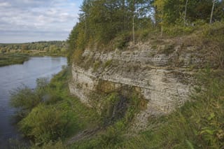
Skalių Kalnas Outcrop, also known as Stipinai Outcrop, is a state-protected Devonian dolomite exposure on the right bank of the Mūša in Pasvalys District.
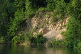
Skaudvilė Outcrop is a cliff shaped by the Ančia River on the northern edge of town.
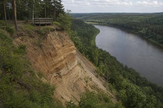
Škėvonys Exposure is a 31 m high, more than half-kilometre-long Nemunas bluff near Birštonas, revealing Ice Age layers and the Nemunas Loops landscape.
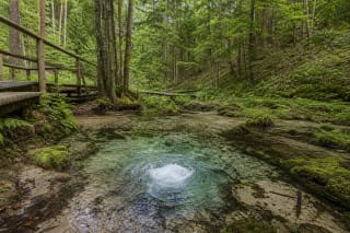
The Skroblus Springs near Margionys form the Skroblus source area with the Bobos Daržas spring, a 5.64 ha thermokarst hollow, cold clear water, and the 13 km…
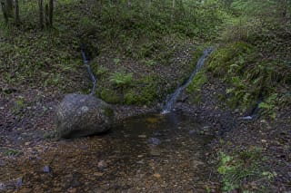
Skudutiškis Spring rises in a woodland clearing beside the state-protected Skudutiškis Stones and Spring Complex, about 700 metres north-west of the Skudutiškis…
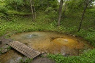
Šmitos Spring, also called the Truikinai Spring, rises at the bottom of a wooded hollow near Truikinai village.
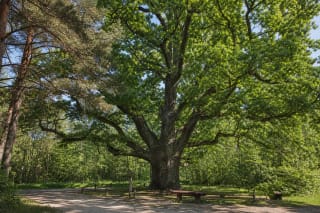
Stakai Oak is a state-protected pedunculate oak in the Stakai Landscape Reserve.
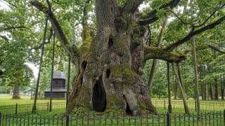
Stelmužė Oak is a pedunculate oak considered Lithuania's oldest oak, protected as a natural monument and botanical natural heritage object in Stelmužė village.
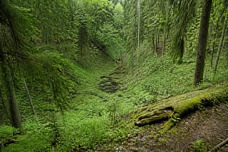
Strėva Sinkhole is a roughly 1.5-hectare thermokarst depression in Strėva Forest, created when buried glacial ice melted.
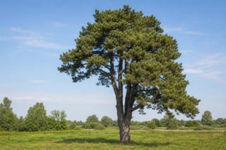
Švenčiuliškiai Pine is a state-protected botanical nature-heritage object in Krekenava Regional Park.
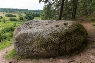
Švendubrė Devil's Stone is a 6.29 m long natural-heritage boulder in Raigardas Valley near Druskininkai, where a granite-gneiss block with carved cup marks…
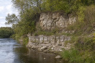
Tabokinė Exposure is a Late Devonian dolomite wall on the left bank of the Nemunėlis, close to the Latvian border, in Biržai Regional Park.
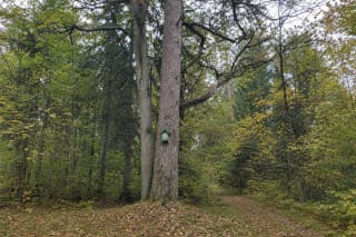
Trakas Pine grows in state-owned Trakas Forest near Straigiškė.
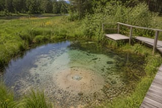
Ūla Eye is a Dzūkija National Park spring where water rises from deep layers and constantly stirs sand in a small suffosion hollow.
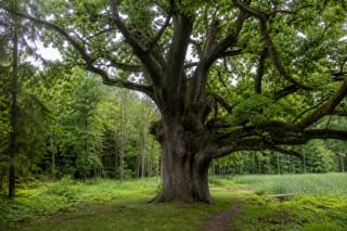
The Varniškės Oaks page is based on the officially confirmed Varniškės II Oak, a common oak more than 400 years old in Aukštaitija National Park, with a trunk…
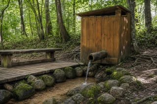
Verknė Oxbow Spring emerges beneath black alders only a few metres from the river's former channel.
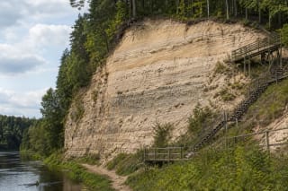
Vetygala Outcrop is an approximately 26 m high geological outcrop on the right bank of the Šventoji in Anykščiai Regional Park.
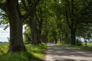
Vidkiemis Oak Alley is a state-protected botanical natural-heritage object in Jurbarkas District, in the landscape between Smalininkai and Vidkiemis.
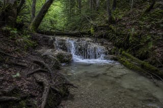
The Vilsos Stream Waterfalls near Žemieji Semeniukai are not one perfectly formed waterfall but a shifting sequence of natural cascades in a deep wooded valley.
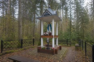
Višakio Rūda Sacred Spring is a small permanent but low-flow groundwater outlet on the right side of the River Višakis valley.
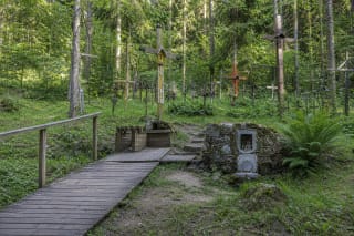
Vištytis Holy Spring is a low-flow groundwater outlet in Šilelis Forest on the eastern slope above Lake Vištytis.
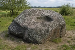
Vištytis Stone is one of Lithuania's largest boulders and an important mythological object in Vištytis Regional Park, with a bowl-shaped hollow on top known as…
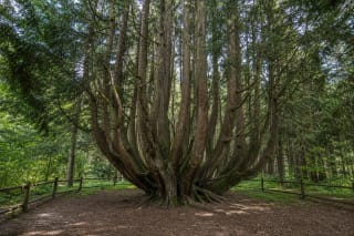
Witches' Spruce is an old multi-stemmed Norway spruce in Vilkyškiai Forest, Rambynas Regional Park.
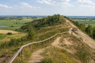
Žagarė Esker is an Ice Age ridge of sand, gravel, and pebble deposits in Žagarė Regional Park.
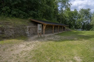
Žagarė Outcrop is not a natural river cliff but a U-shaped system of former dolomite-quarry walls on the northern side of Žagarė.
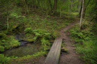
Žaisa Spring lies in the wooded edge of Kaunas Reservoir Regional Park, beside the Laumėnai route and Žaisa Bay.
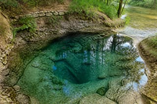
Žalsvasis Spring in Pasvalys is a karst mineral-water spring that emerged through a collapsed sinkhole.
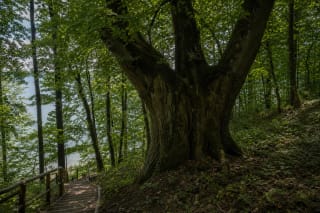
Žiegždrių Linden Tree grows in Žiegždriai village on the slope above Kaunas Lagoon in Samylai Eldership.
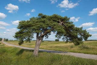
The Žvirgždėnai Pine Tree grows beside the road through Žvirgždėnai, about 3 kilometres from Daugai.