Trakai District Municipality
Trakai District
glaciokarst hollow and natural monument
Mergiškės hills forest, Aukštadvaris Regional Park, Trakai district
54.61200, 24.51600
45-90 minutes
May-October for the trail and forest view; in winter, visit carefully because slopes may be slippery
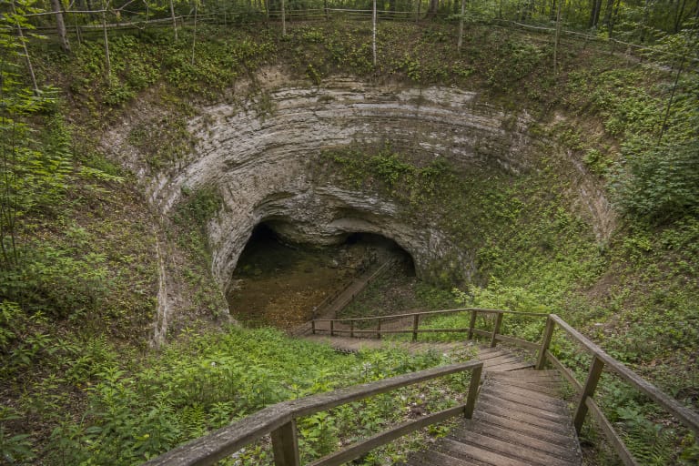
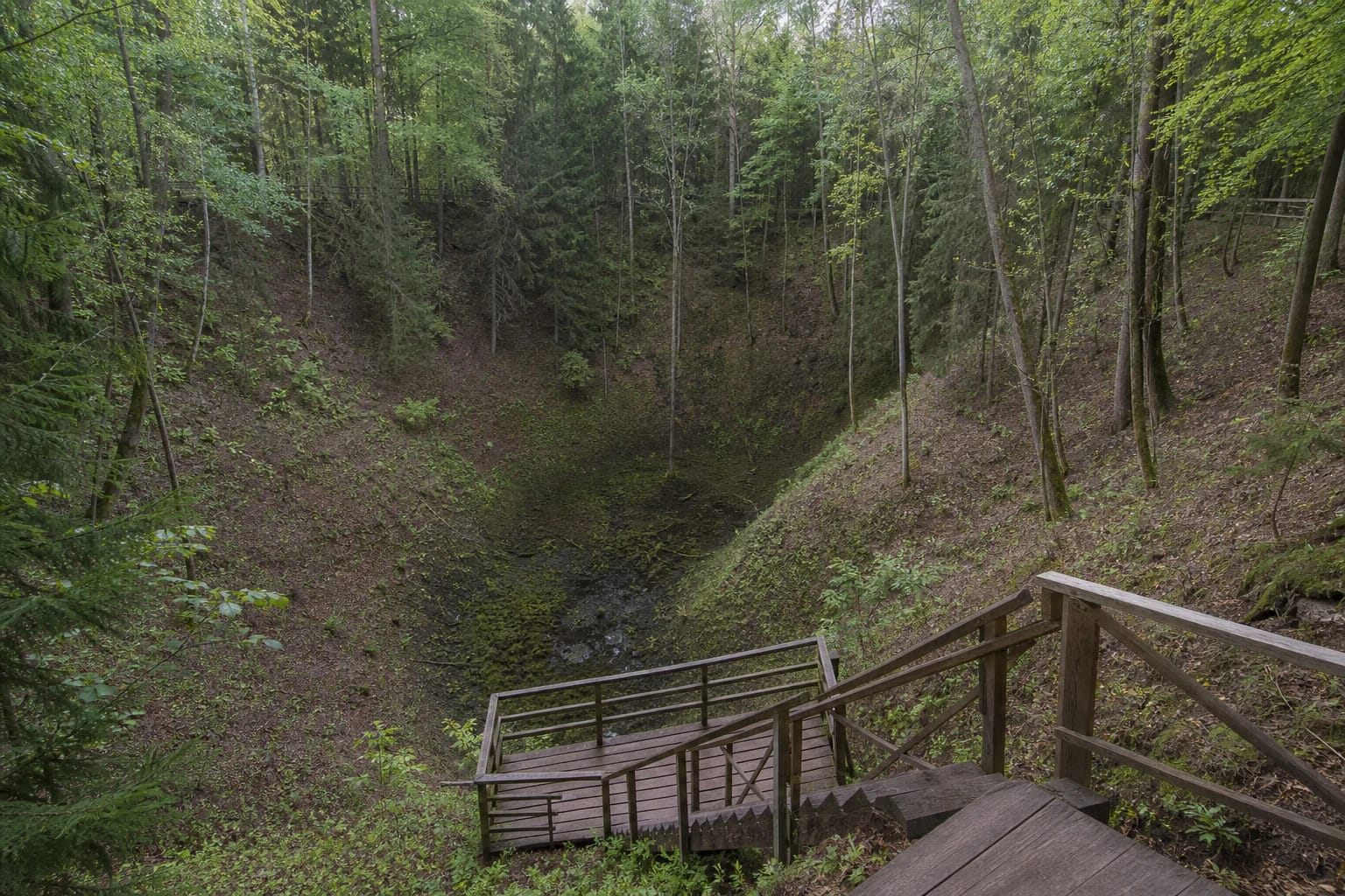
A Deep Forest Hollow near Aukštadvaris
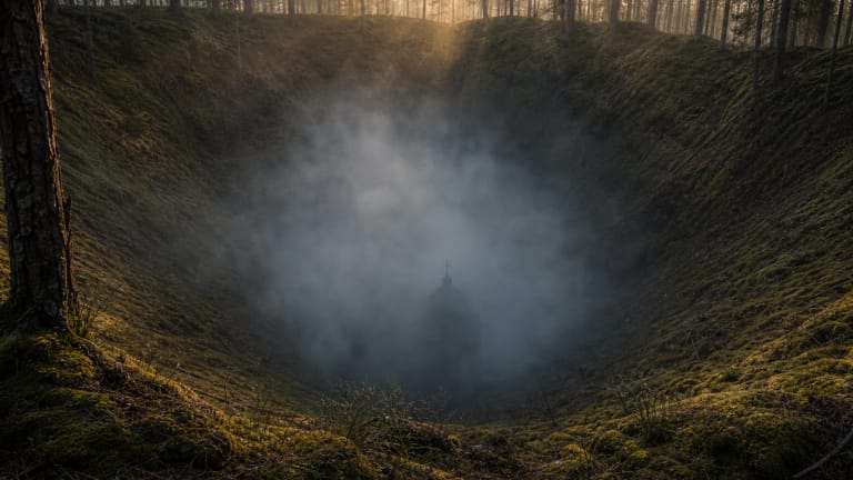
Devil's Pit lies in Trakai district, north of Aukštadvaris, in the Mergiškės hills forest. The name sets a mood, but the real value is the landform: a steep-sided, funnel-like hollow that looks unusual even in Lithuania's hilly terrain.
Saugoma.lt presents it as a visitor object in Aukštadvaris Regional Park. VLE states that Devil's Pit has been protected since 1964 and has held natural-monument status since 2000.
Size and Structure
VLE gives clear dimensions: the upper part measures about 220 x 200 m, the area is about 4.5 ha, and the depth is 40-42 m. The bottom is marshy, with a peat layer that may reach up to 9.5 m.
This is not an ordinary ravine or a man-made pit. Its shape, slopes, marshy bottom, and surrounding relief make it one of Lithuania's important glaciokarst landscape examples.
How Devil's Pit Formed
The main explanation given by VLE is the melting of a buried ice block about 10,000 years ago. When sediment-covered glacial ice melted, the material above it collapsed, leaving the deep funnel-shaped hollow.
Other hypotheses have been mentioned in sources, including erosional, suffosional, and a popular meteorite version. For visitors, the safest wording is that the main scientific explanation is glaciokarst or thermokarst, while a meteorite origin is not the main confirmed version.
Trail of Secrets and Viewpoints
Visitors orient themselves through the established trail and viewpoints. From above, the hollow's scale, steep slopes, and damp bottom are easiest to understand. The forest setting gives the place a closed, deep-landscape feeling rather than an open panorama.
After rain, paths and steps can be slippery, so wear practical shoes. With children, stay by rails and marked boundaries: the slopes are steep and sensitive to erosion.
Legends and Local Imagination
The name Devil's Pit is rooted in folklore. Deep, steep, dark places in Lithuanian oral tradition are often explained through devils, sunken buildings, or mysterious underground connections. Local stories mention a sunken church, devils, ghosts, and even animal bones supposedly emerging in nearby lakes.
Treat these stories as folklore rather than factual history. They explain the atmosphere of the name, while the origin of the object is best explained by geology.
What to See Nearby
Devil's Pit works well as a nature stop in Aukštadvaris Regional Park. It is best combined with hilly relief, lakes, and short trails rather than treated as a whole-day destination by itself.
If you want a less urban object after Trakai or Aukštadvaris, this hollow is a strong contrast to castles and towns: the focus is the shape of the ground and the stories attached to it.
Safe Visiting
Do not leave marked trails for the slopes, climb over barriers, or try to test the marshy bottom. The value of Devil's Pit is the landform itself, so trampling slopes or descending at random damages the site.
For photographs, use wider angles from the viewpoint. The depth is hard to capture, so including rails, the line of steps, or tree trunks helps show scale without needing risky compositions.