- Place
- Daumantai village, Kavarskas elderate, Anykščiai District Municipality
- Region
- Anykščiai District
- Type
- a stratotype exposure of Devonian, Neogene, and Quaternary deposits with a viewing platform
- Address
- Daumantai village, right bank of the Šventoji, Kavarskas elderate, Anykščiai District
- Coordinates
- 55.44568, 24.98512
- Visit duration
- 45-75 minutes for the upper platform and constructed stairway; longer if the entire lower trail is open and safe
- Best time
- a dry day from late spring to autumn; avoid sleet, ice, heavy rain, and periods of high river water
Daumantų atodanga, Daumantai Stratotype Outcrop
The map point marks the upper viewpoint, not the entire 27-metre slope
Daumantai Outcrop lies in Daumantai village, Kavarskas elderate, on the right-hand slope of the Šventoji river valley. The coordinates 55.44568, 24.98512 mark the upper visitor platform, so the metadata identify the pin as a viewpoint. This is a safer arrival reference than a point beside the water or at the foot of the exposure, but it does not mark every parking place, the foot of the stairs, or the centre of the whole protected feature.
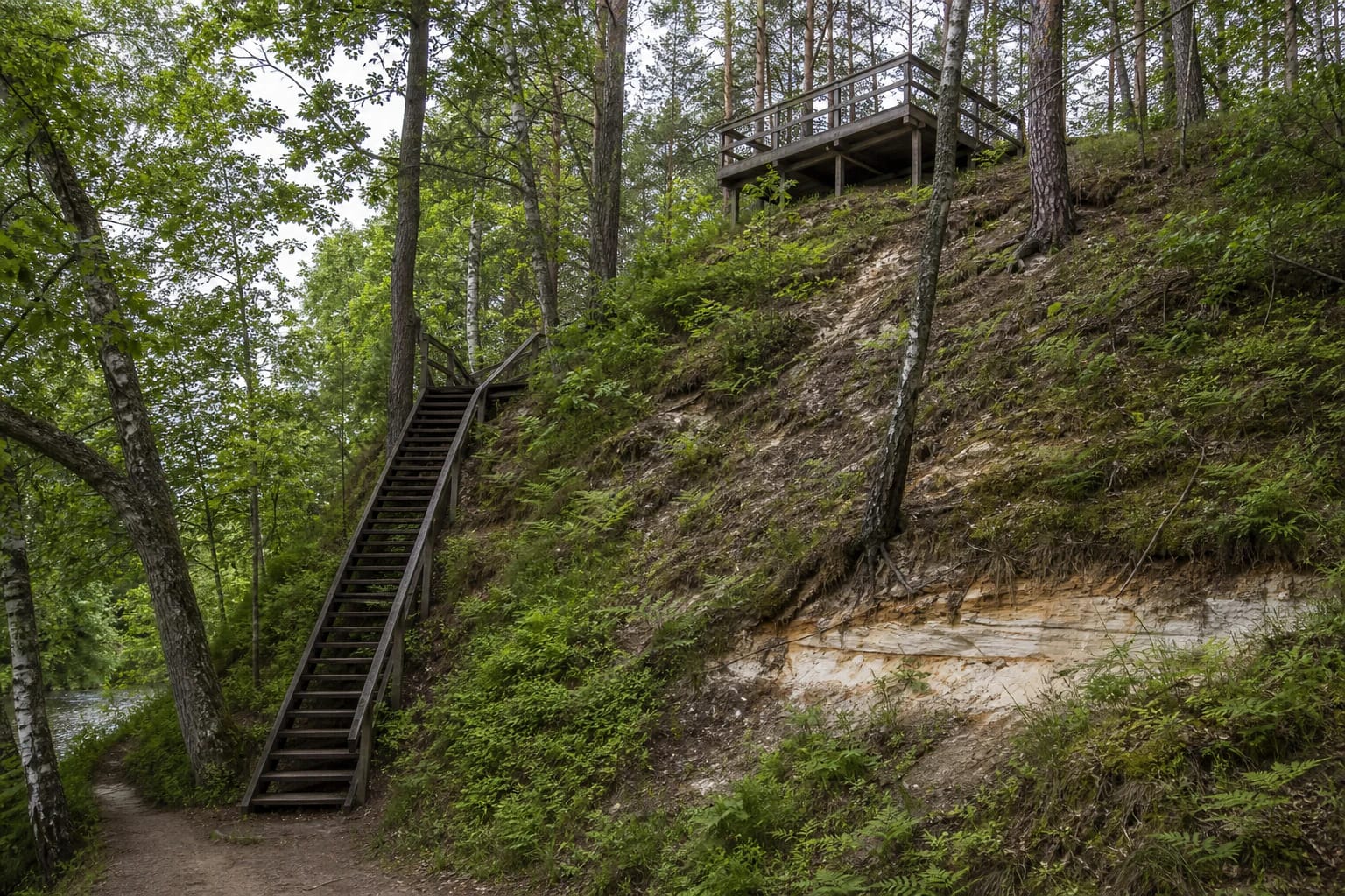
The outcrop is the forested valley slope itself and the patches of sediment exposed within it. The square wooden structure at the top is a low viewing deck on supports, not a freestanding observation tower. Nor should visitors expect a single bare cliff 27 metres high: pines, birches, undergrowth, and slope debris cover much of the site, while geological beds appear only in separate openings.
Official sources agree on the height but describe the length differently. The Saugoma.lt text calls it an approximately 300-metre-long steep slope, while a photograph of the official site sign on the same page gives 450 metres. The most cautious reading is that 300 metres describes the more prominent visitor-facing section and 450 metres the broader protected slope, not a continuously exposed wall of sand.
The section begins with Devonian sandstone and ends with glacial till
The Lithuanian Geological Survey field guide lists the beds from bottom to top. At the base is relatively well-cemented Late Devonian sandstone of the Šventoji Formation. Above it lies white and grey Neogene quartz sand of the Anykščiai Formation, interrupted by silt layers and preserving ripple marks.
The Quaternary preglacial Daumantai Formation follows higher up: horizontally bedded sand and silt containing lenses and interbeds of organic matter. Till deposited during the last glacial stage, known in Lithuania as the Nemunas glaciation, caps the sequence. Rocks and sediments from three geological periods are therefore present in one place, but their boundaries are not brightly coloured tourist stripes. Geologists distinguish them through composition, structure, and laboratory evidence.
The Daumantai Formation is a stratotype whose absolute age is still being refined
Daumantai is called a stratotype because this reference section helps define the preglacial Daumantai deposits and supports research into the boundary between the Neogene and Quaternary. The Lithuanian Geological Survey says researchers have used mineralogical, geochemical, and palaeomagnetic analysis as well as grain-size studies, plant macrofossils, and pollen.
The mineral boundary is associated with a marked increase in hornblende, feldspar, and garnet. Above it, pollen typical of Neogene taxodium trees, sequoias, and exotic pines disappears, giving way to evidence of cool-climate birches, pines, herbs, and later tundra vegetation. The slope is consequently an archive of environmental change, not merely a place to see white sand.
The Saugoma.lt visitor account gives an approximate range of 1.8-0.8 million years for the pre-Pleistocene and Pleistocene beds. In 2024, however, the Aukštaitija Protected Areas Directorate announced a new project using cosmogenic-nuclide methods to establish their true absolute age; researchers discussed possibilities from several hundred thousand years to perhaps 1-1.5 million years. The older range should therefore be treated as an earlier stratigraphic interpretation, not a final measured date.
The Šventoji exposes the beds, and two springs emerge at the foot of the slope
Erosion in the river valley keeps parts of the geological section visible, but it also continually changes them. Sand falls, plants cover some areas, and rain may uncover or bury small surfaces elsewhere. Beds can therefore look different in photographs taken in different years. Daumantai Outcrop is not a quarry and should not be confused with the industrial quartz-sand workings elsewhere around Anykščiai.
Saugoma.lt records two groundwater springs emerging at the foot of the slope that have been made accessible to visitors, as well as a landing stage. They belong to the visitor environment but are not the same feature as the upper platform. River level, deposited material, and trail condition can change seasonally, so an open, safe viewpoint above does not guarantee that every lower section is convenient to reach that day.
A ramp reaches the platform, while the steep stairs form a different level of visit
The accessibility entry updated by the Aukštaitija Protected Areas Directorate in 2026 describes a car park with compacted surfacing and a timber viewing platform with railings reached by a ramp. This makes the upper viewpoint accessible without using the steep stairs, although visitors should still check whether storms or maintenance have temporarily closed the ramp or approach.
A long wooden stairway and trails are used to descend the slope. This section is neither level nor step-free and is not suitable for wheelchairs. Anyone for whom accessibility is essential should plan around the upper platform and ask the directorate about current conditions instead of assuming that the foot of the slope can be reached independently. Official pages do not confirm a permanent toilet or drinking-water point at the site.
There are no posted opening hours, but the slope demands daylight and restraint
As of 21 July 2026, the official site entries published neither separate opening hours nor an admission charge. This is an open natural site, not a guarantee that every piece of infrastructure is always available. Storms, flooding, ice drift, or maintenance may close individual stair or riverside sections. Visit in daylight and check the Aukštaitija Protected Areas Directorate's notices before a long journey.
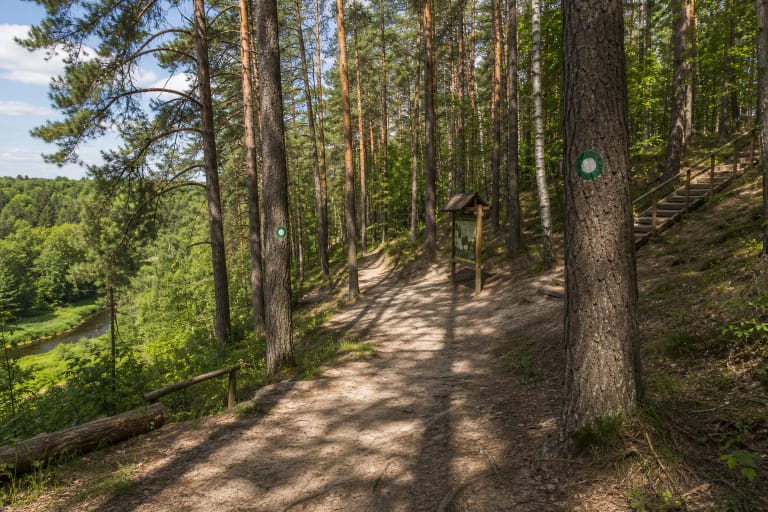
After rain, sand, wooden steps, roots, and leaves can be slippery; in winter, snow and ice obscure the edges. Hold the railings, remain inside barriers, and stay back from eroding margins. Do not climb the exposed face, dig or scrape its beds, collect sand, minerals, or fossils, or allow children to use the slope as a slide. The section retains its scientific value only when visitors leave it undisturbed.