- Place
- Vilkaviškis District Municipality
- Region
- Suvalkija
- Type
- captured low-flow forest spring with a timber walkway and a hill of crosses
- Address
- Šilelis Forest near Čižiškiai village, Vištytis eldership, Vilkaviškis District
- Coordinates
- 54.39926, 22.76985
- Visit duration
- 30-60 minutes for the spring and hill of crosses; about 1.5-2.5 hours for a complete circuit of the chosen Šilelis Nature Trail route
- Best time
- dry daylight from late spring to autumn; the timber walkway and wooded slope can be slippery after rain and in winter
Vištyčio šventasis šaltinis, Šventasis Šilo šaltinėlis, Stebuklingas Šilo šaltinis, Vištyčio ežero Šventas šaltinis, St John Spring near Vištytis
The exact spring lies hidden in Šilelis Forest, well above the lake
The exact Google Maps listing Vištyčio šventasis šaltinis marks 54.399256, 22.769849, place ID ChIJZzH0Oxs-4UYRLT2NZHJhxMI. Saugoma.lt publishes the rounded point 54.399, 22.770 about 30 m away, so both identify the same place in Šilelis Forest near Čižiškiai. On 15 July 2026, the Google card averaged 4.8 out of 5 from 86 reviews. This changing visitor score is not proof that the water is safe or medicinal.
The Lithuanian Geological Survey places the spring on the wooded eastern slope above Lake Vištytis, between Pavarteliai and Pakalniai. It emerges at roughly 198 m above sea level, about 240 m from the lake and approximately 25 m above its surface. The lake is therefore not the main view at the stone capture itself, even though its basin determines the direction and steepness of the slope.
Google categorises the site as a drinking-water fountain, but that is only a map classification. The official visitor-site list maintained by the Dzūkija-Suvalkija Protected Areas Directorate places the spring among other cultural sites, not among Vištytis Regional Park's natural heritage objects. This website groups it with natural monuments and geology to help readers find geological sites; that taxonomy does not confer the legal status of a state natural monument.
Groundwater emerges from sand, but its daily flow remains below two cubic metres
The spring formed where glacial deposits of the Vištytis upland are exposed by the lake slope. Rainwater filters through permeable glaciofluvial sand and appears where the relief cuts into the water-bearing layer. Geologists describe this gravity-fed outlet on a slope as a descending spring. The last ice retreated from the upland around 14,000 years ago, leaving the system of moraine hills, sandy deposits, and the basin of Lake Vištytis.
The Geological Survey measured a discharge of only about 0.015 litres per second in 2014, no more than 1.3-1.5 cubic metres a day. It is a permanent and relatively steady spring, but a very small one. Do not expect a waterfall, broad stream, or large open pool: the outlet carries a quiet trickle that can look even more modest in dry conditions.
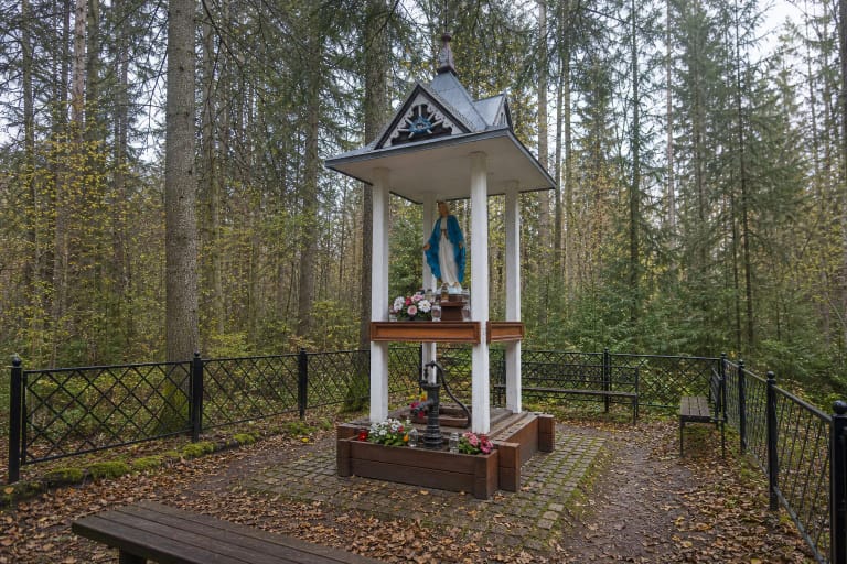
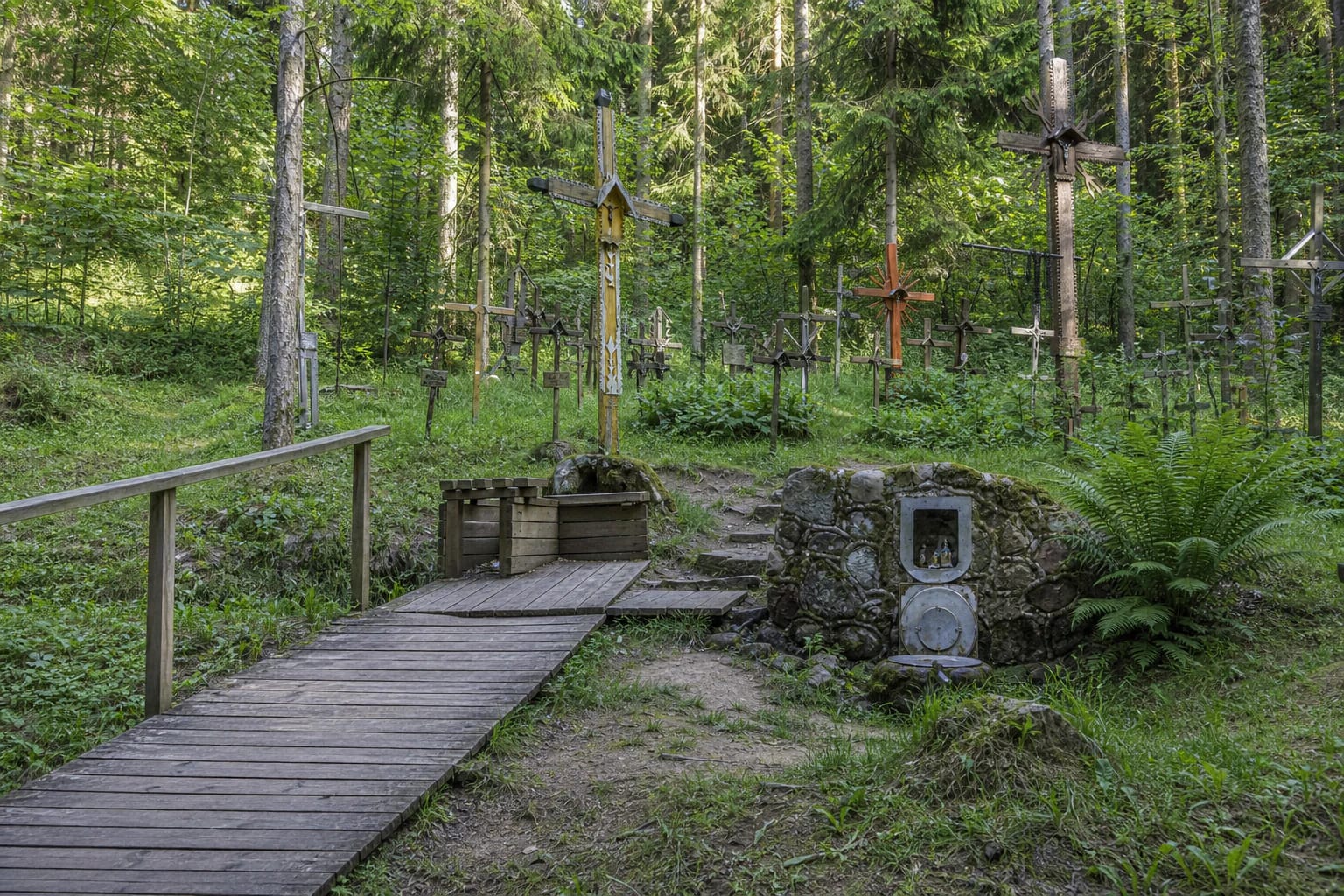
People captured the water within a fieldstone structure. A small overflow pipe releases it, and a longer ceramic drainage pipe of roughly 1.5 m helps carry water away from the capture. Timber surfacing, railings, steps, benches, and signs make the site easier to visit. The groundwater origin is natural; the complete structure visible today is not.
The 2014 chemistry describes one sample, not the safety of drinking the water today
On 5 June 2014, the water measured 7.5 degrees Celsius and pH 7.18 in the field; the laboratory pH was 7.52. Total dissolved minerals were 415 mg/l and total hardness was 4.93 milliequivalents per litre. Its dominant ions made the sample a calcium-magnesium bicarbonate-sulphate water.
The same 2014 table recorded nitrate at 2.18 mg/l and total iron at 0.76 mg/l. These figures provide a useful dated hydrochemical snapshot, but they do not show whether microbial contamination has developed more than a decade later or how downpours, snowmelt, animals, and the condition of the capture have affected the water. No newer public laboratory result confirming the present drinking-water safety of this exact spring was found while preparing the guide.
Clear, cold water, Google's category, and an old chemical analysis are therefore not enough to call the spring safe to drink. Before collecting water, look for the latest official result on the site board or the responsible authority's website. Without current confirmation, the safest choice is not to drink it, especially for young children and anyone at greater risk from infection.
The hill of crosses preserves a living tradition, but only oral accounts explain its beginnings
A green forest hill rises above the stone spring and carries many wooden and metal crosses of different sizes. Official park photographs show no single monumental structure; instead, a group of crosses has accumulated among spruce, pine, grass, and ferns. A small devotional niche is built into the capture, so visitors encounter a spring, a woodland stopping place, and a sacred site at once.
Saugoma.lt and Vištytis Regional Park both say that the exact beginning of cross-building here is unknown. Oral memories recorded from older residents suggest that the first cross may have stood before the First World War. One story says that the Virgin Mary appeared to a poor farmer in a dream and asked him to raise a cross, after which a neighbour helped him cut an oak. This is oral tradition, not a construction history supported by a surviving document.
Another local legend connects the loss of the water's miraculous power with a soldier of the Russian Empire who is said to have washed his sick horse in the spring. Stories that call the water holy, healing, or beneficial to eyesight explain the relationship between people and the spring, but they are not medical evidence. Respect an active devotional place: do not move crosses or offerings, keep naked flames away from forest litter, and never recast legends as verified events.
Today's Šilelis trail has 2.4 km and 3.4 km circuits, while a 7 km route survives in an older survey
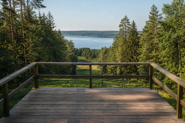
The current official page for Šilelis Nature Trail describes a circuit beginning and ending at an information board beside the Vištytis-Vyžainis road. The route divides at the Holy Spring. The 2.4 km short loop is allotted about 1.5 hours, while the 3.4 km long loop, which also visits Former Ski Slope Viewpoint, is allotted about 2.5 hours.
The Lithuanian Geological Survey's 2014 leaflet instead pairs a 2.4 km route with a 7 km route. That is an older trail description, so the 7 km figure should not be added to today's 3.4 km distance or advertised as a second currently marked long circuit. Waymarking may have changed; use the newest park page and signs on the ground before setting out.
For drivers approaching from Vištytis, the older geological description turns towards Varteliai at the windmill junction and follows the lakeshore for roughly 6.5-7 km to a sign for the Holy Spring. About 0.5 km of forest road remains between that turn and the short-stay parking area. Surface conditions and vehicle access can change, so obey current signs and never leave a car where it obstructs a forest road or other visitors.
The timber approach helps, but the steep slope and forest conditions prevent a fully step-free claim
Saugoma.lt confirms a vehicle stopping area and a timber-surfaced approach to the spring. It also says that a visitor with impaired mobility needs assistance from a companion. Boards and rails are helpful, but the incline, steps, moisture, moss, and possible unevenness mean that independent wheelchair access and a completely level route cannot be promised.
The official sources checked publish no separate admission fee, ticket office, or fixed opening hours for the spring. Google showed 24-hour access on 15 July 2026, but that does not guarantee lighting, daily surface inspections, snow clearance, or a safe forest road. Visit in daylight and check the park's latest information, the weather, and any temporary restrictions before making a special journey.
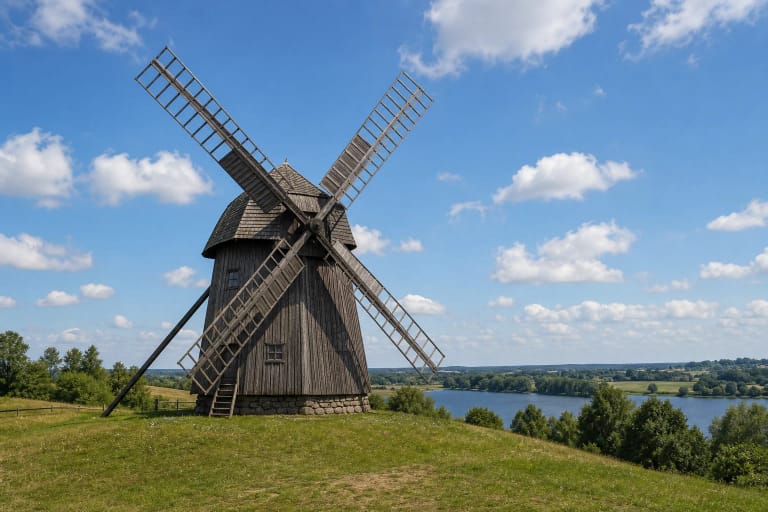
Allow 30-60 minutes to examine the capture, hill of crosses, and woodland slope without rushing. Wear shoes with reliable grip, take extra care on wet boards, observe the water without disturbing the stonework, and leave nothing at the spring. For a longer outing, combine it with Former Ski Slope Viewpoint, Vištytis Stone, and the windmill in town.