Kaunas, Kaunas District, and Kaišiadorys areas
Kaunas District
Reservoir-shore cliffs
54.84300, 24.04200
2-5 hours
dry weather and evening light above the reservoir
Kauno marių regioninio parko skardžiai
Cliffs as a Shoreline System
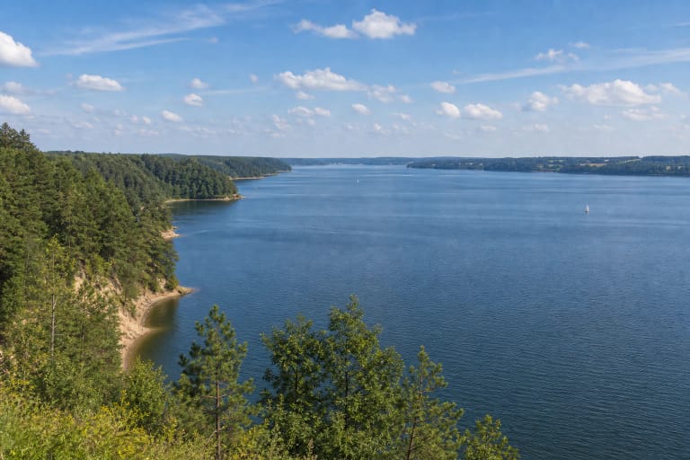
The cliffs of Kauno Marios Regional Park are not one address. They are the reservoir's shoreline slopes, outcrops, ravines, conglomerate locations, and viewpoints, where the history of the Nemunas valley is visible after the damming of the river formed Kauno Marios.
Because of that origin, the landscape is double: natural valley relief and a human-made body of water. This gives the cliffs strong visual impact, but also makes the slopes sensitive to waves, frost, rain, and visitor trampling.
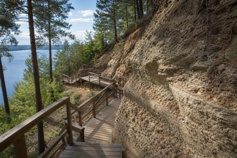
Žiegždriai Geological Trail
Žiegždriai Geological Trail is the best concrete route for understanding the cliffs up close. It shows the Kalniškiai conglomerates, Žiegždriai outcrop, ravines, varved clays, and the shore shaped by Kauno Marios water.
The trail is short, but it has stairs and is linear, so it requires more attention than an ordinary waterside promenade. It is especially suitable for visitors who want not only a panorama but also a clear geological explanation.
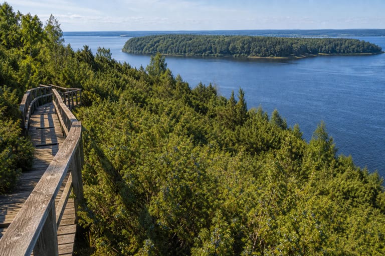
Juniper Valley and Viewpoints
The Juniper Valley Educational Trail shows another side of the Kauno Marios cliffs: dry-slope vegetation, reservoir panoramas, and slow walking above water. It is one of the most popular places to see how the reservoir changes the feeling of shoreline space.
If you have little time, choose one clear point - Žiegždriai for geology or Juniper Valley for panorama. If you want to understand the cliff system, set aside half a day and link several places.
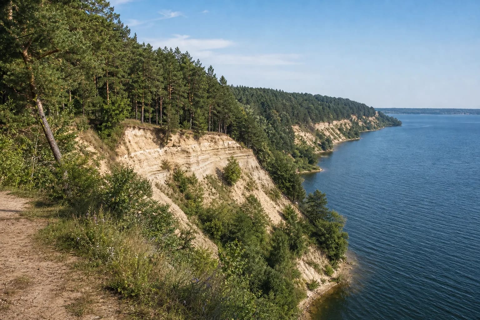
Geology and Erosion
Along the reservoir shores, Ice Age and post-Ice Age layers are exposed: clays, sand, gravel, and conglomerates. Water, frost, and rain constantly work on the slopes, so the outcrops are not a static display.
This ongoing change is part of the beauty of the place, but also the reason to stay on trails. Even one descent in a forbidden place can leave erosion scars that later expand.
How to Plan a Route
One viewpoint can take 30-60 minutes, but the Žiegždriai or Juniper Valley trail deserves 1.5-3 hours. Dry weather and evening light above the reservoir often give the best view.
After rain, stairs and earth slopes can be slippery. Wear suitable shoes, do not approach unstable edges, and do not try to descend to the water by unmarked slopes.