Anykščiai District Municipality
Anykščiai District
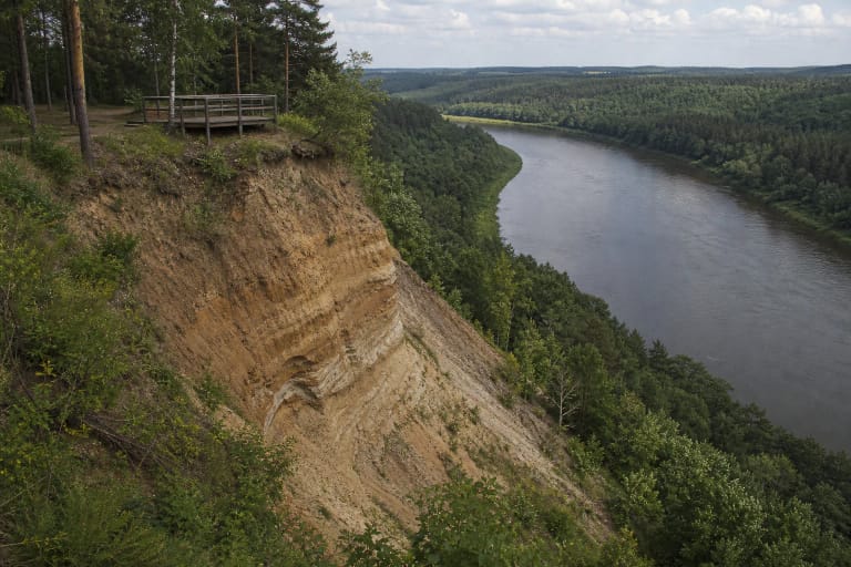
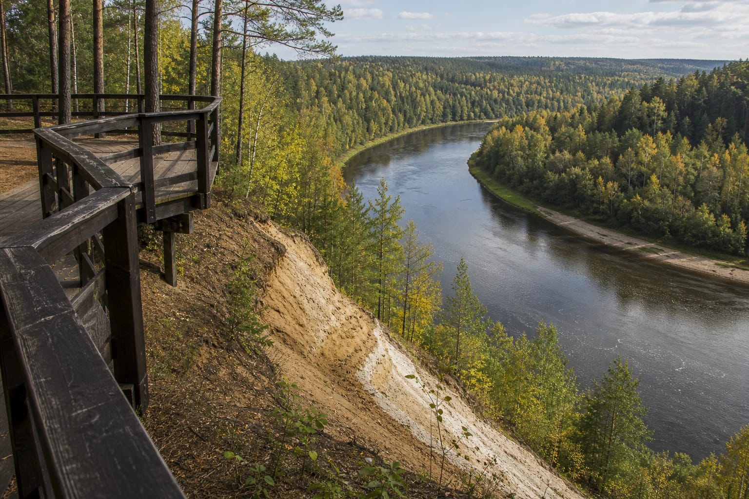
Šventoji valley outcrop and viewing platform
Mikieriai and Šilagaliai surroundings, Anykščiai District Municipality
55.66399, 25.19387
30-60 minutes
May-October for the Šventoji valley panorama; dry weather for easier access
Skardis viewing platform
A scarp above the bends of the Šventoji
Mikieriai Outcrop is often also presented as the Skardis viewing platform. It is a Šventoji River valley viewpoint in the landscape of Anykščiai Regional Park, where the main value is not one vertical rock wall, but the whole scale of the river bend and valley.
Local tourism catalogues connect this viewpoint sometimes with Šilagaliai and sometimes with Mikieriai village, and the coordinates differ slightly. For visitors, this is the same Šventoji valley area near Mikieriai in Anykščiai District.
Why Mikieriai is scenic
Local tourism sources call Mikieriai Outcrop one of the most scenic places in the Šventoji River valley. From the platform you can see one of the river's bends, while the relief helps explain how the Šventoji widened the valley and formed terrace surfaces here.
This is not a city panorama where the eye searches for towers or roofs. The main subject is river geometry: a broad bend, forest on the banks, the channel lower in the valley, and the sense of height from the scarp.
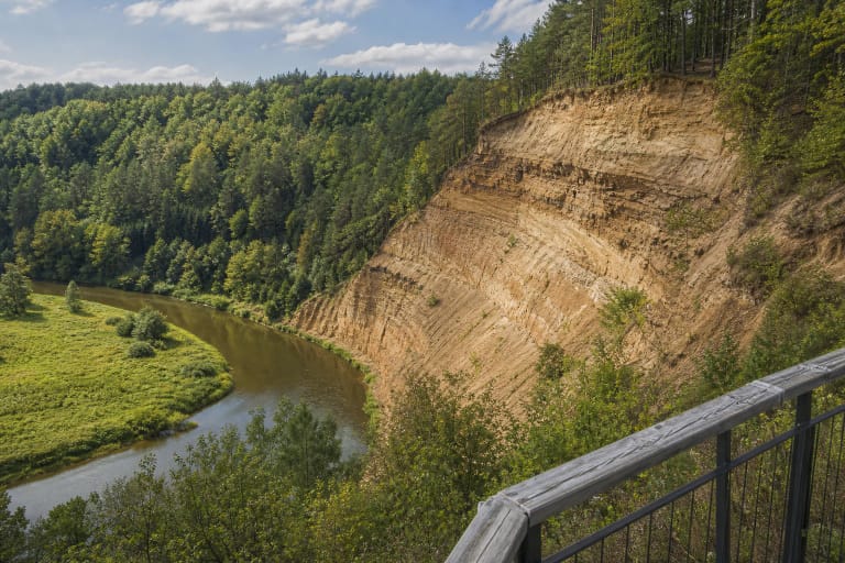
How the valley formed
Local nature descriptions state that the Šventoji valley here began forming about 10,000-12,000 years ago. After the last glacier retreated, the river cut through a nearly 20 m thick body of sandy and gravelly deposits near Mikieriai and reached the moraine loam beneath it.
Later, as the river shifted sideways, it widened the valley and formed terrace surfaces. As a result, the bends of the Šventoji near Mikieriai became broad and rounded, and in places they nearly meet.
Context of Anykščiai Regional Park
VLE states that Anykščiai Regional Park was established in 1992 and covers 15,486 ha, with forests, mostly pine woods, covering about 33 percent of its area. The Šventoji flows through the park with its tributaries Virinta and Varius, and there are 16 natural reserves, including Anykščių šilelis Landscape Reserve, which helps frame the whole region's relief and river valleys.
It is important not to confuse statuses. VLE separately lists the park's state-protected natural-heritage objects: Puntukas and Puntukas' Brother stones, and the Varius and Vetygala outcrops. Mikieriai Outcrop is not included in that formal list, so it is best described as a visited viewpoint and valley site, not as a separate natural monument.
The viewing platform
According to Anykščiai Regional Park Directorate information, the older wooden floor of the platform wore out over about 10 years, and in 2021 the infrastructure was renewed under Anykščiai District Municipality's Sustainable Resort Development Programme.
This practical detail matters because the visiting experience depends on the condition of the platform and access. Before travelling, check the latest park or local tourism information, especially after storms or the winter season.
A place for water travellers
The Šventoji bends near Mikieriai are broad and rounded, and water travellers often use this area. Campsites, rest stops, fire pits, and outdoor furniture are set up nearby.
Mikieriai Outcrop can therefore be experienced in two ways: from above, at the viewing platform, and from the river route. From the water, the height of the valley is easier to feel; from the scarp, the shape of the bend is easier to see.
How to visit Mikieriai Outcrop
A short stop usually takes half an hour, but it is better not to rush: give the view time, look at the river's direction, and notice where the terrace ends and the scarp begins. For photography, a wider frame with the river and forest works best.
Stay within the viewing-platform area, do not climb on slopes, and do not use unmarked paths down the scarp. Sandy and gravelly slopes can look firm, but they are easily eroded, and the safest view is from the built viewpoint.