- Place
- Joniškis District Municipality
- Region
- Joniškis District
- Type
- an Upper Devonian Žagarė Formation dolomite section exposed by a former quarry
- Address
- junction of Dolomito and Žvelgaičių streets, Žagarė, Joniškis district
- Coordinates
- 56.36495, 23.25706
- Visit duration
- 30-45 minutes; allow up to one hour to study the beds and the remains of a lime kiln
- Best time
- a dry day from spring to autumn, when the steps and former quarry floor are free of ice and snow does not obscure the rock beds
Žagarės atodanga, Žagarė Dolomite Outcrop, Žagarė Dolomite Quarry
Arrive at the former quarry, not the other Švėtė outcrop
The visitor point for Žagarė Outcrop is on the northern side of town, at the junction of Dolomito and Žvelgaičių streets. The Žemaitija Protected Areas Directorate publishes the coordinates 56.36495, 23.257057. They mark the site and provide a reliable navigation reference, but they are not a designated parking bay. Drive to the street junction, then follow current signs and do not take a vehicle down into the former quarry hollow.
Two places are easily confused. Žagarė Outcrop is the U-shaped end of a quarry opened by human extraction, while Švėtė Outcrop is a natural riverbank section about three kilometres downstream from town. The latter reaches roughly eight metres in total height, but that figure does not apply to the walls of the Žagarė quarry.
The municipality began a visitor-adaptation project in 2025 and schedules completion for the second quarter of 2029. A car park, new paths, viewing terraces, rest areas, and improved accessibility are project goals rather than a confirmed list of present facilities. Works may temporarily alter access or add barriers, so check current municipal and regional-park notices before travelling.
The 360-million-year-old Žagarė Formation began on a warm seabed
About 360 million years ago, during the Famennian Age of the Late Devonian, a warm saline sea covered what is now Žagarė. Carbonate sediment accumulated on its floor and eventually became dolomite. Geologists call this bedrock unit the Upper Devonian Žagarė Formation and abbreviate it D3žg. Although named after Žagarė, its rocks extend across a much broader part of north-western Lithuania.
Later glaciers scraped away some of the overlying deposits. When the final ice retreated roughly 13,000 years ago, sand, gravel, and glacial till remained at the surface. The ancient dolomite therefore lies unusually close to ground level around Žagarė, beneath only about 0.3-6 metres of Quaternary cover. The complete dolomite body at the former quarry is about 12 metres thick, although visitors see only its upper portion.
The Lithuanian Geological Survey describes pale-grey, locally greenish dolomite with fine to medium crystals. It is fractured in places, porous, and cavernous, so a close view reveals both horizontal bedding and the way individual layers weather at different rates.
About 200 metres of wall does not mean one continuous rock facade
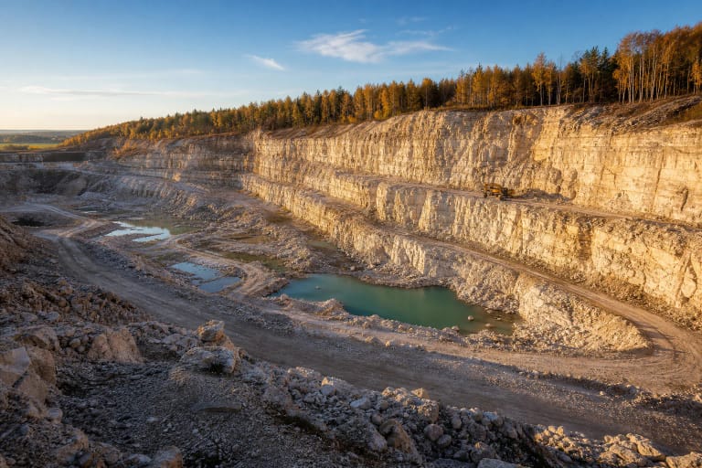
Current Saugoma.lt and directorate descriptions give a wall height of 2.5-3.5 metres and a combined length of about 200 metres. The Lithuanian Geological Survey separates the U-shaped end of the quarry into two side walls of roughly 60 metres each and an approximately 85-metre wall linking them beside Žvelgaičių Street. Their sum is about 205 metres, making 200 metres a reasonable rounded figure for the entire system.
Rock is not exposed equally around that perimeter. Turf and shrubs cover parts of the walls, while Quaternary deposits conceal others, leaving a shorter section that is easy to read. An older municipal planning document's figure of roughly 50 metres describes a shorter open stretch rather than contradicting the current measurement of the whole quarry-wall system.
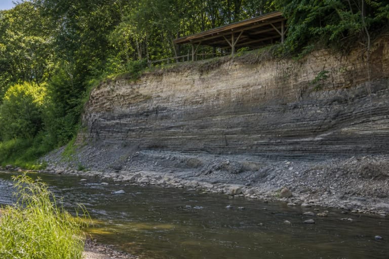
Look for uneven, knobbly dolomite plates about 5-25 centimetres thick. Clay and silt content increases deeper in the section, where the rock weathers more readily, while more resistant upper beds form small cornice-like ledges in places. Do not test them by hand or by climbing: porous, fractured dolomite can crumble.
From hand extraction and tepliai to a protected geological site
The Žagarė dolomite deposit has appeared in geological work since the nineteenth century. K. Grevinskas described it in 1861, E. Toll in 1892, and later researchers included J. Dalinkevičius and M. Kaveckis. A Lithuanian geological survey expedition explored the deposit in 1950 and investigated it further in 1953 and 1960, confirming that its dolomite was suitable for burning lime and building roads.
Dolomite was already being dug by hand for lime before the Second World War and was later also crushed for roads. Local quarry workers recalled loading rock into kilns fired with timber and tree stumps, where burning took four or five days. Žagarė residents called these lime kilns tepliai; the remains of one survive beside the former quarry.
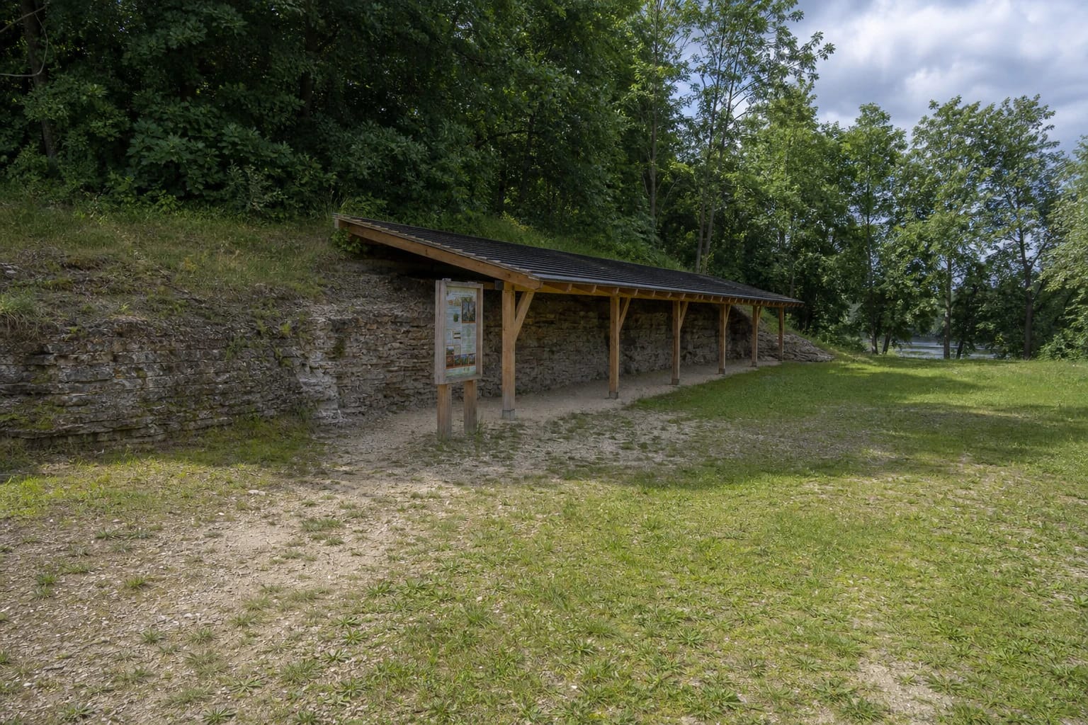
Extraction ended in 1964, and a municipal planning document records that the outcrop was declared a geological natural monument in the same year. It is now a protected geological natural-heritage object in Žagarė Regional Park. Timber steps, a shelter, and an information board were installed for visitors in 2012, although the current redevelopment project may change their condition or the route to them.
The Švėtė explains the local geology but did not cut the quarry walls
The Švėtė flows through Žagarė, and the same shallow Žagarė Formation dolomite can be seen in places along its bed and banks. This helps explain why the stone was readily accessible in town and became a material for construction and lime production. The wall visited at Žagarė Outcrop was nevertheless created by quarrying rather than by a river cutting a high cliff.
The separate Švėtė Outcrop lies about three kilometres downstream. At that natural bank, roughly two metres of Žagarė Formation dolomite appears at the foot beneath glacial till, while the complete slope rises to about eight metres. If a route leads to a mossy, spring-fed riverbank, do not transfer its dimensions, geology, or safety conditions to the former Žagarė quarry.
The Švėtė can rise in spring, leaving riverside paths and low parts of town wet. Official sources do not say that high water regularly floods the principal U-shaped quarry face, so that risk should not be overstated. When combining the outcrop with a riverside walk, however, never wade into a swollen channel and turn back wherever a path is flooded, closed, or fenced.
Surface, accessibility, opening information, and care for the rock
Timber steps descend towards the sheltered wall, while natural ground, grass, and gravelly patches cover the former quarry floor. Steps, turf, and damp dolomite can become slippery after rain, and snow conceals edges and uneven ground in winter. Wear footwear with grip and visit in daylight.
As checked on 20 July 2026, official site pages published neither site-specific opening hours nor an admission charge. That does not guarantee uninterrupted access: construction, weather, or protective barriers may temporarily restrict it. The official pages also did not confirm a permanent toilet, drinking-water point, or a specific current car park.
The existing steps and uneven surface mean the complete route cannot be presented as reliably accessible to a wheelchair or an independent wheeled visitor. Better access is planned in the 2025-2029 project, but its current state must be checked separately. At this protected site, do not climb the walls, chip or collect dolomite, touch unstable ledges, light fires near the kiln remains, or cross any barrier.