- Place
- Šakiai District Municipality
- Region
- Suvalkija
- Type
- a protected permanent erosional spring with a captured outlet and stair system
- Address
- Rūdšilis Forest beside the Lekėčiai-Mikytai road, Lekėčiai Eldership, Šakiai District Municipality
- Coordinates
- 54.99670, 23.51086
- Visit duration
- 30-60 minutes for the spring and ravine stairs; about 1.5-2 hours when visiting it as part of the roughly 4 km Lekėčiai Nature Trail
- Best time
- daylight from spring to autumn, with footwear suitable for a damp ravine and metal stairs; drink the water only after checking a current official test
Great Spring, Rūdšilis Forest Spring, Lekėčiai Spring
The exact map listing marks the ravine south-east of Lekėčiai, not the whole nature trail
The exact Google Maps listing is named Great Spring and gives the Lithuanian alternative Didysis šaltinis. It marks 54.9967047, 23.5108629 and place ID ChIJo5slKPDn5kYRpsfH3uQGM1o. The point lies in Rūdšilis Forest beside the Lekėčiai-Mikytai road, about 200 m east of the Lekėčiai forestry office used as a landmark in the Geological Survey's 2014 description. Its LKS-94 coordinates, 468716, 6095775, identify the same ravine.
On 15 July 2026, Google showed an average rating of 4.7 out of 5 from 397 reviews, categorised the site as a drinking water fountain, and listed 24-hour access. These are changing map details, and the category is not a certificate of water safety. The pin identifies the spring itself, not necessarily a legal parking place or the start of the full Lekėčiai Nature Trail.
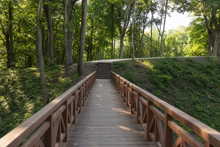
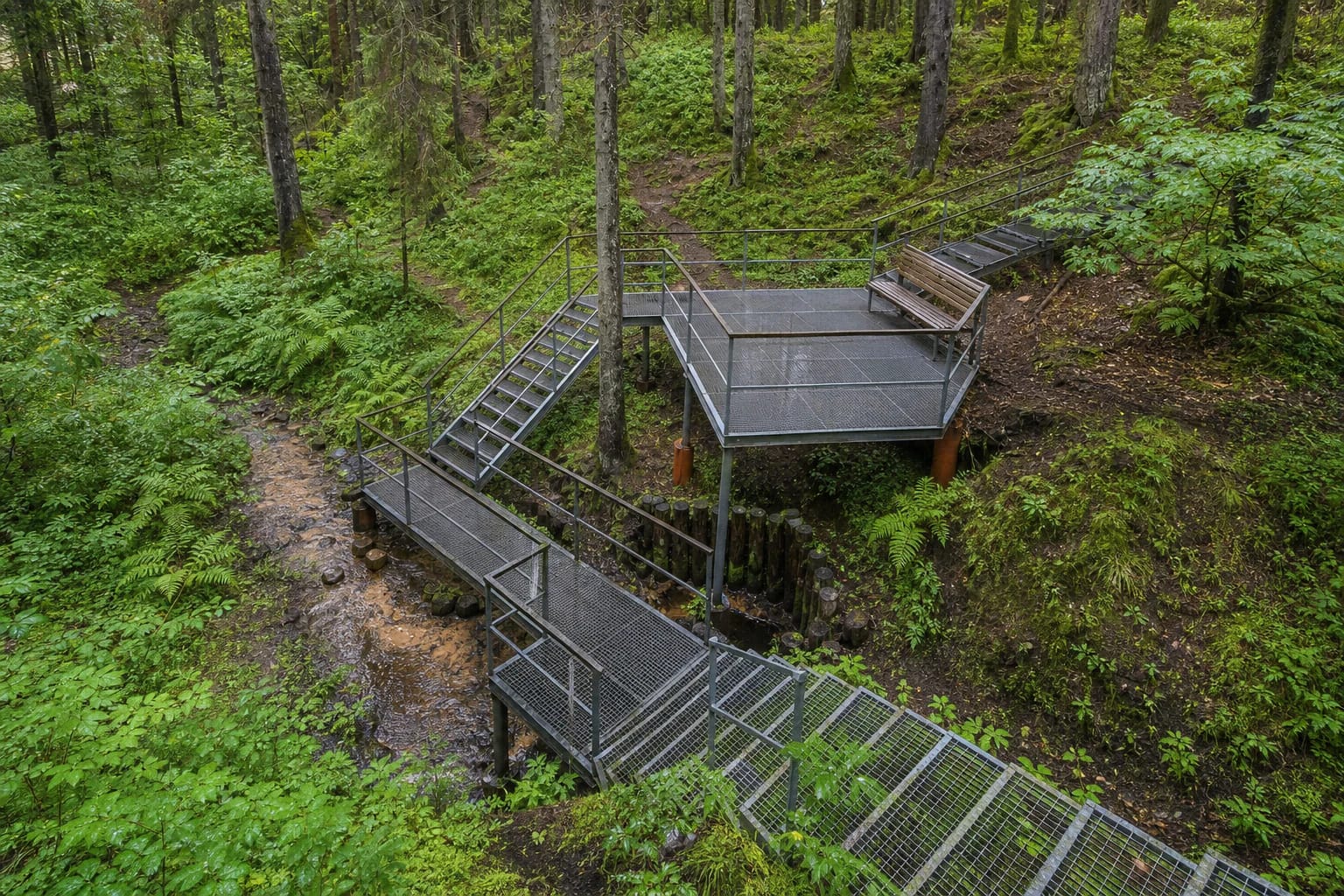
A photograph published by State Forest Enterprise in 2024 shows a steep wooded ravine, sections of grated metal stairs and platforms, a timber bench, a lower footbridge, a log-reinforced spring capture, and a narrow stream. In 2014, the Geological Survey still described wooden stairs and rails. The difference shows that visitor infrastructure has changed, so present signs matter more than an old photograph.
Several outlets on the ravine floor feed a tributary about 1.5 kilometres long
The Geological Survey classifies the spring as a falling, or erosional, type with a permanent regime. It emerges in a small cirque at the head of the ravine: groundwater seeps from several points along the bottom rather than one perfectly defined hole. A timber wellhead contains the highest outlet at the foot of the slope, and the water then gathers into a shared channel.
Great Spring is described as the longest and most water-rich spring in Rūdšilis, but the often-repeated figure of 1.5 km can be misleading. That is the approximate length of the stream beginning at the outlets and joining the Liekė as a left tributary, not the length of the point spring or the visitor trail. The Geological Survey did not assess discharge in 2014, so no defensible litres-per-second figure is available.
Flow can change over time. The geological account records local memories that the spring was once more abundant and steamed even in severe frost. This is testimony about an earlier condition rather than a systematic series of long-term measurements, so it should not be converted into an exact claim about the rate of decline.
The current legal instrument records the site as Lekėčiai Spring
The current consolidated order listing Lithuania's protected natural heritage objects includes Lekėčiai Spring among protected hydrogeological natural heritage objects. The common visitor name Great Spring and the legal name Lekėčiai Spring refer to the same place, so both are useful search terms.
The Geological Survey's 2014 document used the then-current description of a natural monument of local significance. This guide relies on the newer consolidated instrument for present legal status and keeps the older wording only as documentary context. The distinction matters because a protected site's formal name and legal classification can change.
Protection concerns more than the timber wellhead, stairs, or convenient collection point. The natural groundwater outlet, the ravine it has shaped, and the flowing water are the actual feature. Leaving the path can trample the wet floor, erode the slope, and contaminate the flow, so collect water only where intended, do not wash containers in the stream, and carry all rubbish away.
The 2014 chemistry describes one sample, not today's microbiological condition
Water examined on site in 2014 was clear, tasteless, odourless, and 7.9 degrees Celsius. Field pH was 7.39, laboratory pH was 7.80, and total dissolved minerals measured 234 mg/l. Its dominant ions made it a weakly mineralised, soft calcium-magnesium bicarbonate-sulphate water.
The same sample contained 0.43 mg/l nitrate, less than 0.02 mg/l nitrite, less than 0.03 mg/l ammonium, and less than 0.025 mg/l iron. These figures are useful for understanding the spring's hydrochemistry, but they are dated and do not establish its current bacterial condition. Clear, cold, pleasant-tasting water can still be microbiologically unsafe.
Lithuania's National Public Health Centre recommends both microbiological and chemical testing of water from captured springs and requires managers of public captures to arrange regular checks. Boiling can kill some microorganisms, but it does not remove nitrate or nitrite. No new, comprehensive public result for this exact spring was found while preparing the page, so the 2014 table is not treated as permission to drink. Check the latest official notice on site or from the responsible authority.
Laundry, wartime livestock, and a tar works belong to recorded local memory; rejuvenating water belongs to legend
The local history collected by the Geological Survey says people from surrounding villages were still washing laundry at the spring after the First World War. These washing places later disappeared. During the Second World War, residents hid livestock among dense nearby spruce stands to prevent it being taken. The episodes show that the ravine was once a working refuge rather than simply a recreation stop.
Another recorded trace is a rudimentary tar works that operated on the left slope before the Second World War, processing tree stumps until suitable local material ran out. The source gives neither precise years of operation nor dimensions of surviving structures, so visitors should not expect a securely dated factory ruin.
Local folklore assigns rejuvenating powers to the water. It is said that washing here brightens a young person's face and clears the mist from an older person's eyes. This is legend rather than a medical promise. Spring water cannot treat impaired vision or replace care prescribed by a clinician.
A short visit still requires a stair descent, while the longer circuit includes the whole Lekėčiai trail
Great Spring can be a focused 30-60 minute stop or part of a roughly 4 km circuit on Lekėčiai Nature Trail. State Forest Enterprise calls it the trail's main attraction. For the longer walk, find the current trailhead and follow present waymarking because the Google pin at the spring is not a route map for the whole loop.
Numerous stairs and platforms lead to the bottom of the ravine. No official claim of universal access was found, and grated metal treads, moisture, leaves, and the abrupt change in height may be difficult for visitors with limited mobility, small children, and dogs. After rain, use the rails, wear closed non-slip footwear, and never shortcut down the slope.
The official pages checked publish no separate admission charge, ticket office, or fixed opening hours for the spring. Google showed round-the-clock access on the verification date, but daylight is much safer and temporary forestry work or trail closures must be respected. Leave a vehicle only where legal, do not block a forest road, and read any current water-quality notice before filling a container.