- Place
- Antakalnis Eldership, Vilnius City Municipality
- Region
- Vilnius Region
- Type
- state geomorphological reserve protecting the pronounced Dvarčionys glacial valley
- Address
- 15 Barsukynės Street, Vilnius
- Coordinates
- 54.72200, 25.39500
- Visit duration
- 1-2 hours for a walk along a chosen edge of the reserve; longer for an unfamiliar route
- Best time
- a dry day from late spring to autumn; meadows, slopes, and informal ground can be wet after rain
Dvarčionių geomorfologinis draustinis, Dvarčionys Reserve, Dvarčionys glacial valley
The Dvarčionys valley begins on Vilnius's urban edge
Dvarčionys Geomorphological Reserve lies in the north-eastern part of Vilnius City Municipality, about 8 km from the city centre. The official Saugoma.lt point 54.722, 25.395 describes the reserve area, not a gate or visitor centre. The address 15 Barsukynės Street is therefore a navigation landmark, not a promise that a public route across the whole reserve begins there.
VLE describes the reserve as a pronounced subglacial erosional valley. In simple terms, it is an elongated lower landform between higher slopes, shaped by glacial and meltwater processes. The Dvarčionė stream runs along its floor, so the place is understood by walking along different parts of the valley rather than from one scenic overlook alone.
The reserve should not be confused with the nearby Dvarčionys pine recreation woodland, a separate pond, or attractions in Pavilniai Regional Park. They may fit the same outing, but their management regimes, access, and map points differ.
122 hectares protect an entire landform, not just woodland
Saugoma.lt states that the reserve was established in 1992 and covers 122 hectares. VLE gives 123 hectares, a rounded encyclopaedic figure rather than evidence of a different reserve. Both sources agree on the purpose: conserving the pronounced Dvarčionys glacial valley.
The reserve's value lies in the relationship between relief and water. The lower ground can include wetter meadows, shrubs, and stream sections, while the slopes carry drier woodland and clearer changes in elevation. The view depends on season, rainfall, and the access point, so the whole area should not be described as one uniform park trail.
The State Service for Protected Areas planning page lists Dvarčionys among the state geomorphological reserves and records approved boundary and management-planning documents. For visitors, this means that the protected subject is a scientifically important surface form, not simply a green space that can be reshaped by off-road driving or cutting into slopes.
What you see from a real access point
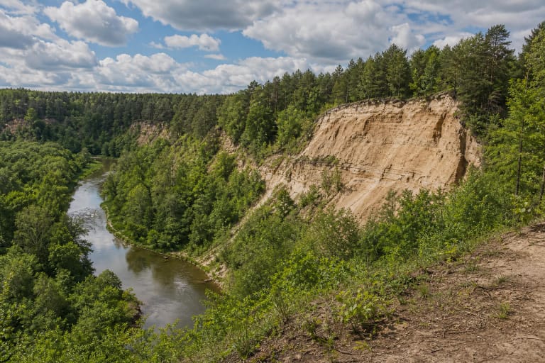
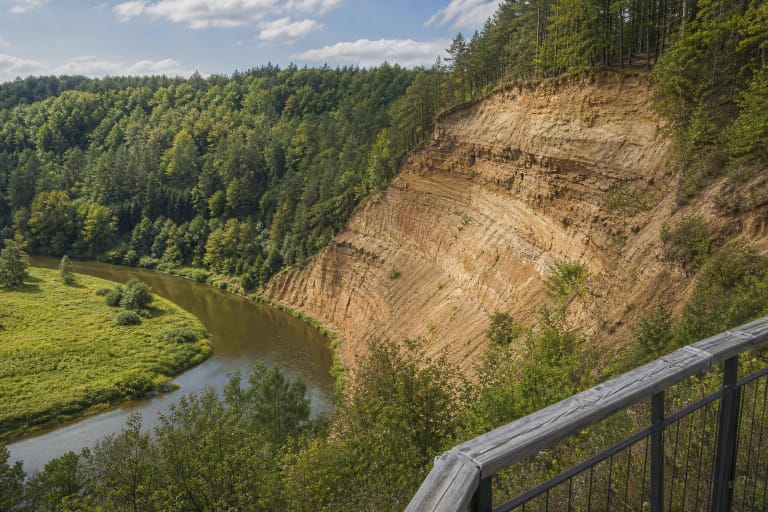
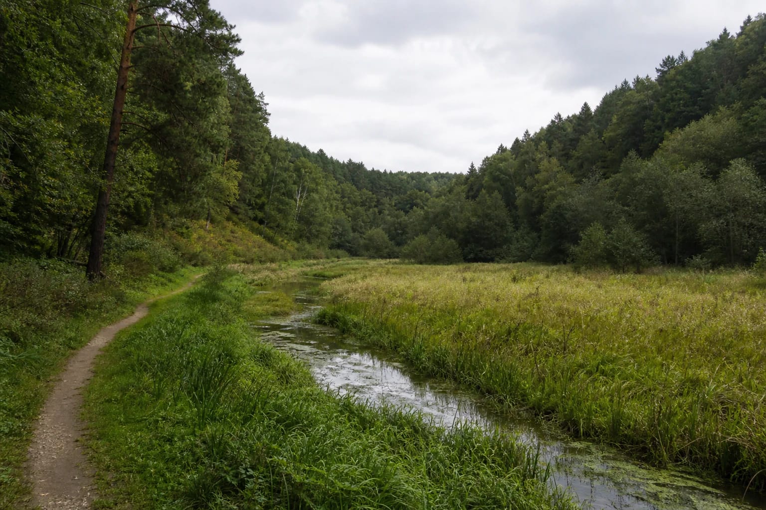
Real photographs of the reserve show a broad grassy valley floor, a narrow watercourse, and wooded slopes rising on both sides. Summer views include green deciduous crowns, pine silhouettes, and tall meadow grass with plants typical of wetter ground. It is a restrained natural landscape in which the relief matters more than built facilities.
The Dvarčionė is not a large tourist river or a bathing place. Its winding channel helps visitors read the damp valley floor and the landform's fall. Mud, tall grass, wet hollows, and fallen branches may occur beside the bank, so approach the water only where the selected route clearly permits it.
The reserve suits quiet nature observation, landform photography, and a short walk, but official sources do not publish one trail length, marked stops, or a guaranteed viewpoint. If you want a defined route, choose a public road or existing path in advance rather than planning to follow the entire reserve boundary.
Visiting begins with careful map reading
The map point is marked as a reserve-centre coordinate because 54.722, 25.395 is not a gate, car park, or exact entrance. Before setting out, check that the road you choose is public, that the final section does not cross private land, and that there is a lawful place to leave a vehicle.
The official sources checked publish no separate reserve ticket, desk, visitor centre, or fixed opening hours. That does not mean visitors may drive into every meadow or forest track: protected-area rules, road signs, landowner rights, and temporary restrictions apply whether or not a blue map marker is visible.
Dry weather makes walking easier, but after rain the natural ground, valley meadows, and slope edges can be slippery. Wear shoes with reliable grip, avoid unfamiliar slopes after dark, and allow for weak phone reception or navigation uncertainty in the lower valley.
Protect the reserve's quiet as well as its relief
The value of Dvarčionys Reserve is more than a photographic backdrop. Do not drive off-road, widen ruts, dig channels, damage slopes, or cut across wet meadows. Such actions can harm precisely the valley landform for which the area is protected.
Keep away from soft stream banks and do not create an improvised fire site. Leave no litter, do not pick plants, and keep dogs from disturbing wildlife and other visitors. If protection or prohibition signs are present, follow them even when an older photograph shows the area as freely accessible.
The reserve is best understood as one relief system rather than a search for a single marked viewpoint. From lawful paths, observe the depression, the direction of the Dvarčionė stream, and the wooded slopes, but do not make new tracks across wet meadow.