- Place
- Juodeliai, Kalvarija Municipality
- Region
- Suvalkija
- Type
- sandy inland cliff and natural panoramic viewpoint in Grandai Botanical Reserve
- Address
- Juodeliai village, Kalvarija eldership, Kalvarija Municipality
- Coordinates
- 54.38695, 23.10456
- Visit duration
- 30-60 minutes for the panorama and natural slope setting, provided local signs allow safe access
- Best time
- a clear, dry day in spring or autumn, when lighter foliage reveals more of the rolling landscape; keep away from the rim after heavy rain, thaw, or icing
The municipal map fixes the exact Juodeliai Cliff viewpoint
Kalvarija Municipality's draft visitor-attraction list of 2023 names Juodeliai Cliff separately and places it in Juodeliai village. Grandai Botanical Reserve and Papiliakalniai Hillfort appear as separate entries in the same list. On the interactive map still linked by the municipality, the cliff marker is at 54.3869516, 23.1045646. Its description confirms both the outlook over rolling Sūduva and the site's position within Grandai Botanical Reserve, established in 1992.
This page classifies the coordinate as a viewpoint because the municipal marker sits on the panoramic upper rim. It is not a mapped car park, the end of a public road, the beginning of steps, or a geometric centre for the whole scarp. The marker identifies the site for navigation, but it does not authorise driving along the final unpaved tracks or crossing private land.
The official visitor list assigns no Cultural Heritage Register code to Juodeliai Cliff, while Saugoma presents the surrounding botanical reserve rather than a separate state geological heritage object. It is accurate to call this a municipally mapped cliff and natural viewpoint; it would be inaccurate to invent a KVR code, geological natural-monument rank, or formally designated outcrop status.
Grandai is protected chiefly for plants, even though the cliff provides its strongest panorama
Grandai Botanical Reserve was created in 1992 and covers 185 hectares according to Saugoma. Kalvarija Municipal Public Library locates the wider reserve roughly 3 kilometres north-east of Liubavas and around Papiliakalniai, while the municipality's map places Juodeliai Cliff inside it. The differing village references are compatible: the reserve spans a broad landscape, whereas the cliff has an administrative address in Juodeliai.
The reserve protects sites occupied by rare and threatened plants. Officially listed species include bastard balm, large-flowered hemp-nettle, wood mint, branched St Bernard's-lily, white water-lily, long-headed clover, and Russow's marsh orchid. The library also stresses scientifically valuable surviving broadleaved-woodland communities. These records describe the entire 185-hectare reserve, so none of the species can be promised at the viewpoint or in a particular season.
Botanical-reserve status is not the blanket access prohibition applied to a strict nature reserve. Lithuania's protected-areas authority explains that people may visit reserves without damaging their protected values. At Juodeliai, that means following existing traces, not cutting shortcuts through vegetation, leaving flowers unpicked, avoiding digging, and keeping vehicles off the loose rim.
Pale sand fits the glacial Sūduva setting, but no formal geological section is published for this cliff
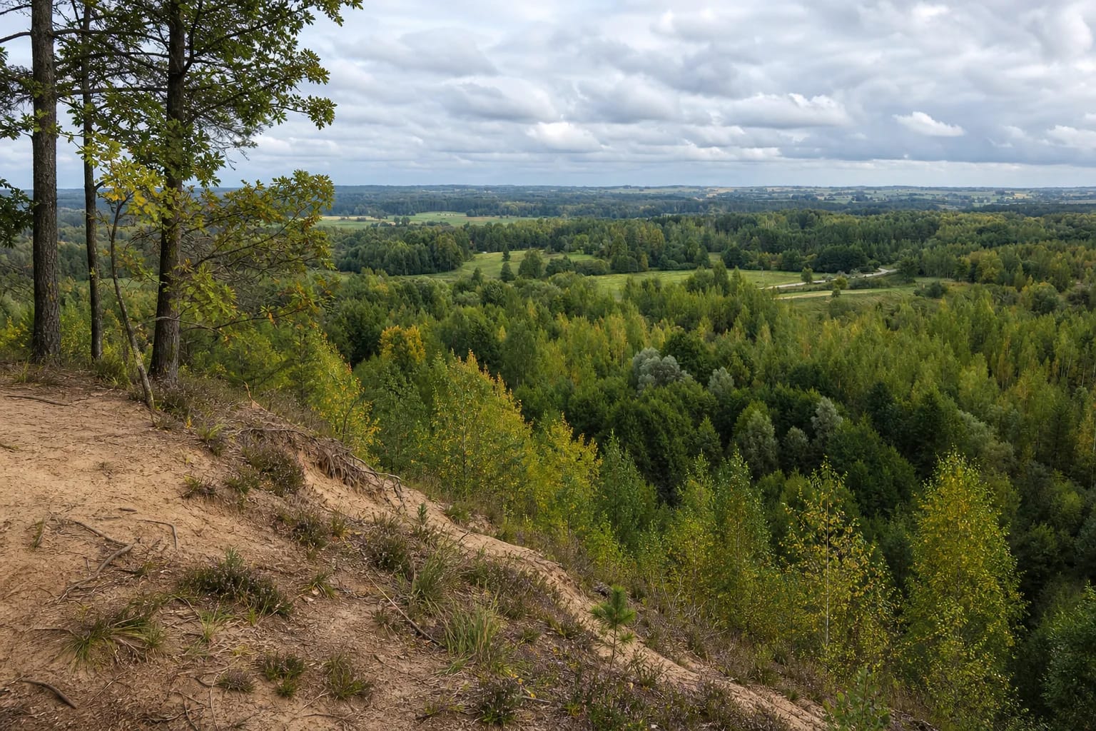
Photographs on the municipal map and public-library page show a pale sandy slope, occasional fine gravel, exposed roots, and regenerating pine and birch. The Lithuanian Geological Survey explains that glaciers and their meltwater formed Lithuania's principal uplands, ridges, and plains, while Quaternary deposits include sand, gravel, clay, and other materials widespread at the surface.
That general Quaternary account explains how glacial and meltwater deposits can create combinations of differently graded material and relief across Lithuania. The official sources checked, however, publish no dedicated stratigraphic column, layer thicknesses, or laboratory composition for Juodeliai Cliff itself. This page therefore avoids assigning named meltwater streams or fine chronological units to an exposure that has not been documented at that level.
Some non-official descriptions associate the place with a former sand quarry, and its curved outline in aerial photographs could suggest a cut slope. No eligible official record was found that establishes a quarry name, operating period, boundary, or closure date. The responsible description is therefore a sandy cliff and panoramic rim, not a definitive quarry history.
The attraction is a mosaic of woods, meadows, and fields rather than a towering rock wall
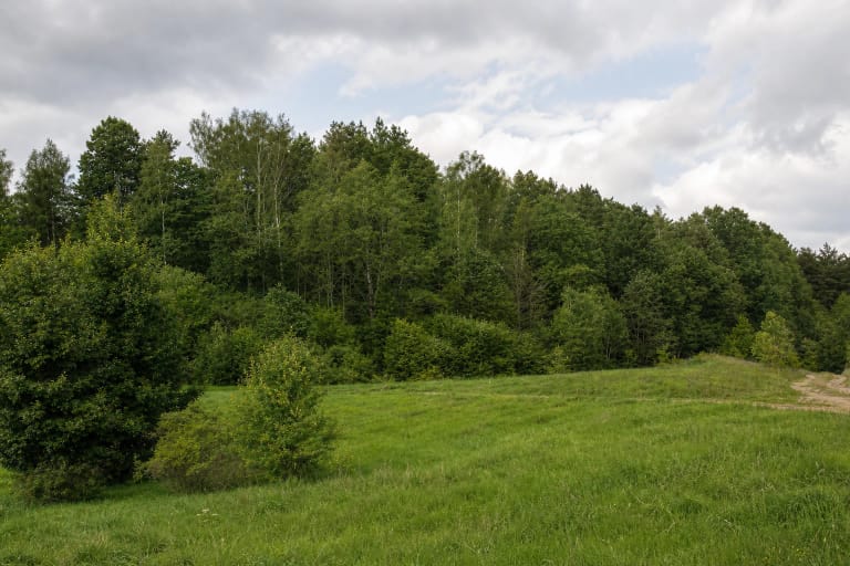
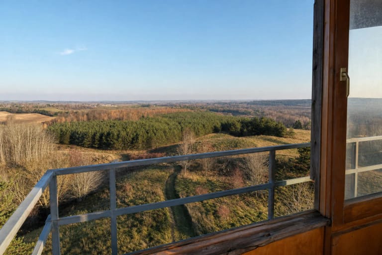
Young birch, willow, pine, and scrub descend below the upper rim. Meadow openings, straighter forestry belts, and cultivated fields lie beyond, while the low horizon continually rises and falls. This layered view challenges the simplified image of Suvalkija as entirely flat and composed only of open farmland.
The Lithuanian word skardis may create an expectation of one sheer rock face. Official photographs instead show a loose slope partly colonised by vegetation, not a stone canyon, maritime cliff, or formal geological display. No reliable source gives its height or length, so perspective in photographs should not be converted into invented measurements.
Foliage creates the strongest seasonal change. Early spring and late autumn reveal more of the drop and distant fields, summer turns the woodland into a dense green mosaic, and autumn picks out bands of birch and other deciduous trees. A clear, dry day matters more than a particular month: mist hides the horizon, while wet sand and fallen leaves increase the risk of slipping.
Access remains natural: an exact marker does not promise parking, railings, or a step-free path
On 19 July 2026, Kalvarija Municipality continued to link its interactive attraction map, and its 2023 draft list did not label Juodeliai Cliff as paid, private, or available only by prior arrangement. That does not establish public access along every approach. The official description provides no designated car park, turn-by-turn route from the main road, continuous trail, ticket, opening hours, or current closure notice.
Municipal and public-library photographs show a natural sandy rim without continuous railings and an uneven approach. They are not a technical inspection for 2026, so any newer signs, barriers, and land-user instructions take priority. Leave a vehicle only in a legal wider place, do not block local roads, and expect to walk the final section if the surface or signs do not permit further driving.
Do not test the loose lip, descend directly over it, or stand below an exposed section. Keep small children close and choose another day after heavy rain or thaw. No official accessibility audit, hard step-free surface, stairs, or continuous handrail has been confirmed, so the viewpoint cannot be considered reliably wheelchair accessible. When access is permitted and conditions are dry, 30-60 minutes is usually enough for the panorama and immediate setting.