- Place
- Balkasodis, Miroslavas eldership, Alytus District Municipality
- Region
- Dzūkija
- Type
- a state-protected glacial erratic of rapakivi granite
- Address
- Norūnai Forest and Balkasodis pine woods, southeast of Balkasodis village
- Coordinates
- 54.26941, 23.98857
- Visit duration
- 35-60 minutes, including the final walk of about 0.5 kilometres described by the official local visitor information
- Best time
- a dry visit in daylight, when forest waymarking is easier to follow and the mossy boulder can be examined safely
Raudonasis akmuo, Balkasodis Red Stone
The exact point is not in the centre of Balkasodis but high on a wooded slope
Red Stone lies in the Miroslavas eldership of Alytus District, in Norūnai Forest near the upper part of a high slope in the Balkasodis pine woods. The exact Google place coordinates are 54.2694081, 23.9885711. They differ by only a few metres from points published in local sources, so select the named place card with its place identifier rather than navigating only to the Balkasodis postcode or village centre.
Alytus District Municipality Cultural Centre publishes the following approach: leave road 2512, the Seirijai-Balkasodis-Tolkūnai road, at Balkasodis, turn southeast, and follow signs towards Red Stone for about 2 kilometres. The final roughly 0.5-kilometre section is described as a narrow footpath marked with bright paint through woodland, scrub, and a clear-cut area. Forestry work, vegetation, and weather can alter waymarks, so save the pin on your phone while you still have reception.
The official description does not confirm a purpose-built car park at the start of the final path. Leave a vehicle only in a legal wider space that does not obstruct residents, other forest users, or forestry vehicles. VLE records an information panel beside the boulder, although signs and panels can change much faster than the protected rock itself.
A 10.15-metre circumference conveys the scale of this irregular boulder better than one photograph
Published measurements describe only the exposed portion of Red Stone: it is 3.23 metres long, 3.11 metres wide, and 2.45 metres high. Its maximum horizontal circumference is 10.15 metres. Official public descriptions give neither the volume nor the mass of the buried portion, so an estimated weight copied from an unsourced website should not be attached to this boulder.
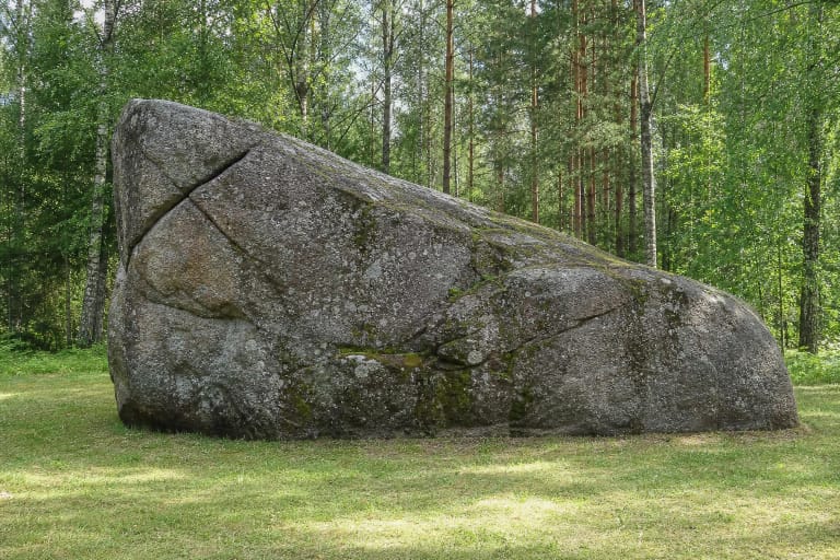
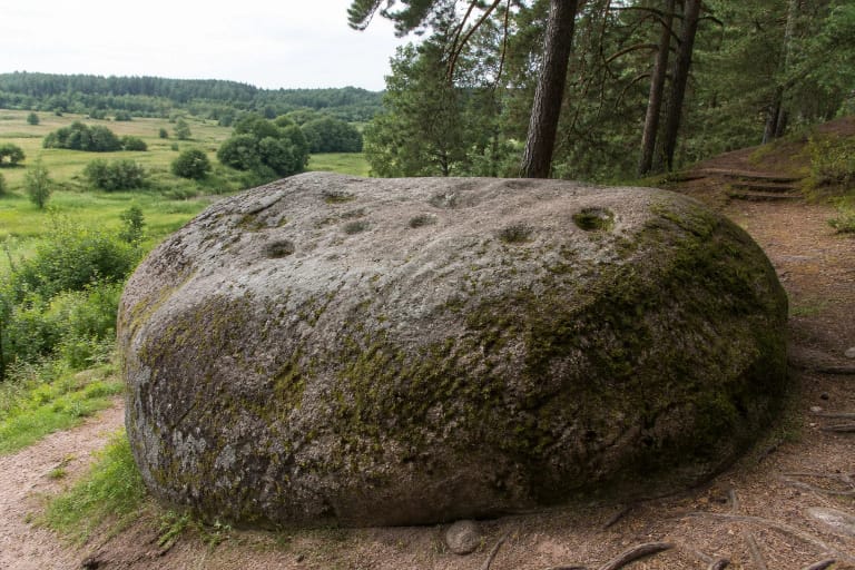
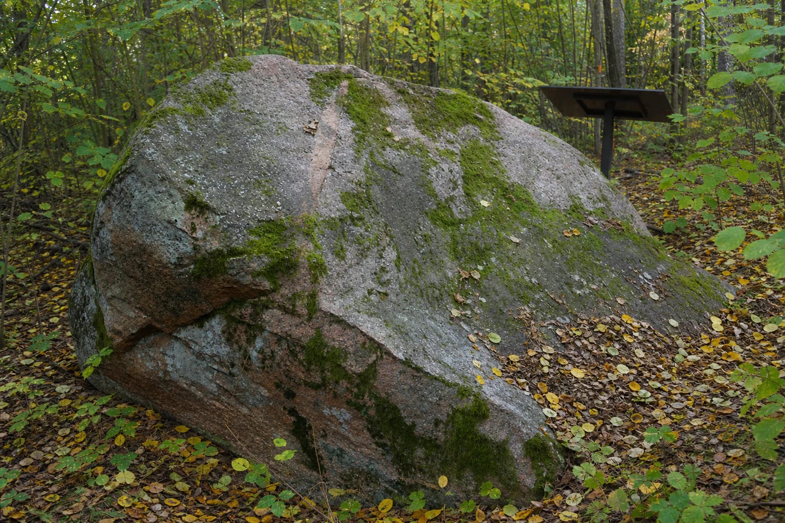
The top rises into a narrowing ridge. One side is more convex and rounded, with several hollows of different sizes; the other is concave, angular, and partly broken away. This asymmetry explains why the same rock looks like a low, long slab from one direction and an almost upright reddish wall taller than a person from another.
Its surface is rough, weathering into thin plates in places, and carries both lichen and moss. These are not defects for a visitor to clean or scrape. Moss becomes slippery in wet weather, while the broken side and ridge have sharper edges, so a slow circuit at ground level gives the clearest and safest reading of its form.
The rock is reddish-brown amphibole-biotite rapakivi granite cut by an unusual aplite vein
The petrographic description identifies Red Stone as amphibole-biotite granite of the rapakivi type. It is reddish-brown with grey and black inclusions. Its structure is porphyritic and uneven-grained, while its texture is massive. Oval feldspar phenocrysts up to 3 centimetres across are among the clearest features that can be recognised at close range without breaking anything from the surface.
An 8-9-centimetre band of finer-grained aplite runs from the ridge across two faces of the boulder. It is not painted waymarking or a crack filled during later repairs. The band formed within the granitic parent rock before ice detached the block and moved it to its present setting. This lighter, finer strip makes the internal geology easier to see than on a uniformly coloured boulder.
Reliable descriptions preserve no separate account of who named the object Red Stone or when the name was adopted. The name clearly suits the dominant reddish-brown granite, but that is a descriptive inference rather than a documented naming legend. Shade, moisture, lichen, and moss can make the rock look much greyer, so red does not mean a uniformly bright-red surface.
The last ice sheet carried the block from Fennoscandia, and formal protection began in 1964
VLE attributes Red Stone's journey to the last ice sheet, which transported the block from Fennoscandia. The Lithuanian Geological Survey explains that ice from Scandinavia reached present-day Lithuania more than once and left most of its Quaternary deposits. The rapakivi granite therefore crystallised in the Fennoscandian basement long before the glaciation, while the ice age explains its transport and deposition on this hill in Dzūkija.
Red Stone is not a meteorite and did not form in the sands of Balkasodis. Its oval feldspar crystals, biotite, amphibole, and aplite vein belong to an old igneous rock. Ice did not make the block; it detached it from a parent mass, carried it south, and left it among other deposits as it melted. No precise Fennoscandian source outcrop for this individual fragment is identified in the public description.
The boulder has been protected since 1964, while VLE associates its present designation as a geological natural-heritage object and natural monument with 2000. The State Service for Protected Areas still includes Red Stone on the official list of geological objects in Alytus District. Geologist Algirdas Linčius described it in 1989. Protection means that visitors may not break samples, enlarge hollows, chemically clean lichen, or otherwise alter the stone and its immediate setting.
The bunker story is recorded local testimony, but the bunker was not beneath the stone
A local publication on Alytus-area natural monuments records Balkasodis resident Antanas Barštys, born in 1930, describing an episode in the postwar conflict in Norūnai Forest. According to his account, auxiliaries of the Soviet repressive apparatus searching for Lithuanian partisans heard a rumour that a bunker lay under Red Stone and forced a local resident to lead them to the boulder. They dug holes and probed the ground around it but found no hideout there.
The same testimony says that the search continued and a bunker was found not beneath the boulder but on the side of a deep ravine farther south. It was blown up while empty, with clothing, several rifles, and ammunition reportedly found inside. The distinction matters: the stone became the landmark in a mistaken search and part of local memory, but it should not be described as a surviving partisan bunker or the roof of a hideout.
The published account gives no exact date, unit name, identities of the bunker users, or archaeological conclusion. It is therefore most accurate to present it as the recorded testimony of a named resident and not embellish it with unverified details. Red Stone received natural-monument protection for its geological value, not because of this postwar episode.
There is no ticket office, but a safe visit needs daylight, a dry path, and spare time
Red Stone is an unfenced forest object, and official sources publish no ticket office, admission fee, gate, or fixed opening hours. That does not make every hour equally safe. No lighting is documented on the path, while paint marks, branches, and the weathered rock surface are harder to see in darkness. Before travelling, check current official local information, forest-access restrictions, and fire risk, especially during a dry summer.
The official description does not present the narrow final forest path through scrub and a clear-cut as barrier-free. It publishes no standard for width, gradient, hard surfacing, handrails, or an accessible toilet, so wheelchair and pushchair users should not assume independent access without checking current conditions. Waterproof walking shoes and a fully charged phone are more useful here than expectations of urban-park infrastructure.
VLE identifies two nearby natural objects: Druskelė Spring about 700 metres to the northeast and Balkasodis Reserve with the Norūnai Forest spruce about 1 kilometre north. Those distances do not promise one continuously marked trail, so plan access to each point separately. On 15 July 2026, the exact Google Maps place card showed 5.0 out of 5 from 8 reviews. It clears the required 4.5 threshold, but such a small sample can move after only a few new ratings.