
Travel spots in Lithuania
Seaside and the Curonian Spit
White-sand beaches, the UNESCO-protected dunes of the Curonian Spit, lagoon fishing villages, and the Nemunas Delta.
Search covers all 64 places in this category.
This category on the map →
Amber Bay in Juodkrantė recalls the nineteenth-century Stantien & Becker amber mine, the largest industrial site in the Klaipėda Region at the time and the…
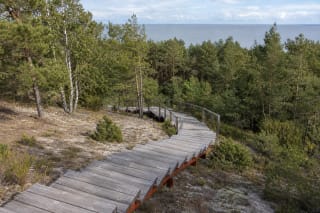
Menininkų kopa, or Artists' Dune, is the specific viewpoint reached by timber stairs and a ridge boardwalk on wooded Preila Dune, not an open sand dune or an…
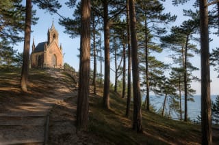
Birutė Hill in Palanga is a 21 m pine-covered hill in Birutė Park, where coastal landscape, Curonian archaeology, the memory of an old sacred site, and the…
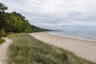
Birutė Park Beach is a roughly 500-metre Palanga shore stretch beside Birutė Hill and Palanga Botanical Park.
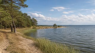
Bulvikis Cape is a Curonian Lagoon promontory between Nida and Preila, about 4 km northeast of Nida.
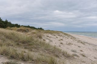
Būtingė Geomorphological Reserve protects a 34-hectare belt of natural coastal dunes in Palanga City Municipality, by the Lithuania-Latvia border north of…
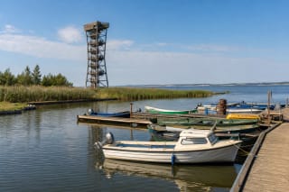
Dreverna Small Boat Harbour, established in 2009, and the 15 m observation tower are one of the best short Pamarys stops: here you see the Curonian Lagoon,…
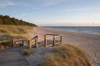
Giruliai Beach is Klaipėda's northernmost large sandy beach, reached through the pine-ringed former summer resort and along the central path from Stovyklos…
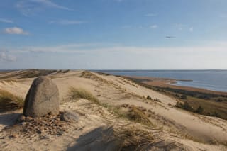
Gliders' Dune, also called the Great Dune, lies south of Nida.
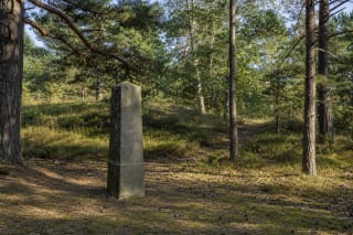
Hagen's Dune in Smiltynė is not an exposed mound of sand but a forest-stabilised, 36.4 m summit on the Great Dune Ridge.
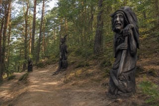
The Hill of Witches in Juodkrantė is a wooden sculpture trail in a pine forest, where the world of Lithuanian fairy tales, legends, witches, and devils is…
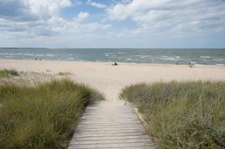
I Melnragė Beach is an official Klaipėda city beach in Pirmoji Melnragė.
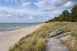
Juodkrantė Beach lies on the western side of the Curonian Spit, across a forest belt from the village on the Curonian Lagoon.
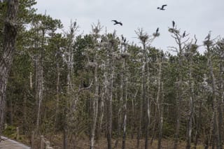
The Juodkrantė cormorant and grey heron colony around Garnių Hill is one of the most striking natural stops on the Curonian Spit, where visitors see not only…
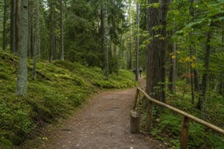
Juodkrantė Dendrological Educational Trail is a 1.6 km section of the former Blocksberg Promenade, running from Amber Bay through the rolling forest on old…
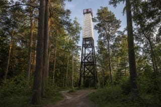
Juodkrantė Lighthouse is a working, 19.7-metre steel lattice aid to navigation on Raganos, or Bloksberg, Hill in the northern part of Juodkrantė's old forest.
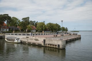
Juodkrantė Pier is the central passenger landing beside L. Rėzos Street, where seasonal services to Dreverna and Klaipėda call at a broad concrete projection…
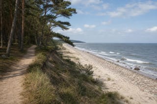
Karklė coast is probably the only undeveloped, wild stretch of Lithuania's mainland Baltic shore: dunes, seaside pine forest, a boulder-strewn beach, and an old…
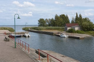
Kintai Harbour is a modest public small-craft landing at the end of Uosto Street, where Kintai meets the Curonian Lagoon.
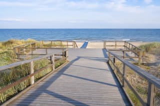
Klaipėda Central Beach is an almost 400-metre sandy stretch between II Melnragė and Giruliai.
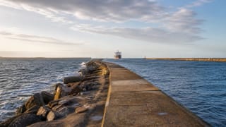
The Melnragė piers are the landscape of the Klaipėda port gates: the 733.66 m north pier in Melnragė and the 1,374 m south pier in Smiltynė let visitors watch…
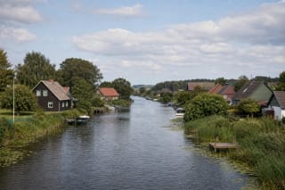
Mingė Village in the Nemunas Delta is the protected Minija ethno-architectural village, where the main axis is not a street but the Minija River, and homesteads…
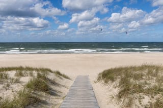
The Monciškės Beach Maps pin marks a broad sandy shore reached by the main path opposite 6A Ošupio Path.
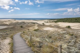
The Nagliai Nature Reserve educational trail crosses one of the most sensitive Curonian Spit landscapes: grey and white dunes, protected-species habitats, and…
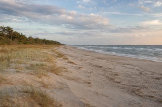
Nemirseta Beach is a broad, lightly urbanised stretch of Baltic coast on the southern edge of Palanga, beside Nemirseta Landscape Reserve.
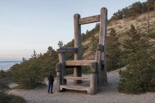
Neringa's Chair is an oak sculpture by Albertas Danilevičius unveiled in the Valley of Silence in 2014.
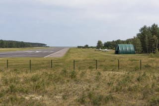
Nida Aerodrome EYNI is an operating general aviation site about 4 km north-east of central Nida.
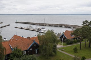
Nida Harbour is a working basin on the Curonian Lagoon in central Nida, used by passenger, recreational, sports, and fishing craft.
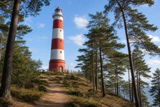
Nida Lighthouse stands on 51 m Urbas Hill: the first 23 m tower was built in 1874 and blown up in 1944, while the current 29 m lighthouse was built in 1953; its…
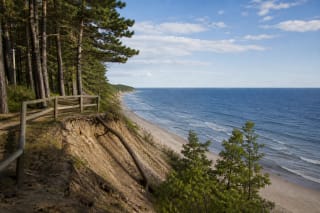
Olando Kepurė is the highest Lithuanian sea-coast cliff near Karklė in Seaside Regional Park.
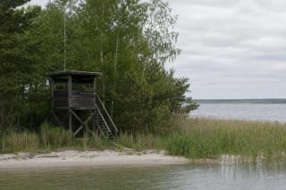
Ožkų Ragas Birdwatching Tower is a small public observation structure on the Curonian Lagoon shore north of Preila.
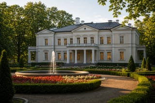
Palanga Amber Museum operates in the Tiškevičiai Palace at the centre of Birutė Park and preserves one of Lithuania's most important amber collections, from…
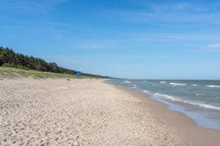
The Palanga Beach map pin marks the sandy shore beside the central lifeguard station, north of the Rąžė river mouth.
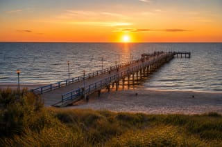
Palanga Pier is the classic symbol of the resort: a 470 m pedestrian pier into the Baltic Sea whose history began with a ship landing built by the Tiškevičiai.
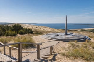
Parnidis Dune is one of Nida's strongest viewpoints: a 54.2 m dune ridge, white-dune landscape, directions toward the Curonian Lagoon and Baltic Sea, and a…
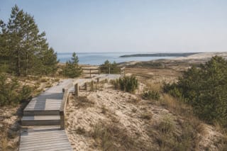
Parnidis Educational Trail is an approximately 1.9 km linear walking route from Neringa Sports School, across the western side of the Valley of Silence, to the…
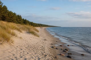
Pervalka Beach is a stretch of Baltic Sea coast in Curonian Spit National Park beside the quiet village of Pervalka.
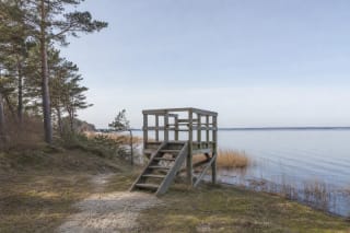
Pervalka Birdwatching Tower is a small public observation structure on the Curonian Lagoon shore south of the village.
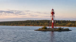
Pervalka Lighthouse is one of the most distinctive Curonian Spit lighthouses: a 14 m metal lighthouse built in 1900, standing not on shore but in the Curonian…
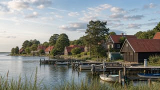
Pervalka Village is one of the quietest settlements on the Curonian Spit, by the Curonian Lagoon 33 km south of Klaipėda.
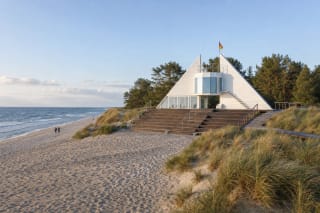
Preila Beach lies on the western side of the Curonian Spit, across the forest belt from Preila village on the lagoon.
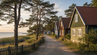
Preila Village is a quiet Neringa settlement by Little Preila Bay, founded in 1843 when residents of sand-buried Naujieji Nagliai moved here.
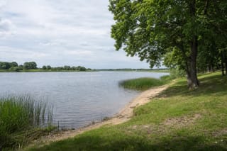
Rusnė Beach is a small local riverside recreation area on the eastern side of Rusnė.
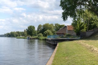
Rusnė Pier is a modest concrete quay on the Atmata, identified in an official 2022 navigation study as Rusnė Pier II at the former Rusnė bridge site.
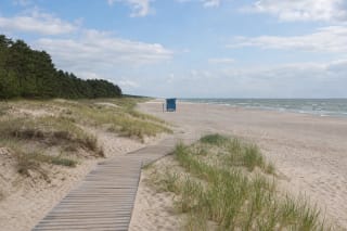
Second Melnragė Beach is a separately managed stretch of Klaipėda's coast, north of the Melnragė neighbourhood and south of Central Beach.
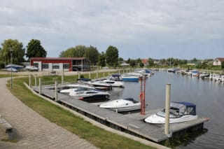
Šilutė Small-Craft Harbour is a compact basin at Uosto g. 9, formed in a Šyša oxbow and connected to the river's main channel.
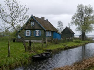
Skirvytėlė is a historic part of Rusnė by the Skirvytė, the southern distributary of the Nemunas Delta.
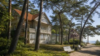
Smiltynė Kurhaus recalls the time when former Sandberg and Sandkrug inns and a postal-road stop became a resort space in the early twentieth century: the…
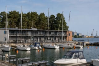
Smiltynė Yacht Club is a working 65-berth marina on the Curonian Lagoon, where yachts and motorboats moor in two basins and pines surround the low 1973 complex…
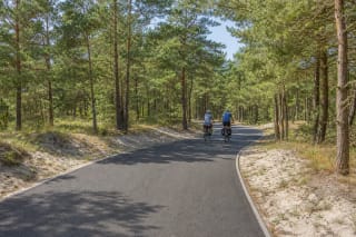
The Smiltynė-Juodkrantė section is the 21 km northern part of the Curonian Spit's shared walking and cycling route.
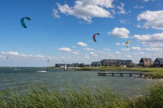
Svencelė is a Curonian Lagoon village between Dreverna and Kintai, now known as one of Lithuania's clearest kitesurfing and water-sports places.
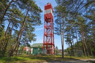
Šventoji Lighthouse is an active coastal navigation mark standing not on the beach but about 780 m inland, among pines and low resort buildings.
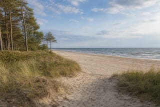
Šventoji Naturist Beach is an officially designated section approximately 280 metres long within Southern Šventoji Beach, between separately marked men's and…
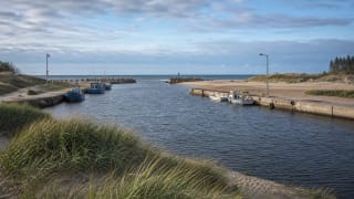
Šventoji Port and the river mouth are where the Šventoji River enters the Baltic Sea, and where breakwaters and quays recall a port ambition more than 300 years…
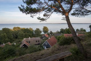
The Italian View is a specific historic viewpoint on Mother-in-Law's Hill by the Thomas Mann Memorial Museum, not a general name for any attractive Nida…
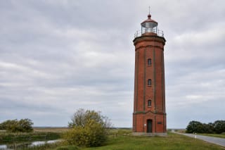
Uostadvaris Lighthouse on the Atmata bank of Rusnė Island is an 18 m octagonal red-brick tower built in 1873-1876, with 48 spiral steps and a viewing platform.
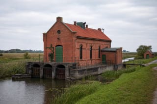
Uostadvaris Water-Lifting Station on the Vilkinė bank is the first station of its kind in Lithuania (1907) and the oldest hydrotechnical installation on the…
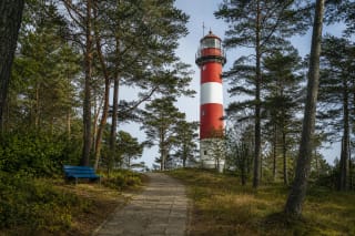
Urbo Hill is a 51.4-metre dune in Nida, on the Great Dune Ridge of the Curonian Spit.
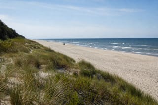
Vanagupė Beach is a Palanga coastal stretch between town infrastructure and the protective dune ridge, where the sand is only part of the experience.
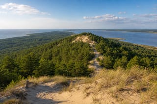
Vecekrugas Dune near Preila is one of the highest dunes on the Curonian Spit: a 67.2 m geomorphological natural monument with views across forest, sand, and the…
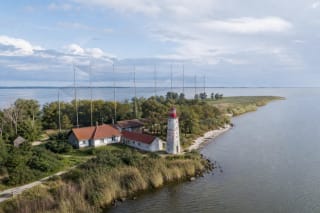
Ventė Cape is one of Lithuania's strongest bird-migration places: a narrow Curonian Lagoon peninsula with an ornithological station, bird traps, museum, and a…
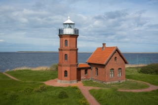
Ventė Cape Lighthouse is an 11-metre, tapering octagonal red-brick tower with ornate spiral stairs and a viewing gallery above the Curonian Lagoon.
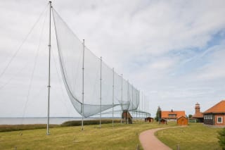
Ventė Cape Ornithological Station has operated since 1929 and is now a branch of the Kaunas Tadas Ivanauskas Zoological Museum that studies bird migration…
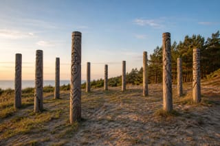
Žemaičių Alkas in Šventoji is Lithuania's only reconstructed pagan sacred site with a paleoastronomical observatory: in 1998, twelve oak posts were erected on a…