- Place
- Mančiagirė and Zervynos, Marcinkonys eldership, Varėna District Municipality
- Region
- Dzūkija
- Type
- an 18.5-hectare geomorphological natural monument encompassing nine actively eroding sandy outcrops on both banks of a 1,850-metre reach of the Ūla
- Address
- Ūla valley between Zervynos and Mančiagirė, in the Ūla Landscape Reserve of Dzūkija National Park
- Coordinates
- 54.12172, 24.46272
- Visit duration
- 3-4 hours for the roughly 9-kilometre circuit from Mančiagirė, including the viewpoint and time to observe the different cliffs; allow longer if wet ground slows the walk
- Best time
- a dry spring or autumn day, when lighter foliage reveals the valley form; summer is greener, but after heavy rain, storms, or a thaw visitors must reassess erosion and fallen-tree hazards
Mančiagirės skardžiai, Ūla Cliffs
The plural name means nine outcrops on both banks of a 1,850-metre reach of the Ūla
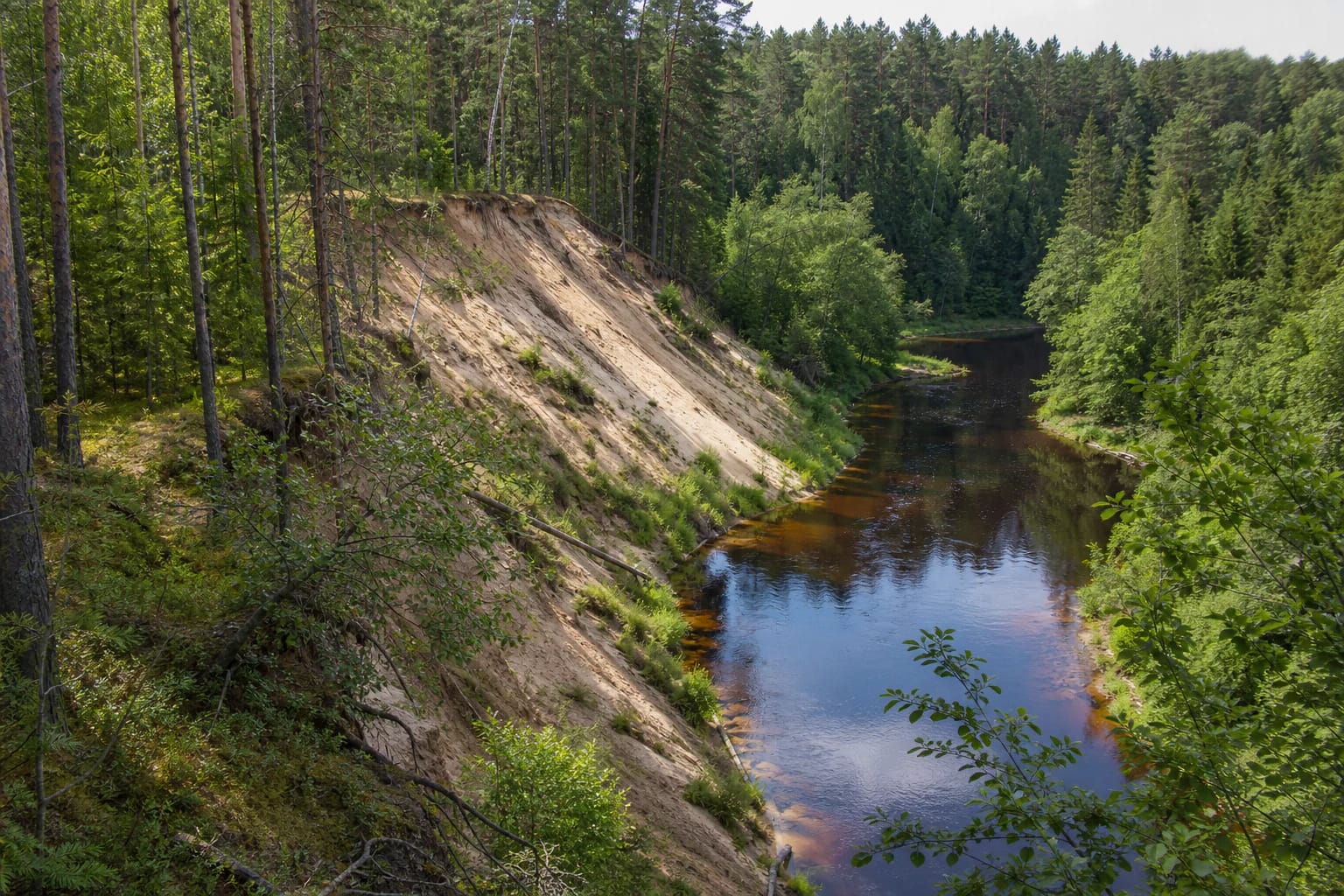
VLE defines Mančiagirė Cliffs as a group of outcrops, not one cliff beside a viewing platform. Within the 18.5-hectare protected area between Zervynos and Mančiagirė, nine sandy faces occur on both banks of a 1,850-metre river reach. No single point reveals the entire natural monument, which is why photographs taken at different bends can look like different places.
The largest cliff stands on the left bank at the protected reach's westernmost meander. It rises 28 metres from water level to its upper edge and has a slope of 34 degrees. These measurements describe the highest face, not every one of the nine outcrops. Some expose a broad pale-brown wall, while pine, spruce, birch, shrubs, and grass partially cover others.
The Lithuanian Geological Survey gives this canyon-like reach a sinuosity coefficient of 1.68; a river is classed as very sinuous once the figure exceeds 1.6. This accounts for the quick succession of bends: the current presses against an outer bank, while another forested curve begins just beyond it. Canyon-like describes a narrow, deeply incised valley here, not a gorge cut through bedrock.
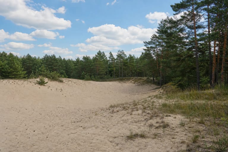
The Ūla cut into inland dunes formed by wind after the Ice Age, so the pale walls consist of loose sand
After the Ice Age, wind reworked large expanses of sand in southeastern Lithuania into inland dune fields. Between Zervynos and Mančiagirė, the Ūla crosses one such field. Flowing water removes sand far more readily than solid rock, allowing the channel to incise and create a narrow valley with exposed yellow-brown faces.
Several processes work together. Bed erosion deepens the channel, while stronger lateral erosion undercuts the outer bank at each bend. Once support is removed, gravity draws the sand downslope together with grasses, shrubs, and trees. A trunk fallen into the river is therefore not necessarily litter or failed maintenance; it may be direct evidence of the geomorphological process still shaping the monument.
When the meandering channel moves away from a particular face, direct undercutting weakens. Grass and woody vegetation then begin to stabilise its loose surface, while exposed sand develops at another bend. The monument's value lies not in one frozen form but in a reach where actively collapsing and increasingly vegetated slopes can be compared.
The swift, groundwater-fed Ūla is protected both as part of the monument and within a landscape reserve
The Ūla is an 84-kilometre left tributary of the Merkys, with 61 kilometres in Lithuania. VLE gives its natural Lithuanian channel as 10-16 metres wide and 0.6-2 metres deep, with an average gradient of 0.65 metre per kilometre and substantial groundwater input. These are figures for the river's Lithuanian course as a whole, not measurements confined to the 1,850-metre Mančiagirė reach.
Across the Ūla as a whole, the average annual water-level range is 1.2 metres and the recorded maximum is 2.7 metres. This does not mean water at Mančiagirė rises by the same amount every spring, but it does show that riverbank conditions are not fixed. After high water, heavy rain, a storm, or a thaw, path edges, roots, and newly undercut slopes may differ from an earlier visit.
The cliffs have been protected since 1997 and became a geomorphological natural heritage site and natural monument in 2000. They lie in the Ūla Landscape Reserve within Dzūkija National Park. The river below Rudnia is also part of the Natura 2000 network for otter and European brook lamprey habitats. Protection covers far more than a view: the natural channel, living communities, and active erosional process all matter.
The exact Google card marks a representative point, while the safest plan is the roughly 9-kilometre walk from Mančiagirė
This page uses the Google point 54.1217208, 24.4627182 and place identifier ChIJ4WPmGXYZ3kYR_hv7nDR_pQs. It lies within the official cliff reach, for which Saugoma publishes the rounded coordinate 54.118, 24.464. Because the monument extends for 1,850 metres, the pin is classified as representative rather than an entrance, the only cliff, or a car park.
Google also displays another card with exactly the same Lithuanian name about 3 kilometres to the northwest. Its coordinates and reviews are not combined with those used here. Select the place identifier given above, but do not drive down a forest track simply because navigation offers a line to the pin. Recent reviews describe a difficult sandy approach and choosing to walk part of it instead.
VLE describes a roughly 9-kilometre circuit from Mančiagirė, a viewpoint above the highest cliff, and a metal bridge across the Ūla. Saugoma recommends the path following the right bank from Mančiagirė towards Zervynos. Official descriptions do not supply a turn-by-turn route or confirm parking at the viewpoint. Leave a vehicle only where it is legal beside a public road, never block a homestead or local track, and carry an offline map.
An actively eroding sand face is not a climbing route: stay on the path and well back from the edge
Allow 3-4 hours for the 9-kilometre route because sand, roots, elevation changes, and viewpoint stops slow progress. No official source confirms a continuous hard surface, rails throughout, or a step-free approach. Loose ground, narrow sections, and natural relief make this walk unsuitable for a wheelchair or pushchair.
Do not approach an unprotected lip, descend an open sand face, or stand beneath a freshly undercut wall. Footfall and extra weight accelerate existing erosion, and a cracked edge can slide without an obvious warning. Keep children close around the viewpoint and slopes. After a storm, turn back rather than clambering over a fallen tree or crossing a new slide.
Walk in daylight and dry weather. Less foliage in spring and late autumn makes the valley form easier to read; summer brings a dense green canopy; snow and ice conceal sandy edges and roots in winter. The natural monument has no ticket gate, but open access does not mean every route remains safe in every condition.
Walking access is free, but paddling the Ūla requires a separate ticket during the 2026 water-route season
Official sources list no compulsory admission charge or opening hours for an independent walk. In 2026, the state-park visitor ticket is a voluntary contribution: a one-day ticket for one park costs EUR 1, a monthly ticket EUR 5, and an annual family ticket for all protected areas EUR 25. Check the directorate's page before travel because prices and purchase methods can change.
Paddling is a separate regulated activity. The 2026 Ūla water-route season runs from 1 May to 30 September and permits non-motorised boats, paddleboards, kayaks, and canoes. The per-person ticket costs EUR 6 from Sunday to Friday and EUR 10 on Saturday; children under six are free. No more than 200 tickets for 100 craft are issued per day. Confirm prices and availability through the official ticket sale linked by the State Service for Protected Areas.
Water-route rules allow tents and fires only at designated campsites and prohibit damaging banks, pollution, and harm to plants or animals. On 15 July 2026, the latest publicly indexed figure for the selected exact Google Maps card was 4.9 out of 5 from 16 reviews. The score clears 4.5, but such a small sample can move quickly and says nothing about water level or path condition on the day of a visit.