- Place
- Rumšiškės eldership, Kaišiadorys District Municipality
- Region
- Kaunas Reservoir Regional Park
- Type
- state-protected geological outcrop
- Address
- Gastilionys Peninsula, Rumšiškės Forest
- Coordinates
- 54.87153, 24.15066
- Visit duration
- 2-4 hours with the Rumšiškės Forest educational trail; the outcrop is best viewed from the reservoir
- Best time
- dry weather and calm water, when the exposed layers are easier to read
Gastilioniai Cliff
A protected outcrop on the Gastilionys Peninsula
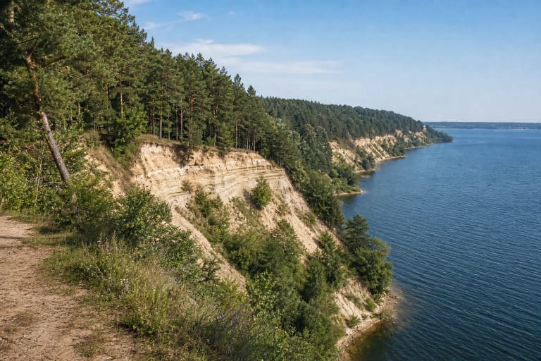
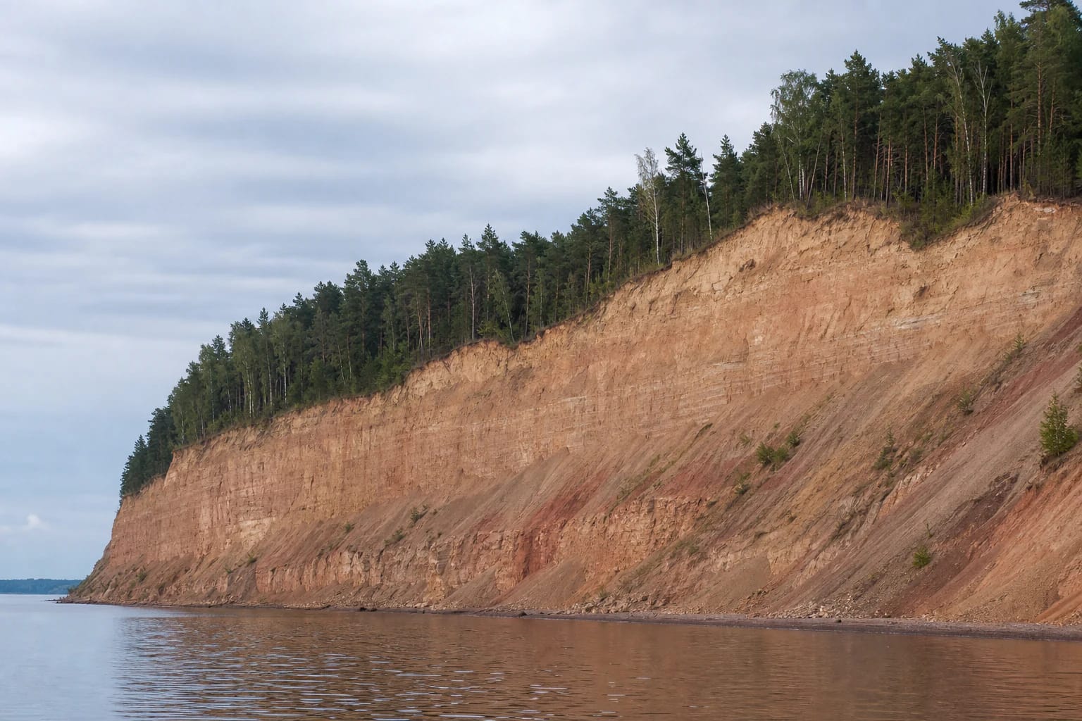
Gastilionys Outcrop lies in Rumšiškės Forest, on the Gastilionys Peninsula reaching into Kaunas Reservoir. The State Service for Protected Areas lists it among the geological natural heritage objects of Kaišiadorys District, while the park directorate describes it as one of the park's scenic outcrops.
This is more than a beautiful shoreline silhouette. The geological wall and its setting are protected, so treat the site as sensitive natural heritage rather than as an unmarked descent to the water.
A long, almost vertical shoreline wall
The outcrop runs along the right bank of Kaunas Reservoir. Different local descriptions give the peninsula's cliff section as roughly 600-800 m long and describe heights of about 20-30 m; the range reflects different ways of defining the outcrop, not one single measured point.
Some sections look almost vertical. Water, rain, and freeze-thaw action continue to erode the shore, so the face is not a static geological display.
Two glaciations and an interglacial sand layer
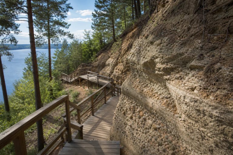
The outcrop exposes a moraine-loam section: deposits left by two glaciations are separated by sand that accumulated around a lake during an interglacial period. The sequence lets you read not only the last glacial advance but also an older climate history in the landscape.
The value lies in the sequence of deposits rather than any single stone. Darker moraine loam and lighter sand bands are best observed from a safe distance; moisture and fresh erosion can change how clearly they appear. Do not disturb the protected face or collect material from it.
The best perspective is from Kaunas Reservoir
The scale of the outcrop is easiest to understand from the water. While travelling across the reservoir, the long sediment profile, dark forest edge above the cliff, and Kaunas Reservoir come together in one view; from land you more often see only the edge of the relief.
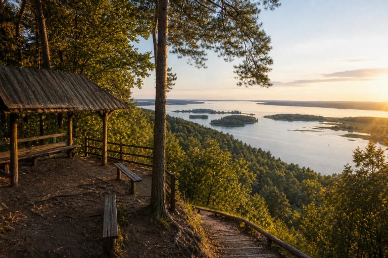
The water-level panorama should not be mistaken for a built viewing platform. Sources confirm the shoreline object and a walking trail, but not a dedicated platform beside the cliff or a permanent boat service.
The Rumšiškės Forest educational trail
The Kaunas Reservoir Regional Park directorate says the outcrop can be reached on foot by the Rumšiškės Forest educational trail. This is a meaningful way to experience the site from land because the route crosses the forest and peninsula landscape rather than taking a short cut straight to the steep shore.
Plan it as a several-hour outing with time to stop and read the geology. You can combine the outcrop with other Rumšiškės Forest and Kaunas Reservoir Regional Park sites, but do not treat the separate nearby trail and campground listings as the outcrop itself.
Visiting safely beside an eroding slope
Do not climb the outcrop face, walk onto an unstable upper edge, or try to reach the water via unmarked slopes. After rain, clay-rich ground can be slippery, and the risk from slides or falling stones changes with season and shoreline conditions.
No official wheelchair access is confirmed. Because the walking approach follows a forest trail and the object is a steep eroding shore, visitors with mobility needs and families should check current trail conditions in advance and choose a safe water-level panorama rather than attempting to descend to the wall.