- Place
- Vilnius City Municipality
- Region
- Vilnius
- Type
- erosional Neris valley outcrop, geological natural heritage object, and viewpoint
- Address
- Karoliniškių kraštovaizdžio draustinis, Neries dešinysis krantas priešais Vingio parką, Vilnius
- Coordinates
- 54.68464, 25.22378
- Visit duration
- 45 minutes to 2 hours, depending on which trail sections are open
- Best time
- a dry spring or leafless autumn; avoid slopes after heavy rain, during thaws, or when trails are icy
Plikakalnis, Lazdynai Escarpment, Łysa Góra
Plikakalnis Outcrop: identity and location
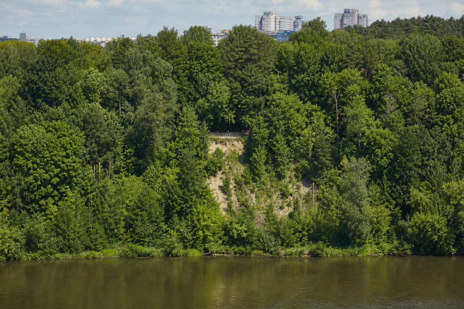
Plikakalnis Outcrop lies in the eastern part of Karoliniškės, within Karoliniškės Landscape Reserve, on the right bank of the Neris opposite Vingis Park. Approached from the Lazdynai side, it is also informally called the Lazdynai escarpment, while historical literature reviewed by the Lithuanian Geological Survey uses the name Łysa Góra.
The 162 ha reserve was established in 1960 to protect the pronounced erosional ravines of the Neris valley, Plikakalnis Outcrop, and rare plant species. Vilnius municipality states that the outcrop became a state-protected geological natural heritage object in 1992, while VLE dates its natural monument status from 2000.
The Google Maps card checked on 2026-07-15 is named Plikakalnio atodanga, has place ID ChIJ23VsA5ST3UYRspWjcL5SFKI, and showed a rating of 4.8/5. The rating can change. Its marker at 54.6846448, 25.2237809 identifies the upper viewpoint, not the entire long section of bluff.
Plikakalnis is not the Liepkalnis viewpoint. Liepkalnis, Laimis Hill, the ski facilities, and the railway or airport-facing panorama are in another part of Vilnius; Plikakalnis is identified by the Neris, Vingis Park, and Karoliniškės Landscape Reserve.
A 58 m high record of the Ice Ages
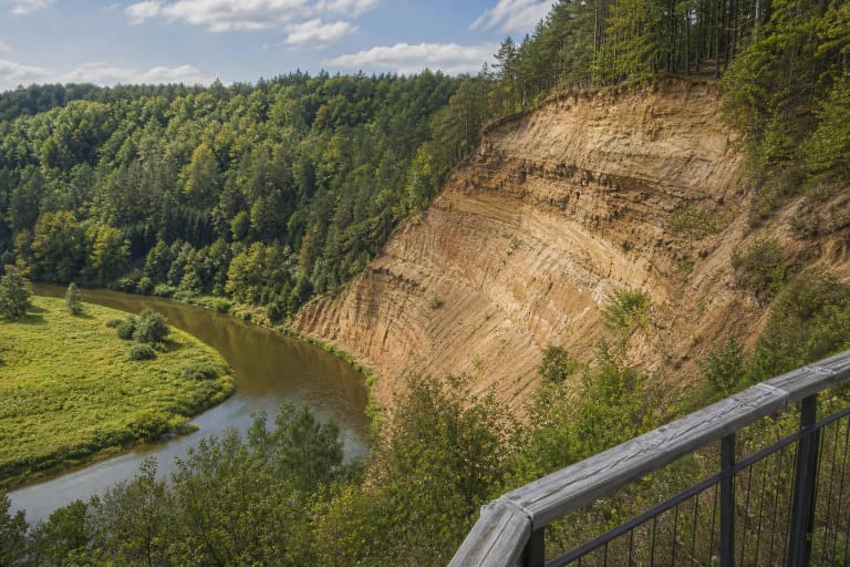
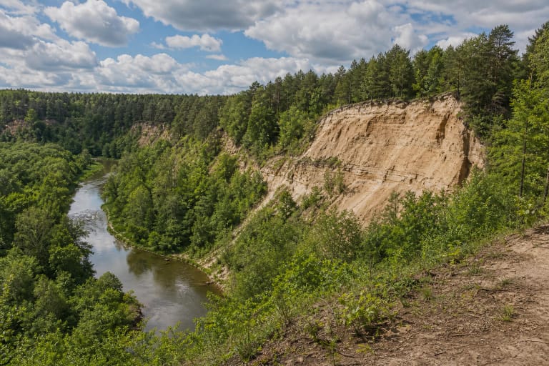
VLE defines Plikakalnis as an erosional outcrop, not merely a scenic wooded slope. It rises 58 m above its base, and Quaternary deposits are exposed along roughly 650 m of the Neris bend. That figure does not describe one continuous bare wall: trees and shrubs cover most of the bluff, leaving only separate pale scars visible today.
The bluff records a horizontally layered sequence laid down by continental ice and meltwater during the Middle Pleistocene Žemaitija and Medininkai glaciations. Boulder-bearing loam and sandy loam alternate with beds of sand, gravel, and clay. In places, geologists found blocks of Jurassic mica-rich clay and silt transported by ice from northwestern Lithuania.
Neris erosion is thought to have begun shaping the present outcrop about 6,000 years ago. That is an estimate for the development of the modern bluff, not the age of its deposits. Two large ravines cut through the outcrop, and active gravity-driven movement continues in several sections.
What you can actually see from Plikakalnis
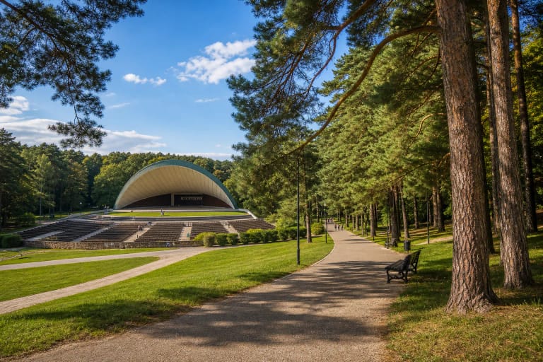
From the upper viewpoint, when it is officially accessible, the main scene is the Neris bend and the broad forest canopy of Vingis Park. Depending on foliage and visibility, you can pick out part of the park's white amphitheatre, the outlines of the stadium and Vilnius University Botanical Garden, two river islands, the direction of Litexpo, and more distant Vilnius buildings.
The scene changes markedly with the season. Dense summer foliage hides part of the river and geological face, hepatica flowers colour the slopes in spring, and the ravines and bluff are easier to read in late autumn and winter. Leafless months improve visibility, but wet ground, ice, and thaws increase both slip risk and slope instability.
Plikakalnis Trail and access
Karoliniškės Landscape Reserve has a network comprising Plikakalnis, River Valley, Forest Edge, Hill Ridge, and Ravine Floor trails. Plikakalnis Trail leads toward the outcrop, River Valley Trail follows the Neris, and Forest Edge Trail offers a quieter walk along the reserve's western boundary. The ridge and ravine routes involve substantial changes in elevation.
The shortest upper approach is normally planned from the Lazdynai side, where a reserve information board stands by 168 Architektų Street. The lower landscape can be explored from the Neris riverside walking and cycling route, but that is not permission to approach the crumbling foot of the outcrop. When the upper deck was closed, the municipality recommended viewing the bluff from the Vingis Park side.
Official descriptions do not identify a dedicated car park at the Google marker, so park only in legal city spaces by residential streets and never drive onto forest trails. Public transport to Lazdynai or Karoliniškės is practical, but check current routes and stops with JUDU before travelling. Steep earth paths and major height differences mean that access to the viewpoint is not reliably step-free.
Slope movement, closure, and safe visiting
In April 2024, Vilnius municipality and the State Service for Protected Areas announced the temporary closure of the upper viewing deck. Slope movement had exposed parts of its pile structure. The Lithuanian Geological Survey later confirmed that heavy rain activated the top of the outcrop in March 2024, creating a risk to both the facilities and visitors.
By 2026-07-15, no newer official notice explicitly confirming that the deck had reopened could be found. A 2025 directorate article describes the trails and viewpoint but does not state an opening status. Check the latest directorate or municipality information before visiting and obey barriers and signs on site; a map pin is not evidence that the deck is open.
Keep well back from both the cliff edge and foot, do not climb the loose face, and do not create shortcuts. The reserve prohibits trampling or riding on slopes, making new tracks or bike jumps, and lighting fires outside designated places. No standard opening hours or mandatory admission fee are published for the trails, but temporary closures and on-site safety instructions always take precedence.