- Place
- Šeškinė Eldership, Vilnius City Municipality
- Region
- Šeškinė, Vilnius
- Type
- a geomorphological reserve protecting a fluvioglacial Neris valley slope
- Address
- Šeškinė Eldership, between Ukmergės, Geležinio Vilko, and Ozo Streets, Vilnius
- Coordinates
- 54.70800, 25.26200
- Visit duration
- about 1-2 hours; longer if combined with Šeškinė Esker and the city's green routes
- Best time
- a dry, bright spring, summer, or autumn half-day; woodland slopes and natural paths can be slippery after rain
Šeškinė Slopes Reserve, Šeškinė Geomorphological Reserve
The reserve protects a fragment of Neris valley slopes
Šeškinė Slopes Geomorphological Reserve is in Šeškinė Eldership, between Ukmergės, Geležinio Vilko, and Ozo Streets, beside heavily used urban spaces. Saugoma.lt gives the protected area 28 hectares and says it was established in 1996 to preserve a fragment of the Neris valley's fluvioglacial slopes.
Saugoma.lt places its map point at 54.708, 25.262. This is a general landmark for a protected area rather than a single gate, so treat it as the reserve's broad centre and choose a pedestrian approach using paths and signs present on the day.
This page is about the reserve, not one viewpoint, car park, or Šeškiuko Lakelet. The wooded slopes, terraces, and urban-edge landscape form one geomorphological complex worth experiencing slowly.
Fluvioglacial relief meets the city here
Fluvioglacial relief was made as meltwater moved and deposited sand, gravel, and other material along the edge of the glacier. In Šeškinė, these processes appear not as a museum exhibit but as wooded terraces, changing gradients, and an uneven forest floor.
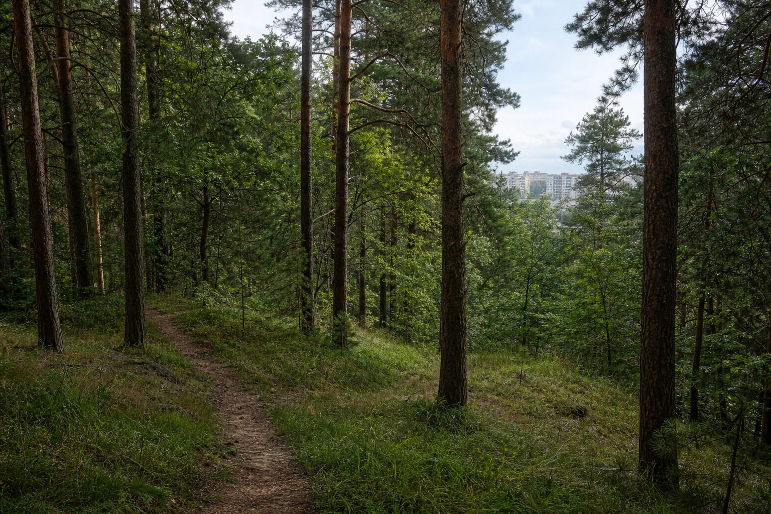
The Pavilniai and Verkiai Regional Parks Directorate describes the reserve as a forested protected area. The woodland hides part of the relief, so the landform is best understood by following an existing path and noticing how slope height and direction change rather than searching for one panorama.
The reserve is almost in the middle of the city: apartment blocks, roads, or commercial buildings may appear beyond the trees. That does not lessen its protected value. Urban noise and glacial slope relief exist side by side, making this a distinctive nature-and-city edge.
Do not promise one main route through the reserve
The checked sources do not describe one permanently uniform signed loop across the entire reserve. Access depends on which street you approach from, woodland works, slope condition, and signs present on the day. Plan a shorter route with a safe turn-back option rather than a mandatory circuit.
You can walk in from the surrounding city streets, but the Saugoma.lt territorial point is not a promise of car navigation. Do not drive onto forest ground, block access, or park where there is no clearly lawful space.
After rain, natural slope paths become slippery, while roots, gravel, and uneven ground require shoes with good grip. Not every section will suit a stroller, scooter, or bicycle; choose your route according to the real conditions on the day.
The protected value is the landform, not only the greenery
A geomorphological reserve protects a characteristic or valuable relief complex. The Encyclopaedia explains that such areas prohibit destroying or altering landforms, draining land, changing natural watershed boundaries, or otherwise damaging protected forms.
Visitors can help with simple actions: use existing paths, do not dig channels, move gravel, or shift boulders, do not break trees, and do not create new descents down the slope. A shortcut across a vulnerable place becomes visible relief damage over time.
Maintenance, nature-management, or planning works may take place at the reserve approaches. If you see a temporary barrier, warning, or machinery, choose another access point and do not bypass the restriction across the slope.
A woodland outing works best with a small footprint
You can combine the reserve with the Šeškinė Esker and Šeškiuko Lakelet, but they are different sites with different approaches. Do not plan them as one official route if there is no clear connection on the day.
Keep children close on the slopes, especially where a path narrows or drops away. Keep dogs under control so they do not erode the slope or disturb wildlife. Do not feed birds or leave food behind.
Take litter away, do not light fires outside designated places, and do not take plants or stones as souvenirs. The reserve keeps its value when a city resident can see a natural relationship between slope and forest rather than the tracks of new shortcuts.