Tauragė District Municipality
Tauragė Region
geological outcrop in the Akmena River valley
Pagramantis, Tauragė District
55.37361, 22.23080
20-45 minutes; longer as part of a Pagramantis Regional Park route
spring to autumn; after rain, keep away from the slope edge and foot
Pagramantis cliff
Pagramantis Outcrop: a geological window in the Akmena valley
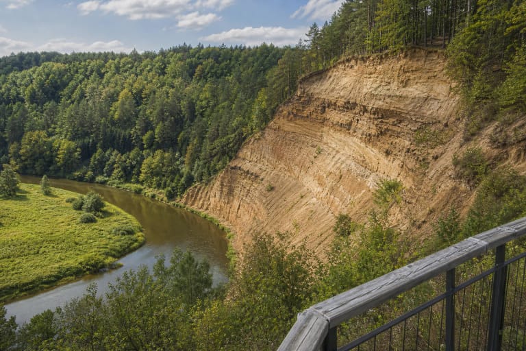
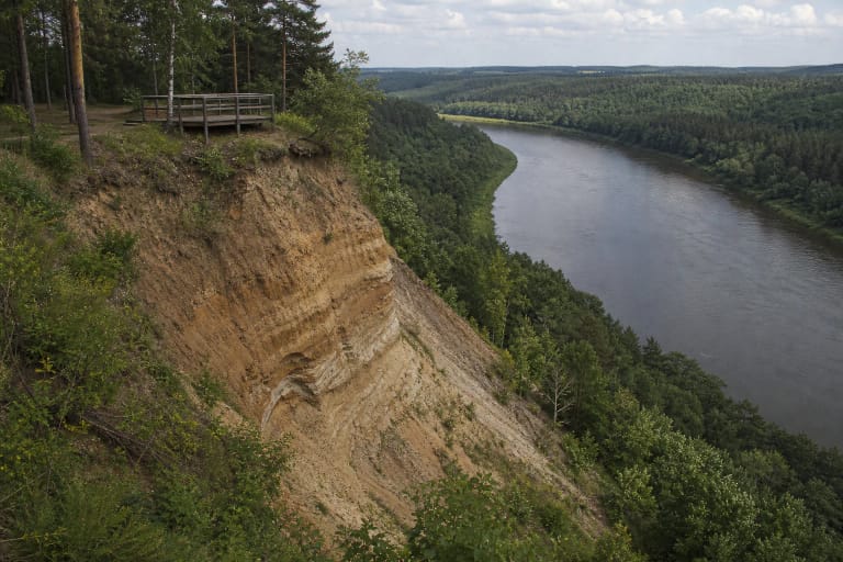
Pagramantis Outcrop is an erosional cliff on the left bank of the Akmena River, in the northern part of Pagramantis, Tauragė District. Here the landscape quite literally opens its interior: the steep slope reveals layers that are normally hidden, while the river bend continues to wash, erode, and renew the cliff.
The outcrop is inside Pagramantis Regional Park, in a bend of the Akmena. The park, established to protect the landscape of the Akmena and Jūra river valleys, covers 13,529 ha in Tauragė and Šilalė districts. Pagramantis Outcrop is considered one of its most valuable geological places, alongside Geniai and Lengveniai outcrops and Milžino akmuo, the Giant's Stone.
Height, length, and scale
According to Visuotinė lietuvių enciklopedija, Pagramantis Outcrop is 29-31 m high and 203 m long, making it one of the largest outcrops in all Samogitia. These numbers matter because on site the slope does not feel like a small riverbank but like a true geological section.
The slopes are very steep: their angle ranges from 35 to 90 degrees, and places show landslides already formed or still forming. A viewing platform above the outcrop makes it possible to see the whole slope and the Akmena bend from a safe height.
Moraines from several glaciations
The slope exposes Late and Middle Pleistocene rocks of the Quaternary system. These are brownish-grey and grey moraine sandy loam layers formed during different glaciations: Nemunas, Medininkai, Žemaitija, and Dainava. They are separated by interlayers up to 1.4 m thick of glacial meltwater deposits, including fine sand, silt, and clay, while the moraine is covered by about 1 m of varved clay.
Geologist Barbora Rupšlaukytė was the first to describe Pagramantis Outcrop in detail in 1965, and geologist Algirdas Gaigalas studied the composition and bedding of the moraines. For visitors, this means the outcrop works like a natural textbook: the layers are visible, and their sequence tells a story of several glacial and interglacial periods.
Geological natural heritage object since 2016
Pagramantis Outcrop has been designated a geological natural heritage object since 2016. It is protected not only as a scenic place but also as a scientifically valuable Quaternary geological section documenting the development of Samogitia's glacial relief.
That status explains why order matters here. Climbing on the slope, digging, or damaging the layers is forbidden, because it harms the protected object and accelerates landslides.
How to visit Pagramantis Outcrop safely
Safety is the main rule at outcrops. It is best to view the site from the installed viewing platform and not climb either onto the crumbling top edge or stand under the slope at its foot. After rain, steep slopes become less stable, and landslides here are a natural, ongoing process.
Most visits need 20-45 minutes: arrive, look around, read the information, and walk by the Akmena only on marked or safe paths. With children, the outcrop is an excellent short nature lesson, but clear rules about keeping away from edges are essential.
What to combine with Pagramantis Outcrop
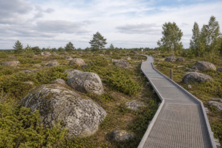
Pagramantis Outcrop combines well with other Pagramantis Regional Park sites: Milžino akmuo, Geniai and Lengveniai outcrops, and routes along the Akmena and Jūra river valleys.
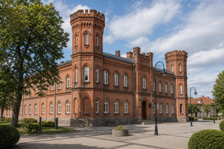
For a cultural extension, the nearest stronger stop is Tauragė city, especially Tauragė Castle and Santaka Museum. For geology-minded travellers, Pagramantis also connects with more distant Samogitian ice-age sites such as the Šaukliai Boulder Field or Škėvoniai Outcrop.