- Place
- Bavainiškė, Švenčionys District Municipality
- Region
- Švenčionys District
- Type
- hydrogeological natural monument and rising erosional spring
- Address
- Bavainiškė farmstead, Švenčionys eldership, Švenčionys District Municipality
- Coordinates
- 55.16305, 26.24794
- Visit duration
- 45-90 minutes for the walk from the car park, a close look at the spring, and time on the Lake Sėtikis shore
- Best time
- dry daylight; the unfrozen water is striking in winter, but the gravel road, stone paving, and footbridge may be icy
Lino verdenė, Lino versmė, Bavainiškė Spring
The map pin marks the spring itself on the eastern shore of Lake Sėtikis
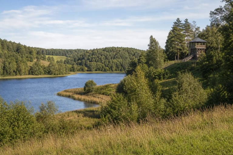
Lino Verdenė lies within both Sirvėta Regional Park and Sirvėta Landscape Reserve, beside the Bavainiškė farmstead in Švenčionys District. The coordinates 55.163051, 26.247940 come from the Aukštaitija Protected Areas Directorate and identify the spring outlet. They are not a car park, a safe turning place, or permission to drive to the water.
Saugoma directs visitors along the Švenčionys-Adutiškis road, then left at Medišionys according to the local sign and along a gravel forest road to a car park. From there, continue on foot through the small settlement and along a stone-paved path. Do not attempt to follow the digital pin by car or obstruct homes and the forest road.
VLE records a footbridge and shelter beside the spring, while the protected-area directorate's work documents referred to a Lino Verdenė rest site in 2024. That establishes visitor infrastructure, but not a live condition audit for 2026. Storm damage, maintenance or thaw can change access, so current signs and barriers always take priority.
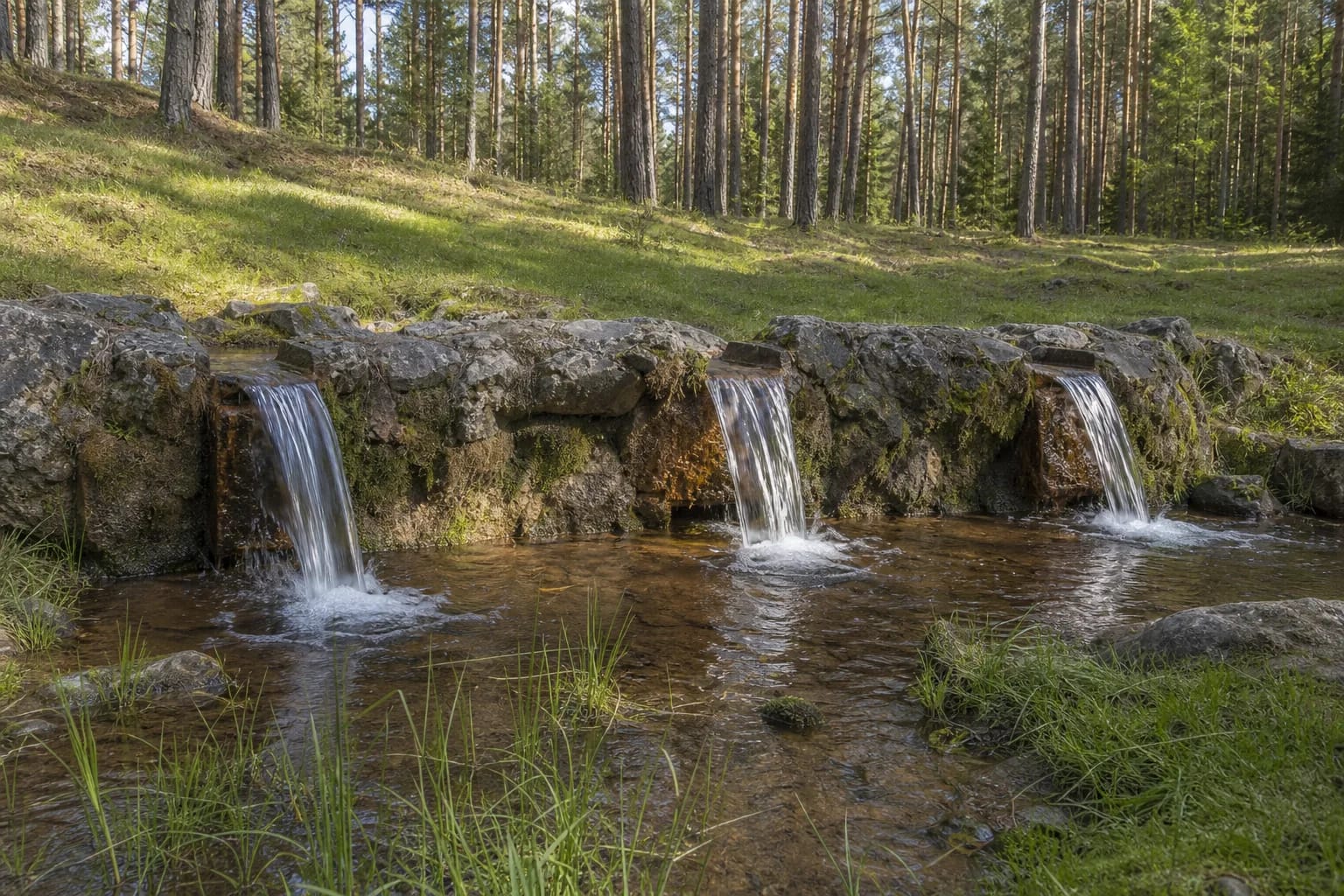
A small horseshoe basin is distinguished by three stone spillways
The spring is compact. In the Lithuanian Geological Survey profile, its concentrated outlet occupies a horseshoe-shaped basin only 1.5-1.8 metres long, 0.45-0.5 metres wide and 0.40-0.47 metres deep. It sits at the bottom of a suffosion hollow measuring roughly 12 by 15 metres, beneath a pine-covered slope 15-17 metres high.
A fieldstone wall on the lakeward side of the basin is approximately 30 centimetres wide and 60 centimetres high. Three cut-basalt channels cross its upper edge. Their water and other shallow threads reach Lake Sėtikis only 6-10.5 metres away, across a vertical difference of 0.85 metres.
The three low cascades can resemble a miniature waterfall in photographs, but they do not define the spring's hydrogeological type. The detailed geological profile classifies Lino Verdenė as a rising erosional spring: groundwater rises into the concentrated outlet and falls only afterwards, as it crosses the constructed wall.
Nearly six litres per second rise through deposits left by glacial meltwater
Groundwater emerges from fluvio-glacial deposits of sand, gravel, pebbles and small boulders laid down by glacial meltwater. Iron-rich sediment can be seen on the sandy bottom, while horsetails and other moisture-loving plants occupy the wetter part of the hollow. Despite the shaped stone edge, this is not an ornamental pond.
The Lithuanian Geological Survey measured a discharge of 5.88 litres per second and classified the spring as permanent and hydrologically significant, with medium discharge. That equates to roughly 500 cubic metres per day, allowing a tiny basin to make a continuous contribution to the whole lake. It remains a measured reference value rather than a guarantee that the visible flow will look identical every day.
The geological profile recorded a water temperature of approximately 7.7°C, rounded by Saugoma to about 8°C. Groundwater varies far less with the weather than surface water, keeping the spring cool in summer and unfrozen in winter. The surrounding paving, bridge and access road can still become icy.
The chemistry is well described, but present-day potability is not certified
A 2012 geological profile described the water as non-saline, slightly alkaline, and of the calcium-magnesium bicarbonate-sulfate type. It reported 421 milligrams per litre of dissolved minerals, total hardness of 4.93 milliequivalents per litre, pH 7.67 and total iron of 0.10 milligrams per litre. These figures characterise one documented chemical assessment, not continuous surveillance for every possible contaminant.
No recent dated microbiological result or explicit statement that visitor-collected water is continuously controlled as a public drinking supply was found in the authoritative object records checked on 19 July 2026. Clarity, cold temperature and an older chemistry table cannot reveal bacteria or short-lived surface contamination. Bring your own drinking water and consume spring water only if current official information on site explicitly confirms that it is safe.
Local tradition credits the spring with treating eye and skin complaints and wounds. Those accounts are valuable folklore and ethnographic evidence, not clinical proof. The spring is no substitute for medical care, and untested natural water should not be put into the eyes or onto broken skin.
The natural monument's name joins geology to the legend of Linas
Lino Verdenė is a state-protected hydrogeological heritage site and currently holds natural-monument status. The Lithuanian Geological Survey dates protection to 1985, while VLE dates the natural-monument rank to 2000. These refer to stages in the site's protection rather than mutually exclusive origin dates.
The Lithuanian term verdenė refers to a rising spring in which the upward movement of water may stir sand. Official records also use the names Lino versmė and Bavainiškė Spring. One connects the feature to its named legend; the other locates it beside the nearest settlement.
In the legend recorded by VLE, a priest called Sėtikis lived here with his son Linas. Linas is said to have led invaders onto the lake ice, drowned with them, and given his name to a spring that rose where their sanctuary had stood; the lake took the father's name. It is a meaningful place-name narrative, not evidence for a sanctuary or a specific historical battle.
Treat the protected spring as a sensitive habitat, not a paddling pool or water tap
Authoritative sources publish no dedicated ticket office, gate or fixed opening hours for Lino Verdenė. This outdoor site is best visited in daylight; allow about 45-90 minutes to walk from the car park, observe the spring without rushing and return. At night the small outlet is hard to read, while wet stone and timber become more hazardous.
Stay on the established path and bridge. Do not wade into the basin, move wall stones, scrape away sediment or obstruct any channel. Coins appear in the old offering tradition, but repeating it today would pollute the protected feature: leave no money, ribbons or other objects in the water or vegetation.
Stone paving, a gravel road, constant dampness and a possible timber crossing mean that reliable step-free access has not been established. Wheelchair users, visitors with pushchairs and anyone with balance difficulties should ask the Aukštaitija Protected Areas Directorate about current path conditions before travelling. Keep children close to the cold water and do not leave the path for the lake shore.