- Place
- Šalčininkai District Municipality
- Region
- Rūdninkai Forest
- Type
- a broad inland dune and sandy-heath landscape in the Rūdninkai Forest biosphere polygon and an active military training area
- Address
- open sandy clearing west of Kernavas Bog, Rūdninkai Forest, Šalčininkai District
- Coordinates
- 54.38764, 25.09488
- Visit duration
- 45-90 minutes for the sandy landscape if access is permitted; about 2 hours for the municipality's 6 km route only after current confirmation
- Best time
- daylight only, after checking the same-day exercise plan, local barriers, and forest fire danger; dry, mild weather in spring or autumn is most comfortable
Rūdninkai Continental Dunes, Rūdninkai Forest Dunes, Rūdninkų girios kontinentinės kopos
A landscape, not one registered dune point
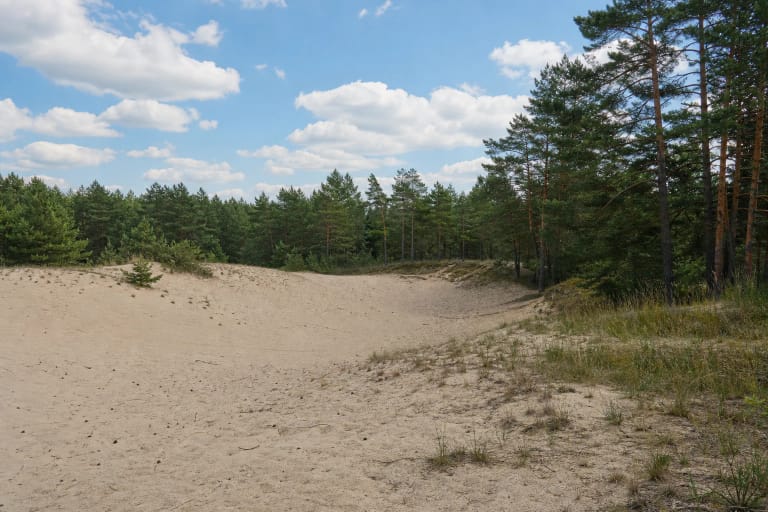
The name Rūdninkai Forest Continental Dunes covers a larger complex of landforms and habitats: low waves of sand, forested ridges, heath, and several more open sandy clearings. The Šalčininkai Tourism Centre says that dunes near Žygmantiškės rise to 30 m. These are inland rather than coastal dunes, so there is no sea and no single white ridge with an official viewing platform.
After the last glaciation, winds reworked the sandy plain into natural dune relief. The famous open clearing represents a different layer of the story: the official local tourism source links its continued openness to fires caused by bombing on the historic training ground. Bombs did not create the inland dunes, but military disturbance kept part of the sandy habitat from becoming fully wooded.
The coordinate on this page marks a representative point in a broad clearing clearly visible on national aerial imagery. It is not an entrance, car park, safe end of a road, or permission to cross a barrier. Do not drive towards the pin or seek a shortcut across the forest floor.
The biosphere polygon and Zygmantiškės reserve are not interchangeable
The sandy landscape belongs to the 20,095.5 ha Rūdninkai Forest Biosphere Polygon. Established in 2004, it protects the forest ecosystem and bird populations including black grouse, capercaillie, nightjar, boreal owl, and tawny pipit. Biosphere-polygon status concerns conservation and monitoring; it does not promise visitor facilities.
Beside it is the 2,258.86 ha Zygmantiškės Geomorphological Reserve, established in 1998 specifically to conserve the pronounced Zygmantiškės dune ridge. Current register geometry places the representative point for the popular open clearing immediately beside the reserve boundary rather than in its middle. The popular sand opening and the complete reserve therefore should not be treated as identical names for one object.
Both the protected relief and open sandy habitats are vulnerable. Do not break young pines, uproot heather, dig in the sand, or drive off road. Old wheel ruts are not evidence that cars or quad bikes are permitted.
An active military training area changes the entire visit
The sandy clearing lies within the active Rūdninkai Training Area. The Lithuanian Armed Forces explain that civilians may visit ranges outside danger areas, but may enter danger areas only when live firing is not taking place. Closed barriers, prohibition signs, and military instructions remain binding even when a phone map or older travel account shows a path.
Exercises are not a rare exception here. The July 2026 plan, for example, listed live firing on many days, in some cases until midnight. Before every visit, open the municipality's exercise section, find the newest monthly plan for Rūdninkai, and reassess the signs on arrival. A blank period in a timetable is not permission by itself because plans can change and a particular zone may remain closed.
Never walk or drive around a lowered barrier. If you hear gunfire, explosions, or intensive military-vehicle movement, or receive an instruction from personnel, do not continue. The correct backup plan is to turn around and choose another Šalčininkai District site.
The municipality's 6 km route is a reference, not an access guarantee
Šalčininkai District Municipality still publishes a 6 km Rūdninkai Forest walking route starting at 54.4131977, 25.1437398. Its map draws a loop along forest tracks towards Kernavas Bog and sandy openings. At a comfortable pace, 6 km would normally take about two hours, with additional time on loose sand or for stops.
There is an important qualification. The route material predates the training area's 2022 reactivation, and the current page does not promise that every section is continuously open to civilians. Nor does it clearly identify the start point as a developed car park. Use it as a planning reference only, and only walk when the latest exercise plan and local signs allow it.
There is no sound basis for recommending a drive to the sand itself. Motor vehicles may use forest roads only, and military rules additionally prohibit leaving roads and tracks. Park legally without blocking passage for military, fire, or forestry vehicles.
Old ordnance and fire danger are not theoretical warnings
Unexploded ammunition from earlier military use is still found at Rūdninkai. Never touch, uncover, dismantle, or carry away an object resembling a shell, mine, metal cylinder, or fragment. Retreat along the same line, note the location from a safe distance, and call 112 or the contact number posted on range signs.
Military rules prohibit digging, camping, fires outside designated places, and off-road driving. No official campsite or marked fireplace has been confirmed at the open clearing, so do not light any fire there. Dry heather, lichens, grass, and young pine can ignite from a tiny spark.
During the warm season, check the State Forest Enterprise fire-danger map and Šalčininkai municipal notices before leaving. Forest access can be temporarily restricted during extreme fire danger. If you see smoke or fire, call 112; if it cannot be controlled safely, retreat against or across the wind rather than running downwind.
What to expect if access is permitted
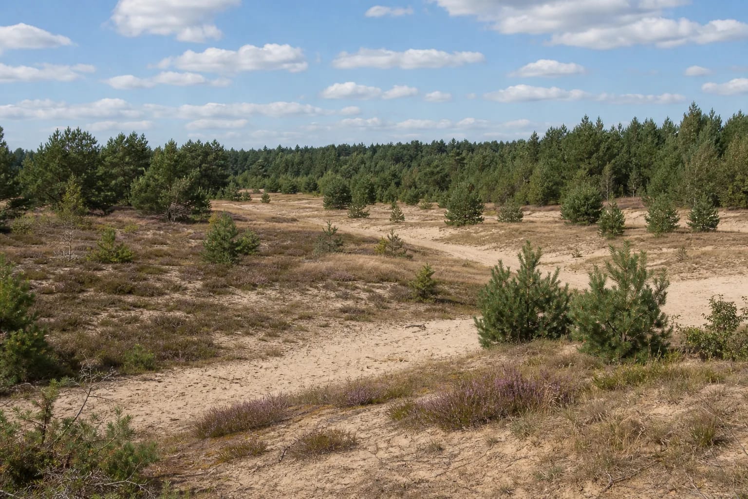
The attraction is scale and texture rather than one summit. Pale sand gives way to a carpet of grey lichens, dry grasses, and purple heather, with self-seeded young pines scattered across it and mature forest closing the horizon. It feels more like a wild steppe inside a pinewood than a seaside panorama. Heather is most colourful in late summer, when the sand can also be hot and fire danger high.
There is no continuous boardwalk, handrail, lighting, toilet, drinking water, or visitor centre at the clearing. Loose, rutted, partly vegetated sand makes the route unsuitable for wheelchairs and pushchairs. Closed sturdy footwear helps around branches and sharp debris, while an offline map assists orientation but never overrides military signs.
If every access condition is satisfied, 45-90 minutes is usually enough for the open landscape. Photograph from existing sandy lines rather than forcing a higher viewpoint through regenerating vegetation. The site matters as an intersection of geology, habitat, and difficult military history, and a responsible visit may sometimes mean deciding not to enter at all.