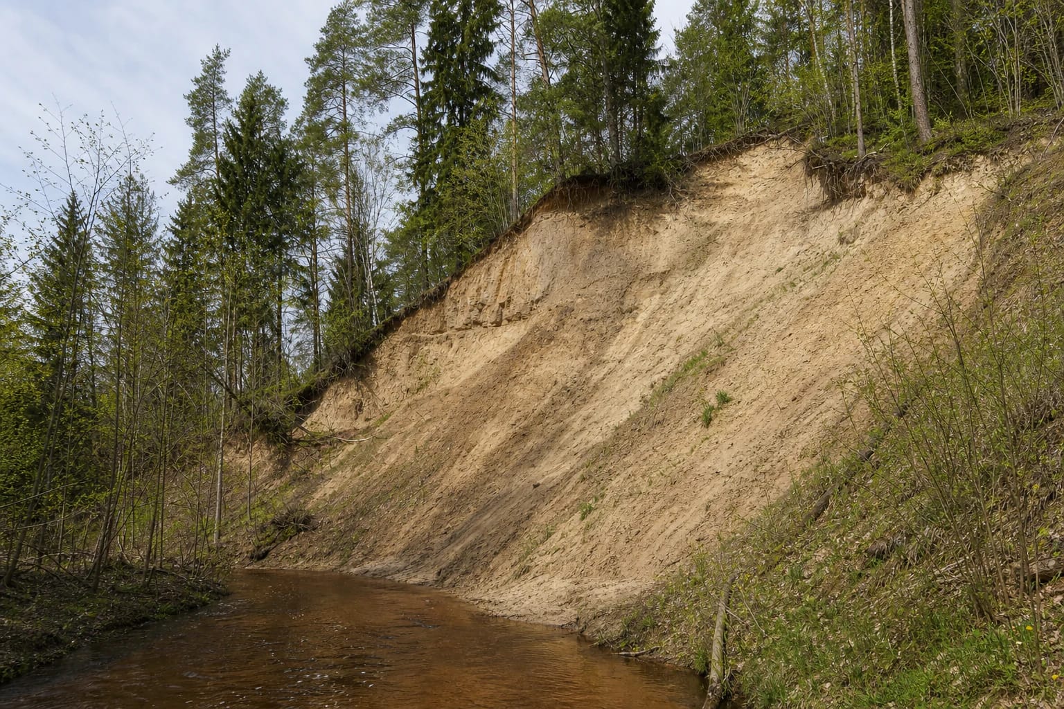
- Place
- Alovė Eldership, Alytus District Municipality
- Region
- Dzūkija
- Type
- a protected erosional river exposure containing Merkinė Interglacial weathering crust above Middle Pleistocene Medininkai glacial till
- Address
- near Kaniūkai, LT-64104 Alytus District Municipality
- Coordinates
- 54.35871, 24.09540
- Visit duration
- 45-90 minutes from a legal stopping point to the exposure and back; allow longer when the woodland approach is wet or difficult to follow
- Best time
- a dry day in full daylight from late spring to early autumn; avoid snowmelt, heavy rain, darkness, and ice
Alovės atodanga, Alovėlės atodanga
The exact 5.0 Google listing is based on only four reviews
The exact Google Maps listing Alovės atodanga, place ID ChIJ0fm3kiGx4EYRid96iFtmqc0, marks 54.3587145, 24.0954038 near Kaniūkai. On 15 July 2026, it showed 5.0 out of 5 from four reviews. The site meets the required 4.5 threshold, but four ratings are an exceptionally small sample, so both the average and review total can change quickly.
The Google point lies only a few metres from the publicly documented coordinate 54.358645, 24.095421. It therefore identifies the exposure itself rather than the centre of Kaniūkai. Google classifies the listing as an observation deck or viewing platform, yet none of the authoritative sources checked describes a constructed platform, safety rail, or formal viewpoint.
Alovė Exposure lies south-west of Kaniūkai on the right bank of the Alovė River. It should not be confused with Alovė village or treated as a generic panorama marker. The older name Alovėlės atodanga refers to the same geological feature.
River erosion and rainfall continually reshape the almost 23 m bluff
VLE supplies precise dimensions: the exposure is 22.9 m high and about 40 m long, with a slope angle ranging from 40 to 65 degrees. The small Alovė River, a right-bank tributary of the Nemunas, runs below it. The yellow-brown face in the wooded valley is best understood from the lower or opposite bank, although a safe viewing position can change over time.
This is an active erosional exposure, not a fixed museum display. VLE notes damage from heavy rain and spring snowmelt. River flow undercuts the base, while runoff from above can cut fresh gullies, carry away loose sediment, and bring down trees.
A photograph taken online is no promise that the same bank or informal approach will remain after a storm. Do not stand beneath hanging roots, fresh landslips, or a crumbling face. The most dramatic part of the site is also the most hazardous.
Four metres of weathering crust preserve evidence of the Merkinė Interglacial
The scientific value of the site is its Quaternary sediment profile. Approximately 4 m of weathering crust formed during the Merkinė Interglacial, when warmer conditions, water, vegetation, and soil-forming processes altered the ground between glaciations. Younger deposits later covered and preserved this ancient land surface.
The weathered layer rests on Middle Pleistocene Medininkai glacial till. Till is mixed material left by ice, whereas the altered unit above records a different environmental stage. The same face therefore preserves a sequence rather than a single event, joining evidence of glaciation and the interglacial interval that followed.
VLE describes the profile as uniquely well preserved in Lithuania. Differences in colour and texture may look subtle to an untrained visitor, which is precisely why nobody should cut the face or collect samples. Geological information survives only while the layers and their relationship remain intact.
Research and protection rest on geology, not an invented legend
Geologists V. Čepulytė and Algirdas Gaigalas studied Alovė Exposure, with later work by Algirdas Linčius and Petras Šinkūnas. Their interest lay in the sedimentary sequence and the significance of its weathering profile. The site needs no fabricated story about a castle, treasure, or healing spring to make it compelling.
The exposure has been protected as a natural monument since 1987. The State Service for Protected Areas continues to include it among the geological natural-heritage objects of Alytus District. The Directorate of Dzūkija National Park and Čepkeliai Reserve says that it monitors and carries out protection and management measures for this site outside the national park boundary.
Protection concerns more than the photogenic front of the bluff. The geological profile, foot of the slope, upper edge, and continuing natural processes all matter. Do not climb, dig, scratch the layers, or take sediment as a souvenir. Even a small intervention can destroy a significant detail in the sequence.
The woodland approach is harder than Google's viewing-platform category suggests
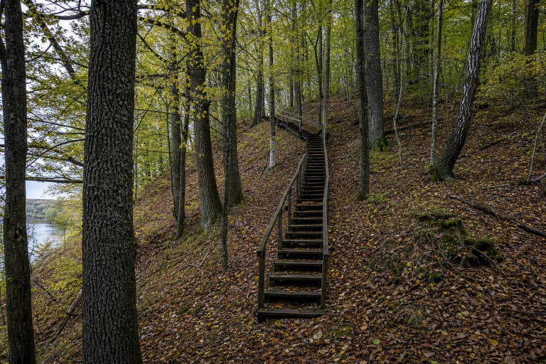
The authoritative sources checked do not provide a waymarked trail from a public car park to the face. A public visitor description calls the site very difficult to find and suggests approaching along the Alovė riverbank or through woodland from Užuolankos Street in Kaniūkai, using coordinates. This helps with orientation, but current access, land-use restrictions, and the river level must still be assessed on the day.
Download the map area for offline use, tell someone your intended route, and do not go alone after heavy rain. The riverbank can be muddy, blocked by fallen trees, and hemmed in by steep side slopes. Never cross fences or drive along a forest track where signs prohibit it, and leave a vehicle only in a legal place where it does not obstruct traffic.
No formal step-free route is confirmed. Natural forest ground, a sharp change in elevation, and an undeveloped bank may make the destination unsuitable for either a wheelchair or pushchair. Keep children well away from both the rim and the foot of the bluff, and choose another site after rain.
There is no admission charge, but a 24-hour label is not an invitation to visit at night
On 15 July 2026, Google displayed 24-hour access. The official sources publish no separate admission charge, ticket office, gate, or fixed opening schedule. This is an outdoor natural feature, but the map label does not confirm lighting, an attendant, a cleared path, or safe access in every kind of weather.
Choose dry conditions and full daylight, allowing 45-90 minutes from a legal stopping point to the exposure and back. Summer foliage can partly hide the profile. It may be easier to see in spring, but snowmelt also increases the risk of slipping and slope failure. Postpone the visit after sustained or intense rain.
No daily-maintained toilet, bin, or visitor facility is confirmed at the site. Carry everything out, light no fires, and never treat the bluff as a climbing venue. If the approach appears unstable or the public status of a track is unclear, turning back is the correct decision.