- Place
- Vilnius City Municipality
- Region
- Vilnius
- Type
- a state landscape reserve in the Neris Valley
- Address
- Karoliniškės Landscape Reserve, Vilnius
- Coordinates
- 54.69375, 25.23210
- Visit duration
- 1-3 hours for a chosen trail; longer if you combine the reserve with Vingis Park or the Plikakalnis area
- Best time
- April to October for the trails; leafless autumn for relief and the Neris bend panorama
Karoliniškės Reserve, Karoliniškės State Landscape Reserve, Karoliniškių kraštovaizdžio draustinis
Karoliniškės Reserve is the whole Neris Valley woodland
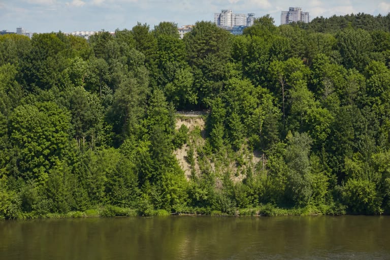
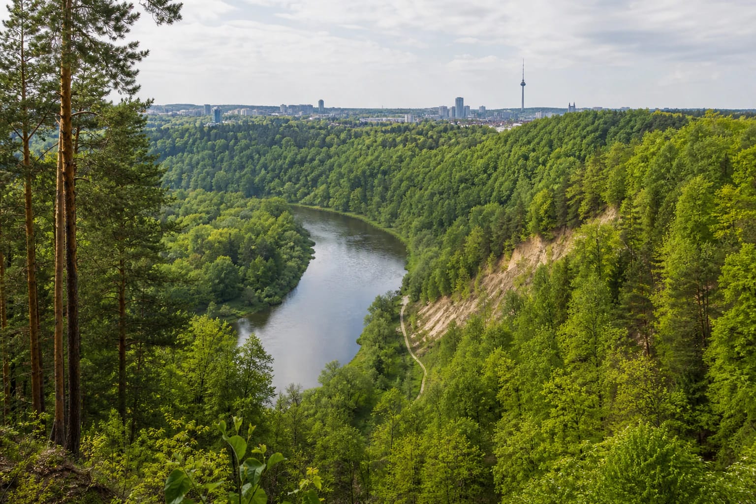
Karoliniškės Landscape Reserve stretches through Vilnius on the right bank of the Neris, opposite Vingis Park. Saugoma.lt says it was established in 1960 and covers 162 hectares. It is not one viewing platform and not only the Plikakalnis outcrop, but a wider protected area of woodland, ravines, slopes, riverbank, and trails of different lengths.
The map point marks an approximate centre of the reserve rather than one gate, parking area, or trailhead. There are several approaches from the city's edge, so choose a particular trail before setting out and check whether the approach and the site you want to visit are open that day.
What the reserve protects
The reserve's main purpose is to preserve the pronounced erosional ravines of the Neris Valley, the Plikakalnis outcrop, and rare plant species. The Directorate also highlights large oaks and rare animals. Surrounded by the city, the area acts as a green continuation of the valley where relief is not just a backdrop to a walk but the protected value itself.
Ravines are flat-bottomed or steep-sided small valleys shaped by water erosion. Ridges, slopes, and the Neris channel create a landscape of several levels: from city streets and forest edges you descend into lower valley sections and then climb again toward viewpoints.
Five trails for different reserve experiences
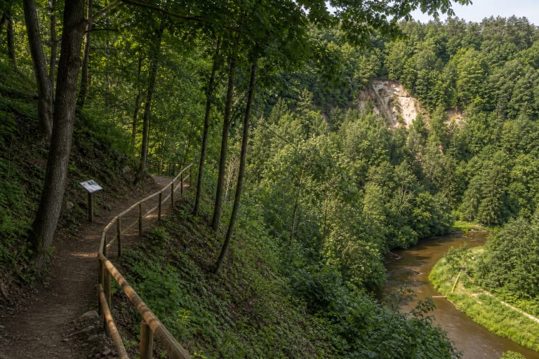
The Directorate describes five main walking trails: Ravine Floors, Hill Ridges, Forest Edge, River Valley, and Plikakalnis. They differ in terrain and mood. Ravine Floors lets you feel the depth of the erosional valleys, Hill Ridges stays higher, and Forest Edge is a calmer walk on the neighbourhood side.
The River Valley trail follows the Neris and connects with a cycling route and picnic spaces, while the Plikakalnis trail leads to the reserve's main geological highlight. Do not try to fit every trail into one short visit: the slopes and changes in elevation can be greater than the city map suggests.
Plikakalnis Outcrop and the city panorama
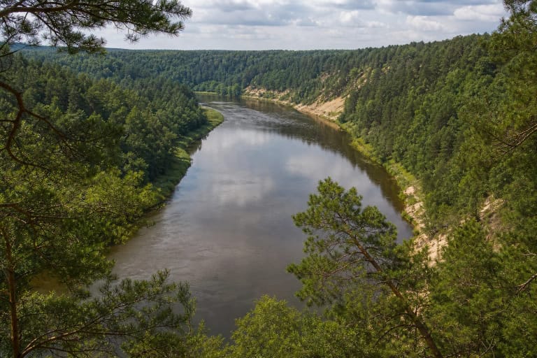
Plikakalnis Outcrop is a state-protected geological heritage site within the reserve. The municipality gives a relative height of about 58 metres and a length of 650 metres; from its top, the Neris bend, Vingis Park, and Vilnius panorama open out. It is the reserve's strongest landmark, but it should not be equated with the whole protected area.
In April 2024, the municipality announced that the Plikakalnis viewing platform was temporarily closed because of intensified landslide processes and exposed structural elements. That notice describes a particular period of safety information, so check the latest status before travelling and never cross barriers even if other sources still describe the platform as a visitor site.
Visiting without damaging an urban nature reserve
The reserve is convenient because it is in the city, but the same high visitor pressure creates erosion risk. Stay on marked trails, do not walk down ravine slopes, do not create new shortcuts, and do not cycle where the trail is not intended for bikes. A new shortcut can become a new erosion channel that is difficult to stop.
Use only designated picnic and fire areas, and after rain or a thaw account for mud, roots, steep descents, and slipping. The value of the reserve is more than a city view: it is a living Neris Valley relief, woodland, and habitat for rare species that should be left undamaged.