- Place
- Vangelonys, Nemunaitis eldership, Alytus District Municipality
- Region
- Dzūkija
- Type
- the largest glacial erratic in Dzūkija and the ninth largest in Lithuania, protected as both a geological natural monument and a state-protected mythological site
- Address
- Vangelonys village, Nemunaitis eldership, Alytus District; northern edge of Noškūnai Forest
- Coordinates
- 54.27252, 24.02030
- Visit duration
- 30-60 minutes for the boulder, information panel, and a short section of forest path; allow longer if the final part of the road has to be walked
- Best time
- a dry day from early spring to late autumn, or an ice-free winter visit; the approach softens after rain and the mossy rock becomes extremely slippery
Didysis Dzūkijos akmuo, Dzūkijos didysis akmuo, Vangelonys Boulder, Dzūkija's Puntukas
The exact pin lies in woodland south of Vangelonys, and the condition of the final road depends on the weather
The boulder's coordinates are 54.2725221, 24.0202989. The Google pin agrees within a few metres with the clearing marked by official tourism and protected-area sources. Direction signs from the Nemunaitis side point towards Vangelonys and the Great Boulder of Dzūkija; one official photograph shows a 2.5-kilometre direction sign. Select the exact place name and place identifier in navigation, because the centre of Vangelonys village is not the destination.
The approach changes from asphalt to gravel and then a narrower forest or field-road section. Older route descriptions advised walking the final roughly 200 metres, while newer visitor reports mention a small parking area and information panel beside the boulder. This suggests that access has been improved, but it does not guarantee an equally firm surface in every season. After heavy rain or a thaw, leave a low-clearance car only where parking is legal and the local road remains unobstructed.
Official sources list no ticket office, admission charge, gate, or fixed opening hours. Google marks the site as accessible at all hours, but daylight is safest for seeing potholes, signs, and the mossy rock surface. Alytus tourism information marks the attraction as adapted for disabled visitors, yet gives no specification for path width, gradient, or surface. A wheelchair user should check current access conditions in advance and travel with a companion.
The figures 7.10 by 4.58 by 3.82 metres describe the exposed portion because much of the boulder remains underground
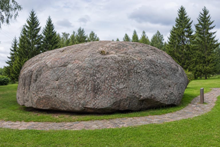
VLE gives the exposed portion as 7.10 metres long, 4.58 metres wide, and 3.82 metres high, with a maximum horizontal circumference of 18.03 metres. Alytus-area sources calculate a volume of 65.04 cubic metres and a mass of approximately 176 tonnes. The rock was not placed on a scale: its mass is estimated by combining volume with the density of compact gneiss, so 176 tonnes is a reasoned estimate rather than an exact measured weight.
The Cultural Heritage Register rounds the dimensions differently, giving a length of 7.6 metres and a width that varies from 4.5 to 6 metres. These figures do not describe a second Vangelonys boulder, nor can the difference be resolved by choosing one supposedly correct number. The rock is irregular, with one steep face and one sloping side, so the result depends on the height, direction, and outermost projection selected for measurement. Its nearly 18-metre circumference is the clearest single guide to scale for a visitor.
The lower portion remains buried, so published dimensions describe what can be measured without excavating a protected object. Alytus District Municipality identifies the boulder as the ninth largest in Lithuania and the largest in Dzūkija. The nickname Dzūkija's Puntukas expresses its regional stature; it does not mean that the rock is a copy of Puntukas or larger than Lithuania's record-holder at Barstyčiai.
Biotite plagiogneiss with garnet is a metamorphic rock, not a meteorite or an ordinary local fieldstone
The petrographic description identifies the rock as brownish to dark-grey biotite plagiogneiss with garnet. Gneiss is crystalline rock transformed under high pressure and temperature; plagioclase makes up an important part of its lighter minerals, while biotite is a dark member of the mica group. Here, garnet means small mineral grains within the rock, not jewellery stones that can be picked out of its surface.
VLE describes a fine-grained structure and massive texture. Grey, brown, and almost black areas can be seen at close range, but not the conspicuous speckled pattern many visitors associate with granite. Lichen, moss, and plates loosened by weathering obscure part of the true colour, so the geology should be observed without scraping the surface. No sample may be broken off, and the public geological description does not identify one precise Scandinavian outcrop as the rock's source.
The Lithuanian Geological Survey explains that glaciers from Scandinavia reached the territory of Lithuania at least six times and that the last, or Nemunas, glaciation shaped much of the present surface. VLE directly attributes the Great Boulder of Dzūkija to the last glaciation. Ice entrained the block, transported it, and left it in Dzūkija as it melted. The term glacial erratic therefore describes the boulder's journey, not the age at which its parent rock first formed.
Deep cracks at the high end, a long sloping flank, and moss are best examined by walking around the boulder at ground level
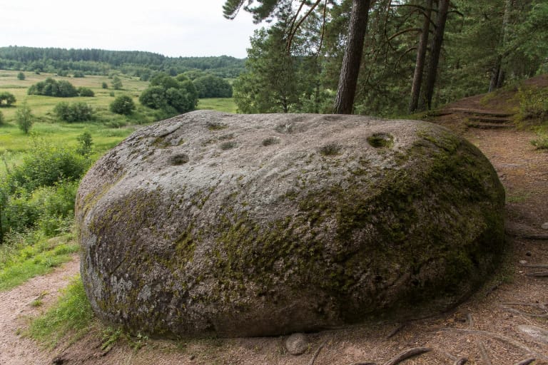
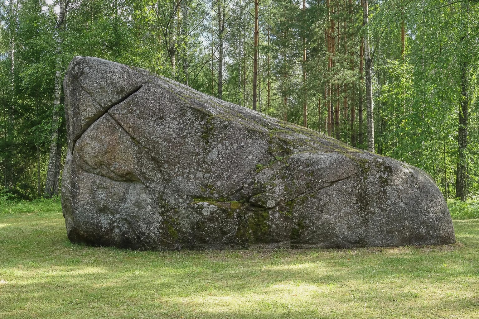
The boulder is elongated and asymmetrical: one end rises as a steep, nearly vertical wall, while the other descends in a long sloping surface. Deep natural and enlarged cracks cut the top and high end, and hollows of varying depth mark the surface. In places the rock weathers into thin plates, while green moss and grey lichen trace the damper joints.
VLE and the Cultural Heritage Register preserve a local account that lightning struck the boulder more than once. This may explain why residents paid particular attention to its fractures, but it is not presented as a geological study proving the origin of every crack. Freeze-thaw cycles, water, mineral weathering, and earlier human interference can also widen existing weaknesses. The lightning claim is most accurately read as local memory, not the only scientific diagnosis.
The clearing is not entirely natural. VLE notes that part of the pine-covered hill was removed during an attempt to uncover the boulder. This made more of the rock visible, although its base remained underground. The safest and most informative visit is a circuit at ground level, comparing the steep and sloping sides before reading the information panel. Climbing the mossy top risks a fall and can damage lichen and already weathering edges.
One boulder has two protection histories: geological protection since 1964 and a separate heritage registration since 2002
The boulder has been protected since 1964, when it received the status of a geological monument of national significance. VLE dates its present natural-heritage and natural-monument designation to 2000, and the State Service for Protected Areas still lists the Great Boulder of Dzūkija among Alytus District's geological objects in its official register updated in 2025. This protection concerns the rock itself, its scientific value, and its immediate setting.
A separate entry in the Cultural Heritage Register was created on 29 March 2002. This state-protected property of regional significance has unique code 26431 and former code M222; the register records archaeological, landscape, and especially mythological value. Its registered area covers 324 square metres. The same physical rock is therefore both a natural monument and a protected part of a cultural landscape shaped by local stories.
Some internet accounts label a larger natural hollow a pagan altar, but the publicly accessible heritage description does not say that it was carved by people or cite dated evidence of offerings. The archaeological and mythological classifications are meaningful, yet they do not turn every depression into a proven ritual trace. What can be stated securely is that a giant boulder, a body of legends, its landscape relationship, and the place-name Akmenų kalnas, or Stone Hill, about 150 metres away have all survived.
Legends of giants and the Nemunaitis church bells explain the names, while Google 4.8 reflects a small remote attraction
One legend says that two giants were carrying the boulder. One stumbled over a hill, the load slipped from their hands, and the rock sank deep into the ground. The tale gives a vivid explanation for both its extraordinary size and its buried lower portion, but the geological explanation is transport by ice from Scandinavia.
Another folktale links the rock to Nemunaitis church. Its bells supposedly tormented a devil living in a marsh, so he carried the boulder towards the church in order to destroy it. A cock crowed near Vangelonys at daybreak; the devil dropped the stone and retreated to a place beyond the sound of the bells. The church and boulder are real, while the devil's journey is folklore rather than a record of a historical attack.
On 15 July 2026, the latest publicly indexed figure for the exact Google Maps place was 4.8 out of 5 from 33 reviews. It clears the required 4.5 threshold but can change quickly because the sample is small. Reviews most often praise the boulder's scale and maintained clearing, while criticism concerns the approach. This is best planned as a 30-60-minute geological stop on a route through the Nemunaitis area, not as a full-day visitor park.