Neringa Municipality
Curonian Spit
educational trail through a dune reserve
55.42066, 21.08864
45-75 minutes
spring to autumn, morning or evening when side light reveals the sand relief
Nagliai educational trail, Grey Dunes, Dead Dunes
Nagliai Nature Reserve educational trail: what kind of place is it?
The Nagliai Nature Reserve educational trail, often officially called a learning trail, is one of the most important places on the Curonian Spit for visitors who want to see not only resort settlements but the actual sand landscape of the spit. The trail crosses a reserve zone where grey dunes, white dunes, rare sand-habitat species, and lagoon-facing relief meet.
Curonian Spit National Park presents the reserve in numbers: it covers about 1,699 ha, is about 9 km long, has an average width of about 2 km, and its highest point reaches almost 60 m. VLE lists Nagliai as one of the two nature reserves of Curonian Spit National Park, together with Grobštas Reserve, so it has the strictest protection regime. This is not a decorative sand park but a living wind-shaped landscape where every visitor step has an effect.
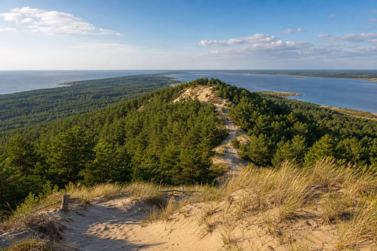
Grey and white dunes in Nagliai Reserve
The greatest value of the trail is that it lets visitors see two different dune habitats in a short time. In the Grey Dunes, lichens, mosses, and drought-resistant plants cover the sand surface, so from a distance they look muted, grey-green. The White Dunes are more open, brighter, and more mobile: wind keeps rebuilding the sand.
These habitats matter for more than the view. The park authority mentions rare and protected species, including baltijinė linažolė, baltijinis pūtelis, dirvoninis kalviukas, and other sandland inhabitants. Some disappear when open sands overgrow with grass, shrubs, or forest, so nature management here is not simple 'tidying up' but an attempt to preserve a dynamic dune state.
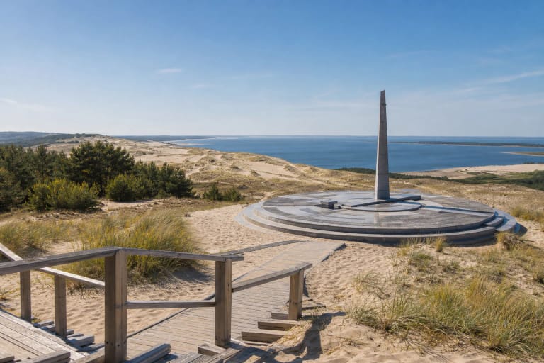
The buried villages remembered in Nagliai Reserve
The Nagliai landscape is often connected with the Dead Dunes and the history of Curonian Spit villages buried by sand. This story matters because it reminds visitors that dunes are not a frozen postcard. Historically they moved, changed shores, threatened settlements, and shaped people's relationship with the spit.
When walking the trail, do not stop at the photo from the higher point. Read the relief as a historical layer: where the sand is open, where lichens hold, where forest begins, how the trail directs people into one line, and why that direction is necessary here.
Nagliai trail visiting rules and tickets
Because the Nagliai trail is inside a reserve, visiting is more strictly regulated than on an ordinary forest path. Before going, check the official Curonian Spit National Park page for current seasonal hours, visiting conditions, ticket prices, discounts, and limits on independent visits.
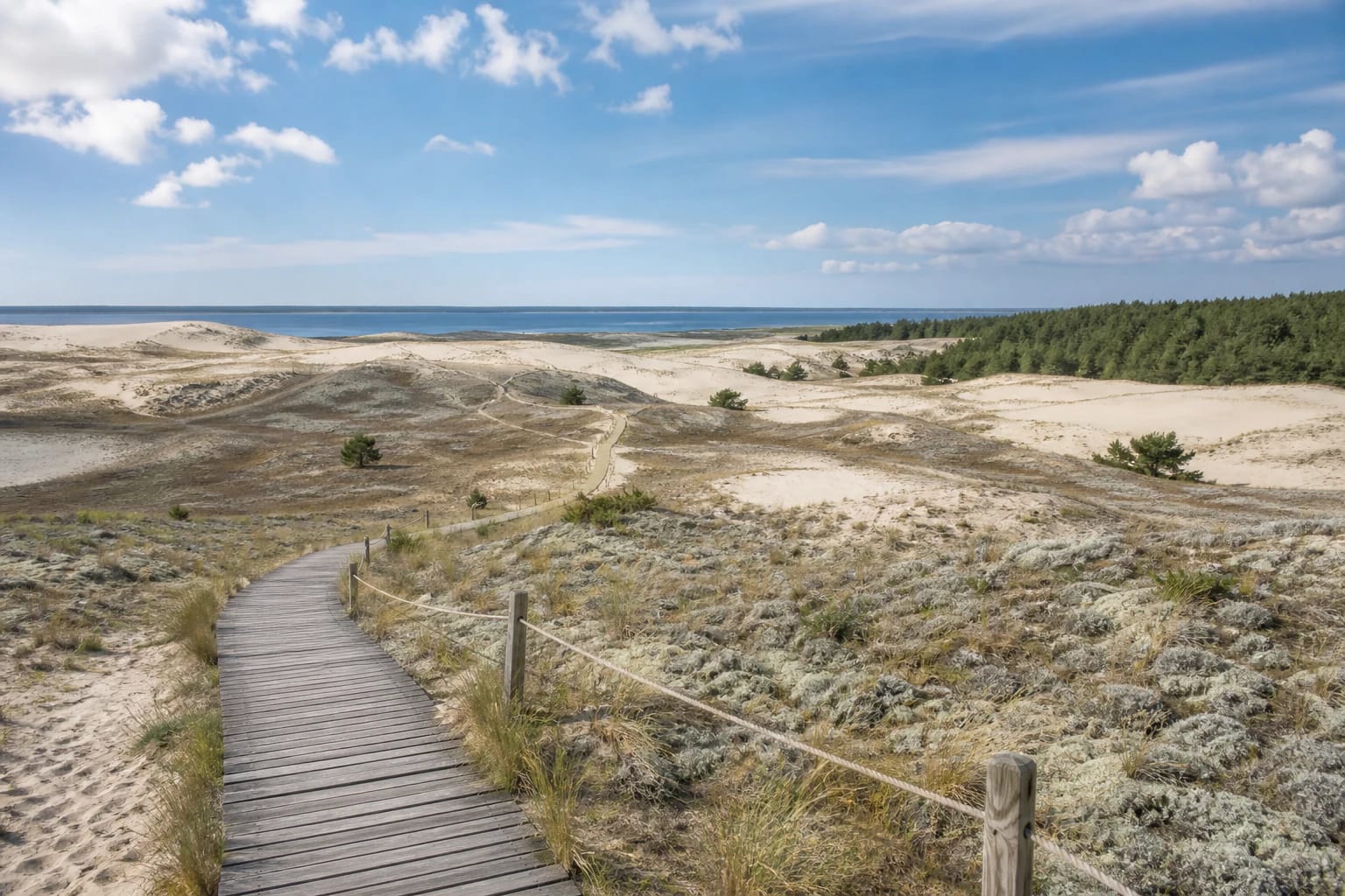
The main rule is simple: do not step outside the marked trail. The park explains that the most trampled places change relief fastest, and footprints left in sand can be turned by wind into gullies. For that reason, boardwalks, sand traps, and visitor-flow limits are used here.
How to plan a visit to the Nagliai Nature Reserve trail
The trail is most convenient when travelling between Juodkrantė, Pervalka, Preila, and Nida. In season, arrive earlier or avoid peak hours because parking is limited and visitor flow is regulated. In summer, bring water, a hat, and shoes suitable for sand and boardwalk.
For photography, morning or evening light is most beautiful, but even then the best image is not a reason to step off the trail. The strength of Nagliai Reserve is precisely that it remains fragile and not fully convenient for people.