- Place
- Kintai, Šilutė District Municipality
- Region
- Pamarys
- Type
- public small-craft harbour and fishing-infrastructure site
- Address
- Uosto g. 12, Kintai, Šilutė District
- Coordinates
- 55.42457, 21.24963
- Visit duration
- 20-45 minutes to view it from land; launching, mooring, or taking a boat trip must be arranged separately
- Best time
- in daylight and calm weather; boaters must check water level, approach conditions, and local use arrangements
Kintų uostas, Kintų prieplauka, Kintų uostelis
Where exactly Kintai Harbour is
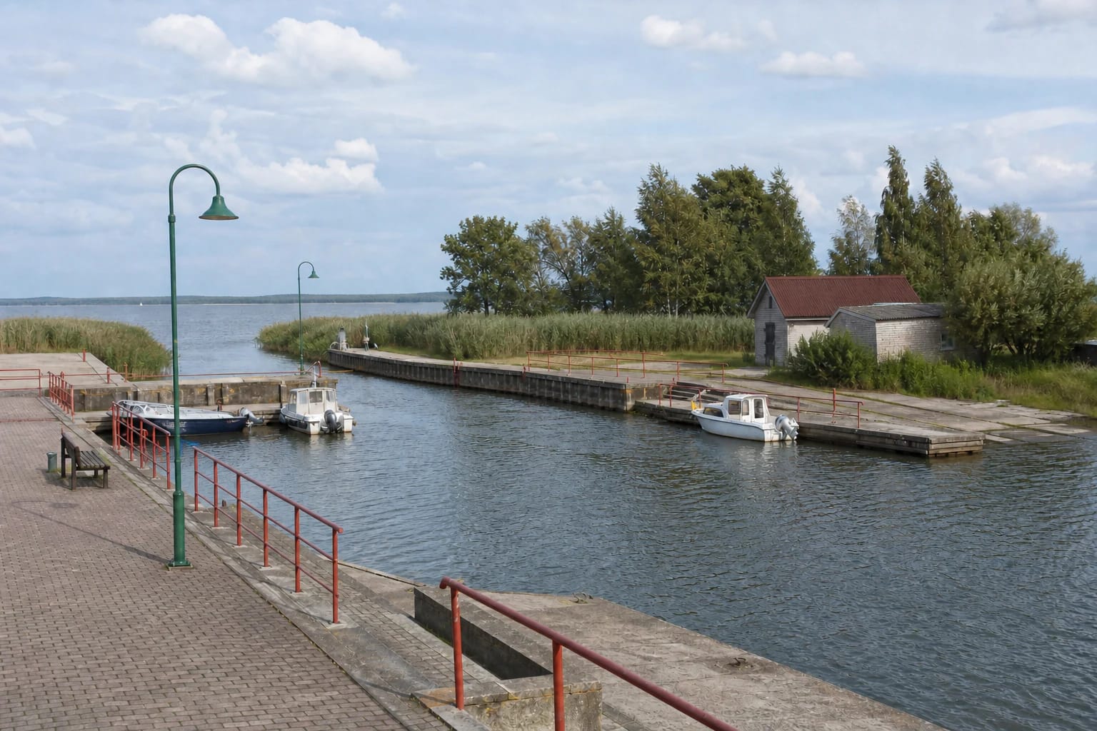
The harbour lies on the western edge of Kintai, at the end of Uosto Street beside the Curonian Lagoon. Official Šilutė District Municipality documents give the site as Uosto g. 12 and call it Kintų prieplauka, while the exact Google Maps card is named Kintų uostas. On this page, both names refer to the same basin and quay at that address.
The map point at 55.4245676, 21.2496325 marks the harbour basin beside the quay. Vehicle access approaches slightly farther east from Uosto Street, so navigation may lead into the shared harbour area rather than to a single defined gate. Follow signs on arrival and do not block the slipway or the working route used by boats.
Kintai Harbour is not the yacht and motorboat marina in Minija, or Mingė, village, roughly 7 km to the south. The current LTSA register lists the Minija marina as a separate registered facility associated with Kintai sailing enthusiasts' club Marių burės. The club's name does not make it the operator of the Kintai landing at Uosto g. 12.
The modern harbour built in 2014
The reliable starting date for the present landing is 2014. Šilutė District Municipality states that a small-craft harbour meeting the needs of fishers and tourists was installed in Kintai that year. The work formed part of a fishing-infrastructure project, so the quay was intended from the outset not merely as a scenic waterfront but as a place to launch and moor boats and support fishing activity.
The quay has two levels, helping crews reach boats as lagoon water levels change. Beside it are a concrete slipway, a paved upper waterfront, red safety rails, benches, and lighting columns. The scale is that of a small Pamarys harbour, not a deep-water port or a marina for large yachts.
In 2024, the historically inspired sailing boat KINT'A1, built on the initiative of Kintai Arts, was launched into the Curonian Lagoon here. The event confirms community use and the launching of small craft, but it does not by itself establish a regular public passenger or excursion service.
Quay, slipway, and services that can actually be verified
The reliably visible and documented infrastructure consists of the basin, two-level quay, slipway, road approach, and improved pedestrian area. The official sources reviewed on 2026-07-14 do not publish a current number of visitor berths, quay capacity, or a separate harbour master for Kintai Harbour. A berth count cannot therefore be assigned from photographs alone.
Nor was there a verified permanent visitor-service list covering fuel, drinking water, shore power, sewage pump-out, repairs, an always-open toilet, or showers. Equipment mentioned in some fisheries projects is not enough evidence that it now operates as a public marina service. Boaters should bring what they need and confirm current arrangements with the municipality or Kintai Eldership.
The slipway is a working boat-launch facility, not an unrestricted parking lane. Before bringing a boat or leaving one for any length of time, arrange use and any applicable fee. Boat excursions must likewise be booked with a named provider, because municipal sources do not publish a permanent departure timetable from Kintai Harbour.
Arriving by road and visiting on foot
From central Kintai, follow Uosto Street toward the lagoon. There is a paved approach and open parking-area space by the site, but no official visitor-space count or parking terms are published. Park only where signs permit and leave room for trailers to turn, for the slipway, and for emergency and service access.
The waterfront can be viewed on foot from the publicly accessible upper part of the quay. The official sources reviewed do not list a separate admission ticket or museum-style visiting hours. Vessel movements, events, maintenance, or temporary signs may still restrict access, so a public site does not mean visitors may enter boats or occupy every part of the quay.
Parts of the upper area are paved and reasonably level, but a change in height separates the lower quay, and no accessible boarding point is officially identified. A wheelchair user should assess the surface in advance and remain on the upper level unless local conditions clearly allow otherwise. Close to the water, watch for wet surfaces, ropes, and unguarded working edges.
Approach from the Curonian Lagoon and safety
Boats approach Kintai Harbour from the Curonian Lagoon and the Dreverna-Ventė state inland waterway. The Inland Waterways Authority reported that in 2025 it completed clearance of the 580 m Kintai approach, removed about 11,500 cubic metres of sediment, and achieved a depth of at least 1-1.25 m after the work even under unfavourable low-water conditions.
Those figures describe the result of specific work in the approach in 2025. They are not a permanent guarantee for the entire basin, every point along the quay, or a vessel of any given draught. Wind quickly changes water level and wave conditions on the Curonian Lagoon, while sediment can return to the shallow approach, so check the latest navigation notices, weather, and actual depth before sailing.
Keep children close at the quay because the lower level and slipway may be slippery and moored boats move. Do not treat the harbour basin as a bathing area: the municipality's 2022 activity report describes Kintai town beaches and the fisheries project at the landing as separate infrastructure. Use a marked Kintai beach zone for swimming and leave harbour space to vessels and fishing work.