Karklė, Klaipėda District Municipality
Seaside Regional Park
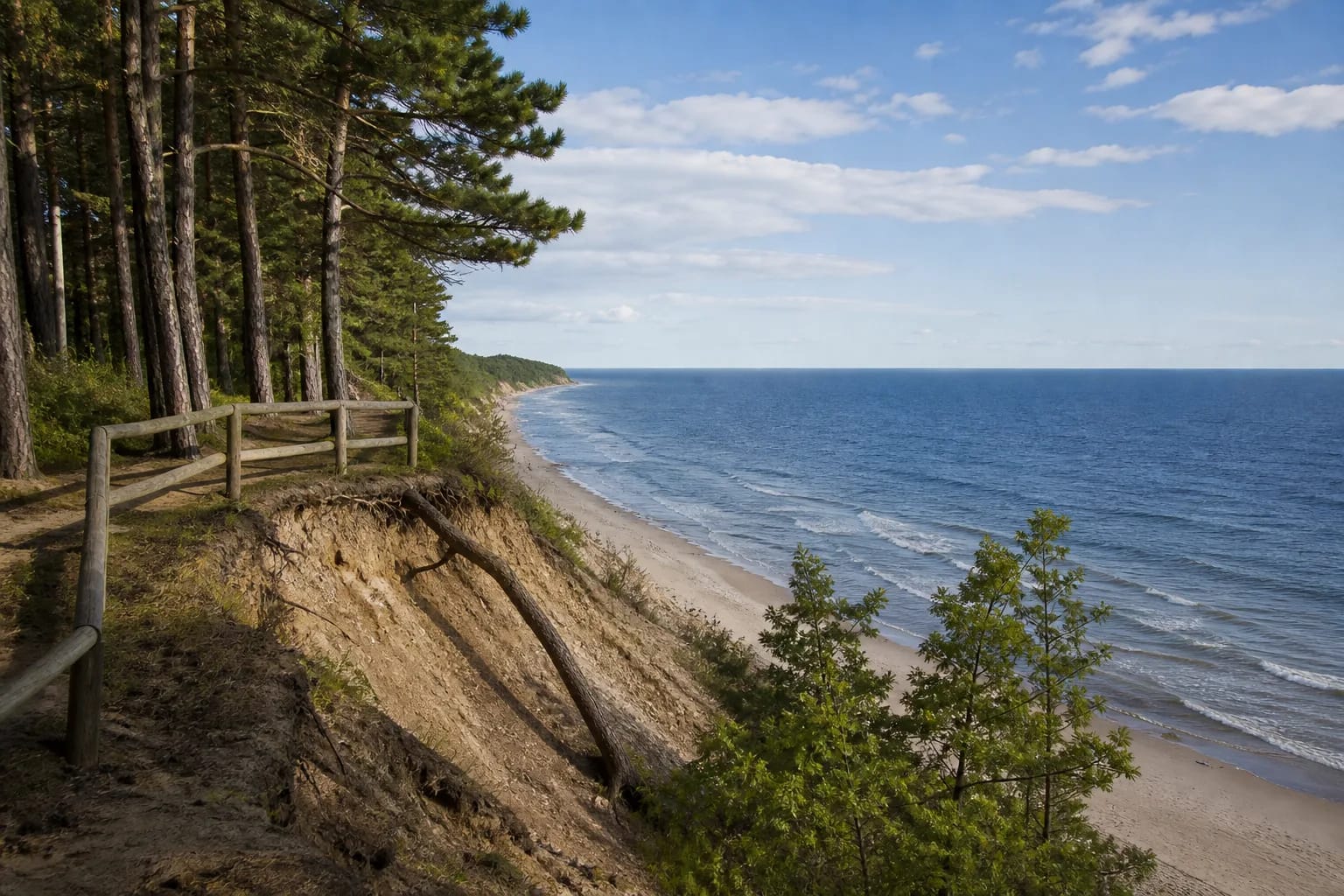
erosional Baltic Sea coast cliff
55.79810, 21.06750
30 minutes-1.5 hours
late spring to early autumn, clear day for the sea view
Olando Kepurė, Olandų Kepurė
Olando Kepurė: Lithuania's highest seaside cliff
Olando Kepurė is an impressive Baltic Sea cliff near Karklė, about 2 km north of Giruliai in Klaipėda District. VLE identifies it as the highest place on the Lithuanian coast, and the surrounding area belongs to Seaside Regional Park and is protected as Olando Kepurė Landscape Reserve. The cliff extends for about 1 km, so it is not just a point, but a whole section of high coast.
For visitors, Olando Kepurė matters in two ways: from the top opens a wide sea panorama, and the slope itself shows what the Lithuanian coast is made of. Nowhere else on the country's coast is there such a high and steep rocky shore, so the site is useful for both view and geology.
How high is Olando Kepurė
The exact height should be given carefully because sources differ. The VLE article states that Olando Kepurė is about 18 m high and the highest on Lithuania's coast, while the VLE article on Seaside Regional Park adds that, by other data, the cliff reaches up to 24 m. Popular sources often repeat a value of 24.4 m.
The most accurate wording is that Olando Kepurė is Lithuania's highest sea-coast cliff, with its height given from about 18 to 24 m depending on measurement and source. The number also changes with nature itself: the shoreline is constantly reshaped by marine erosion.
How the cliff formed
VLE states that Olando Kepurė is an erosional cliff whose slope exposes moraine loam with thin sand layers. These deposits formed during the last glaciation, about 12-15 thousand years ago, as the Baltic glacier retreated. The cliff is therefore not rock in the traditional sense, but a section through deposits carried by ice and exposed by waves.
Waves continuously erode the coast, washing gravel and boulders from the foot of the cliff. The geology of Olando Kepurė was studied by the noted geologist V. Gudelis. Erosion changes the shore over decades, making the place both beautiful and fragile.
Name origin and navigation marker
It is thought that the name 'Olando Kepurė' came from the cliff's form: viewed from the sea, the high coast resembled a Dutch sailor's cap. The site long mattered for navigation because the high shore served as a landmark for sailors.
VLE notes that in the early nineteenth century navigation signs were installed here, and from then on the place appeared on maps and nautical charts. Olando Kepurė therefore has both natural and maritime-cultural meaning: it is at once a landscape monument and an old coastal landmark.
Visiting: trails, erosion, and safety
Olando Kepurė is an open natural site without a ticket. It is conveniently reached by Karklė educational and health trails, and the Klaipėda-Palanga seaside bicycle route passes nearby, so it fits easily into a longer coastal route on foot or by bicycle. A short visit takes half an hour; with trails and the beach, plan up to a couple of hours.
Safety is the most important rule. The cliff top is continuously eroded and may slide, so standing right on the steep edge is dangerous. Use installed paths or stairs to reach the sea, not the crumbling slope. To protect the fragile coast, do not climb the slope and stay on marked paths.