- Place
- Šilutė, Šilutė District Municipality
- Region
- Pamarys
- Type
- stationary inland-waterway landing and small-craft harbour
- Address
- Uosto g. 9, Šilutė
- Coordinates
- 55.33984, 21.45213
- Visit duration
- 30-60 minutes to view it from land; launching, mooring, or taking a boat trip must be arranged separately
- Best time
- in daylight from May to September for a land-side view; boaters must first check Šyša conditions, weather, and harbour rules
Šilutės mažųjų laivų uostas, Šilutės uostas, Šilutės prieplauka
Where exactly Šilutė Small-Craft Harbour is
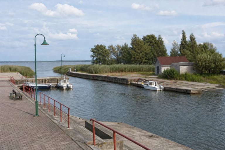
Šilutė Small-Craft Harbour is on the western edge of Šilutė at Uosto g. 9. It is an elongated basin set back from the main river channel in a historic Šyša oxbow, with a connection to the Šyša flowing below the town. It is not a generic name for the entire Šilutė waterfront, a landing on Rusnė, or the group of marinas at Mingė.
The coordinates 55.339835, 21.4521346 mark the exact Google Maps harbour card within the basin site. This is an honest marker for the whole facility, not an officially confirmed gate point. Pedestrian and vehicle access follows Uosto Street towards the red harbour building and paved yard; follow local signs and staff directions on arrival.
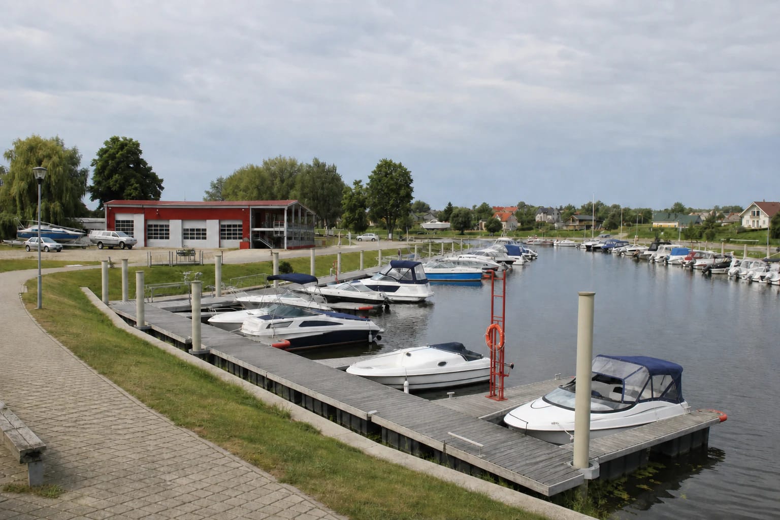
The clearest land-side view is from the paved approach beside the harbour building. Floating piers, the slipway, boathouse, manoeuvring water, and service yard are working areas. An open view of the water does not by itself grant permission to enter every pontoon, board a vessel, or occupy a berth.
From a steamer port to the reconstructed basin
VLE dates the beginnings of Šilutė's harbour to the First World War. Steamers sailed from here to Klaipėda, Tilsit, and Königsberg, while the Šyša linked the town to the Atmata and the wider waters of the Nemunas Delta. The harbour developed as a transport and trading place, not as a seaside yacht resort.
A regional historical account gives the original oxbow basin an area of about 2,500 sq m, a depth of 1.82 m, and a 120 m reinforced-concrete quay. These figures describe the early harbour and are not a guarantee of today's depth, usable quay length, or safe vessel draught.
The 2007-2009 reconstruction project cleaned the basin and a section of the Šyša while renewing quays and adding pontoons, a slipway, boathouse, and shore infrastructure. The municipality's 2022 activity report recorded 137 permanent moorings and 158 contracts during that season. This documents the previous operating model; it does not mean the same number of guest berths is available in 2026.
Who manages the harbour in 2026
The concession agreement signed with UAB Kintai in 2008 was terminated in spring 2026. The current harbour notice states that Šilutė District Municipality has managed Šilutė Small-Craft Harbour since 2026-05-06. Municipal council materials envisaged temporary infrastructure administration by the public body Šilutės turizmas.
Following that change, old contracts, former concessionaire pages, and earlier price lists cannot be treated as automatically valid 2026 terms. The official telephone number published for practical harbour questions is +370 659 60 463. Before arriving by boat, confirm not only the price but the assigned berth, permitted duration, and payment procedure.
The official sources reviewed did not publish a general 2026 guest-booking page, consolidated tariff, or opening hours for the whole site. A brief land-side view and a contracted boat service are different things, and short stays, slipway use, or winter storage should never be assumed to be free.
The Šyša approach, mooring, and verified services
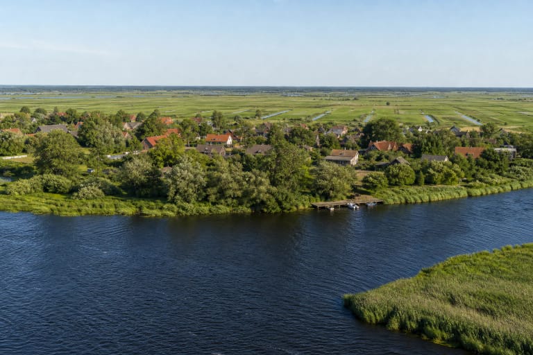
Boats approach from the Nemunas Delta via the Atmata and Šyša. The Inland Waterways Authority cleaned the 4.0-4.7 km section of the Šyša in 2025 and aimed for a depth of 1.5 m after the work, but the 2026 list of operated state-significance waterways gives the Šyša no guaranteed dimensions or navigation dates. A 2025 maintenance result must not be turned into a standing 2026 draught guarantee.
Before sailing, provide the vessel's length, beam, draught, planned arrival time, and length of stay, then obtain confirmation for a specific berth and any slipway use. Check actual water levels, silting, navigation notices, and weather as well. The former operator's page states that the scheduled Šilutė-Nida route does not operate in 2026, so the harbour should not be treated as an automatic departure point for regular excursions.
Temporary-administration documents include mooring, electricity, drinking water, and waste collection among essential services for boat owners. A short-stay visitor must confirm access to them in advance. Fuel, public toilets or showers, pump-out, repairs, boat hire, and a café open every day were not reliably verified as public daily harbour services on 2026-07-14.
Land-side visits, accessibility, and safety
The official sources do not publish a separate ticket for a brief land-side view or museum-style visiting hours. The safest choice is to arrive in daylight and remain in the clearly accessible paved area. Launching activity, events, maintenance, or temporary barriers can alter normal access.
The approach and part of the shore-side yard are paved and fairly level, but no official visitor-space count, free-parking policy, or certified step-free route is published. Gangway slopes change with water level, while quay edges and wet surfaces present hazards. Visitors with limited mobility should call ahead to agree on the most suitable stopping and viewing point.
The basin is a place for mooring and manoeuvring boats, not a confirmed bathing area or public fishing platform. Do not swim or fish from the pontoons without checking local rules and permission. The exact Google Maps card's 5.0/5 rating was recorded on 2026-07-14, but it does not verify a particular service, price, or level of access and may change over time.