- Place
- Neringa Municipality
- Region
- Neringa
- Type
- working Baltic Sea aid to navigation on Raganos, or Bloksberg, Hill
- Address
- Raganos (Bloksberg) Hill, Juodkrantė old forest, Juodkrantė, Neringa
- Coordinates
- 55.55650, 21.11583
- Visit duration
- 10-20 minutes at the tower; 1.5-2.5 hours with the Miško katedra route
- Best time
- in dry daylight; spring or autumn foliage conceals less of the tower
Bloksberg Lighthouse, Raganos Hill Lighthouse, Juodkrantė navigation light
A working marine light, not an observation tower
Juodkrantė Lighthouse stands in the old forest north of the main settlement, on historic Bloksberg, now also called Raganos Hill. It is a working aid to navigation for the Baltic Sea. Its purpose is to remain identifiable from offshore, not to carry sightseers above the trees.
You can walk to the tower and view its exterior. The Curonian Spit National Park states plainly that the lighthouse has not been adapted for visitors. The platform visible high on the structure is a service gallery, not a public viewpoint, so the tower, stairs, and upper gallery must not be entered or climbed.
Do not confuse this site with the well-known Hill of Witches sculpture trail nearer central Juodkrantė. VLE identifies that 42-metre Jono Hill with the woodcarving project begun by Lithuanian folk artists in 1979. The lighthouse is on a different hill farther north: the historic Bloksberg, also called Raganos Hill in Lithuanian sources.
What Juodkrantė Lighthouse looks like and how its light works
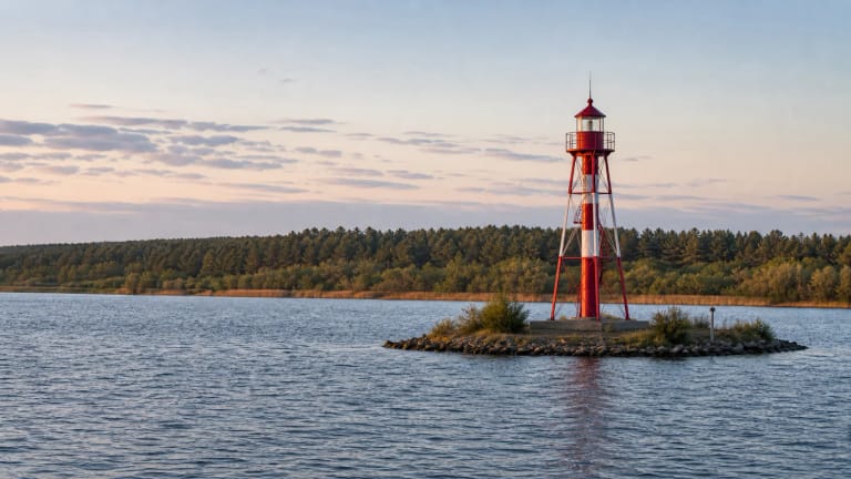
This is not a conventional masonry lighthouse. Its lower section is a black, four-sided steel lattice tower tapering upwards like a pyramid. A large white rectangular daymark made of horizontal slats covers the upper section, and an open service gallery crowns the structure. In the dense pine forest, the complete form only becomes clear at close range.
The National Park gives the tower's height as 19.7 metres, while the 2021 LTSA List of Lights rounds it to 20 metres. That publication records the elevation of the light as 75 metres above sea level and its nominal range as 18 nautical miles, or roughly 33 kilometres. This is a navigational specification, not a promise that a person standing among the trees will see the beam from that distance.
Its characteristic is one long white flash every eight seconds: three seconds of light followed by five seconds of darkness. LTSA also notes that only the upper part of the tower is visible from the sea. The white slatted panel acts as a daymark above the canopy, while the distinctive flash rhythm identifies the station after dark.
Bloksberg, Werners Blick, and the disputed construction year
Before the lighthouse was built, Bloksberg was one of the principal walks of the old Juodkrantė resort. Lithuania's protected-area information records that when the dune was still open, visitors could see the Curonian Lagoon and the Baltic Sea, with views towards Nida and Klaipėda. The National Park guide describes a glass viewing pavilion on the summit called Werners Blick, or Werner's View, named after resort commissioner Rudolf Werner.
The experience is entirely different today. Mature forest surrounds the dune, the historic pavilion has disappeared, and the lighthouse platform did not replace it as a public belvedere. The reward is not a broad panorama but the meeting of nineteenth-century resort promenades, a wooded dune landscape rescued from moving sand, and a starkly functional twentieth-century navigation tower.
Official sources disagree on the construction date. The National Park's dedicated lighthouse page gives 1953, while its Raganos Hill page and official guide give 1950. Until a primary construction record settles the discrepancy, the transparent description is that the tower was built in the early 1950s, with both official dates acknowledged.
Finding the lighthouse on the Miško katedra route
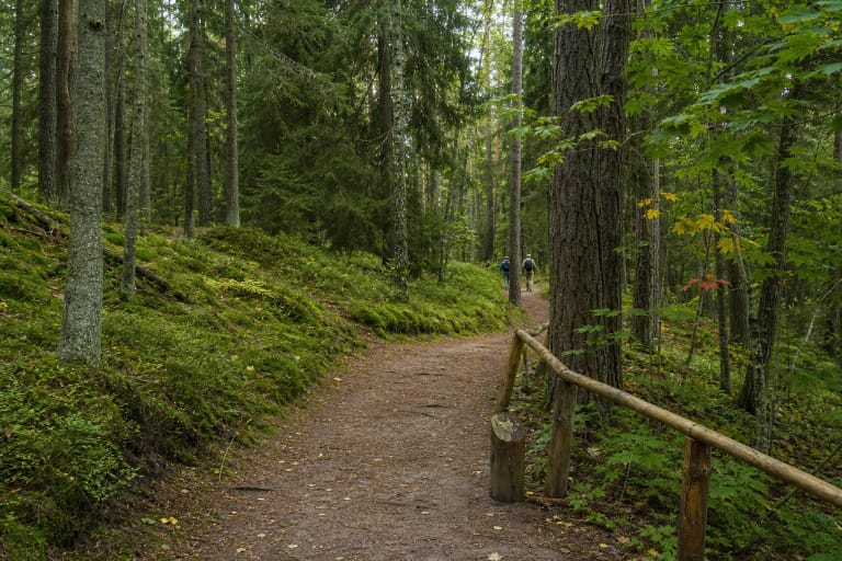
The Curonian Spit National Park directs visitors to the lighthouse along the Miško katedra, or Forest Cathedral, walking route and says that the site can be reached on foot or by bicycle. Its official guide describes a wider historical-promenade circuit of about six kilometres that passes the lighthouse through old parabolic dunes and Juodkrantė's mature forest.
The guide suggests two approaches: from Amber Bay, starting across the road, or from the Juodkrantė church side, climbing the steps behind the open-air stage. Trail markers, steps, and temporary diversions can change, so check the latest park information or ask at the visitor centre on L. Rėzos Street before setting out.
The pin on this page is not a general hill centroid. The coordinates 55.556500, 21.115833 are converted from LTSA's published position of 55 degrees 33.39 minutes north and 21 degrees 06.95 minutes east, so they mark the official location of the light.
Tickets, access, and safe behaviour at the tower
No visitor ticket or tower opening hours are published for Juodkrantė Lighthouse because the interior is not open for tours. The forest route leads to the exterior, but that does not guarantee uninterrupted access: storm damage, forestry work, or protected-area management may temporarily alter the path. Check the National Park's current advice before travelling.
Ten to twenty minutes is enough at the tower itself, but allow 1.5-2.5 hours for a fuller Miško katedra walk. Wear shoes suited to natural forest paths, carry tick and mosquito repellent in summer, and leave enough daylight for the return through an unlit forest.
Although the National Park says the tower can be reached by bicycle, sandy surfaces, dune slopes, and occasional steps are not equivalent to a paved cycleway. No official source confirms a step-free route to the tower, so visitors with reduced mobility should ask the park about current conditions in advance. Do not cross barriers, touch operational equipment, or attempt to climb the service stairs.