Klaipėda District Municipality
Seaside Regional Park
wild sea coast and educational trail system in a regional park
Placio g. 54, Karklė village, Kretingalė Eldership, Klaipėda District
55.81200, 21.07200
1.5-2 hours for the red trail; up to half a day for the whole network
late spring to early autumn; winter for birdwatching
Karklininkai, Karkelbeck, Karklė health trails
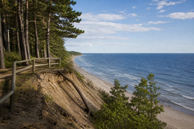
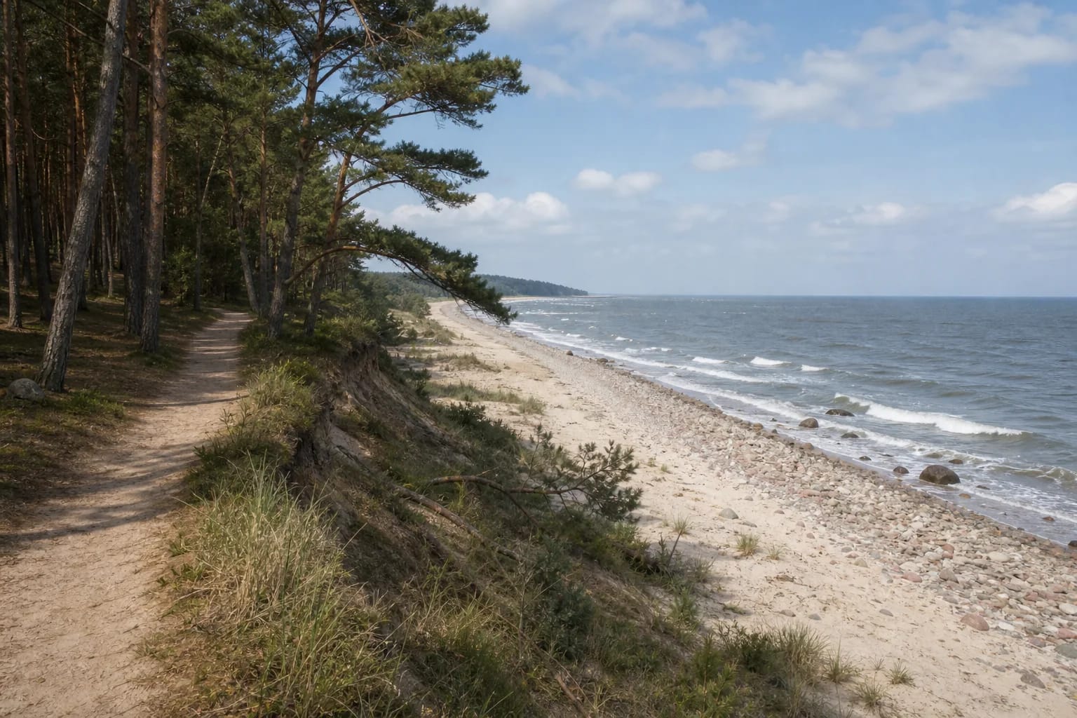
Karklė coast: wild Baltic shore
Karklė coast is probably the only undeveloped, wild stretch of Lithuania's mainland Baltic Sea shore. Elsewhere the coast is resorts, the Curonian Spit, or Klaipėda port; here there are dunes, seaside pine forest, a boulder-strewn beach, and an old fishing village. All of it is protected in Seaside Regional Park.
The wild character partly formed during the Soviet period: the entire coastal strip was a USSR border zone, and in 1954 part of Karklė was assigned to the military. The coast therefore remained undeveloped, and the regional park established in 1992 secured that character legally.
Health trails: a network of educational paths
The coast is crossed by the park's health-trail network: colour-marked forest paths, all returning to the park directorate parking area on Placio Street. The whole network is about 15 km long and takes roughly 2.5 hours; the trails are considered easy.
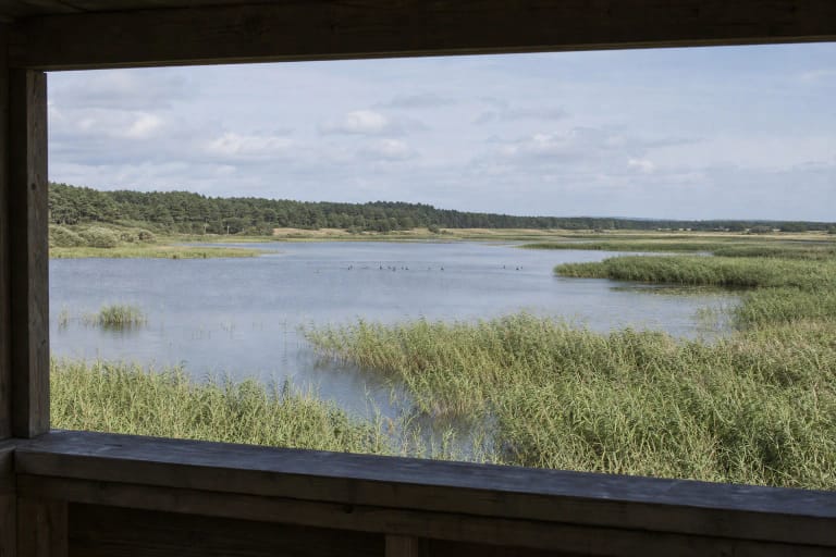
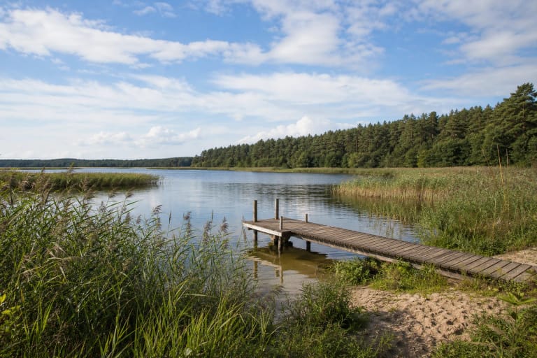
The best-known is the red 'Karklė' trail, about 4 km long, which follows coast and forest past the Olando Kepurė viewpoint, through wild seaside nature, and back through old Karklė. The yellow trail runs through seaside pine forest, while the blue trail leads to Kalotė Lake. Information boards along the paths state how many calories are burned on each section, hence the 'health' name.
Dunes, boulder shore, and natural values
Seaside Regional Park protects an active sea-zone landscape: dune belt, the Litorina Sea Nemirseta dune ridge, sandy beaches, cliffs, and a glacial boulder field in the sea and on shore from Olando Kepurė to Nemirseta. The underwater boulders form Lithuania's only reef-type coast, protected in Karklė Marine Reserve.
The coast is important for birds as well: a major migration route runs along it, and in winter more than 10 thousand waterbirds winter in the sea between Karklė and Palanga. Rare bird species breed in the park, and plants typical of the eastern Baltic coast grow here.
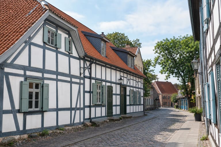
Old Karklė fishing village
Karklė was first mentioned in 1253, and in the nineteenth century separate homesteads merged into Karklininkai, considered the longest village in the Klaipėda Region. It stretched along the sea so that every yard had its own access to the water. It is Lithuania's only fishing village directly on the open sea that has preserved an ethnographic character, and it is protected in Karklė Ethnocultural Reserve.
The village retains a late-nineteenth-century German-built sea rescue station and old seaside cemeteries with authentic gravestones. The park visitor centre has an exhibition about the meeting of land and sea, including a Baltic-coast aquarium and amber story.
How to visit
The coast and health trails are open, free, and accessible year-round. The trails begin at the park directorate parking area at Placio g. 54 in Karklė. Late spring to early autumn is best for swimming and dunes, while winter is interesting for birdwatching.
Olando Kepurė is a separate object on the red trail and is worth treating as a stop. A wild-coast trip combines well with Plazė and Kalotė lakes or nearby Klaipėda.