- Place
- Klaipėda City and Neringa municipalities
- Region
- Curonian Spit
- Type
- 21 km paved section of a shared walking and cycling path through Curonian Spit National Park
- Coordinates
- 55.56792, 21.11222
- Visit duration
- 2-3 hours one way with short stops; 4-6 hours if returning by the same route
- Best time
- a calm morning in May, June, or September, when the path is quieter and the pinewoods are not too hot
Juodkrantė-Smiltynė Cycle Path, Smiltynė-Juodkrantė Cycle Path, Northern Section of the Curonian Spit Walking and Cycling Path
The 21 km section is not the whole Smiltynė-Nida path
Curonian Spit National Park divides the full paved route from Smiltynė to Nida into three parts: 21 km from Smiltynė to Juodkrantė, 16.5 km from Juodkrantė to Pervalka, and 14.5 km from Pervalka to Nida. This page covers only the first section, so the Nagliai Nature Reserve and its Grey Dunes are not part of the 21 km ride.
The path starts in Smiltynė, within Klaipėda City, and finishes in Juodkrantė, within Neringa Municipality. The mapped point at 55.5679161, 21.1122197 is a representative location near the Juodkrantė end, not the only route entrance, an official car park, or a bicycle-hire desk.
Decide how you will return before setting out. Riding the same path both ways makes a journey of about 42 km, while continuing south to Nida turns the day into a substantially longer trip that requires separate planning.
Pinewoods, sand, and a former fire site rather than constant sea views
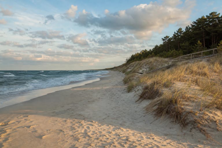
The official route description says the Smiltynė-Juodkrantė section runs near the sea, through a former fire site and small woodlands. That does not mean the Baltic remains visible from the saddle for all 21 km. Coastal pinewoods and the protective dune ridge screen the horizon along most of the path.
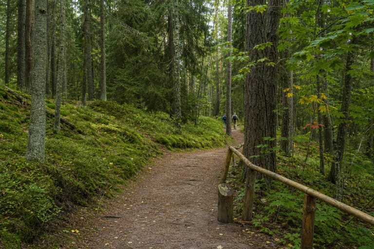
The section's defining sight is not a single panorama but a changing forest corridor: dark asphalt, pale sandy edges, gentle rises, and moving pine shadows. The woodland opens in the former fire area, making it especially clear why fire prevention matters on the Curonian Spit.
The landscape is protected as a national park and as part of the Curonian Spit World Heritage property. Stay on the maintained route, do not cut across the forest floor, and use designated stairs or marked access points when going to the sea so that the protective dune ridge is not damaged.
Why a 21 km ride includes a 13.5 km reconstruction figure
In 2023, a 13.5 km stretch from Second Smiltynė Beach towards Juodkrantė, between kilometre markers 2.104 and 15.567, was comprehensively rebuilt. This is why official sources place a second figure beside the 21 km journey distance: it identifies the major reconstruction project, not the full section described on this page.
Before the work, parts of the path were 2-2.5 m wide. The rebuilt stretch was widened to 3.5 m, additional protection against tree roots was installed below the surface, and the structure was strengthened so that forestry and firefighting vehicles can use it in an emergency.
The wider asphalt makes passing easier, but it does not give cyclists priority over the entire space. This is a shared walking and cycling path, so slow down around families, children, and slower pedestrians, signal before overtaking, and leave adequate clearance.
Planning a one-way ride
From Klaipėda, the first stage is the ferry crossing to Smiltynė. Sailings, ticket prices, rules for carrying bicycles, and congestion at a particular terminal can change, so check the official Smiltynė Ferry website before departure. On a summer weekend, build possible ferry waiting time into the day.
At an unhurried touring pace, allow 2-3 hours for the 21 km one-way ride with short stops. Carry water, food, a pump or repair kit, and check brakes and tyres while still in Klaipėda because long forest stretches do not offer continuous shops or repair services.
In 2026, a public bicycle repair station with an air pump and basic tools was installed beside the path at Zuikynė, on the approach to Juodkrantė. It can solve a minor problem near the end of the ride, but it is no substitute for a spare tube, patches, and the ability to make basic repairs yourself on a remote section.
Safety on a shared path through a fragile landscape
Although ordinary motor traffic is excluded from the separate path, do not assume that a service vehicle can never appear. The strengthened structure is designed for forestry and firefighting access, so keep to your side on bends and ride at a speed that allows you to stop within the visible distance.
Check wind, rain, and national-park notices before travelling. Wet sand on the asphalt, fallen branches, a layer of pine needles, or maintenance work can change conditions even on a well-rebuilt path. Functional front and rear lights are essential if there is any chance of finishing after dark.
During periods of high fire risk, it is especially important not to smoke in the forest, use open flames, or obstruct emergency access. Carry all litter out and stop in maintained rest areas or settlement spaces rather than on the mossy forest floor.