- Place
- Rusnė, Šilutė District Municipality
- Region
- Pamarys
- Type
- short-stay passenger disembarkation landing and river quay
- Address
- Nemuno Street quay at the former Rusnė bridge site, Rusnė, Šilutė District
- Coordinates
- 55.29818, 21.38038
- Visit duration
- 15-30 minutes for the quay and Atmata view; arrival by boat or mooring must be arranged separately
- Best time
- in daylight and calm weather, after checking quay restrictions and the latest navigation information
Rusnės prieplauka, Rusnė Pier II, Rusnė passenger landing
Which point on the Atmata the map marks
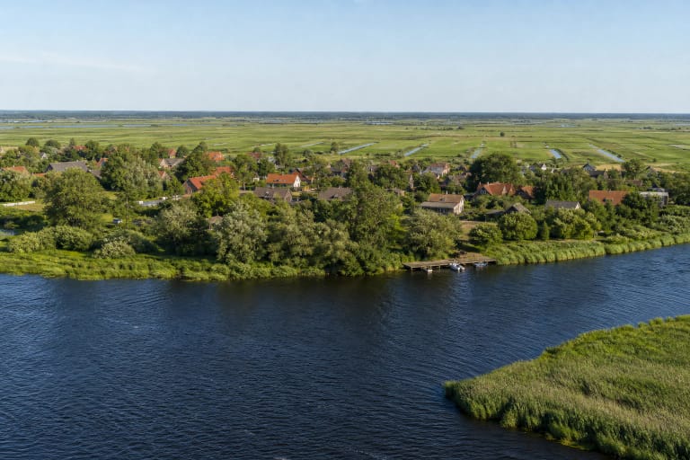
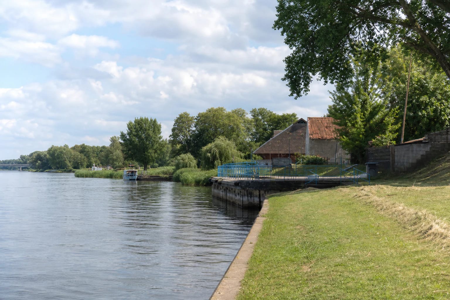
The official 2022 navigation study assigns coordinates 55.298184, 21.380383 to Rusnė Pier II on the Atmata at the former Rusnė bridge site. It is a low quay on the Rusnė town bank of the Atmata, one of the main distributaries of the Nemunas Delta. The present road bridge is a separate structure farther north, while the map pin marks the landing itself rather than the whole waterfront.
The same study inventories Rusnė Pier I farther north and Rusnė Pier III farther south as separate sites. Pakalnė Piers I, II, and III stand on another island channel, while Uostadvaris harbour lies much farther down the Atmata. Even the name can mislead: the study associates Pakalnė Pier III with the registered name Rusnės prieplauka, but that is not this Google Maps place.
Rusnė island is a 43.5 sq km inhabited delta landscape, not a synonym for this quay. No ratings or services from the island, the other landings, or Uostadvaris are used on this page. The exact card is identified by place ID ChIJWwI7eoWO5EYRkrMcJF24_XU.
The quay and equipment recorded in 2022
The navigation study described this point as a short-stay passenger disembarkation landing. It recorded mooring rings, passenger boarding and disembarkation steps, and timber beams used as fenders along the concrete quay. There were no bollards at the time of the survey, and a quay fitted with rings continued north towards the separate Rusnė Pier I.
In 2022, benches, litter bins, a waste container, and portable toilets were also observed beside the stone-paved quay apron. This is a dated condition record, not a promise that every item is present and operating on every day in 2026. No permanent toilet timetable or servicing schedule is officially published.
The study table gives no verified depth at this exact landing, permitted vessel draught, working quay length, or guest-berth capacity. Dimensions from nearby harbours and the maintained depth of the Atmata fairway therefore cannot be applied to the water immediately beside the quay edge.
Navigation, mooring, and unverified services
The Atmata forms part of Lithuania's state inland waterway network. VVKD reported completing channel clearance near Rusnė in July 2026, but work on the river reach does not guarantee a particular depth at the landing. Before approaching, check the latest navigation notices, water level, weather, and your vessel's draught.
Mooring rings and a short-stay disembarkation function do not create an unrestricted or free berth. On 2026-07-14, the official sources reviewed provided no dedicated guest-berth tariff, booking system, or permanent passenger timetable for this exact landing. Arrange an approach, a longer stay, and any fee in advance with Šilutė District Municipality or the current administrator named on site.
No public slipway, fuel, drinking water, shore power, pump-out, showers, or repair service is officially confirmed at the exact map point. A slipway recorded at a separate Pakalnė landing, or equipment mentioned elsewhere in Rusnė, is not a service of this quay. The short-stay passenger designation also does not prove that a scheduled excursion boat departs from here.
The former bridge site, structural condition, and plans
The landing is identified not only by its name but by its position at the former Rusnė bridge site. The 2026 design proposals for the wider Nemuno g. 2A quay area mark remains of the old bridge, the existing pier, and the harbour section extending north. This evidence separates the point from the present road bridge and other delta quays.
The design proposals reproduce findings from a special inspection in 2025: the pier, transition section, and harbour showed signs of a potentially dangerous structural condition. Deformation, excessive tilt in some piles, and through-cracks wider than 5 mm were recorded by the pier, prompting a recommendation for urgent reconstruction. This does not mean that the entire waterfront is permanently closed, but on-site barriers and warnings must be taken seriously.
Proposals published in 2026 envisage reconstructed quays, an expanded harbour, and water, wastewater, and metered electricity for future berths. The project documents describe these utilities as planned and state that the existing area lacked water-supply and domestic wastewater networks. Future marina facilities must therefore not be presented as services operating now.
Visiting on foot, accessibility, and safety
The Atmata view can be reached on foot from Rusnė town. As of 2026-07-14, the official sources reviewed published no separate sightseeing ticket or museum-style opening hours, although repairs, vessel movements, or structural condition may temporarily restrict part of the quay. Do not cross barriers, and keep access clear for crews and machinery.
The 2022 study said that cars could enter the stone-paved apron, but this does not establish a public car park or permission to leave a vehicle by the water. Follow current signs, do not obstruct the quay, and do not drive into a working area simply because navigation shows road access.
The upper apron has a hard surface, but passenger steps descend towards the water, parts of the quay edge are open, and fully step-free vessel access is not confirmed. Visitors with limited mobility should assess current conditions in advance and ask the vessel operator about a specific boarding. Keep children close and watch for wet edges, ropes, and moving boats.
Official sources do not designate this point as a bathing site or a separate public fishing place. A pier name is not permission to swim, fish from the working area, or board vessels. Use the safe upper part of the apron for the view and do not interfere with navigation.