Nida, Neringa Municipality
Curonian Spit
Dune, viewpoint, and sundial
55.29167, 20.99444
45-90 minutes
early morning, sunset, or a clear day after wind
Parnidžio kopa, Parnidis dune, Parnidis Dune and Sundial
Parnidis Dune in Nida: why climb it
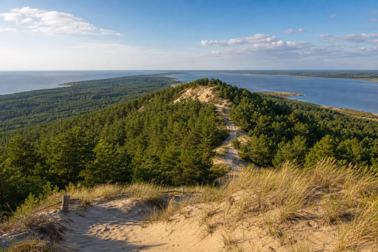
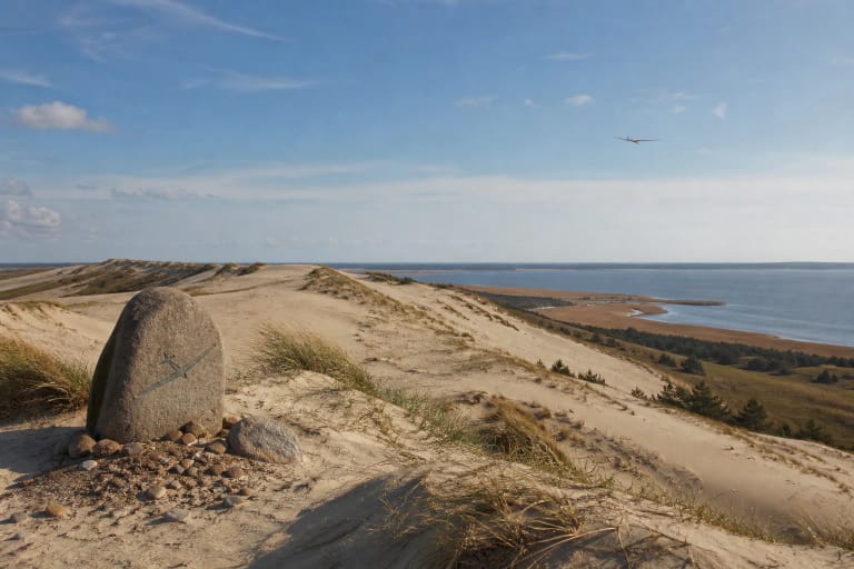
Parnidis Dune is in the Curonian Spit, south of Nida near Parnidis Cape, inside Curonian Spit National Park. It is one of the places where the Curonian Spit stops feeling like a simple seaside resort and becomes a narrow landscape of sand, forest, lagoon, and sea. Lithuanian encyclopedic sources give the dune's height as 54.2 m, so from the viewpoint you can see white-dune belts, Nida, the Curonian Lagoon, Bulvikis Cape, and, on a clear day, distant landmarks across the lagoon. North of the dune is Urbas Hill; to the south is the interdune hollow known as the Valley of Silence or Valley of Death.
This is one of the strongest first impressions in Nida. Once you climb up, the scale changes quickly: the town stays below, the paths and dune vegetation show how fragile the sand is, and the top opens into a wind-smoothed space. For visitors, Parnidis Dune works both as a short walk and as a slower way to understand the whole Curonian Spit landscape.
The Sundial on Parnidis Dune
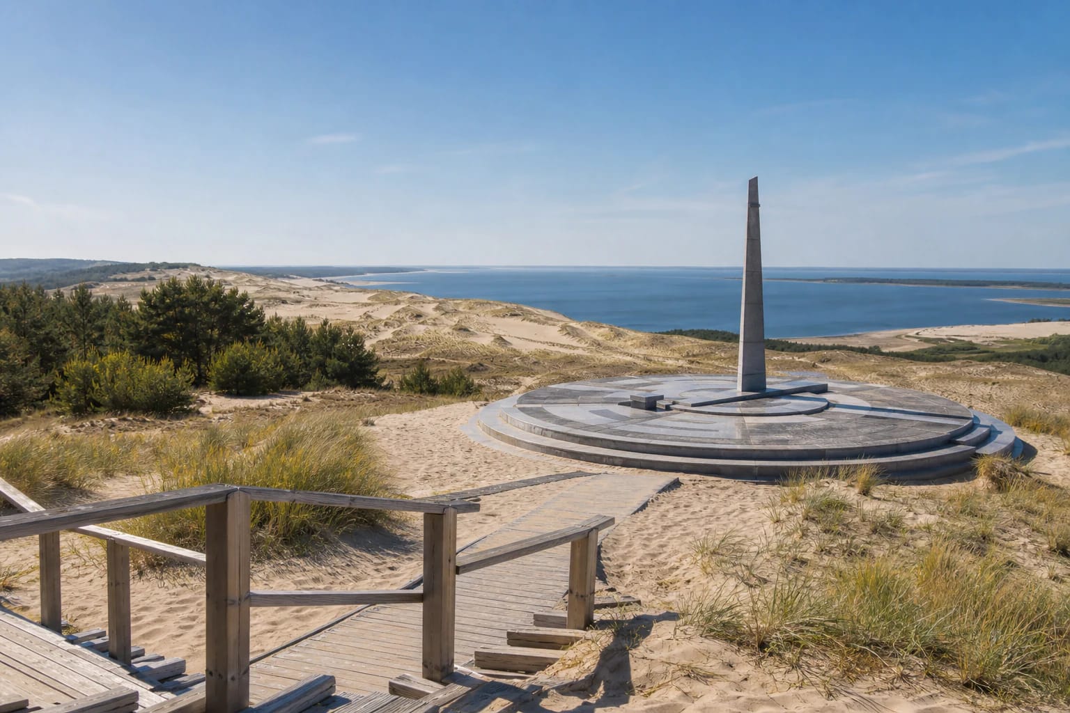
The most visible accent on Parnidis Dune is the granite sundial-calendar. Lithuanian encyclopedic sources note that it was built on the dune in 1995 and damaged by a hurricane in 1999, after which it was restored. The sundial is positioned so the dune top works as a natural viewpoint, while the vertical stone obelisk and circular stone platform with marks refer to the sun's path, the seasons, and calendar dates.
The carved calendar signs and festival pictograms are not only decoration. The object joins an astronomical idea, Nida's horizon, and a human attempt to leave a sign on the dune that works with the sun and the open landscape rather than overpowering it. The 1999 hurricane story is also a useful reminder of how strong wind and weather are on this ridge.
Landscape protection and the moving dune
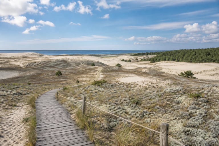
Parnidis Dune belongs to the protected Curonian Spit landscape, valued for the relationship between a sand peninsula, dunes, forests, lagoon shores, and settlements. Even if the view is your main reason to visit, the place itself is sensitive: dune slopes and dune vegetation are easily damaged, so visitors should stay on marked paths, stairs, and platforms and avoid restricted areas.
The movement of dunes on the Curonian Spit was historically a real danger to settlements, not a romantic postcard scene. Lithuanian sources note that Parnidis Dune moves toward the Curonian Lagoon and is getting lower: in 1955-1973 it shifted 75 m toward the lagoon, covered a nearby lagoon-side palve, and filled part of Nida Bay. Those numbers show that an open dune is not a fixed hill; wind is constantly rebuilding it.
Sand has buried more than one old village on the spit, while nineteenth- and twentieth-century planting, forest work, and dune-stabilization projects reshaped the landscape. Parnidis Dune descends toward the Curonian Lagoon on its eastern side, while its southern part is planted with mountain pines. From the viewpoint, open sand, forest belts, and settlements can be read as one system.
How to visit Parnidis Dune
The easiest way to reach Parnidis Dune is on foot or by bicycle from Nida, combining it with a walk through the southern part of town. If you arrive by car, follow local traffic and parking signs carefully: Nida is busy in season, and movement near sensitive dune areas is restricted.
Most visits need 45-90 minutes, but it is worth not rushing. Allow time for the climb, the sundial platform, and the views toward the lagoon and dunes. On windy days expect strong exposure, and in summer bring water because there is little shade on top.
When Parnidis Dune is most beautiful
For photography, Parnidis Dune is strongest early in the morning or in the evening, when side light reveals the shape of the sand. Sunset is popular, but in high season it can be crowded, so choose morning or a weekday evening if you want a calmer visit.
On a clear day you can read distant directions best: Nida Lighthouse, Bulvikis Cape, the Curonian Lagoon, and open dunes. After rain or stronger wind, the sand surface may look cleaner, but dune protection matters more than a shortcut to a better photo.