- Place
- Preila, Neringa Municipality
- Region
- Curonian Spit
- Type
- summit viewpoint on Preila Dune with timber stairs and a boardwalk
- Address
- Access from around 97 Preilos Street, Preila, Neringa
- Coordinates
- 55.36808, 21.05331
- Visit duration
- 30-60 minutes; longer when walking from central Preila or lingering at the viewpoint
- Best time
- a clear day in daylight; timber steps can be slippery after rain or during frost
Menininkų kopa, Preila Dune, Dailininkų kopa
What the Menininkų kopa Google listing actually marks
The Google Maps card with place ID ChIJy5LVwiqV5EYRy2vdk13cf1I marks the viewpoint and a section of ridge boardwalk at 55.368076, 21.053308. The pin is on the summit rather than at a car park. The card's address at 97 Preilos Street is better understood as the access side from the settlement than as a street address for the viewpoint itself in the woods.
This is not an independent nature reserve, although Google categorised the card as a nature reserve on 15 July 2026. The official sources reviewed define no separate protected-area polygon for Menininkų kopa. It is a summit viewpoint on Preila Dune, part of the Great Dune Ridge within Karvaičiai Landscape Reserve. It is also not Parnidis Dune, Urbas Hill, the Nida Artists' Colony, Thomas Mann House, or a stand-alone work of art.
A wooded summit of Preila Dune
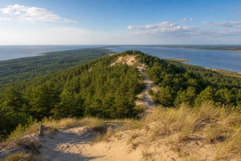
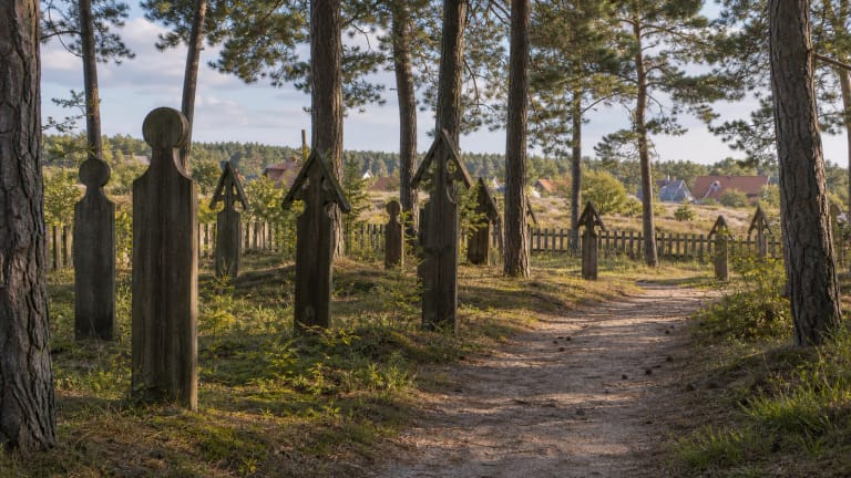
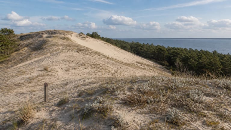
Lithuania's protected-area service describes the visitor-ready Preila Dune as a 53 m summit of the Great Dune Ridge. The landform here is stabilised and wooded with pines, birches, mountain pines, and low sand vegetation. Visitors should therefore not expect the immense open white sandscape associated with Parnidis Dune or the Nagliai landscape.
In clear weather, views open towards the Curonian Lagoon, the Preila surroundings, the wooded dune ridge, and the Baltic Sea direction. How much is visible on a given day depends on weather, foliage, and growing vegetation. The official park guide separately mentions 57.4 m Preila Hill, a 51.7 m summit shown under that name on old maps, and another summit called Menininkų kopa. Their names and height figures should not automatically be treated as synonyms for one point.
The local Artists' name and the official Preila Dune name
The official park guide records Menininkų kopa as a summit overlooking the lagoon and Preila. Neringa visitor material explains the local name: several painters reportedly worked on this dune during the Soviet period, leading Preila residents to adopt Menininkų kopa, also rendered as Dailininkų kopa, meaning Artists' Dune. The reliable sources reviewed do not name those painters, so individual names should not be supplied.
Park activity reports and path projects more often call the site Preila Dune or Preila Hill. Menininkų kopa is a local summit name recorded in an official park publication and now used by the Google card, not a separate legal or natural-heritage designation. The naming story does not prove that the nineteenth- and twentieth-century Nida Artists' Colony operated at this spot.
Timber stairs and boardwalk protect the slope
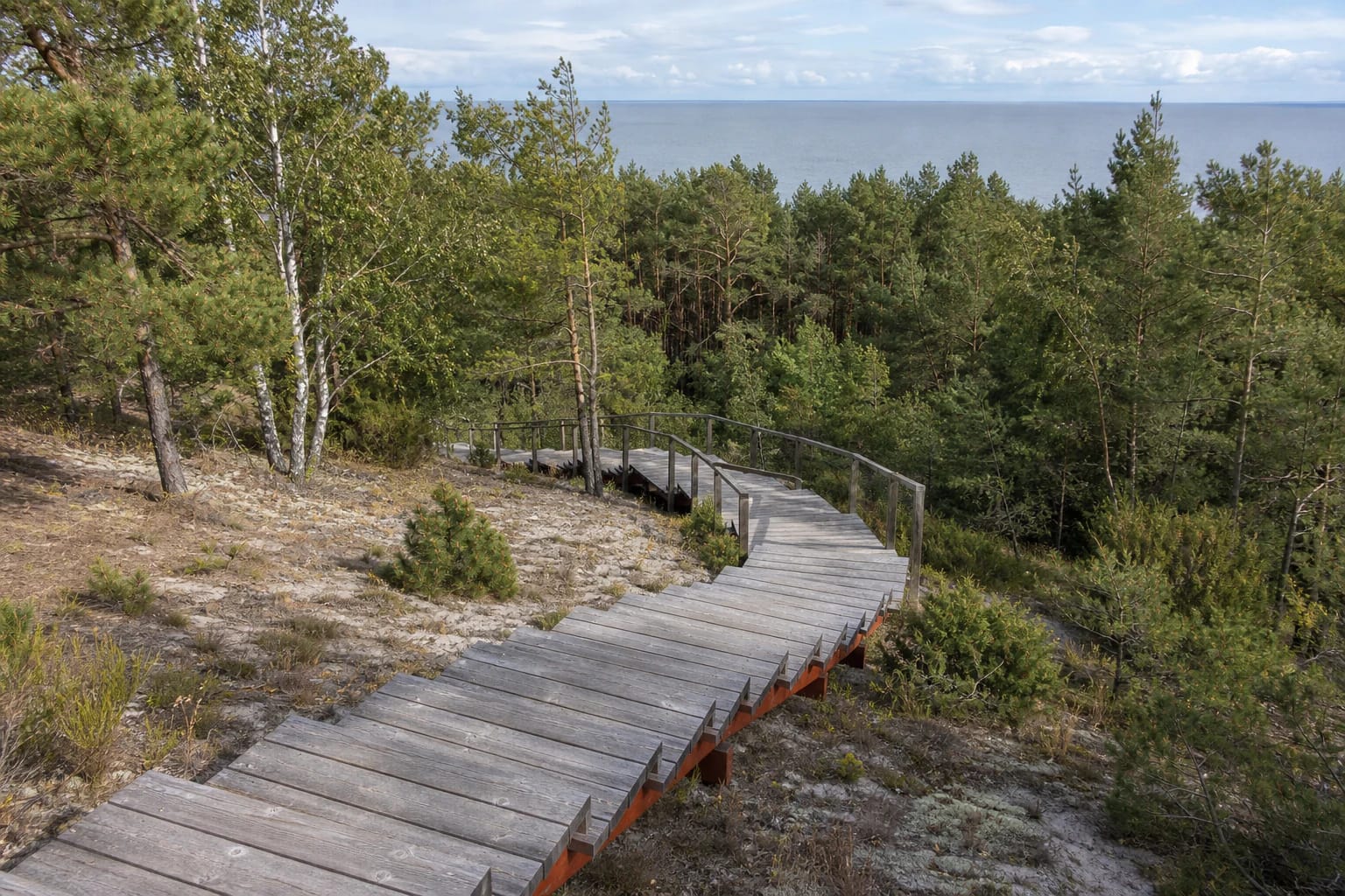
The park's 2020 activity report records the second and third stages of adapting Preila Dune for visitors, including stairs, a path, and platforms. In 2021, the authority reported completion of the viewpoint and timber route around the summit. The structure allows visitors to climb the steep wooded slope and circle the more sensitive top without trampling loose sand and vegetation.
The present route consists of a long sequence of timber steps, simple handrails, and a boardwalk that follows the ridge. The park authority's project Pėsčiųjų takas Neringoje, by Vytautas Paulionis, Janina Domeikaitė, and Nijolė Piekienė, won third place in the 2023 recreational architecture competition. It is visitor and erosion-control infrastructure, not a sculpture park or a single observation tower.
Access, visiting conditions, and the 4.9 rating
Approach from the 97 Preilos Street side, follow local wayfinding, and continue up the timber stairs. Because the Google pin marks the viewpoint above, it should not be treated as an instruction to drive along a forest path. The long stairway and gradients mean the route is not step-free; timber may be slippery after rain, in frost, or under snow. A typical visit takes 30-60 minutes, depending on the starting point and stops.
No separate admission ticket, ticket desk, or officially published viewpoint opening hours were found. The Google card showed 24-hour access on 15 July 2026, but daylight is safer and temporary closures or on-site signs take precedence. The national park visitor ticket was voluntary on that date, while ferry, vehicle-entry, and parking charges are separate and may change. Stay on the steps and boardwalk, do not disturb the slope, and do not take shortcuts through vegetation. On the same date, the exact Google card showed a rating of 4.9 out of 5.