
Places in this guide
Compare the places at a glance. Select a name to open its detailed visitor guide.
- Palanga Pier
A 470-metre pedestrian pier extending into the Baltic Sea, and the resort's classic place for watching the sunset.
- Palanga Amber Museum
One of Lithuania's most important amber collections, displayed in the Tiškevičiai palace and ranging from inclusions to the Sun Stone.
- Birutė Hill
A 21-metre coastal hill associated with an ancient sacred place, the legend of Birutė, and a Neo-Gothic chapel built in 1869.
- Olando Kepurė Cliff
Lithuania's highest Baltic coastal cliff, beside Karklė in Seaside Regional Park.
- Melnragė Piers
The sea gates of Klaipėda Port: northern and southern breakwaters, the lost White Lighthouse, and a close view of passing ships.
- Lithuanian Sea Museum
A museum in the nineteenth-century Nerija Fort at Smiltynė, with an aquarium, dolphinarium, and maritime-history exhibitions.
- Hill of Witches
A woodland trail of carved figures that brings Lithuanian tales, witches, devils, and the giantess Neringa into the landscape.
- Nagliai Nature Reserve Trail
A protected route through grey and white dunes and the memory of Curonian Spit villages buried by moving sand.
- Vecekrugas Dune
A 67.2-metre natural monument near Preila and the highest dune on the Curonian Spit.
- Nida Lighthouse
A red-and-white lighthouse on Urbas Hill, with a 1953 tower and 132 steps to its seasonal viewing gallery.
- Parnidis Dune
A 54.2-metre viewpoint with a monumental sundial and the Curonian Spit's most memorable panorama of open dunes and lagoon.
- Ventė Cape
An ornithological station, bird traps, and an 1863 lighthouse on one of Europe's major migration routes.
- Mingė Village
A protected fishing village in the Nemunas Delta whose principal street is the Minija River.
- Uostadvaris Lighthouse
An octagonal red-brick tower built in 1873–1876 on Rusnė Island, beside the Atmata River.
- Nemunas Delta
A landscape of river branches, polders, bird migration, and spring floods unlike anywhere else in Lithuania.
- Category
- Travel and places
- Reading time
- 15 min.
- Sources
- Lietuva.love travel guides and the sources cited in each place guide
One coast, three different worlds
Lithuania's coast is short, yet remarkably varied. In the north are open-Baltic resorts with broad beaches and sunset gatherings on Palanga Pier. Near Karklė rises the country's highest seaside cliff, while at Klaipėda the coast becomes a working harbour through which roughly 7,000 ships pass each year. Beyond the strait begins a different world: the Curonian Spit, whose Lithuanian section is protected by Curonian Spit National Park, was inscribed on the UNESCO World Heritage List in 2000 as a cultural landscape that records the long struggle—and cooperation—between people and moving sand.
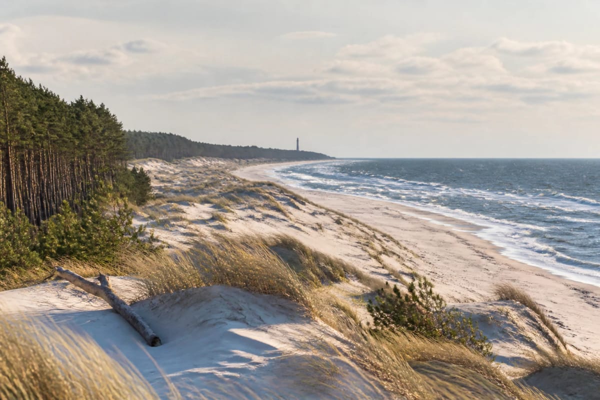
Two bodies of water define the spit: the open Baltic Sea to the west and the Curonian Lagoon to the east. Between them runs the Great Dune Ridge, part of an approximately 80-kilometre ribbon of sand from Smiltynė to Lesnoye, formerly Šarkuva. The dunes are not scenery alone but a living force: sand historically buried entire villages, and Parnidis Dune moved 75 metres towards the lagoon between 1955 and 1973. A third landscape waits across the water in the Nemunas Delta, where the river divides into branches, spring floods redraw the lowlands, and vast streams of migrating birds pass Ventė Cape.
This guide arranges fifteen places geographically from Palanga to the Nemunas Delta, making it practical to build a multi-day itinerary. Its facts come from the detailed Lietuva.love destination pages and the sources cited there; follow each place link for fuller history, verified figures, and current-planning advice.
Palanga and the northern coast
A classic journey begins at Palanga Pier, a pedestrian pier extending about 470 metres into the Baltic Sea. The first pier was built here in 1889, and its story began with commerce rather than romance: an initiative associated with the Tiškevičiai counts was intended to ship products from their brickworks. When navigation proved unsuccessful, the structure evolved into the resort's promenade. Today its best-known ritual occurs on summer evenings, when crowds gather at the end to watch—and sometimes applaud—the setting sun.
A few minutes away in the centre of Birutė Park, Palanga Amber Museum occupies the Tiškevičiai palace, built in 1897–1902 to a design by Franz Heinrich Schwechten. The museum opened in 1963 and holds more than 29,000 objects. Its approximately 15,000 amber inclusions form one of Europe's largest such collections, while the most sought-after exhibit is the Sun Stone, a 3,524-gram piece of amber. The palace stands in a park designed by Édouard François André, so the collection, architecture, and landscape are best experienced together.
The same park contains Birutė Hill, a pine-covered, 21-metre rise only about 150 metres from the sea. A pre-Christian sacred place once operated here. Tradition connects the hill with Birutė—wife of Grand Duke Kęstutis and mother of Vytautas the Great—who is said to have tended a sacred fire here and, according to belief, to have been buried on the hill. The Neo-Gothic chapel on the summit dates from 1869 and represents a later Christian layer at the old sacred site.
Karklė, Klaipėda, and Smiltynė
Halfway between Palanga and Klaipėda, in Seaside Regional Park, the shoreline suddenly rises. Olando Kepurė Cliff beside Karklė is Lithuania's highest Baltic coastal cliff; sources place its height between roughly 18 and 24 metres. Erosion exposes moraine deposits laid down by the last ice age around 12,000–15,000 years ago. Sailors probably supplied the name because the high shore resembled a Dutch seaman's cap from the water, and navigational markers stood here by the early nineteenth century.
At Klaipėda, sea and port meet most visibly at the Melnragė Piers. These harbour gates consist of a 733.66-metre northern breakwater at Melnragė and a 1,374-metre southern breakwater at Smiltynė. Work on the southern pier began in 1791, and the celebrated White Lighthouse was lit at the tip of the northern pier on December 16, 1884. Reconstruction in 2020–2024 made the piers convenient places to watch ships, but they remain dangerous during storms and strong winds.
A ferry across the strait leads to the Lithuanian Sea Museum at Kopgalis in Smiltynė. Formally opened on July 28, 1979, the museum occupies the nineteenth-century Nerija Fort, whose construction Prussia began in 1864. An aquarium with an 18-metre acrylic tunnel, a collection exceeding 98,200 objects, a dolphinarium, and maritime-history displays can readily occupy half a day. The site is also a natural gateway to the Curonian Spit, standing at its northern end.
Dunes of the Curonian Spit and Nida
At Juodkrantė, the Hill of Witches winds across a 42-metre parabolic dune. The outdoor sculpture trail turns the beings and stories of Lithuanian folk narrative into carved-oak figures. Its first folk-artists' camp in 1979 produced 25 sculptures; more than 100 have been created over the decades, from the giantess Neringa to the devils and witches of the darker part of the trail. The hill also preserves an older cultural memory: residents of Lithuania Minor celebrated Rasos here in the nineteenth and early twentieth centuries.
The most strictly protected section between Juodkrantė and Pervalka is reached on the Nagliai Nature Reserve Trail. It crosses grey dunes anchored by lichens and open white dunes still reshaped by wind. The reserve covers about 1,699 hectares, extends for approximately nine kilometres, and reaches almost 60 metres at its highest point. Known as the Dead Dunes, this is the landscape where shifting sand buried former villages. Access is regulated: a fee applies in season, and visitors must remain on the marked trail.
Near Preila, Vecekrugas Dune rises to 67.2 metres and is considered the highest dune on the Curonian Spit. Unlike open white dunes, much of it is covered in pines. Its name comes from the Curonian language—*vece* means old and *kruogs* an inn—so it is also called Old Inn Dune. From the top, forest, sand, and the Curonian Lagoon divide the narrow spit into a lucid landscape.
In Nida, Nida Lighthouse stands on Urbas Hill, an approximately 51-metre dune and the highest ground near the town. The first lighthouse, built in 1874, was destroyed by retreating German forces in 1944. The present 29-metre tower was completed in 1953, and its light is visible from roughly 41 kilometres away. During the summer season, visitors can climb 132 steps to a gallery overlooking Nida, forest, dunes, and lagoon.
The most powerful landscape on the spit is Parnidis Dune south of Nida. From its 54.2-metre viewpoint, white-dune ridges, the Curonian Lagoon, and Bulvikis Cape open below. A monumental granite sundial-calendar was erected on the ridge in 1995, damaged by a hurricane in 1999, and later restored. The dune itself offers the clearest lesson in the spit's fragility: it continues to move towards the lagoon, making marked paths essential rather than optional.
The lagoon coast and Nemunas Delta
On the eastern shore of the Curonian Lagoon, Ventė Cape projects towards the spit and forms one of Lithuania's most important bird-migration points. An ornithological station was established here in 1929 on the initiative of Professor Tadas Ivanauskas. On average, 60,000–80,000 birds are ringed each year, with the most intensive migration in September and October. Beside the station stands an 11-metre red-brick lighthouse built in 1863, a protected technical monument with a viewing platform over the lagoon.
The Nemunas Delta conceals one of Lithuania's most unusual settlements: Mingė Village, whose principal street is the Minija River. Houses line both banks, and traditional double-ended fishermen's homes turn their main façades towards the water. Mentioned from 1540, the settlement is protected as the Minija ethnographic-architectural village within Nemunas Delta Regional Park. It is best experienced slowly, from the banks or from a boat.
On Rusnė Island, on the left bank of the Atmata opposite the mouth of the Minija, Uostadvaris Lighthouse is an 18-metre octagonal red-brick tower built in 1873–1876. Green-glazed edges articulate the masonry, and 48 spiral steps lead to a viewing gallery. The tower no longer serves navigation, but it was declared a cultural monument in 1996. Together with the neighbouring water-lifting station, it explains the engineering of Lithuania's polder country.
Nemunas Delta unites this lagoon landscape. Its regional park, established in 1992, covers 29,069 hectares and joined the Ramsar List of Wetlands of International Importance in 1993. Here the Nemunas divides into the Rusnė, Atmata, and Skirvytė branches, while 36 polders and 44 pumping stations protect low ground from water. Spring floods lasting 20–28 days are known locally as *šaktarpis*; at such times, the delta becomes a vast shallow lake broken by islands of farmsteads and embankments.
Practical planning: ferries, seasons, and time
Ferries connect Klaipėda with the Curonian Spit. The Old Ferry Terminal is the convenient choice for pedestrians and cyclists, while motorists use the New Ferry Terminal. Drivers should budget for ferry, entry, and parking charges and allow extra time for summer-weekend queues. Ventė Cape, Mingė, Rusnė, and Uostadvaris lie on the mainland side of the lagoon and are reached overland through Šilutė without a ferry.
Season changes both access and experience. The Nida Lighthouse tower opens only in summer, and the Nagliai reserve trail charges admission in season. Spring and autumn—especially September and October—are best for migration at Ventė Cape. Spring flooding may close or disrupt the Šilutė–Rusnė road, so check current road and park information before setting out. Summer suits boat trips from Mingė or Rusnė, while Palanga Pier is at its best around sunset.
Allow three or four unhurried days for the full route: one for Palanga's pier, Amber Museum, and Birutė Hill; one for Klaipėda, Olando Kepurė, the Melnragė Piers, and the Sea Museum at Smiltynė; at least one for the Curonian Spit from Juodkrantė to Parnidis Dune; and another for Ventė Cape, Mingė, Uostadvaris, and the delta. With less time, choose one coherent landscape—the resort coast, the spit, or the delta—and leave the others for another journey. This region rewards travelling slowly.