Šilutė District Municipality
Šilutė District
regional park, river-branch and flood landscape
Kuršmarių g. 13, Rusnė, Šilutės r.
55.30100, 21.36500
2-6 hours, or a full day with a boat trip or birdwatching
spring floods and bird migration; summer for water routes
Nemunas Delta Regional Park, Pamarys Delta
A delta best understood as a whole landscape
The Nemunas Delta is not one roadside object. It is a large Pamarys landscape where the Nemunas, before reaching the Curonian Lagoon, splits into branches, channels, oxbows, flooded meadows, and polders.
Saugoma.lt presents Nemunas Delta Regional Park as a protected area founded in 1992 and covering 29,069 ha. VLE adds that in 1993 the Nemunas Delta was included in the list of internationally important wetlands under the Ramsar Convention. For visitors, this means one route can include Rusnė, Ventė Cape, Krokų Lanka, Minija village, Uostadvaris, polder roads, and birdwatching places.
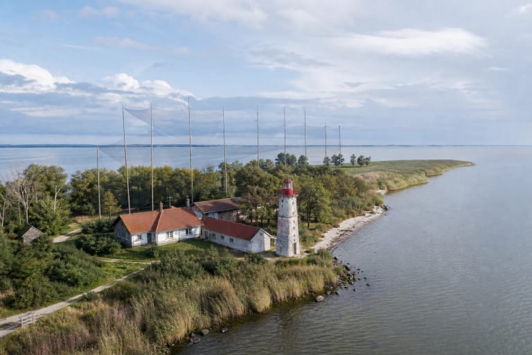
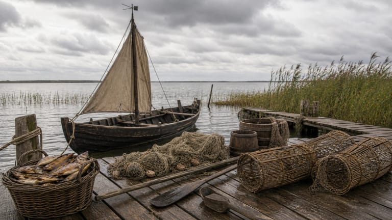
River branches, oxbows, and Rusnė Island
VLE describes the Nemunas Delta branching into water-rich arms and lowland by the Curonian Lagoon. It states that below Tilsit, now Sovetsk, about 48 km from the mouth, the Nemunas splits into the left Gilija and the right Rusnė; at Rusnė town the latter further divides into the Skirvytė and Atmata. On a trip this is visible in practice: Atmata, Pakalnė, Skirvytė, Vorusnė, and other water veins divide the plain into a network of islands, meadows, and channels. The main Nemunas-Rusnė-Skirvytė water artery also carries the Lithuania-Russian Federation border.
Rusnė is the easiest orientation point, because the regional park visitor centre operates there, many water routes begin there, and in flood season it is the best place to feel that the delta is a living territory that changes every year.
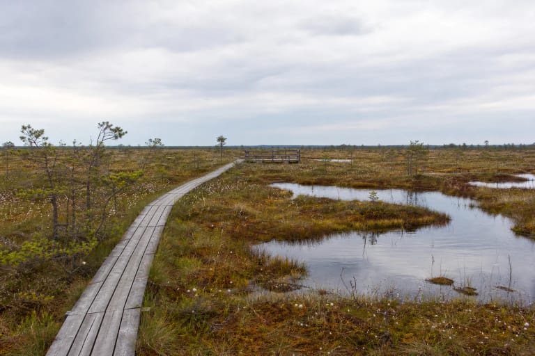
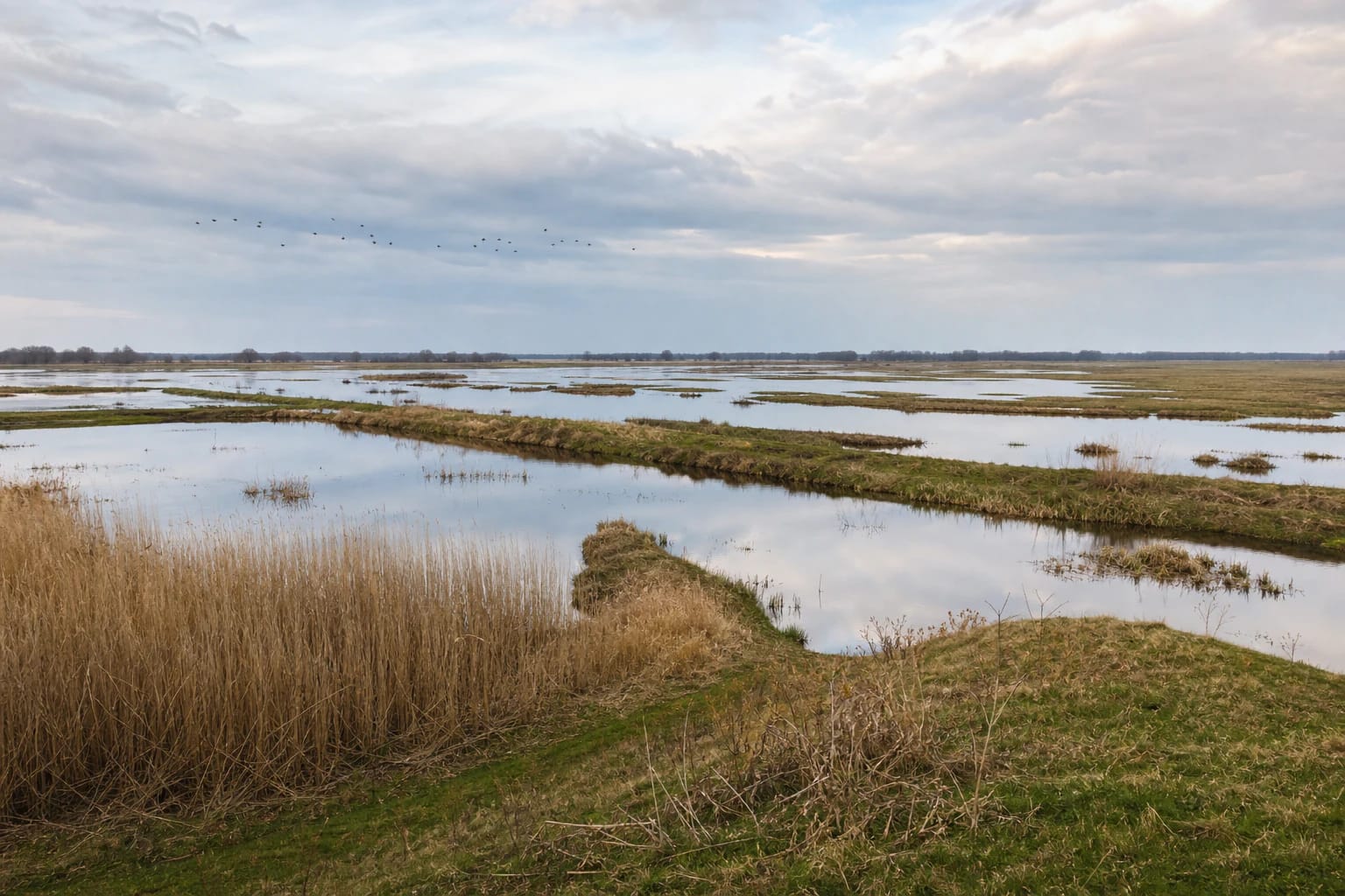
Spring floods
Floods shape the image of the Nemunas Delta. VLE gives the average annual Nemunas discharge at the start of the delta as about 612 m3/s, and during spring floods it increases tenfold. In spring, water can cover meadows, lower roads, and approaches to homesteads, making the landscape look like a vast shallow lake with islands of trees, farmsteads, and embankments. The largest floods since observations began in 1812 were recorded in 1829 and 1958.
This is impressive, but not always convenient. VLE notes that spring floods last 20-28 days, a period locals call šaktarpis. Before travelling in spring, check roads, ferries, flood conditions, and regional park information. Water may be the main reason for the trip, but it can also change the route within hours.
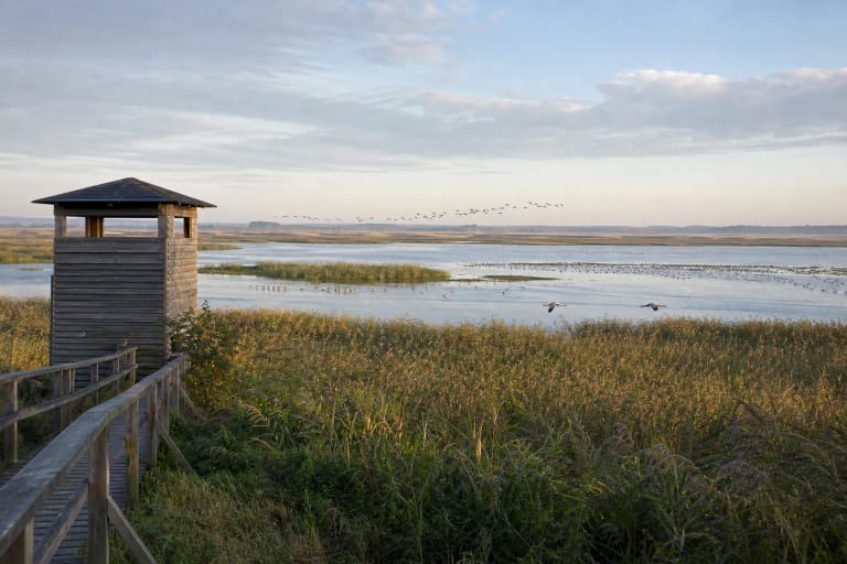
Bird migration place
Saugoma.lt emphasizes that the Nemunas Delta is one of the most important bird-migration places. Delta meadows, shallows, reedbeds, and coastal waters are important for both nesting and migrating birds.
Ventė Cape, Krokų Lanka, polder roads, and open flooded meadows are especially good for birdwatching. Come early in the morning or evening, bring binoculars, and keep your distance from flocks, because feeding and resting sites here are sensitive.
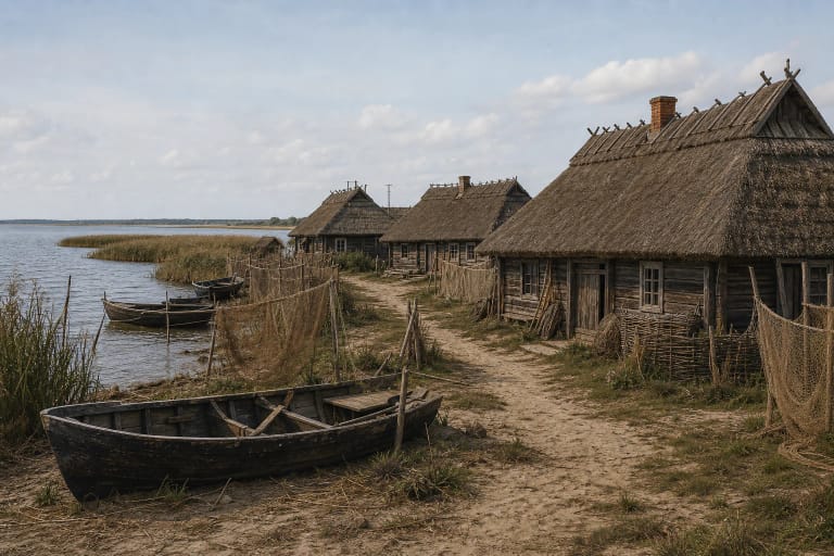
Polders and human work
The delta looks natural, but its landscape is also the result of human engineering. VLE states that the Lithuanian part of the delta contains 36 polders and 44 pumping stations. Polders, embankments, canals, pumping stations, and haymaking in flooded meadows have long shaped Pamarys life.
During a trip, notice the level meadows, water-level differences behind embankments, the Uostadvaris area, and Minija village. This helps you see not only a beautiful view but how people tried to live beside water that returns every year.
How to build a Nemunas Delta route
For a short visit, choose Rusnė, Uostadvaris, and Ventė Cape. If you have more time, add Krokų Lanka, Minija village, the Pakalnė or Atmata banks, and one longer birdwatching stop.
In summer, water routes, boats, and slow driving along polder roads give the richest experience. In autumn, plan for bird migration; in spring, plan for the flood if roads allow safe access to chosen points.
Practical details in the Nemunas Delta
Distances in the Nemunas Delta are deceptive: points look close on the map, but water, embankments, and narrow roads often force detours. Plan by real access, not by straight-line distance.
In summer, insect and sun protection are useful; in spring, rubber footwear and a backup plan; in all seasons, binoculars. If you travel to sensitive bird places, follow signs and do not try to drive closer across meadows.