- Place
- Ukmergė District Municipality
- Region
- Aukštaitija
- Type
- historic city park on Castle Hill with archaeological traces of Vilkmergė Castle, viewpoints, and family recreation spaces
- Address
- Kauno Street 8, Ukmergė
- Coordinates
- 55.24872, 24.76495
- Visit duration
- 30-60 minutes for the park; 1.5-2 hours with Ukmergė Hillfort and the local history museum
- Best time
- daylight for the views and historical route; dry weather is more comfortable on the hillside stairs and viewpoints
Pilies parkas Ukmergėje, Ukmergė Pilies Park, Castle Hill Park
Castle Park and Ukmergė Hillfort are two different historic hills
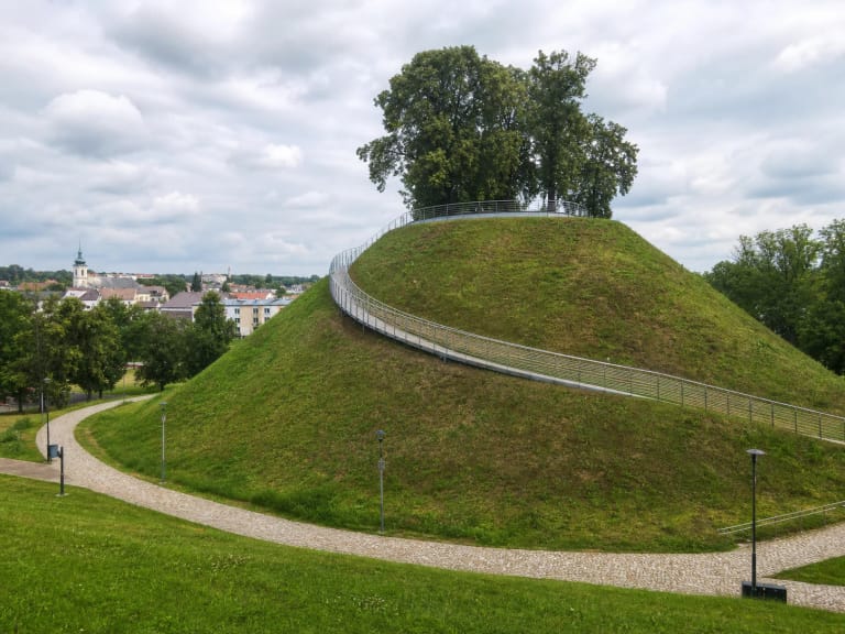
Municipal planning material assigns approximately 2.00 ha to Castle Park. It occupies Castle Hill in the town centre, west of the Vilkmergėlė valley. The official visitor address is Kauno Street 8, although the park is a broader area with approaches from Pilies and Vilniaus streets. The coordinate on this page marks a representative point, not the only gate, a parking bay, or a guaranteed step-free entrance.
Ukmergė Hillfort rises nearby on the opposite side of the Vilkmergėlė. A wooden Vilkmergė castle stood there in the fourteenth and fifteenth centuries. The later masonry fortress was built on the site of today's Castle Park. The two places may have functioned together as parts of one defensive system, but that does not make park and hillfort interchangeable names for the same object.
The Cultural Heritage Register data for Ukmergė Old Town name Castle Hill Park as a valuable public open space and identify its deciduous planting character as important. Castle Hill also falls within the protected old-town archaeological site, but the park is not separately registered as a complex of surviving castle ruins. Protected topography, archaeology, and twenty-first-century infrastructure meet here.
The masonry castle plan is unknown and no standing walls survive in the park
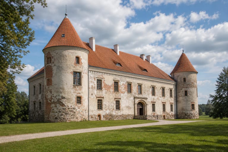
Historical accounts associate the developing masonry fortress with the fifteenth century, but the primary report for investigations in 2019-2020 dates the uncovered masonry no earlier than the sixteenth century. It began only about 50-60 cm below the surface, and part of the wall was about 1 m wide. Ukmergė Local History Museum stresses that the exact castle plan is unknown. A likely elongated enclosure may have had a ditch, bank, masonry wall, and at least one tower, but none has been reconstructed for visitors as a castle model or standing ruin.
Official local accounts describe the archaeology differently. The tourism page calls the large fieldstone masonry found in 2019 the remains of a seventeenth or eighteenth-century defensive tower. The museum route and primary report discuss several fragments discovered through 2020 and present the tower identification as a possible interpretation. The secure conclusion is that castle-period masonry survives below and around the present park, while its precise purpose and the complete plan remain research questions.
The museum describes a straight rise of roughly 3.5 m along the southern slope as a possible trace of former defensive structures. Read it as a clue in the terrain rather than leaving the paths to hunt for stones. Do not dig or move masonry and finds: the archaeological layer matters more than a self-collected souvenir.
A manor site, Orthodox church, and market came before the municipal park
The fortress lost strategic importance and declined during the seventeenth century, while the land continued as an administrative manor site. During the 1794 uprising, a Russian garrison destroyed an ammunition-holding structure before withdrawing. The museum's interpretation is cautious: the explosion probably ended the last comparatively intact masonry tower rather than demolishing a complete undamaged castle in one event.
A manor and planted-space layer remained during the early nineteenth century. Around 1842, a wooden Orthodox church was built approximately in the middle of today's park and burned in the town fire of 1877. A marketplace subsequently occupied the site; the official tourism account dates its operation here to 1882-1936.
Gardener S. Oželis-Kazlauskas prepared the municipal garden design for Castle Hill in 1937-1938, and the park was laid out in 1938. After the mid-twentieth century, the removal of remaining buildings allowed it to expand towards the northeast. The present space is therefore not an untouched castle courtyard: centuries of urban use and landscaping altered both its terrain and limits.
The 2021 renewal created a contemporary family and viewpoint park
A town-centre public-space project implemented in 2018-2022 covered Castle Park, its approaches, and Pilies Street. The official tourism description dates the principal park transformation to 2021. Hard-surfaced walking paths, planting, and lighting were renewed, while retaining walls, street furniture, and surveillance infrastructure were installed.
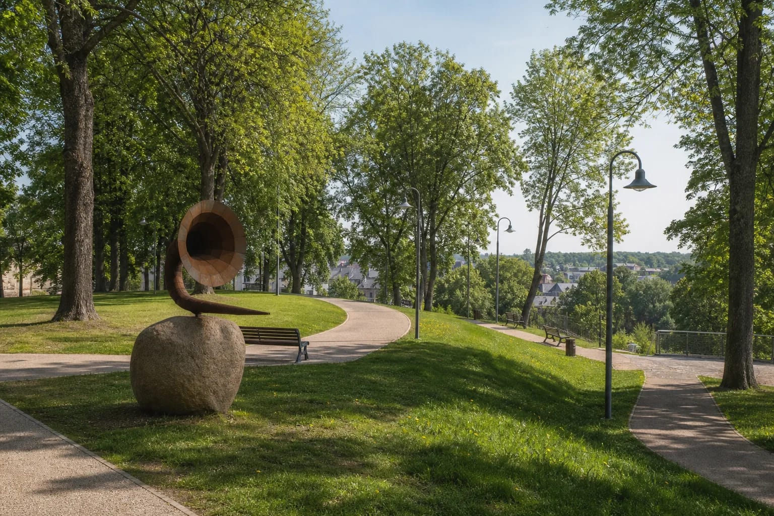
A playground, family recreation zone, and outdoor musical instruments were added. The most distinctive is V. Ramoška's Nature Speaking and Listening Horn mounted on a granite boulder. It is a work of public art installed in 2021, not an archaeological find or a reconstruction of the former castle.
New stairs connect the park with Vilniaus Street, and three illuminated platforms offer filtered views across Ukmergė's roofs and valley. The project also built a heated public toilet designed for visitors with mobility disabilities and an information pavilion. No consistent operating schedule for either is published on the official pages, so do not assume the pavilion is a permanently staffed visitor centre and keep a backup plan for toilet access.
The public space has no published ticket office or formal visiting schedule
The checked official park listings publish no admission fee, ticket office, or gated opening schedule. It functions as an urban public space, although events, maintenance, or temporary safety work can affect individual areas. Daylight is the most useful time for understanding the history and seeing the viewpoints.
The principal renewed paths have hard surfaces, and the municipality and museum included the park in their 2025 city route for visitors with mobility disabilities. Even so, hillside stairs, gradients, and individual viewpoint approaches are not equally easy. Wheelchair and pushchair users should approach from the upper Pilies or Kauno Street side and assess the main path network on arrival.
Parking spaces were created on Pilies Street during the surrounding works, but vehicles do not belong on the park paths or lawns. Use marked central Ukmergė spaces, obey the current signs, and keep pedestrian access clear. The representative map pin is not an instruction to drive into the centre of the park.
A short loop works best as a three-stop route through Ukmergė history
Allow 30-60 minutes for the park itself. Begin with the gentler upper paths, inspect the outdoor music features and children's area, then choose one or more hillside viewpoints. The castle story is read through terrain and interpretation here, not by searching for a tower that no longer exists.
Continue to Ukmergė Hillfort. The short walk makes the distinction between the earlier wooden-castle hill and the later masonry-fortress site in Castle Park immediately legible. Slopes and stairs at both places can slow the route, so allow at least 1-1.5 hours for the two hills.
For artefacts and a broader town chronology, add Ukmergė Local History Museum after checking its separate opening hours. Park, hillfort, and museum are three independent places with different visitor arrangements, not one ticketed castle complex.