- Place
- Ignalina District Municipality
- Region
- Aukštaitija National Park
- Type
- lake in Aukštaitija National Park and Baluošas Landscape Reserve
- Address
- Lake Baluošas, Vaidžiuškės, Ignalina District
- Coordinates
- 55.40150, 26.03371
- Visit duration
- 2-5 hours; longer if you combine the lake with a water route, ethnographic villages, or park sights
- Best time
- late spring, summer, and early autumn; choose a stable, calm day for paddling and check current park rules
Baluošas Lake, Baluošas in Ignalina District, Baluošas near Vaidžiuškės
A deep, winding Aukštaitija lake
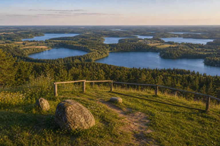
Lake Baluošas lies in Ignalina District, about 9 kilometres north-west of Ignalina. The Utena District boundary follows its eastern edge, and the lake belongs to the landscape of Aukštaitija National Park and the Baluošas Landscape Reserve. It is not an isolated beach but part of a larger protected lake system.
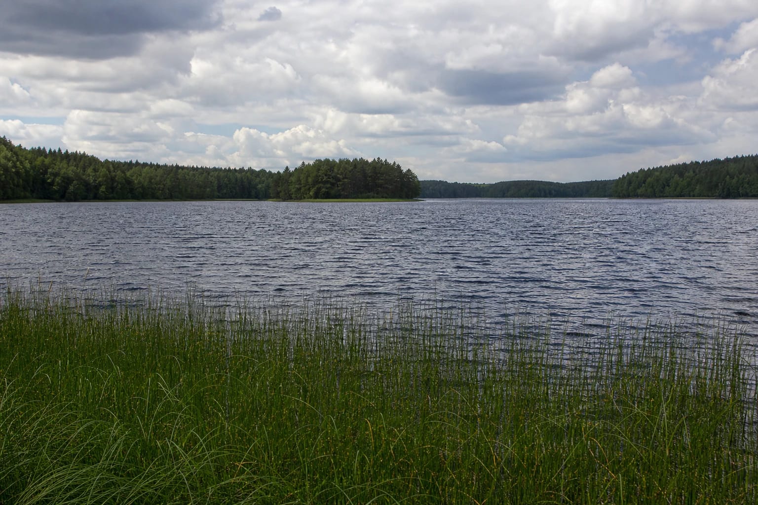
VLE gives an area of 427 hectares, a length of 4.6 kilometres, a maximum width of 1.4 kilometres, and a surface elevation of 143.5 metres. The tunnel-valley lake reaches 33.1 metres at its deepest point, averages 10.7 metres, and has a very winding 14.7-kilometre shoreline. Wind and waves can therefore change paddling conditions quickly.
The coordinate 55.4014968, 26.03370515 is a representative point for the exact public card near Vaidžiuškės. It identifies the lake rather than confirming a particular road, beach, landing place, or car park.
Seven islands and Ilgasalė create a rare water landscape
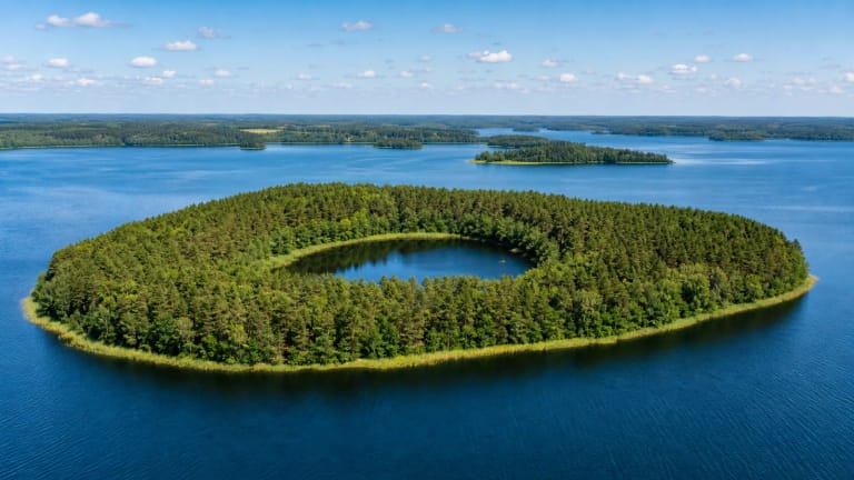
Lake Baluošas has seven islands with a combined area of about 19 hectares. The best known is Ilgasalė in the eastern part of the lake, where a lakelet about 7.7 metres deep lies within the island. It is Lithuania's only lake island with its own lake, a separate natural-heritage object and natural monument.
The whole lake should not be confused with Ilgasalė. You can experience Baluošas from the shore, while reaching Ilgasalė is connected with a water route and different access conditions. Islands, shallows, and narrow bays are not uniform, so do not paddle into unfamiliar water without assessing wind, waves, and park rules.
Ilgasalė's uniqueness does not make it a free camping or bathing facility. Its value lies in its form rather than additional infrastructure. Observe the protected site without damaging the shore, breaking vegetation, or disturbing birds.
The national park and reserve protect Baluošas's landscape
Saugoma.lt describes the 2,510-hectare Baluošas Landscape Reserve as protecting a lake-and-forest landscape complex with the thermokarst relief typical of Aukštaitija, ethnographically valuable lakeside villages, and rare hydrographic and biological elements. The lake is the core of that protected complex, not merely a scenic backdrop.
The Aukštaitija National Park Directorate highlights the hilly, lake-rich landscape, connected tunnel-valley lakes, and wild orchids along Baluošas, including the lady's-slipper orchid. Visit slowly: use marked roads and water routes rather than taking the shortest line through sensitive shore vegetation.
In the protected area, park only in a lawful place, do not light fires where they are not allowed, and avoid clearly marked sensitive zones. One convenient landing place does not prove that the entire 14.7-kilometre shore has the same access.
Būka and Kragžlė connect Baluošas to the Žeimena basin
The Būka flows into Lake Baluošas from Lake Utenykštis, and the Kragžlė flows out to Lake Baluošykštis. Both links belong to the Žeimena basin, making Baluošas part of a water route. The Būka connection is useful context for paddlers, but it does not mean that every river or lake edge is a lawful launch site.
VLE also records white lake chalk close to the surface around Baluošas. This geological feature helps explain the light shores and the history of the lake-rich relief, but it is not a reason to dig, collect, or disturb the bank.
A deep, winding lake deserves respect for weather. Even in summer, a change of wind can alter waves in a narrow bay or near an island. Choose a route suited to your experience, carry appropriate safety equipment, and follow current park guidance.
Ethnographic villages extend Baluošas's story onto the shore
Baluošas is not only a hydrographic feature. VLE records the ethnographic villages of Strazdai and Šuminai on the eastern shore, and the Šuminai Pine, a botanical natural-heritage object, in Šuminai. The villages let visitors read the lake as a lived landscape where water and forest shaped everyday life.
The Vyžiai burial-mound cemetery lies on the north-western shore, while the Trainiškis Oak on the south-eastern shore was broken by a strong wind in 2016. These are not one combined route or one car park; plan access to each site independently.
If you combine the lake with villages or park viewpoints, leave time for a quiet stop. Do not enter yards, drive over meadows, or photograph without respecting residents and the protected landscape.
How to plan a visit to Lake Baluošas
Lake Baluošas suits a longer day in Aukštaitija National Park: shore landscapes, responsible paddling, learning about Ilgasalė from a water route, and visiting ethnographic villages. Allow at least 2-5 hours for a stop; a water trip needs more time depending on the start, wind, and return plan.
The representative lake coordinate is not permission to swim anywhere, a guarantee about road conditions, or a promise that infrastructure stands at that point. Choose access through national-park information, local signs, and lawful roads.
Check park information, the forecast, and water-route conditions before leaving. Park lawfully, launch only from an allowed place, wear a life jacket, and take all litter with you. Baluošas is best understood when you do not reduce it to one rushed stop.