Ignalina District Municipality
Aukštaitija National Park
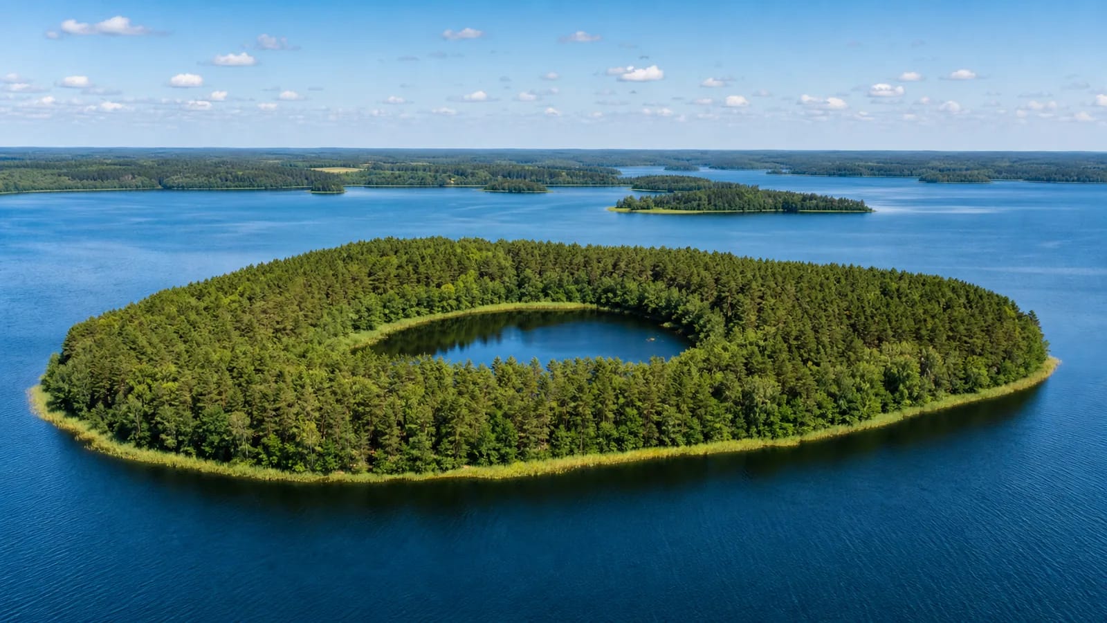
lake island with a lakelet
55.39400, 26.05050
1-3 hours on a water route, depending on the starting point
summer for calm, responsible paddling; early autumn for a quieter water route
Ilgasalė, Ilgasalė lakelet, Baluošas island with a lakelet
An island with another lake inside it
Baluošas Ilgasalė is one of those places that sounds almost like a geographical riddle: there is an island in a lake, and on that island lies another small lakelet. VLE's article on Baluošas states that Ilgasalė, in the eastern part of Lake Baluošas, contains a lakelet 7.7 m deep, and that it is the only island with a lake in Lithuania. This water body inside a water body is a rare hydrographic phenomenon, formed after the glacier melted across the broken relief of Aukštaitija.
That feature is what makes Ilgasalė exceptional. According to Saugoma.lt and VLE, Ilgasalė is a hydrographic natural-heritage object and natural monument inside Aukštaitija National Park. It is not an ordinary recreation site or just another island for camping, but a protected object whose value lies in the rare relationship between lake, island, and inner lakelet.
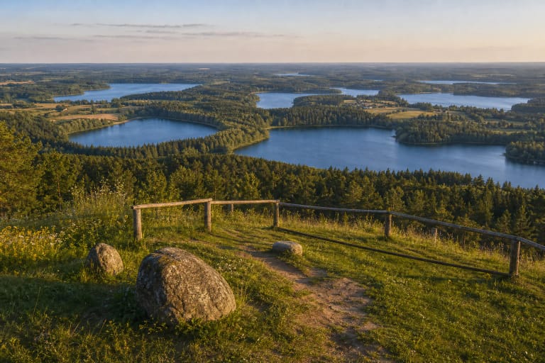
Lake Baluošas: scale and origin
VLE states that Baluošas is a tunnel-valley lake covering 427 ha. It is 4.6 km long and up to 1.4 km wide, with a surface altitude of 143.5 m. Its maximum depth is 33.1 m, its average depth 10.7 m, and its very winding shoreline is 14.7 km long. The lake contains 7 islands with a total area of about 19 ha; Ilgasalė is the best known of them.
These numbers explain why Ilgasalė is not a tiny accidental patch of land. VLE notes that the Būka flows into Baluošas from Lake Utenykštis, while the Kragžlė flows out to Lake Baluošykštis, in the Žeimena basin, so the lake is part of a larger water system. Around Baluošas, white lake chalk lies close to the surface, and wild orchids grow along the shores.
Ethnocultural villages and nature heritage around Baluošas
Baluošas matters not only because of Ilgasalė. VLE states that the ethnocultural villages of Strazdai and Šuminai stand on the eastern shore; in Šuminai grows the Šuminai Pine, a botanical natural-heritage object. On the north-western shore is the Vyžiai burial mound cemetery, and on the south-eastern shore grew the Trainiškis Oak, broken by a strong gust of wind in 2016. Baluošas belongs to the Baluošas Landscape Reserve of Aukštaitija National Park.
The lake is rich in fish: according to VLE, roach, rudd, bream, tench, and crucian carp are common. All of this means Ilgasalė should be seen as part of a living, protected lake, with old villages, burial mounds, and rare plants, not as a separate sightseeing dot.
How to reach Ilgasalė
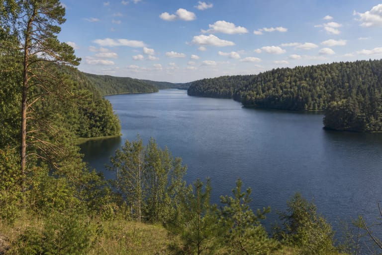
Ilgasalė is linked with water routes. That means you plan it not like a normal car stop, but as responsible travel by kayak, boat, or another permitted method, taking park rules and weather into account. Baluošas is large and deep, so wind and waves can quickly change how difficult a trip feels.
Before setting out, check Aukštaitija National Park information on water-tourism routes, camping, landing points, and possible restrictions. Because Ilgasalė is a natural monument, it is especially important not to make informal paths, damage vegetation, or disturb birds.
Why this is not a beach site
Ilgasalė's value is first of all natural and landscape-based. If a visitor expects an ordinary beach, the place can be misunderstood: the main point is not swimming, but the rare fact of a lakelet on a lake island, the white lake chalk along the shores, and the feeling of the water journey itself. The inner 7.7 m deep lakelet is sensitive, so it should be treated as an object to observe, not to use.
That is why careful visiting matters. The strongest impression comes when the place is seen as part of the Aukštaitija National Park lake system, not as a freely usable island. That attitude helps preserve Lithuania's only natural phenomenon of this kind.
What to combine with a Baluošas route
If your trip focuses only on Lake Baluošas, Ilgasalė is its strongest highlight. If you are planning a broader day, combine it with Ladakalnis, the Ginučiai hillforts, Ginučiai Watermill, or Lake Tauragnas, so the water experience is joined by panoramas and a historical landscape.
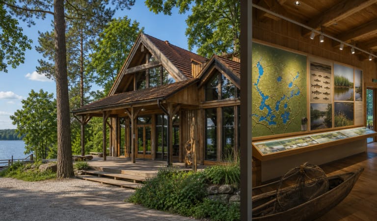
In practical terms, it is useful to begin with information from the Aukštaitija National Park Visitor Centre in Palūšė. There you can check not only sights but also rules, because water-route conditions, restrictions, and camping places can change.