Ignalina District Municipality
Ignalina District
Aukštaitija National Park hill and viewpoint
Papiliakalnė village, Ignalina District
55.36641, 25.99067
30-60 minutes
May-October, on a clear day for the lake panorama; a summer evening for calmer light and shadow
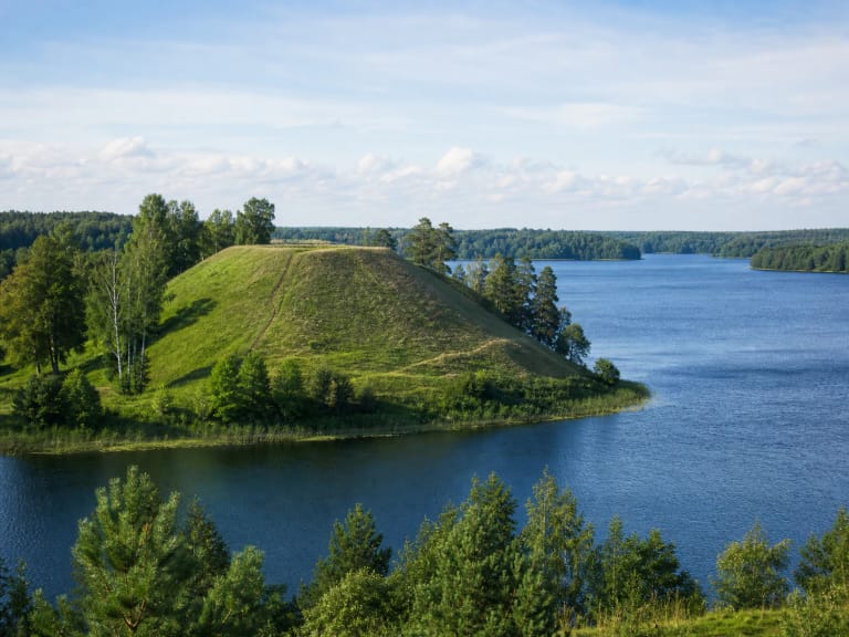
Ladakalnis hill
A lake viewpoint on the Šiliniškės Ridge
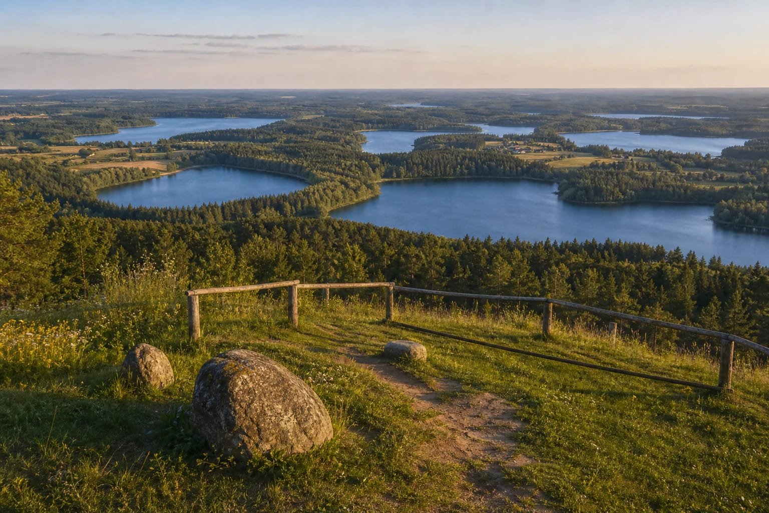
Ladakalnis is not a tower but a natural viewpoint hill in Aukštaitija National Park, near Papiliakalnė village. Saugoma.lt states that the hill rises 176 m above sea level and that the expressive Šiliniškės Ridge ends at Ladakalnis.
Saugoma.lt identifies Ladakalnis as a geomorphological natural monument, not simply a beautiful viewpoint; VLE, using the form Ledakalnis, also lists it among the geomorphological natural monuments of Aukštaitija National Park. Because of the relief, Ladakalnis works as a natural viewing platform: the climb is fairly short, but the view opens widely, without a tower structure.
Six visible lakes
Saugoma.lt describes Ladakalnis as the most popular object in Aukštaitija National Park and states that six lakes are visible from it: Ūkojas, Linkmenas, Pakasas, Asėkas, Alksnaitis, and Alksnas.
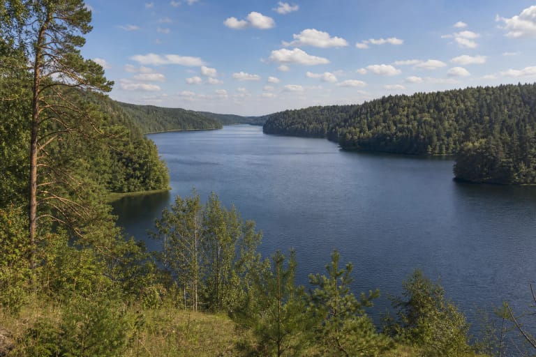
The landscape here explains especially well why Aukštaitija National Park is associated with a lake district. From one place you see not a single water body but a whole system of lakes and forests: water, peninsulas, islands, shores, wooded gaps, and ridges continuing into the distance.
Why Ladakalnis feels so wide
The impression of Ladakalnis comes from two things: height and an open slope. Because the hill stands on a strong ridge, even a short climb creates a sense of space much larger than on many forest trails.
This is a good orientation point in Aukštaitija National Park. Looking across the lakes makes it easier to understand how roads, water routes, hillforts, and villages connect in this region.
Legends and a sacred layer
Ladakalnis is often presented not only as a viewpoint but also as a hill wrapped in legends. A popular tradition links the name with the goddess Lada, but that explanation is best understood as a storytelling and mythological layer rather than a precisely documented historical fact.
That layer is exactly what makes the place stronger than an ordinary panorama. Natural relief, images of an old sacred site, and today's park route meet here.
Aukštaitija National Park context
Aukštaitija National Park, where Ladakalnis stands, was established on March 29, 1974, according to VLE, and is the oldest national park in Lithuania. Its area is 41,056 ha, and it contains 127 lakes, including Lithuania's deepest lake, Tauragnas. Ladakalnis, the surrounding Šiliniškės Ridge, and nearby hillforts help visitors understand the site as a landscape complex, not a single isolated stop.
If you have more time, combine Ladakalnis with Ginučiai Hillfort, Ginučiai Watermill, the Beekeeping Museum in Stripeikiai, Palūšė, or water routes across the Aukštaitija lakes.
How to visit Ladakalnis
Ladakalnis usually needs 30-60 minutes, although photography or nearby trails can easily extend the visit. On a clear day the lake outlines are easiest to read, while evening light brings out the contrast between forest and water.
Use only the built paths and steps, do not climb over barriers, and do not shorten the route across slopes. The hill is heavily visited, so its main protection is simple: do not widen trampled areas and do not damage the turf.