Utena District Municipality
Utena District
Lithuania's deepest lake in Aukštaitija National Park
Tauragnai area, Utena District
55.43780, 25.91210
1-3 hours for shores and nearby objects
May-September for water and shores; autumn for wooded shore colours
Tauragnas
Lithuania's deepest lake
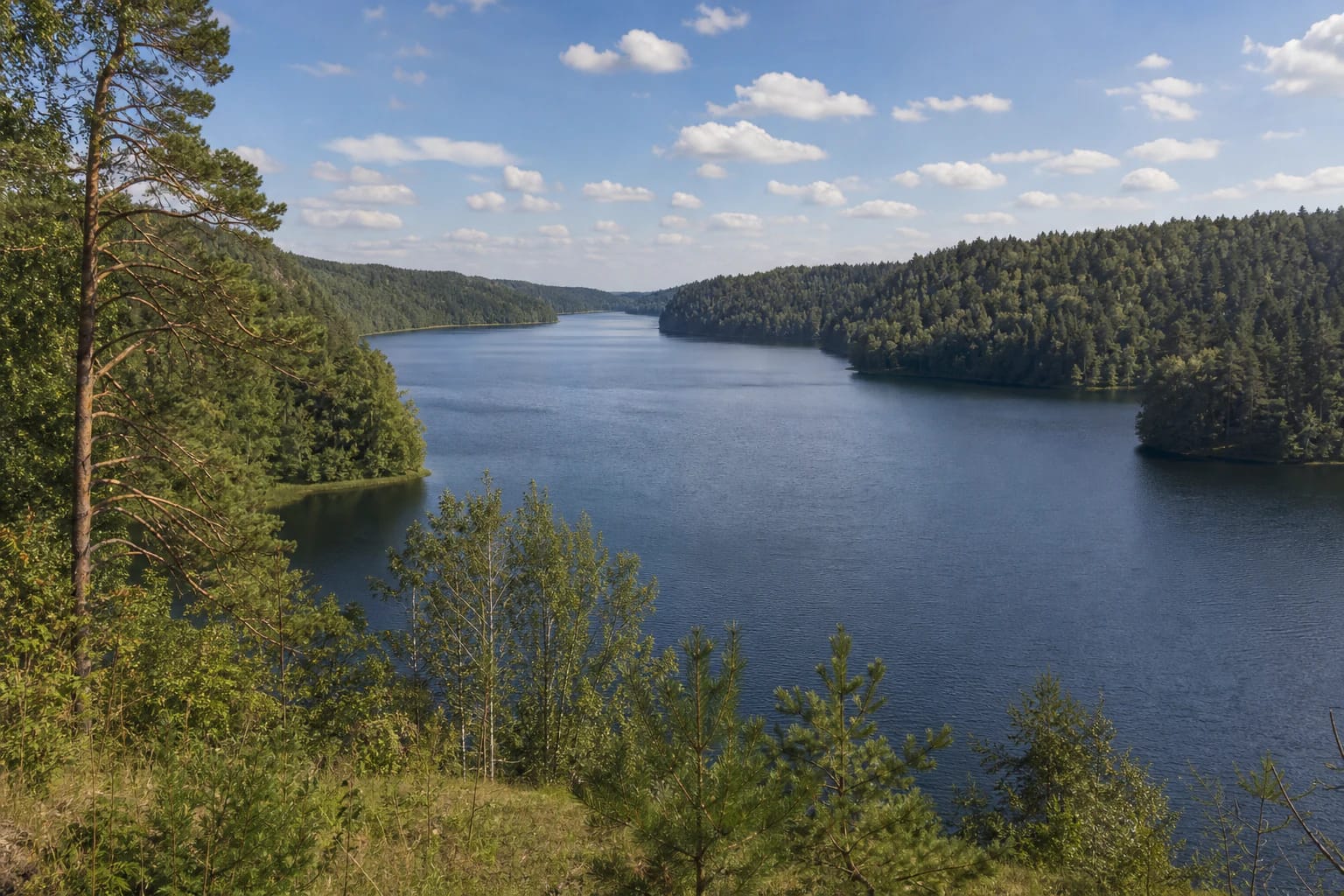
Lake Tauragnas is a clear Lithuanian record: VLE gives its maximum depth as 62.5 m. This lets it be presented not only as a beautiful Aukštaitija place but as an exceptional natural object.
VLE also gives 503.3 ha area, 9.5 km length, only 1.1 km maximum width, 18.4 m average depth, and 24.3 km shoreline. Surface altitude is 164.8 m and basin area 73.6 sq. km. The numbers show a long, deep, narrow runnel rather than a broad round lake.
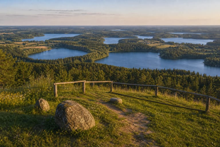
In Aukštaitija National Park
Tauragnas belongs to the landscape of Aukštaitija National Park. Saugoma.lt presents the park as a protected area of lakes, forests, villages, and cultural heritage.
Visiting Tauragnas should therefore be planned as a protected-area trip: recreation, camping, fires, and parking should happen only where rules and signs allow.
Why it is so deep
VLE describes Tauragnas as a glacial-runnel lake. Such lakes are often long, narrow, and deep because they formed in glacial hollows. Tauragnas belongs to the Žeimena basin, and the Tauragna stream flows from it.
VLE notes that Tauragnas is fed by underground springs, so its water level fluctuates little, and its water exchange is only 25 percent. This explains the visual character: from shore you often see not a wide field of water but a dark, long, clear lake stretch between wooded banks.
Tauragnas, Tauragnai, and Taurapilis
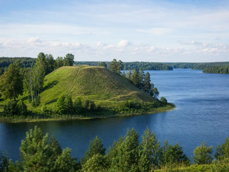
For visitors, Tauragnas opens best together with Tauragnai surroundings. Nearby Taurapilis Hillfort and ancient-settlement context make the lake part of a historical landscape.
VLE states that hillforts and barrow cemeteries cluster on the southern shore: Taurapilis, Tauragnai, and Sėlė hillforts, while the northern shore has Šeimatis Hillfort and Stučiai barrows. The lake and its surroundings form Tauragnas Landscape Reserve in Aukštaitija National Park.
How to visit
For a first visit, make a short route: Tauragnai town, one chosen shore point, and Taurapilis Hillfort. In a few hours you can sense both the lake's scale and its historical setting.
If swimming or camping, check official rest places and park rules in advance. Deep lakes can have colder water, and not all shores have convenient access.
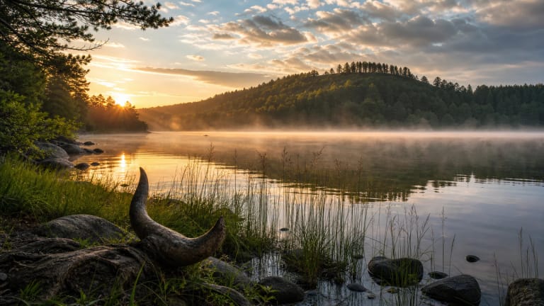
When it is most beautiful
Summer is most convenient for water recreation, but autumn gives strong forest-colour effects. Morning and evening are best for calm reflections and photography.
Because the lake is long, the impression can differ greatly by shore. If time allows, do not limit yourself to one point.