Ginučiai and Papiliakalnė, Ignalina District Municipality
Aukštaitija National Park
pair of hillforts and Linkmenys Castle landscape
55.37398, 25.98517
45 minutes-1.5 hours
summer and early autumn, when the ridge opens views of Aukštaitija's lakes and forest belts
Ginučiai Hillfort, Papiliakalnė Hillfort, Ginučiai-Papiliakalnė hillforts
Two hillforts between Lakes Ūkojas and Linkmenas
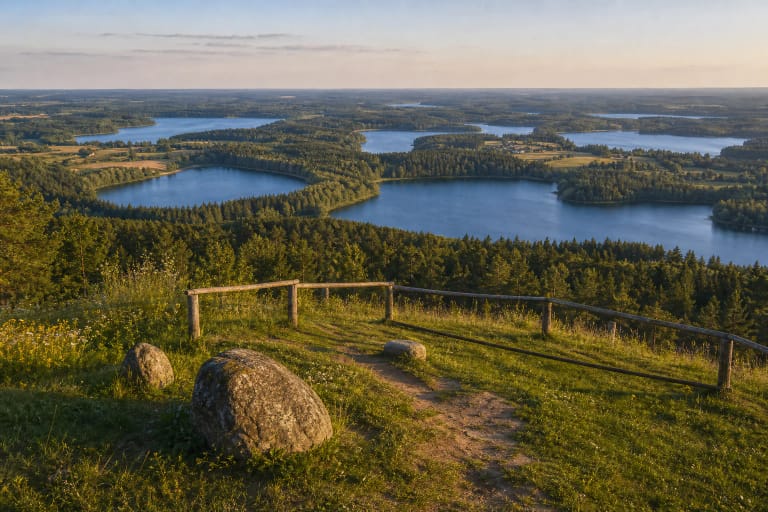
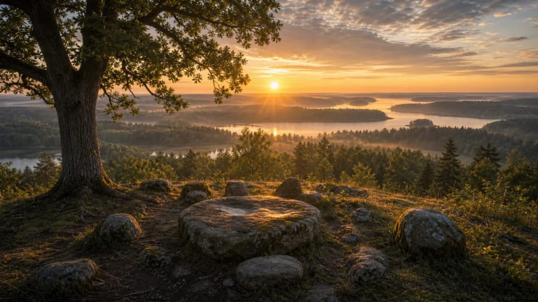
The Ginučiai and Papiliakalnė hillforts stand on the narrow Šiliniškės Ridge, between Lakes Ūkojas and Linkmenas or Asalnai, in Linkmenys elderate, Ignalina District. VLE states that Papiliakalnė Hillfort lies beside Ginučiai Hillfort and burial mounds, so this is not one isolated hill but a defensive complex: two fortified heights, a foot settlement, and burial mounds in one place. The slopes are steep, in places up to 40 m high, and the ridge gives clear views of Aukštaitija's lake landscape.
Aukštaitija National Park sources place these hillforts in the twelfth- to fifteenth-century defensive line of north-eastern Lithuania, together with the Linkmenys, Tauragnai, Taurapilis, and Vajuonis hillforts and the ancient defensive rampart at Rėkučiai. When visiting, look not only at the summit platforms but at the whole relief: from the hills, routes open toward Ginučiai village, Ladakalnis, and the chain of lakes that served as a natural network of movement and defence in the Middle Ages.
Papiliakalnė Hillfort dimensions and finds
VLE dates Papiliakalnė Hillfort to the end of the first millennium BC through the middle of the first millennium AD. Its rectangular platform measures 25 x 40 m and is encircled by a rampart, 1 m high and 11 m wide at the southern end, 0.6 m high and 5 m wide at the northern end. A 10 m wide and 1 m deep ditch was dug on the south-eastern footslope; beyond it stands a second 15 m long rampart, and 60 m north is another 14 x 26 m platform with its own rampart and ditch.
In the foot settlement of about 4 ha, spreading along the eastern, western, and northern lower slopes, VLE records finds of tools such as a stone axe and a clay spindle whorl, artefacts of brushed and rough pottery, and iron-smelting slag. The slag shows that people not only lived here but worked metal, while the pottery types confirm a long layer of settlement reaching back into prehistory.
Linkmenys Castle and the 1373 Wartberge chronicle
Ginučiai Hillfort matters as the presumed site of Linkmenys Castle. VLE's article on Linkmenys says that Hermann of Wartberge's chronicle mentions Linkmenys Castle in 1373, believed to have stood on Ginučiai Hillfort. Aukštaitija National Park sources state that a wooden Linkmenys Castle stood here in the thirteenth to fifteenth centuries, and that in the thirteenth century it may have been ruled by Lengvenis, nephew of Mindaugas. Linkmenys district is mentioned from 1434, so the place has a strong written-history layer.
VLE states that in the fifteenth century Papiliakalnė Hillfort became part of the defensive system of the wooden Linkmenys Castle, which existed from 1373 to 1433. It is important to separate the documented core from later memory: the identification of the castle with Ginučiai Hillfort rests on chronicle evidence and tradition, while for visitors the key point is that the ridge explains why fortified heights mattered so much in a lake landscape during conflicts with the Livonian Order.
The Antanas Smetona stone and interwar memory
A memorial stone to President Antanas Smetona stands on Ginučiai Hillfort. It reminds visitors that the site has not only archaeological value but also a modern Lithuanian memory layer: in the interwar state, symbols of statehood were joined with stories of old castles and hills in the Aukštaitija landscape. Smetona's connection with this region is not accidental: nearby Užulėnis was the president's birthplace and manor.
The stone is not the main archaeological value, but it helps explain why the Ginučiai hillforts are visited as a cultural site, not only a natural one. Medieval defence, local community memory, and the national narrative overlap here, turning the hillfort into a crossing point of historical layers.
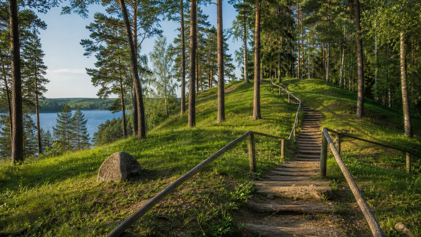
How to visit the Ginučiai hillforts
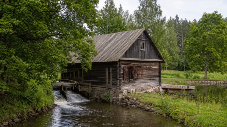
Allow at least 45 minutes for the hillforts, and half a day if you combine them with Ladakalnis, the Šiliniškės Observation Tower, or Ginučiai Watermill. A 14 km circular walking route of Aukštaitija National Park also passes through Ginučiai and begins at Ginučiai Watermill, so the hillforts are easy to include in a longer walk. Paths cross hilly terrain, so comfortable footwear matters.
After rain, stairs and grassy slopes can be slippery. Stay on marked paths, do not climb straight across slopes, and do not push bicycles over sensitive hillfort areas. The archaeological value lies in the relief and cultural layer itself, so even a short cut across a rampart can damage the very thing you came to see.
What to combine on the same route
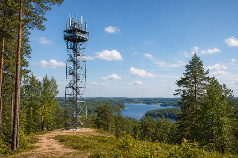
Ginučiai is one of the easiest places in Aukštaitija National Park to join several themes in one route. In a single outing you can see the hillforts, Ladakalnis, a geomorphological natural monument from which six lakes are visible, Ginučiai Watermill, and, with more time, the Šiliniškės Observation Tower and Baluošas Ilgasalė.
Such a route shows the logic of the place: heights, lakes, water routes, mill economy, and the village network are not separate stops here. They are one lake-filled Aukštaitija landscape, with historical sites placed very close together and the hillforts forming its defensive core.