- Place
- Kaunas City Municipality
- Region
- Kaunas
- Type
- historic boulevard-style street through Kaunas New Town with a pedestrian zone, linden avenue, fountain, public spaces, and architecture from several periods
- Address
- Laisvės Alėja, Kaunas; pedestrian zone from Vilniaus Street to Nepriklausomybės Square
- Coordinates
- 54.89735, 23.91358
- Visit duration
- 25-35 minutes to walk the pedestrian section without stops; 1.5-3 hours with the fountain, facades, monuments, and one museum or theatre
- Best time
- a weekday morning for architecture, a warm afternoon beneath the lindens, or early evening for a livelier promenade; check fountain operation and events separately
Laisvės Alėja, Kaunas Laisvės Alėja, Freedom Avenue, Freedom Boulevard
The 1,621-metre street and the pedestrian boulevard are not exactly the same thing
The Universal Lithuanian Encyclopedia gives Laisvės Alėja a total length of 1,621 metres. The pedestrian zone created in 1982 has narrower boundaries, however: it runs from Vilniaus Street at the western end to Nepriklausomybės Square in the east. This linden-lined section is the promenade most visitors mean when they speak of walking Laisvės Alėja.
Beyond Nepriklausomybės Square, the street named Laisvės Alėja continues east to Trakų Street and the slopes of Vytautas Park. In 2025 the municipality renewed both pedestrian surfaces and the carriageway on this stretch from the Sobor to Trakų Street and retained parking spaces. It would therefore be misleading to describe all 1,621 metres as one uninterrupted car-free space.
The coordinates 54.897355, 23.913583 on this page mark a representative point at the principal fountain, approximately halfway along the pedestrian route. They are not the beginning of the avenue, a car park, or its only entrance. At the western end the walk continues along Vilniaus Street into the Old Town; at the eastern end it crosses Nepriklausomybės Square and can continue towards Žaliakalnis.
Nicholas Avenue and its linden rows established the nineteenth-century axis of New Town
A broad boulevard-style street was included in the Kaunas development plan approved by Tsar Nicholas I on 21 February 1847. It was called Nicholas Avenue from 1848 to 1915. Works began in 1848, two rows of lindens were planted in 1851, and the central section as far as the present Nepriklausomybės Square opened on 1 May 1859.
Single-storey wooden houses initially dominated the edges of New Town. As the provincial centre expanded in the late nineteenth century, two- and three-storey masonry buildings multiplied, the City Theatre and Orthodox Sobor appeared, and the City Garden was improved. The straight street became an administrative and representative urban stage rather than merely a traffic corridor.
From 1892 to 1929, a horse-drawn tram known locally as the konkė travelled along the avenue. It formed part of a through route between Town Hall Square and the railway station, not a tourist carriage confined to today's pedestrian street. After the service closed and new water mains were laid, the surface changed again. No operational rails survive on the present promenade, so historic plans and photographs are needed to imagine the route.
During the temporary-capital era, the avenue became a showcase for the modern state
On 16 February 1919, the first anniversary of the restored Lithuanian state, the street received the name Laisvės Alėja, or Freedom Avenue. Once Kaunas became the temporary capital, older buildings gained upper floors, shop windows and cafes spread across ground floors, and cinemas and other public functions filled the interiors of blocks.
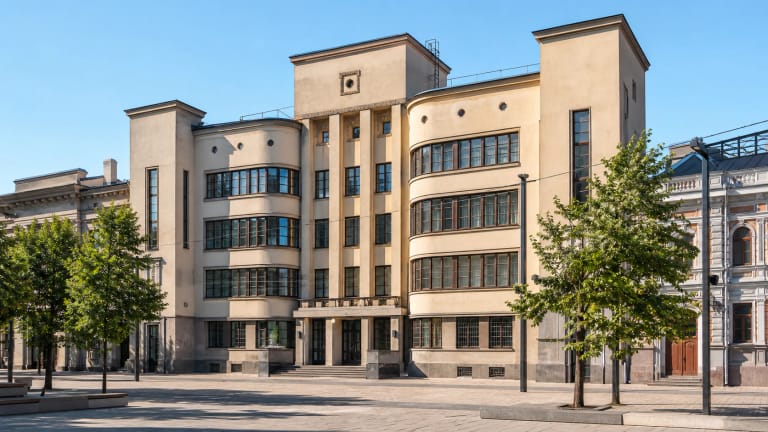
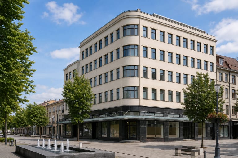
Building regulations introduced in 1932 required masonry buildings on Laisvės Alėja to be at least three storeys high. The Central Post Office, Pienocentras, Pažanga, and Savings Bank buildings rose within a short period, alongside banks, theatres, restaurants, and newspaper offices. The avenue's value lies in this entire urban fabric, not in one showpiece facade.
The UNESCO World Heritage property Modernist Kaunas: Architecture of Optimism, 1919-1939 encompasses urban landscapes in New Town and Žaliakalnis. UNESCO's documentation identifies Laisvės Alėja as the axis of New Town, inherited from the nineteenth-century grid and transformed during the temporary-capital period. This does not give every shopfront, sculpture, or individual building a separate UNESCO designation.
Stalin Avenue gave way to the restored name and the 1982 pedestrian zone
During the First World War the street was called Kaiser Wilhelm Street from 1915 to 1919. Soviet authorities renamed Laisvės Alėja Stalin Avenue in 1940, and the earlier name returned in 1961. These official changes record political occupation and regime change, but do not mean every building was physically rebuilt at the same moment.
The 1970 general plan proposed giving the central street to pedestrians, and the idea returned in a 1977 city-centre scheme. That year architects Alfredas Paulauskas and Vanda Paleckienė prepared the reconstruction ultimately completed in 1982 between Vilniaus Street and Nepriklausomybės Square.
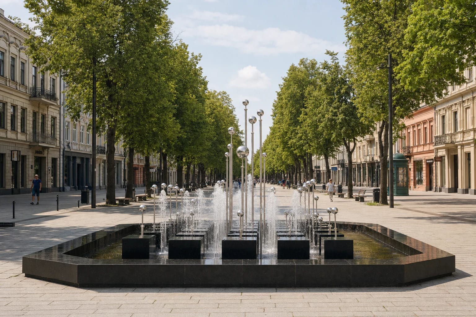
The project did more than remove through traffic. It composed paving patterns, seating, lighting, and other street furniture and created the principal fountain. The fountain became a familiar meeting point, but it remains one element of the avenue rather than a separate square or the administrative midpoint of the entire 1,621-metre street.
The 2015-2020 project renewed the promenade, while the eastern continuation was completed in 2025
The latest major renewal of the pedestrian section began in 2015. Its first phase between Nepriklausomybės Square and A. Mickevičiaus Street lasted about two years, while the other four phases towards Vilniaus Street began in 2018. The project by Šarūnas Kiaunė's studio renewed underground services, laid granite paving, and upgraded lighting, benches, bicycle stands, and planting, with the principal works completed in 2020.
The 1982 fountain beside S. Daukanto Street underwent a major repair from 2018 to 2020 while retaining the character of its black basin and decorative metal elements. Water, light, and music programs depend on season, maintenance, and city decisions. An old published showtime is not a standing guarantee, so anyone travelling specifically for the fountain should check current municipal information.
In 2025 the same wider scheme finished the eastern section from the Sobor to Trakų Street. The linden row was retained and granite slabs, benches, lights, and bicycle stands were installed, but a carriageway and about fifty parking spaces remained. This completed renewal of the full named street; it did not extend the 1982 car-free zone all the way to Trakų Street.
Buildings, monuments, and events make the route, but each operates separately
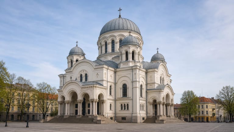
The Church of St Michael the Archangel, usually called the Sobor, stands in Nepriklausomybės Square at the pedestrian zone's eastern end. Near the City Garden in the west are Kaunas State Musical Theatre and the Aukos laukas memorial to Romas Kalanta. A monument to Vytautas the Great stands beside the municipality, while a sculpture of singer Danielius Dolskis is near the former Metropolis. Each is a distinct site with its own history and boundaries.
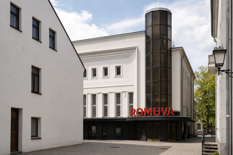
The facades of the Central Post Office, Pienocentras, Pažanga, and Savings Bank buildings are visible from the avenue, while Romuva Cinema sits deeper within its block. Their exteriors can be read while walking, but institutional interiors are not automatically public. Check official hours and admission for museums, the church, theatres, cinema screenings, and guided tours.
The main promenade is a free, ungated public space accessible around the clock. Much of the renewed granite surface is level, but traffic crosses the avenue at several streets, and event structures, cafe furniture, wet surfaces beside the fountain, or winter conditions can narrow the easiest route. Do not look for parking inside the pedestrian zone; use a legal city-centre space and follow the signs and paid-zone rules in force that day.