- Place
- Kėdainiai, Kėdainiai District Municipality
- Region
- Aukštaitija
- Type
- historic market and event square, Radziwiłł-era townscape and a public bronze-and-granite sculpture
- Address
- Great Market Square, Kėdainiai
- Coordinates
- 55.28554, 23.98172
- Visit duration
- 30-45 minutes for the square and monument; 2-3 hours with the surrounding Old Town sites
- Best time
- in daylight for the sculpture's reliefs and the surrounding façades; check for events in the square before travelling
Kėdainiai Great Market, Great Market Square, Monument to the Radziwiłł Princes, Skrynia Monument, Janusz II Radziwiłł Monument
The square, monument and surrounding buildings are connected but distinct sites
Great Market is an open civic square, while 'Skrynia' in its northern part is an outdoor sculpture with no interior, ticket desk or separate opening schedule. The town hall, Evangelical Reformed church and buildings around the perimeter create the historic setting, but their doors do not automatically open simply because the square itself is public.
The coordinate on this page marks the monument rather than the square's geometric centre, an entrance or a car park. From that point you can walk around the sculpture, then step back towards the town hall to read the wider urban composition.
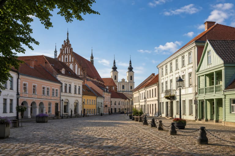
Do not focus on the sculpture alone. The broad lower space, public buildings on the higher terrace, perimeter façades and streets leading towards the Nevėžis explain why this location functioned as the town's centre for centuries.
A fourteenth-century settlement and an old Nevėžis channel survive beneath the later square
Archaeology shows that a fishing and farming settlement began to develop where Great Market now lies in the early fourteenth century. This was not yet a formal town square: beneath today's surface, researchers found settlement layers, traces of timber building and deposits from an old channel of the Nevėžis. The fourteenth-century date therefore describes occupation of the site, not the date when Great Market was planned.
A rectangular market space of roughly 135 by 110 metres was laid out in the late sixteenth century, probably after Kėdainiai received self-government in 1590. It had lower and upper levels. The lower area, about 110 by 60 metres, became the principal market and retained that function until the First World War; the Reformed church, town hall and shops rose on the higher ground in the seventeenth century.
The square acquired its defining outline around 1654, after the town hall was completed and rows of shops formed the western edge. Archaeologists found several paving horizons at different depths, so the surface visible today is not an untouched seventeenth-century pavement. This is a living urban place that has repeatedly been raised, repaved and redesigned.
Read a market, parade ground and festival space through its perimeter
Commerce was only one part of life here. The Regional Museum's archaeological account records regular markets, noisy fairs, military exercises, parades, town celebrations and ceremonial welcomes for the town's owners. That mixture continues in a modern form: Great Market is still an important event space, so a festival or civic ceremony can make it look and function very differently from a quiet morning.
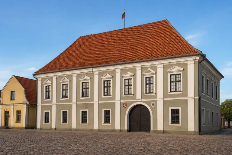
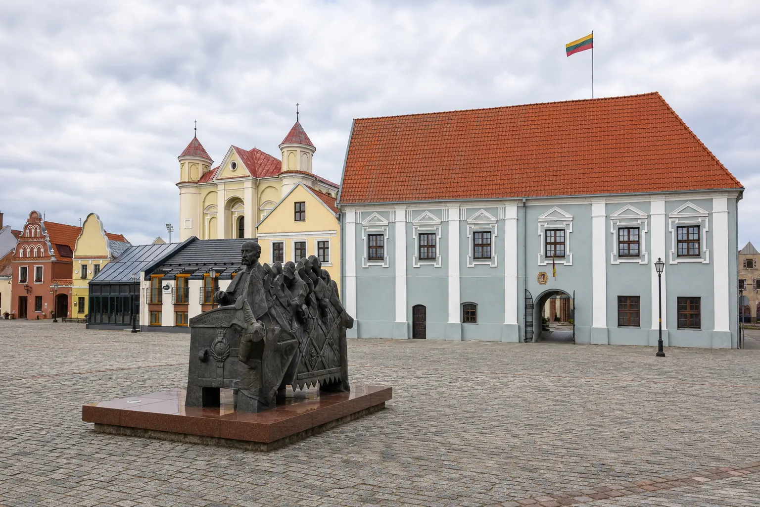
The eastern edge is defined by the long grey-green façade and tall tiled roof of Kėdainiai Town Hall. Close by, on the higher side of the square, stands the Evangelical Reformed church, while warmer gabled façades recall houses and commercial buildings from different periods. Not every visible building is seventeenth-century or equally intact, but their scale retains the enclosure of the historic square.
A reconstruction in 1959-1961 turned the square into a planted public garden that disrupted its historic spatial character. The more open present-day layout, combining modern pavers with fieldstone inserts, dates mainly from work in 2004-2005; the Radziwiłł monument followed in 2006. What visitors see is therefore a protected old-town structure shaped by a modern public-realm project.
Algirdas Bosas's 2006 'Skrynia' is not a conventional bust on a pedestal
The monument was unveiled on 12 August 2006. Its author is Algirdas Bosas, a sculptor born in Kėdainiai in 1943. Cast in bronze and set on a polished reddish-brown granite base, the low horizontal ensemble deliberately avoids the usual formula of a ruler raised high above the viewer.
The name 'Skrynia', meaning chest or coffer, comes from the massive central form evoking a state treasury. A moustached half-figure of Janusz II Radziwiłł rises above it with a deliberately enlarged hand, while soldiers, heraldry, a town panorama and historical reliefs unfold around the sides. Krzysztof Radziwiłł the Thunderbolt and Krzysztof II Radziwiłł also appear, making it worth circling the work rather than photographing only its front.
Sources use two slightly different names. The municipality and Lithuanian encyclopaedia describe a monument to Janusz Radziwiłł, while it is also presented as a monument to the Radziwiłł princes. The first identifies the principal figure and the second the wider family-and-town programme; 'Skrynia' is the artwork's own title.
Janusz II represents both Kėdainiai's flourishing and the disputed treaty of 1655
The figure is Janusz II Radziwiłł (1612-1655), not the namesake Janusz Radziwiłł who lived from 1579 to 1620. He was Grand Hetman of Lithuania and Voivode of Vilnius, and in Kėdainiai he supported Reformed culture, learning and a strong system of urban self-government.
The Lithuanian encyclopaedia records that Janusz reorganised the school as a gymnasium in 1649, founded the Rheto press and a paper mill in 1650, and granted Kėdainiai broad self-government rights in 1653. That civic programme explains why his figure stands beside the town hall and the former principal market.
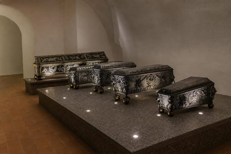
Under the Kėdainiai agreement of 1655, a group of nobles broke the Grand Duchy of Lithuania's union with Poland and aligned with Sweden. The encyclopaedia notes sharply opposed readings of that decision, from an attempt to preserve Lithuanian statehood to an act of betrayal. The monument is best approached as a work of contested historical memory rather than a simple verdict on a hero. Janusz II's sarcophagus is in the nearby Reformed church mausoleum; he is not buried beneath the outdoor sculpture.
The square is free, but events, paving and interiors require separate planning
The square and outdoor monument can be visited free of charge at any time; there is no general ticket, gate or tourist opening schedule. A public event, stage build or civic ceremony can temporarily alter routes and obscure some façades, so check the town's event listings if your priority is an undisturbed architectural visit.
Modern concrete pavers are combined with fieldstone inserts. The route is broadly open, but uneven joints and stone sections can be harder to cross, especially in rain or ice; no comprehensive accessibility audit for the whole square was found. The coordinate does not promise a parking space, so leave a car only in a legally marked old-town bay.
Allow 30-45 minutes for the square and sculpture. The town hall courtyard and rooms, Reformed church and Radziwiłł Mausoleum have their own functions, access rules and, in some cases, tickets. If an interior matters to your trip, use that specific site's current official information rather than the access conditions for this open square.