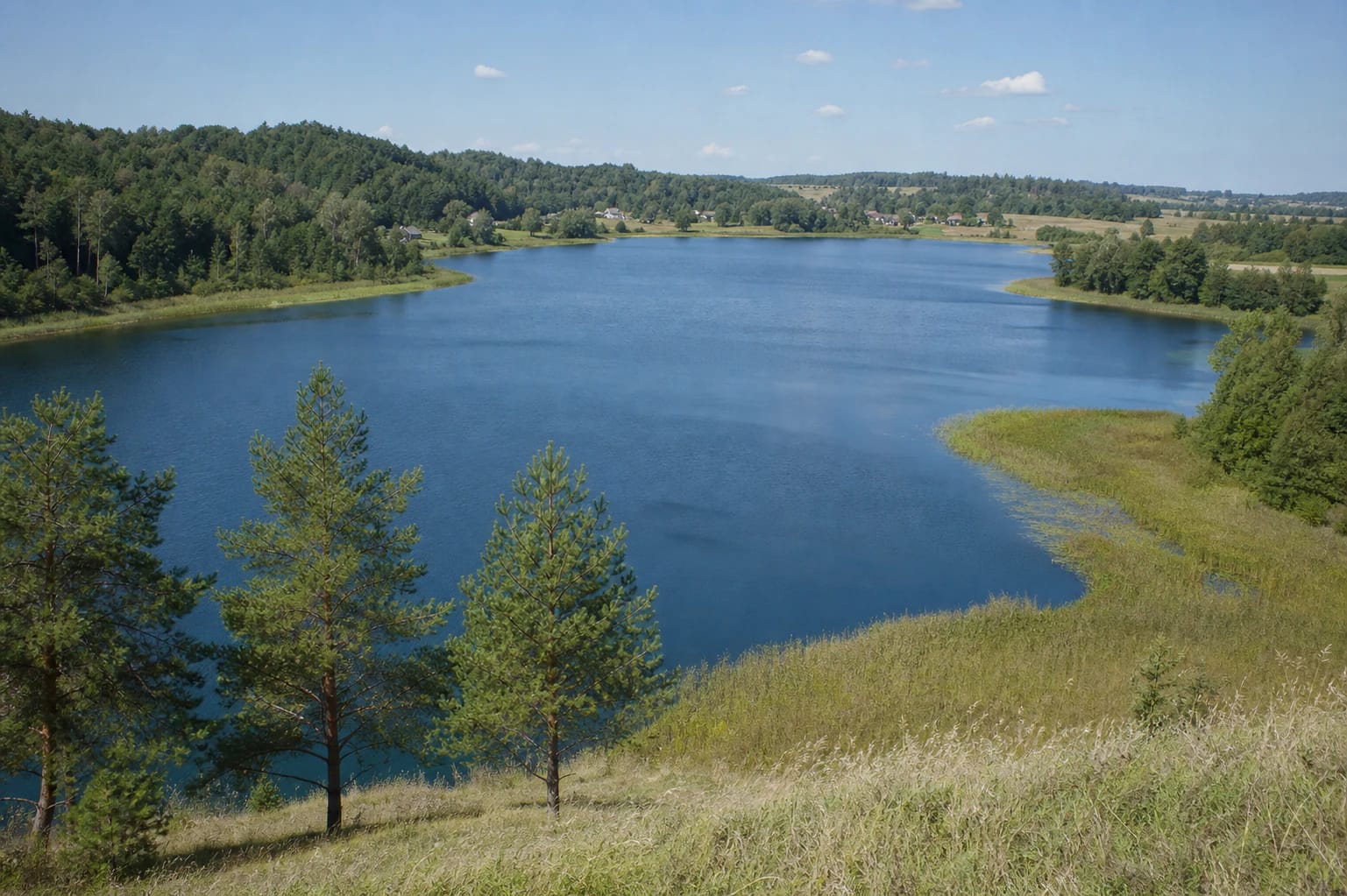
- Place
- Grendavė Eldership, Trakai District Municipality
- Region
- Vilnius Region
- Type
- a glacial tunnel-valley lake in Aukštadvaris Regional Park
- Address
- Lake Vilkokšnis, Žuklijai, Grendavė Eldership, Trakai District
- Coordinates
- 54.51842, 24.68291
- Visit duration
- 2-4 hours for one shore perspective and the Žuklijai hillforts; longer to explore the lake area
- Best time
- May to October for shore views; a sunny day for the relief and water colour
Vilkokšnio ežeras, Vilkokšnis near Žuklijai, Vilkokšnis in Aukštadvaris Regional Park
Lake Vilkokšnis is the whole lake, not only the Žuklijai shore
Lake Vilkokšnis lies in the southwestern part of Trakai District, about 7 kilometres west of Rūdiškės and about 6 kilometres northeast of Onuškis. This page describes the whole lake, its bays, forests, spring-fed ends, and relationship with Aukštadvaris Regional Park. One recreation site or the Žuklijai hillforts cannot represent a shoreline 26 kilometres long.
The coordinate 54.51841660, 24.68291275 supplied on this page is a central point for the lake, not one official entrance, beach, or guaranteed parking place.
A 336-hectare tunnel-valley basin
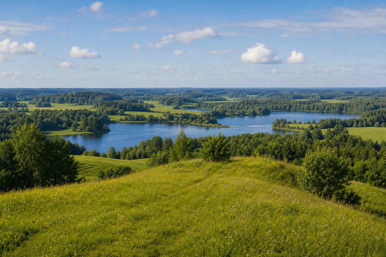
VLE gives Lake Vilkokšnis an area of 336 hectares, a northwest-to-southeast length of 6.6 kilometres, a maximum width of 0.9 kilometres, and a surface elevation of 124.7 metres. Its maximum depth is 23.6 metres and its average depth 7.1 metres. The semicircular lake and highly indented shore mean that different bays look like separate water landscapes from land.
Vilkokšnis is a glacial tunnel-valley lake: meltwater flowing beneath a glacier shaped its long basin. Its shoreline is about 26 kilometres long, with many bays and peninsulas. Tolkiškės and Kreivakojas woods reach the western shore, while the lower ends of the lake are spring-fed and partly marshy.
The Koja inlet, the Verknė, and a living water system
A long, narrow inlet called Koja branches eastward from the northwestern end of Lake Vilkokšnis. The lake receives the Samė, Koja, Galarknė, and several other streams, while the Verknė, a right-bank tributary of the Nemunas, flows through it. The throughflow is about 80 percent, so this is not a closed basin that can be understood from one quiet bay.
Wind, sunlight, open farmland, and wooded shores continually change the colour and appearance of the water. One view can show a broad blue surface, while another narrows it with a peninsula, reed bed, or backwater. That variety is the main reason to visit Vilkokšnis, rather than one supposedly definitive photo point.
The Žuklijai hillforts on the northern shore
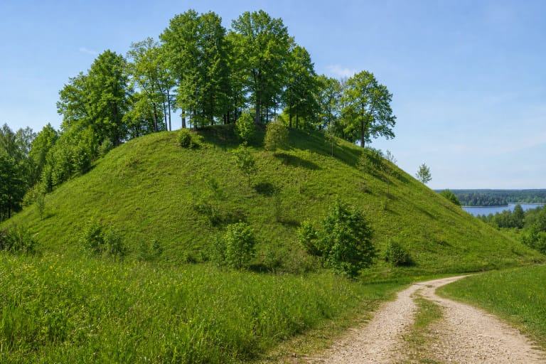
VLE places the Žuklijai hillforts on the northern shore of Lake Vilkokšnis. The State Service for Protected Areas lists Žuklija among the protected hillforts of Aukštadvaris Regional Park, so the lakeshore's history is inseparable from the wider cultural landscape. Treat the hillfort area as a separate landform and archaeological site, not as a label for the entire lake.
On the Žuklijai side, village roads, woodland, meadows, and lower shore sections add detail to the lake view. An open slope makes the crescent-shaped water easier to read between the woods, but no single place reveals the entire 6.6-kilometre lake. Treat the hillforts as protected heritage: do not cut into slopes, dig, or leave established paths.
Aukštadvaris Regional Park's water landscape
Aukštadvaris Regional Park was established in 1992 to protect the landscape, ecosystems, and cultural heritage of the upper Verknė and Strėva watersheds. The State Service for Protected Areas describes more than 40 lakes in the park's hilly glacial landscape, where the ice sheet formed high hills and hollows. Lake Vilkokšnis is one of the major waters in that system.
The lake surroundings are not a city park with one uniformly maintained path around the entire shore. High banks, gullies, spring-fed and marshy areas mean that different access roads and paths can have different difficulty. The 2024 Trakai District Municipality visitor-site list names a Vilkokšnis beach recreation site on Piliakalnio Street in Žuklijai, but check what is open and accessible before travelling.
How to visit a large lake safely
Start from a clearly accessible public place on the Žuklijai side or another chosen shore and do not expect the central lake coordinate to lead directly to the water. Do not drive onto private land, meadows, or woodland paths; near marshy lake ends, stay on a clear trail and wear suitable footwear.
Lake Vilkokšnis is best understood from several perspectives rather than by rushing to circle the entire shore. For boating, fishing, swimming, or another water activity, follow local rules, access instructions, and same-day safety information. This page does not confirm a particular rental point or boating route.
In winter, ice above inflowing streams and the flowing Verknė system can be uneven. A depth of 23.6 metres is also no reason to take a risk: step onto the ice only when official information confirms that it is safe, and never judge it solely by seeing people on another part of the lake.