- Place
- Aukštadvaris, Trakai District Municipality
- Region
- Aukštadvaris Regional Park
- Type
- hillfort with a foot settlement
- Address
- V. Mongirdo Street, Aukštadvaris, Trakai District Municipality
- Coordinates
- 54.57299, 24.51914
- Visit duration
- 45-75 minutes
- Best time
- a dry spring or autumn day, when the rampart is legible and foliage is lighter
Pilaitė, Aukštadvaris Pilaitė Hillfort
Pilaitė between the Verknė and the lake
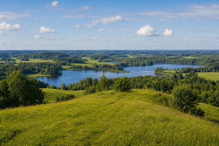
Aukštadvaris Hillfort rises on the south-western edge of the town, on the left bank of the Verknė. The river encloses it to the north, while Pilaitė Lake, also called Zambelis, lies to the south-east. This position controlled the waterside landscape and supplied natural obstacles on three sides.
The slopes rise 9-15 m. The oval summit measures about 80 by 50 m, with the remains of a 0.5-1.5 m rampart around its edge. Walk the full summit rather than stopping at one viewpoint: the relationship between its shape and the water becomes much easier to understand from several sides.
What the 1957-1960 excavations uncovered
Archaeologists from the Institute of History, led by Vytautas Daugudis, excavated 958 sq m on the hilltop and roughly 2,400 sq m in the settlement below. This was more than a small test trench and allowed researchers to separate several markedly different phases of use.
The second- to first-century BC layer contained a timber defensive barrier, traces of domestic and farm buildings, stone axes, bone tools, and brushed pottery. The first- to fourth-century layer included the remains of a long post-built structure characteristic of Baltic communities, metal objects, and pottery with different surface treatments.
Furnace remains in the foot settlement point to metal smelting, while Saugoma also records a jeweller's workshop, ornaments, arrows, and spearheads. Together these finds describe craft, food production, and household life as well as defence. The assemblage is held by the National Museum of Lithuania.
The timber castle and the later manor
The defences were strengthened between the tenth and fourteenth centuries. Inside the rampart, archaeologists identified six log-built structures together with metalwork, pottery, animal bones, and charred cereal and pulse grains. Some buildings were dwellings, so this was an inhabited stronghold rather than an empty lookout.
VLE records remains of fifteenth- to seventeenth-century timber manor buildings in the upper cultural layer. Saugoma connects this later stage with a grand-ducal manor and the development of the name Aukštadvaris. These are documented archaeological and historical interpretations, not a hillfort legend.
How to read the earthwork on site
Begin with the surviving rampart and compare the more vulnerable landward approach with the slopes protected by the Verknė and the lake. Then cross the summit lengthwise. Its 80 m span makes the former capacity of the enclosed space easier to grasp.
The buried cultural layer is part of the protected monument. Do not dig, collect objects, drive onto the mound, or cut new shortcuts into the slopes. Even minor disturbance can destroy an archaeological context that is more informative than an isolated object.
Practical access and the current visitor rating
The map pin marks the hillfort itself, not a guaranteed car park. Follow signs on arrival and keep access routes clear. Natural grassy slopes can be slippery after rain, so wear shoes with grip and supervise children near steeper edges.
This is an outdoor archaeological site without a ticket office. Check the official protected-areas page before travelling for event notices, maintenance work, or changed access. On 27 July 2026 its Google Maps listing showed 4.7 out of 5 from 545 reviews; both figures are changeable.