- Place
- Kupiškis District Municipality
- Region
- Aukštaitija
- Type
- dendrological park on a long island artificially separated from the shore of the Kupiškis Reservoir
- Address
- 9 Marių Street, Aukštupėnai village, Kupiškis District (Aukštupėnai recreation-area approach)
- Coordinates
- 55.85728, 24.97949
- Visit duration
- 1-2 hours for the island paths, tree labels, and reservoir views; longer during events
- Best time
- in daylight from spring to autumn; check the seasonal pontoon's status before using the Aukštupėnai approach
Uošvės Liežuvis, Uošvės Liežuvis Dendrological Park, Uošvės Liežuvis Park, Kupiškėnai Park
The 8.97 ha island was once a long peninsula
Uošvės Liežuvis is the southernmost of three islands in the Kupiškis Reservoir. VLE gives an area of 8.97 ha, while a local geographical study describes a strip roughly 800 m long and 50-150 m wide. The park consequently feels like a long green ribbon between two reaches of water rather than a compact town square. The map pin is the centre point used for the municipality's official 2025 vegetation monitoring, not the only entrance or a car park.
Before the reservoir existed, a peninsula between the Lėvuo and the Pajuodupė stream occupied this ground. It remained above water when the Lėvuo was impounded, and a later artificial channel finally separated it from the shore. This is therefore not a naturally formed river island: its present geography reflects both the reservoir and an additional excavation.
Two dates describe different stages. The municipality's older account associates the reservoir's beginning with 1984, while VLE specifies that the Kupiškis Reservoir was developed in 1984 and filled in 1986. That sequence distinguishes construction from the later impoundment of the 828 ha water body more accurately than a single simplified date.
The Uošvės Liežuvis name and the Nature Laboratory begun in 1988
A local study relates that residents soon nicknamed the long, pointed landform Uošvės Liežuvis, literally 'Mother-in-law's Tongue'. This is an evocative descriptive name, not a documented legend about one identifiable woman. The old name endured after the channel transformed the peninsula into an island and is now applied both to the island and its park.
In 1988, four years after reservoir development began, Kaunas-based forester Steponas Maculevičius started creating a Nature Laboratory here. That is the spelling used by the municipality's primary historical page; some secondary accounts give the variant Matulevičius. The then Ministry of Land Reclamation and Water Management provided funding for the initial works.
The founding ambition was to plant 88 tree species on the island. It should not be presented as a census of species alive today. By 2010, the municipality recorded an access road, parking area, principal path and cycle paths, shelters, benches, and a space reserved for events.
More than 50 species is not the same claim as the original plan for 88
Current Kupiškis visitor information cites more than 50 tree species and identification labels beside the plantings. No dependable recent inventory of every taxon on the island was found during research. The evidence therefore supports three separate statements: 88 species was the founding idea, more than 50 is the current visitor-facing figure, and the municipality's 2025 monitoring assessed selected plantings rather than surveying the entire collection.
The monitoring tables nevertheless make the collection's real variety tangible. They include English and northern red oaks, silver, downy, and paper birches, white, blue, and Serbian spruces, ginkgo, several maples, European yew, northern catalpa, European silver fir, and tulip tree among many native and introduced plants. Numbers in those tables describe monitored groups, not a census of every specimen on the island.
The 2025 report found many ornamental shrubs in good condition, but also identified vulnerable groups. Mountain pines showed stronger defoliation and needle necrosis, rowans had leaf damage and thinning crowns, and some recently planted trees were struggling to establish. The arboretum is therefore a managed, changing living collection rather than a frozen museum of the 1988 planting campaign.
How to read the park while walking the island
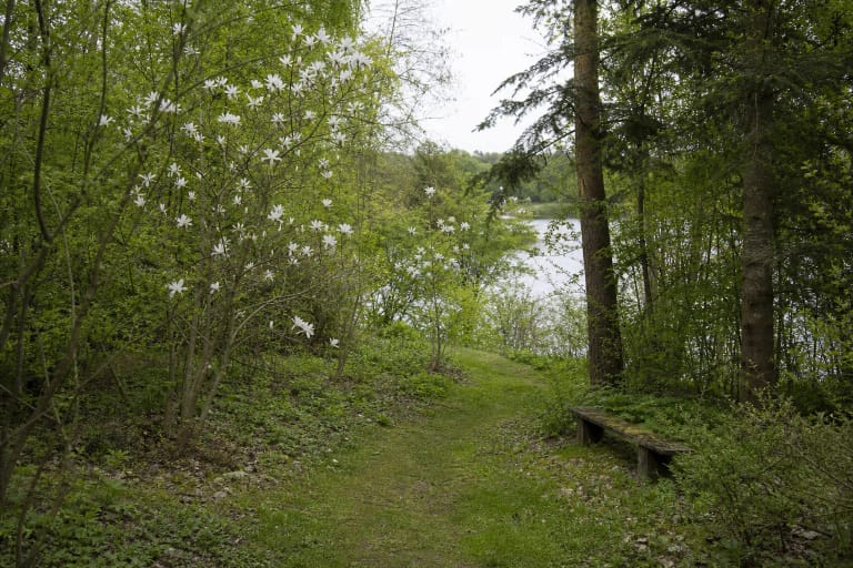
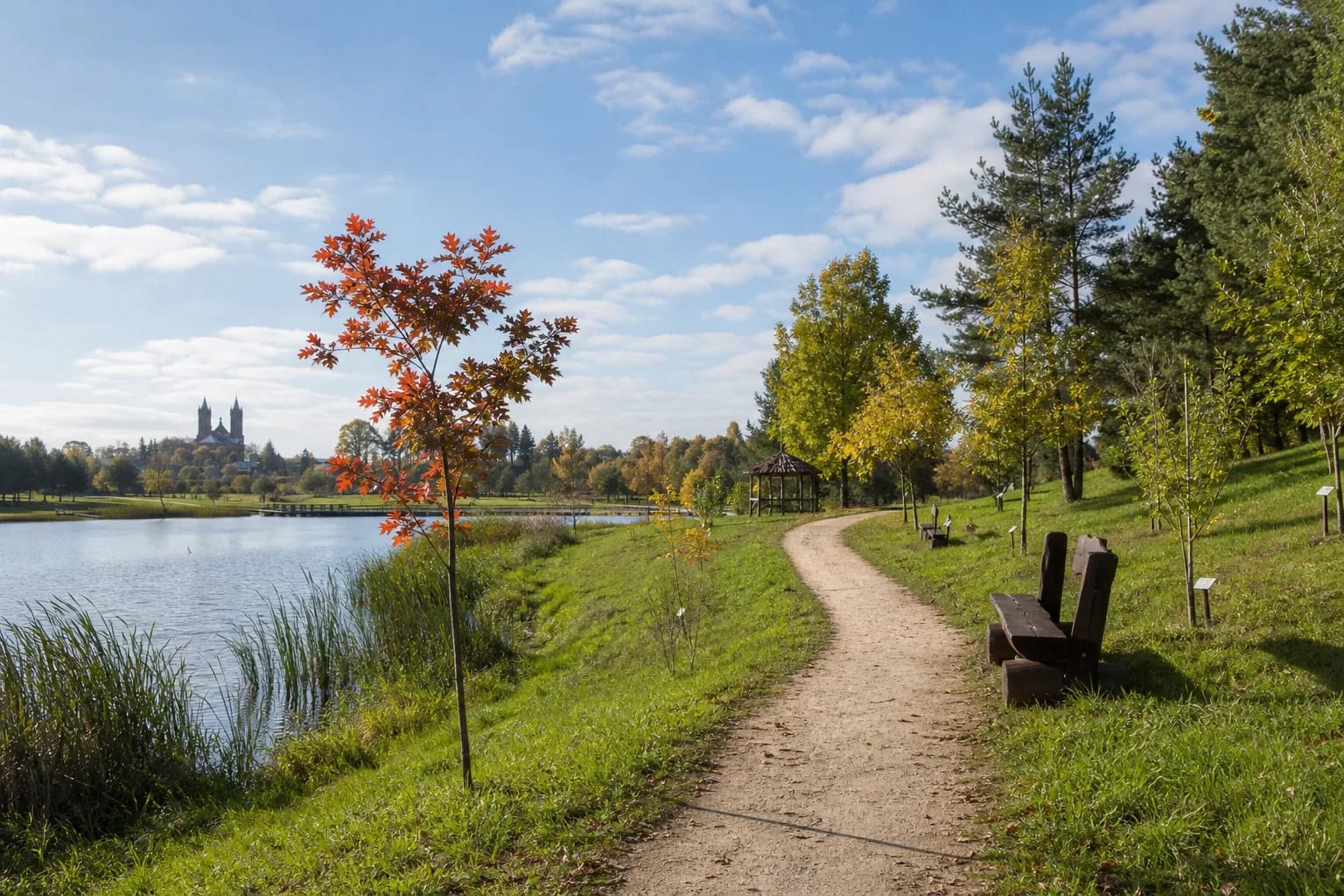
A broad pale-surfaced main path runs along the island, while narrower paths approach reedy shores and different planting groups. Open lawns alternate with denser conifer and deciduous stands. Small plant labels invite tree-by-tree observation, while shelters and heavy timber benches give the place the understated character of a recreation park rather than a formal botanical garden.
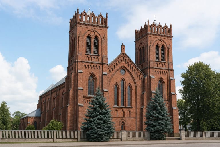
The reservoir opens beside the western and southern edges, and the twin towers of Kupiškis Church of the Ascension of Christ are visible on parts of the horizon. Spring favours flowering shrubs and new foliage, summer offers the deepest shade, and early autumn distinguishes maples, oaks, and other deciduous trees by colour. Research found no single officially waymarked circuit with a dependable published distance.
The park also hosts community celebrations, concerts, and other gatherings. The event ground is part of the island's identity, but an event may bring crowds, temporary equipment, or traffic controls. For a quiet botanical walk, check the municipality and Kupiškis cultural programme for that date.
Two approaches, but the Aukštupėnai pontoon is seasonal
Current visitor information lists two pedestrian approaches: a bridge from the Pajuodupė side and a pontoon from the Aukštupėnai recreation area. The address at 9 Marių Street points to that Aukštupėnai visitor area, not the geographic centre of the island. Leave vehicles in a lawful car park beside the chosen approach and keep them off the park paths.
The Aukštupėnai pontoon was created as a public LEADER project in 2013. The municipality describes two supporting pontoons at the banks and a bridge assembled from floating modules between them. That design explains why it is not a permanent all-season crossing: the municipality removed it on 25 November 2025 for visitor safety and left it out through the winter.
On 9 April 2026, the municipality announced that the pontoon was being installed and that easier island access would resume on 10 April. This confirms conditions at the page's review date, but not the opening date in every future year or its status after storms and repairs. Look for the newest official notice before relying on the Aukštupėnai approach, and never cross a closed or taped-off bridge.
Opening hours, tickets, and realistic visitor conditions
The dendrological park publishes neither a general admission ticket nor gate hours. Its 2013 pontoon project defined the facilities as public and non-profit, so an ordinary self-guided walk does not require a separate park ticket. A concert, trading area, or other organised activity may set its own times, tickets, and access rules; check those with the organiser.
Main paths are fairly broad, but surfaces combine gravel, compacted soil, and grass, with wet ground, roots, and irregularities near the shore. A pontoon can move with the water. No current comprehensive step-free audit was found, so the whole island should not be promised as reliably wheelchair accessible; discuss individual needs with Kupiškis eldership or the local visitor information service in advance.
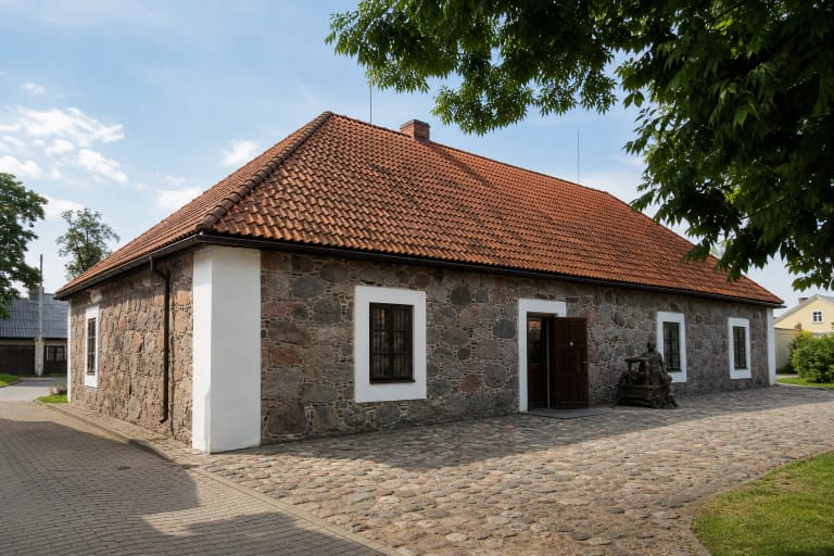
Allow 1-2 hours and visit in daylight. Supervise children at the water, keep away from wet bank edges, and do not damage branches or plant labels. The most coherent pairing is with the wider Kupiškis Reservoir shore, followed in town by the ethnography museum or the church whose towers can be seen from the island.