- Place
- Vilkaviškis District Municipality
- Region
- Suvalkija
- Type
- two connected circular walking routes of 2.4 and 3.4 km along Lake Vištytis and through Šilelis Forest
- Address
- Beside the Vištytis-Vyžainis road at Žirgėnai, Vištytis Eldership, Vilkaviškis District
- Coordinates
- 54.40771, 22.76379
- Visit duration
- about 1.5 hours for the 2.4 km short route or about 2.5 hours for the 3.4 km long route
- Best time
- a dry day from late spring to autumn; lakeside slopes, steps, roots, and timber surfaces can be slippery after rain
Šilelio pažintinis takas, Šilelis Short Nature Trail, Šilelis Long Nature Trail
Two circuits share one start and divide at the spring
The exact Google Maps entry Šilelio pažintiniai takai marks the start at 54.407708, 22.763788. The official park description places its information board beside the Vištytis-Vyžainis road at Žirgėnai. Saugoma.lt gives the rounded point 54.402, 22.766 farther inside the trail area, so these coordinates should not be mistaken for two separate attractions.
The route is circular. A shared section leads from the starting board to the Holy Spring, where walkers choose the short or long return. The official time is about 1.5 hours for the 2.4 km circuit and about 2.5 hours for the 3.4 km circuit. These are not speed-walking targets: allow extra time for interpretation boards, viewpoints, and uneven ground.
The park describes the waymarks as circular signs with a tree symbol. Markers help, but their condition can change in woodland, so save the official map and check the starting board for temporary diversions. Longer organised hikes across the regional park are not the same as these 2.4 and 3.4 km circuits.
A calm forest path gives way to bluffs and high slopes beside Lake Vištytis
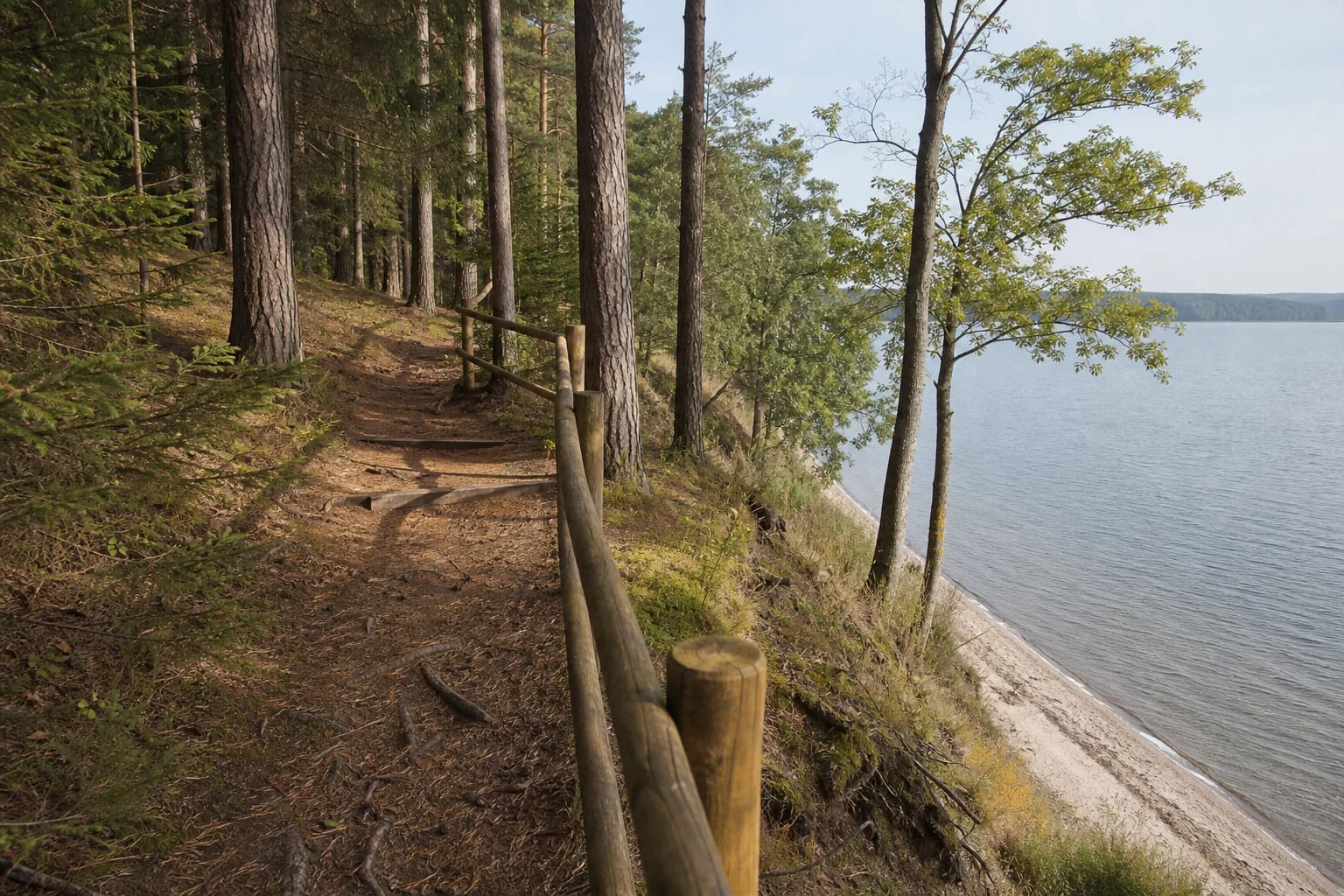
Much of the route follows Lake Vištytis through Šilelis Forest. Real photographs show a narrow earth path among mature pine, spruce, and deciduous trees, simple log handrails, log steps, and a thin sandy shore below the slope. This is not a continuous level boardwalk around the lake.
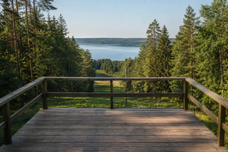
The official park description stresses the contrast along the shoreline: a gentle incline can give way to a bank rising as much as 50 metres. The visitor landmark known simply as the bluff reveals the lake basin, but water, freeze-thaw cycles, and surface runoff continue to erode its edge. Stay behind rails and do not cut straight down to the beach.
Surfaces include soil, needles, leaves, roots, gravel-road sections, steps, and occasional timber structures. Exposed soil at the top of the bluff, mossy surfaces, and timber boards can become slippery after rain. Footwear with reliable grip matters more than the modest distance, and children need close supervision beside the steep shore.
The short trail teaches walkers to read an old forest, not merely reach the lake
Official descriptions list hollow trees, the tallest spruce identified in Šilelis, and a witch's broom among the trail features. Cavities matter to birds, bats, and invertebrates, so old trees and deadwood are not simply untidiness. Never break them open or leave the marked path to search for nests.
A witch's broom is a dense cluster of small branches that resembles a broom high in a tree. Its folkloric name does not make it a supernatural object; it is an abnormal growth pattern that can have several biological causes. The stop asks walkers to notice an unusual tree form rather than accept a witch legend as fact.
Interpretation boards and rest areas stand along the route. A Vilkaviškis District strategy also mentions a barefoot-trail element, but small recreational fixtures wear out and are replaced. Do not make a special journey for one installation without checking its present condition on site.
On the long route, a suffosion cirque reveals groundwater reshaping the slope
The longer circuit adds the Rominta Forest Viewpoint and the nearby Šilelis suffosion cirque. This semicircular hollow formed as groundwater carried fine, insoluble particles out of the lakeside slope. Water still seeps more than 10 metres above the lake and drains towards it in small erosional channels.
The park calls the cirque a living geological feature because the process continues. This does not mean visitors will witness a sudden collapse or a waterfall. The important signs are its natural-amphitheatre form, a wet or eroding slope, and the small stream leaving it. Do not descend into the hollow or trample its edges.
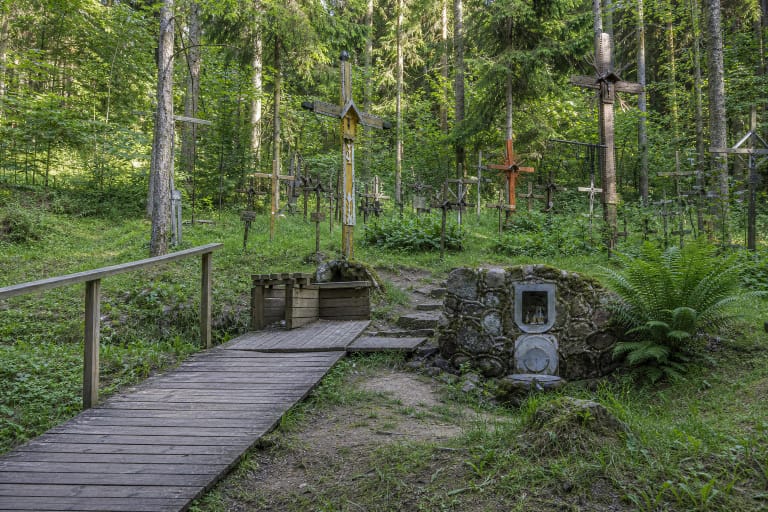
The Holy Spring is another expression of the same groundwater landscape. Its outlet is captured in stone and a hill of crosses rises above it. Stories of healing water belong to living religious and oral tradition, not medical evidence; without a current official microbiological analysis, the spring water cannot be assumed safe to drink.
This is a public outdoor route without a separate ticket office, but not a fully step-free park
The official pages checked publish no separate Šilelis trail ticket, gate, or fixed opening hours. The forest, however, has no guaranteed lighting, daily surface inspection, or winter maintenance. Walk in daylight, check the weather and park notices, and leave vehicles only in lawful marked areas.
At the Holy Spring, Saugoma.lt confirms a parking zone and a timber-surfaced approach that visitors with reduced mobility may need assistance to use. That is not an accessibility certificate for the entire 2.4 or 3.4 km circuit. Natural slopes, steps, roots, and changing surfaces prevent the full route from being described as suitable for wheelchairs or pushchairs.
Rest beside the lake only within protected-area rules. Saugoma.lt reminds visitors to use car parks, pitch tents only in designated campsites, and light fires only in designated fire pits. A nature trail is not automatic permission to camp, drive to the water, or make a fire anywhere along the shore.