- Place
- Vištyčio Laukas II, Vilkaviškis District Municipality
- Region
- Vištytis Regional Park
- Type
- nationally significant hillfort with a foot settlement
- Address
- Vištyčio Laukas II village, Vištytis eldership, Vilkaviškis District
- Coordinates
- 54.44460, 22.77551
- Visit duration
- 40-60 minutes for the hill, enclosure, and panorama
- Best time
- a clear spring or early-autumn morning, when grass is lower and the directions of Lake Vištytis and Vištytgiris Forest are easy to see
Vištyčio Laukas II Hillfort, Vištytis Hillfort and Settlement, Pilė's Hill
Vištytis Hillfort is the Vištyčio Laukas II mound, not Pavištytis Hillfort
Vištytis Hillfort stands in Vištytis eldership, southeast of Vištyčio Laukas II village, at 54.444604, 22.775515. The Cultural Heritage Register formally calls the protected site Vištytis Hillfort and Settlement and assigns it unique code 23001. The complex has two constituent parts: the hillfort itself, code 3705, and the foot settlement, code 23002.
The names are easy to confuse. Vištytis Hillfort is also known as Vištyčio Laukas II Hillfort, but it is neither Pavištytis I Hillfort nor the second Pavištytis hillfort identified in 2005. All lie in the wider Vištytis Regional Park landscape, yet they occupy different hills and have separate entries in the Cultural Heritage Register.
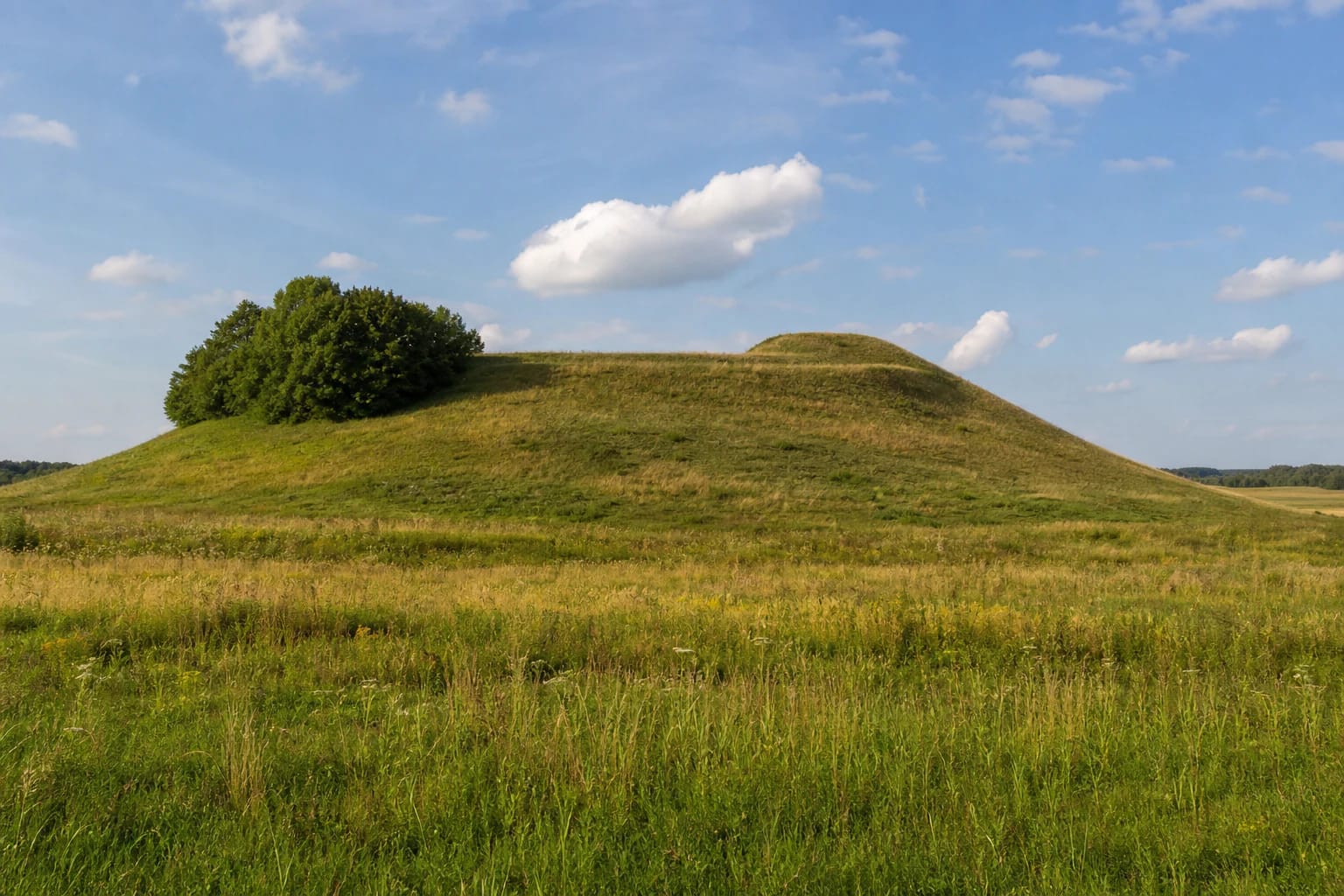
The knoll stands out in an open, rolling moraine landscape among other hills, cultivated fields, and marshy hollows. It is best understood not as the ruin of a stone castle but as an archaeological site read through the shape of the earth. From the summit, the view opens westward toward Lake Vištytis and the town, while the dark band of Vištytgiris Forest lies to the east.
A levelled rampart survives beside the 28-by-11-metre enclosure, while older visitor accounts measure the broader hill
The current Cultural Heritage Register measures an oval enclosure of roughly 28 by 11 metres. It is aligned northwest-southeast and rises slightly at its eastern end. Along the northwestern edge is a terrace about five metres wide with an outer face up to 1.5 metres steeper than the ground beyond; the register interprets it as the probable site of a rampart that was later spread and levelled.
Other figures also appear in public sources. The protected-areas visitor description calls the whole mound 20 metres high, gives its slopes an angle of 35-40 degrees, and rounds the oval summit to about 30 by 20 metres. The more narrowly defined valuable features updated in the register in 2016 and 2024 measure the surviving enclosure as 28 by 11 metres and individual slopes at up to ten metres. These are different ways of measuring a disturbed hill and its remaining archaeological elements, not evidence for two Vištytis hillforts.
The original form does not survive intact. The register records damage from long cultivation, land drainage, trenches on the summit, and a former triangulation tower. Today most of the enclosure and slopes are rough grassland, a small grove grows on the western slope, and cultivation still affects the southern foot. Look first for the subtle enclosure profile and northwestern terrace rather than expecting a tall, sharply defined bank.
The foot settlement, rough pottery, and 1962 survey reveal everyday life but no known castle name
The Cultural Heritage Register dates the complex from the end of the first millennium BC through the first millennium AD. This is broader and more precise than the shorthand first millennium often used in visitor descriptions. It does not mean that a single wooden fort stood here continuously for the whole period; the site may have had several phases of use whose boundaries remain unknown.
During a reconnaissance expedition by the Institute of History in 1962, archaeologists noticed a thin dark-grey cultural layer containing charcoal in the upper slopes. Settlement traces were recorded at the southern and northwestern foot, covering about 0.7 hectares in the older hillfort inventory. Finds included hand-built rough-surfaced pottery, structural clay daub, and burnt stones, all materials associated with buildings and daily life.
What remains unknown is equally important. The current register describes the cultural layers of both the hillfort and foot settlement as unexcavated because the 1962 work was a survey rather than a large excavation. No reliable castle name, complete defensive plan, destruction date, or specific battle is known, and colourful reconstruction should not be used to fill those gaps.
The tale of Pilė and Mindaugas explains the name Pilė's Hill but does not prove the site's history
The Cultural Heritage Register protects the site's mythological as well as archaeological character. A local tale says that the estate of a cruel lord named Kakeraitis once stood here. His youngest daughter Pilė fell in love with a serf named Mindaugas, but her father ordered the young man flogged to death and buried without a visible grave.
According to the story, Pilė carried earth in her apron at night and piled it over her beloved's grave until she had raised a high hill, then died soon afterwards. People supposedly began calling it Pilė's Hill, or simply the hillfort. The tale movingly explains a place-name, but the archaeological date reaches much further back, so Pilė and Mindaugas are not documented historical people.
The register preserves another, shorter motif: French soldiers allegedly carried earth in their caps and raised the hill to hide something. Both stories belong to folklore rather than the measured chronology of the archaeological mound. They show how a community incorporated this unusual isolated hill into cultural memory.
The approach follows a field road, and dry daylight offers the safest short climb
Approach from the Vištytis-Žinėnai road: after roughly 900 metres, turn east toward Vištyčio Laukas II and continue along the local road for about two kilometres; the mound stands approximately 200 metres south of the field road. The surface and passability of the final section can change after rain or farm work. Use the exact hillfort pin, leave your vehicle without obstructing local traffic, and never drive across cultivated land.
Official object descriptions list no separate ticket, gate, or opening schedule, but that does not make darkness the best time to visit. The ascent crosses uneven grass and can become slippery after rain; summer grass may be high, so take tick precautions. The steep natural terrain makes the summit impractical for wheelchairs and many visitors with reduced mobility. Check the latest protected-area information before setting out.
Allow 40-60 minutes for an unhurried climb, a close look at the enclosure and terrace, and the panorama. In clear weather, look toward Lake Vištytis, the town, and Vištytgiris Forest; the best view of the mound itself comes from stepping back into the meadow so its isolated profile and western grove remain visible. On 15 July 2026, the exact Google Maps listing averaged 5.0 out of 5 from five reviews. It is a high but very small and changeable visitor sample.