- Place
- Vilkaviškis District Municipality
- Region
- Suvalkija
- Type
- low natural viewing mound with short timber steps, an interpretation board, and a direction sign
- Address
- Klevų g., Pavištytis village, Vištytis eldership, Vilkaviškis District
- Coordinates
- 54.40811, 22.78639
- Visit duration
- 20-40 minutes for the viewpoint; 1-2 hours when combined with Pavištytis Hillfort and other nearby stops
- Best time
- a clear day in early spring or late autumn, when sparse foliage leaves the three lakes most visible; in summer, choose a clear morning or evening
Regykla Trys ežerai, Trijų ežerų regykla, Three Lakes Observation Point, Observation Desk Three Lakes
This is a small viewing mound, not a tower or the platform at Pavištytis Hillfort
Three Lakes Viewpoint occupies the rolling landscape beside Klevų g. in Pavištytis village. Its exact public Google Maps pin is 54.4081129, 22.7863872. Saugoma.lt calls the site Regykla Trys ežerai, while the Environment Ministry's official panorama register lists it as Trijų ežerų regykla in Vištytis Regional Park. That formal identity distinguishes it from several nearby panorama points, including the viewpoint at Pavištytis I Hillfort.
There is no tall timber or metal tower here. Official photographs show a low grass-covered mound, a short flight of timber steps with a simple handrail, a small roofed interpretation board, and a wooden direction sign on the crest. Visitors look out from the natural relief, so the sense of height comes from the surrounding Pavištytis hills rather than an observation structure.
Three Lakes Viewpoint is not the same place as Pavištytis Hillfort. The official list assigns them different coordinates and records several other easily confused panoramas nearby, including a separate viewing point in Pavištytis, Dunojaus Hill, and viewpoints towards Lake Vištytis. Navigate to the exact Three Lakes listing rather than entering only the village or hillfort name.
The panorama joins broad Lake Vištytis with two small lakes tucked between the hills
Look for three bodies of water on very different scales: Lakes Vištytis, Grabauskas, and Pakalniai. Vištytis forms the broad distant horizon, while the smaller Grabauskas and Pakalniai lie closer, held among green hills and belts of forest. This compressed perspective can make it difficult at first to tell where a shaded hollow ends and the surface of a small lake begins.
The wooden sign on the crest helps with orientation. In the official Saugoma.lt photograph, its arrows give approximate distances of 1.8 km to Lake Vištytis, 0.3 km to Lake Grabauskas, and 0.5 km to Lake Pakalniai. Treat these as orientation distances from the viewing point, not as marked walking-trail lengths or permission to cross the fields directly to each shore.
Lake Vištytis is transboundary, with most of its surface outside Lithuania. VLE records a total area of 1,860 ha, of which 381 ha lie in Lithuania, and a maximum depth of 54 m. From Three Lakes Viewpoint, the point is not to trace every shore but to understand how this large lake basin relates to much smaller waters and the high relief of the Sūduva Highland.
The Pavištytis hills explain why this part of Suvalkija resembles a lake-filled upland
Vištytis Regional Park protects the moraine landscape of the Sūduva Highland, where high, steep hills alternate with lakes in inter-ridge depressions. VLE gives the area of the park, established in 1992, as 10,428 ha. At Three Lakes Viewpoint, that protected landscape is especially legible: the water is not an isolated feature on a plain but part of a system of ridges and hollows shaped by glacial ice.
A chain of the park's highest hills extends to the south and west. The park's official description gives elevations of 285.5 m for Stankūnai Hill, 282.4 m for Pavištytis Hill, and 285 m for Dunojaus Hill, while the Dunojaus ridge rises about 110 m above Lake Vištytis. Those figures describe the scale of the wider Pavištytis massif and should not be assigned to the viewpoint's own modest mound.
Read the panorama in layers. The foreground contains the grassy mound and its simple visitor furniture; beyond it lie the basins of the smaller lakes, meadows, and forest belts; Lake Vištytis and a long wooded skyline close the view. This arrangement makes the viewpoint a concise lesson in how the last ice age formed one of south-western Lithuania's hilliest landscapes.
The three lakes are easiest to identify in clear weather and outside the full leaf season
The name does not guarantee that all three water surfaces will appear equally distinct every day. The viewpoint is low and surrounded by natural vegetation, so summer foliage, tall grass, mist, or atmospheric haze can hide the smaller patches of water. Tree crowns are more open in early spring and late autumn, while a clear day after a cold front often produces the sharpest distant lines.
Begin at the direction sign and compare each of its three arrows with the hollows in the relief. Lake Vištytis is the broadest band of water; Grabauskas and Pakalniai must be sought closer among the slopes. Compact binoculars help separate reflected water from dark forest, although the composition makes most sense when viewed without magnification.
Morning light reduces glare and models the folds of the hills, while warmer evening light separates meadow from woodland. After rain, the timber steps and grass can be slippery. Snow reveals the relief in winter, but the local road, steps, and mound may not be cleared, so photographic conditions must always be balanced against safe access.
Access is from Klevų g., but do not expect a marked car park or step-free route
The Google pin lies beside narrow Klevų g. in Pavištytis. Drive the final section slowly and look for a safe stopping place, because the official sources checked on 15 July 2026 did not identify a dedicated marked car park at this viewpoint. Do not block the road, gates, or farm access, and do not park on meadow or crops. Road-surface conditions can change after rain and in winter.
A short stretch of grass and several timber steps separate the road from the viewing point. Official photographs show one simple handrail but no ramp, level hard-surfaced path, or universal viewing platform. The uneven ground means access is not reliably step-free and may be unsuitable for a wheelchair, pushchair, or anyone with limited balance.
The Saugoma.lt object page publishes no separate admission price, staffed timetable, toilet, or visitor service at the site. Plan for a simple, unstaffed outdoor viewpoint and visit in daylight. Before making a long journey, check the official page and current signs, since access, road, and protected-area conditions can change.
Combine the short stop with the hillfort, Vištytis, and a wider regional park route
Most visitors need 20-40 minutes at the viewpoint: enough time to climb without haste, find the three lakes with the sign, change viewing direction, and descend safely. Allow up to an hour for photography or close reading of the relief. There is no long marked nature trail at the site, so never create a shortcut across private meadow or cultivated land.
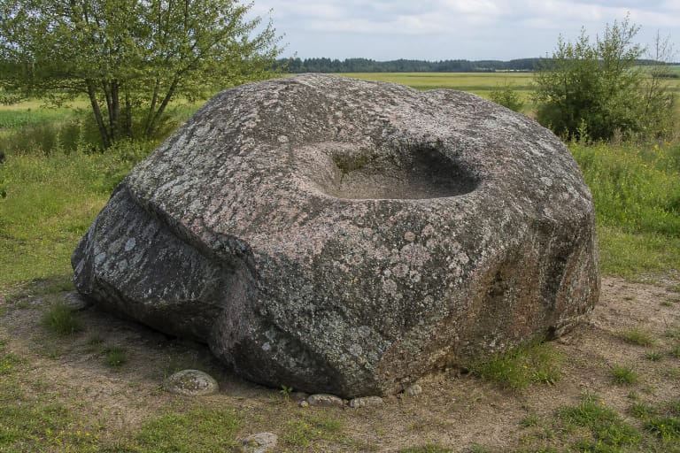
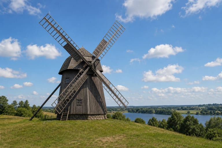
Pavištytis Hillfort adds archaeological context and another angle on the landscape, while the historic windmill makes a cultural stop in the town of Vištytis. Vištytis Stone is an immense glacial boulder left by the same ice age. When continuing through the park, stop only at officially marked viewpoints and pay attention to their names, since several nearby sites reveal different perspectives on the lake and hills.
On 15 July 2026, the exact Google Maps listing named Observation Desk Three Lakes averaged 4.8 out of 5 from 21 reviews. That meets the 4.5 selection threshold, but both the score and review count will change. The site will appeal most to travellers who enjoy reading a quiet landscape rather than expecting a high tower or extensive visitor facilities.