- Place
- Ukmergė, Ukmergė District Municipality
- Region
- Aukštaitija
- Type
- two circular wellness routes on natural-surface paths through Pivonija Forest
- Address
- Šilo Park, Antakalnio Street 74, Ukmergė, LT-20145, Lithuania
- Coordinates
- 55.23855, 24.79369
- Visit duration
- 45-75 minutes for one loop with pauses; up to 1.5 hours for a longer visit
- Best time
- daylight and drier weather; the natural surface can be wet or slippery after rain and in winter
Pivonijos šilo sveikatingumo takas, Šilo Wellness Route, Pivonija Forest Fitness Trail
The precise trailhead serves two Pivonija Forest loops, not the entire woodland
The current State Forest Enterprise recreation map identifies this facility as record RO58054, Pivonija Forest Wellness Trail. Its point at 55.23855406674795, 24.793689249829104 lies at the forest edge in Pašilė forestry district, compartment 131, plot 9. This page therefore uses it as the entrance pin rather than a centroid for Pivonija Forest. The official tourism address is Šilo Park, Antakalnio Street 74, Ukmergė.
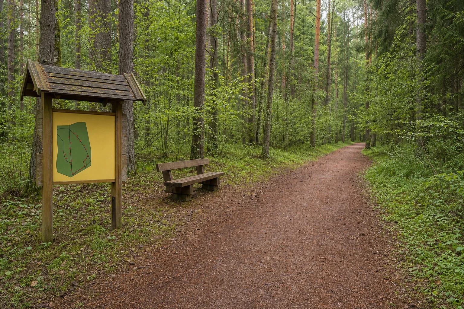
Ukmergė's official tourism listing describes two broad circular routes on natural ground: 1.65 km and 1.80 km. Together they equal the 3.45 km in the VMU manager record, and an official photograph of the trailhead diagram depicts both routes from the same starting area. They suit a short run, a walk, or a combination of exercise and rest, but the surface is neither asphalt nor a timber boardwalk.
A May 2026 municipal notice also gives approximately 5 km for the route's complete path system and says the area contains about thirty objects ranging from a bench to the large shelter. The safest reading is that this broader figure includes internal paths and connectors, not a third marked 5 km loop. Pivonija Forest is larger again, so every track visible beyond a junction should not be assumed to belong to the two visitor circuits.
The dates 2005, 2015, and 2026 describe different stages of one recreation route
The municipality dates the first Šilo wellness route to 2005, when it was installed by the former Ukmergė State Forest Enterprise. It is now managed by the Ukmergė regional division of the State Forest Enterprise, and the current VMU map assigns it to Pašilė forestry district. This is maintained public forest recreation infrastructure, not a private fitness club.
The official tourism website separately says that the wellness trail was formed in the forest in 2015. The two dates can be reconciled by the different actions they describe: the facility was first installed in 2005, while its present pair of 1.65 and 1.80 km loops was formed or renewed in 2015. The official sources do not publish a construction drawing comparing both layouts, so this is a careful reconciliation, not a claim that the 2005 and 2015 routes were identical.
The latest condition update is dated 22 May 2026. Ukmergė District Municipality confirmed that VMU repaired the shelters and exercise stations, added new benches, and installed swings and a punching bag. Older reports about rotten equipment being dismantled describe the preceding maintenance phase, not the current condition after the completed renewal.
The forest carries the memory of Pivonija's vanished interwar resort
A settlement began to take shape at Pivonija on the right bank of the Šventoji in 1929, followed by a park. The locality received resort rights in 1932. Ukmergė's timber kurhaus opened here in 1935 with modern amenities for its time, and 20 hectares were allocated to the resort park. That history explains why a route combining movement and rest in this forest is more than a recent fitness fashion.
The official tourism description is equally clear that only a nostalgic memory of the Pivonija resort remains today. Do not expect a surviving kurhaus, a reconstructed resort ensemble, or a ticketed museum along the loops. The value is in the woodland landscape and its connection with the way Ukmergė residents used the area for recreation between the wars.
Here, wellness describes active movement, woodland, and rest rather than medical treatment or a guaranteed health effect. Nor is this a conventional interpretation trail with a continuous nature or history exhibition. Its core is the pair of walking routes, rest infrastructure, and exercise stops.
On a natural-surface route, choosing a loop matters more than counting every facility
Both loops follow broad forest tracks among conifers and deciduous trees. The surface consists of compacted natural soil, needles, small roots, and patches affected by seasonal moisture. It is straightforward for an everyday walk in dry weather, but rain, thaw, or ice can make the same ground soft or slippery.
The 2026 renewal confirms shelters, benches, exercise equipment, swings, and a punching bag. The municipality's count of approximately thirty objects does not mean thirty fitness stations: it includes infrastructure of different sizes, from benches to the main roofed shelter. Check any moving or suspended equipment before use and do not alter its construction.
An entrance diagram and a shared walking and cycling sign are documented at the trailhead, but the official pages do not publish a continuous colour-blaze system or a GPX track. Photograph the diagram, save the start pin, and check at junctions that you remain on your chosen circuit. The difference between 1.65 and 1.80 km is small, and neither loop has an official difficulty grade.
The open forest facility has no published ticket office, but not every amenity is confirmed
The checked official object pages publish no admission fee, ticket office, gate schedule, or booking requirement. This is open forest recreation infrastructure. Physical access does not mean that the trail is lit, patrolled, or cleared in winter, so daylight and footwear suited to the season remain the prudent choice.
The VMU coordinate marks the trailhead, but official sources do not identify a dedicated car park or accessible bays. Leave a vehicle only where permitted, keep the forest road passable, and do not drive onto the routes. No official confirmation was found for toilets, drinking water, lighting, bicycle hire, or food service, so bring water and plan those needs before entering the forest.
Broad paths and benches may help some visitors, but natural soil, mud, roots, and unverified parking and toilet facilities mean that the full loop cannot be described as a certified wheelchair-accessible route. A robust pushchair may manage the smoother parts in dry conditions, but this is not an official step-free guarantee.
Current rules and a safe way to fit the trail into a day in Ukmergė
On 19 July 2026 the VMU map showed an active recreation object, and the latest municipal notice invited visitors to use the renewed route; no object-specific closure was posted. General VMU rules still prohibit entering an area where timber work or forest protection operations are under way and warning signs or visible Stop tape have been placed. A temporary notice on site always takes priority over a general web description.
Runners, walkers, cyclists, and people with pets share these tracks. Ride slowly enough to pass safely and keep a dog under control near other visitors. The municipality asks everyone to protect nature, avoid littering, refrain from dismantling or damaging equipment, and respect other users. After high winds or wet snow, watch more carefully for branches and unstable trees.
Allow roughly 45-75 minutes for one loop with short pauses. After the forest, return to central Ukmergė for Castle Park, Ukmergė Hillfort, or the local history museum. Plan the Old Fire Tower only after checking its separate access arrangements, since it is not a freely accessible park viewpoint.