- Place
- Molėtai District Municipality
- Region
- Molėtai District
- Type
- linear, wild-feeling Lake Asveja shore trail with a steep pine slope, stairs, a suffosion cirque, educational installations, and rest places
- Address
- Giraičiai village area, Dubingiai eldership, Molėtai District
- Coordinates
- 55.04720, 25.50050
- Visit duration
- about 1.5-3 hours for the roughly 3.6 km outward-and-return walk, excluding long lakeside stops
- Best time
- April-October in dry weather; lake views widen without foliage, but the slope and stairs can be slippery after rain, in frost, or during winter
Liudgarda Slope Trail, Liudgardas Slope Trail, Liudgardas Slope
This is a 1.8 km linear trail, so the full return comes close to 4 km
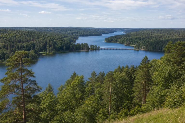
Liudgardas Slope Nature Trail begins near Giraičiai on the high northern shore of Lake Asveja and leads to the mouth of the Baluoša Stream. Both the official Saugoma.lt entry and VLE give a distance of about 1.8 km one way and describe a linear route. It is not a 1.8 km loop: walking all the way to the Baluoša and returning on the same trail makes about 3.6 km, while using the forest-road alternative can alter the total slightly. For practical planning, allow roughly 4 km and 1.5-3 hours.
The first part lies at Liudgardas Slope itself; the far end reaches the Baluoša, which enters Asveja from Lake Baluošas. The official descriptions do not promise a stream crossing or a loop back along the opposite bank. Check the current diagram and markers at the first information panel, particularly if you intend to use the forest road rather than repeat the shore path.
Coordinates 55.0472, 25.5005 come from Saugoma.lt's official directions point. They are labelled representative because they identify the Liudgardas Slope and trail-start area, not a verified parking bay, the exact centre of the first stair, or the Baluoša mouth.
A 20-25 m slope means stairs, natural ground, and lake views between pines
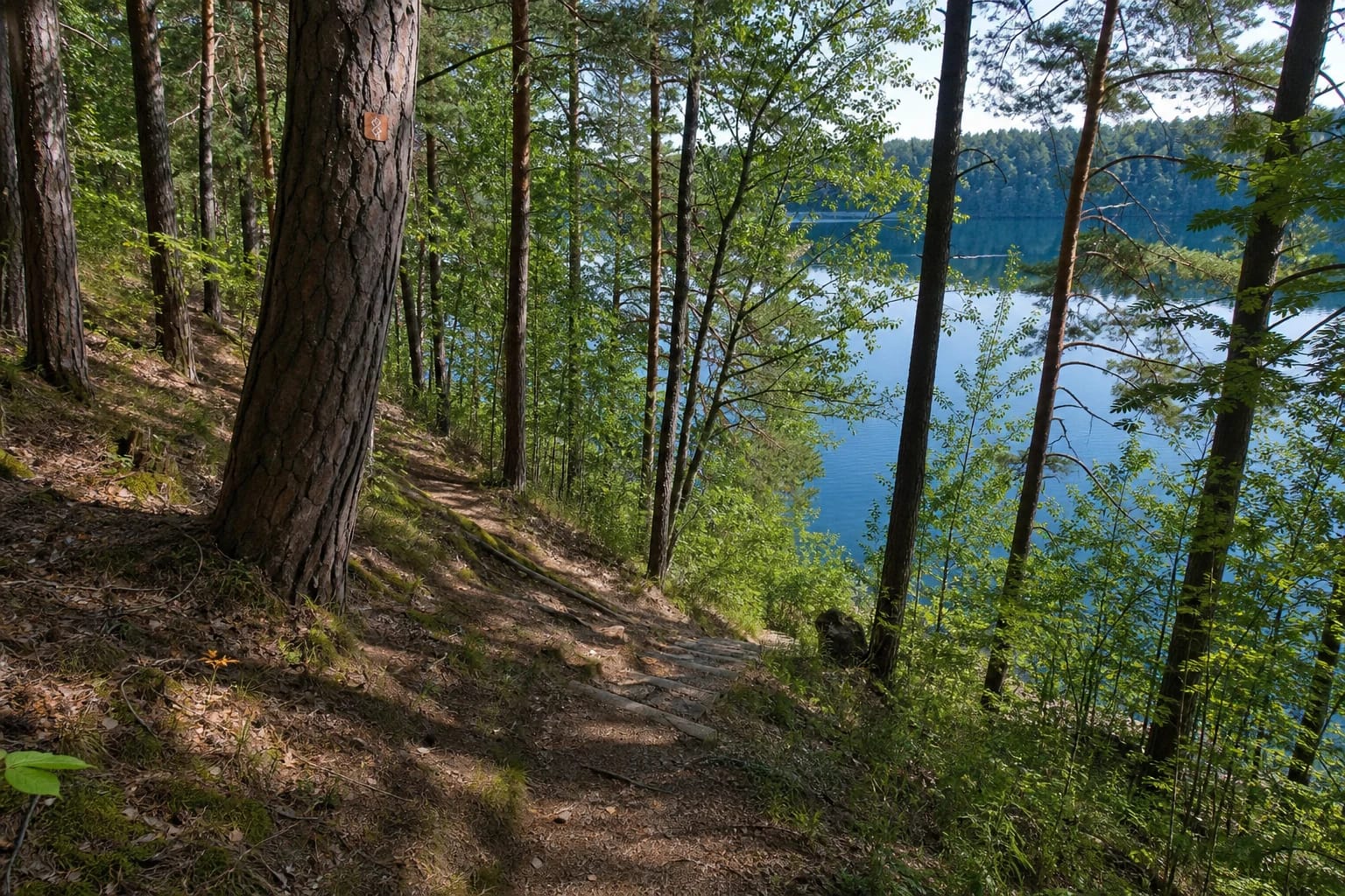
Liudgardas Slope extends for roughly 570 m. The stated distance from its upper edge to the lake is about 60 m, while its vertical height is approximately 20-25 m. Mature pine forest covers the slope, which faces Vainikai Island. The steep side of Asveja's glacial channel, rather than a purpose-built tower, creates the defining view.
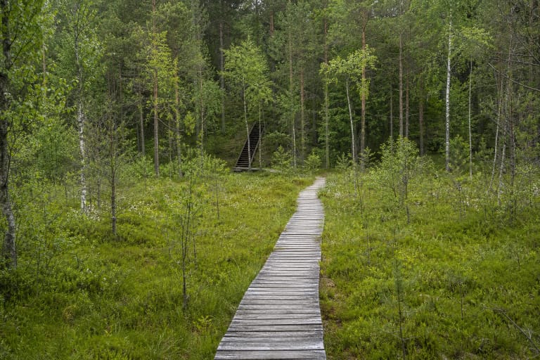
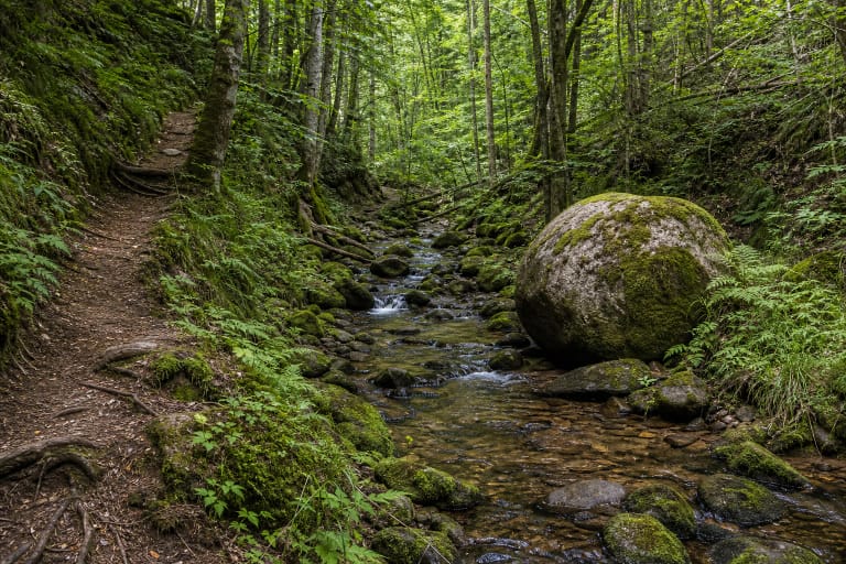
Official photographs and current route images show a narrow natural forest path with some fine-gravel reinforcement, exposed roots, stones, and stair sections. It is not a continuous timber boardwalk, paved promenade, or level cycle route. Views of Asveja appear through trees and beside the water, so summer foliage can narrow them; the official trail description does not promise a separate elevated viewing platform.
An interpretive system, playful educational installations, benches, and rest places stand along the route. Tree markers help distinguish direction, but colours and individual plates may change or suffer damage over time. Read the diagram at the start rather than navigating solely from an old photograph on a phone.
The suffosion cirque explains why shortcuts over the slope edge are unsafe
Near the middle of the trail is a suffosion cirque, a rounded hollow created when groundwater carries fine sand particles out of a slope. Its shape resembles a natural amphitheatre. The route passes above it, and a small stone model nearby explains the process without requiring visitors to descend into the hollow.
Suffosion is not a decorative pit or an abandoned quarry. It demonstrates that groundwater continues to alter Asveja's sandy slope, making shortcuts across the edge both unsafe and damaging. Loose ground and stairs can become much more slippery than they look from above after prolonged rain or spring snowmelt.
Asveja is a glacial-runnel lake with high, sandy shores largely covered in pine forest. VLE gives a length of 21.9 km, 29.7 km including bays, and a maximum depth of 50.2 m. Liudgardas turns those statistics into visible relief: a narrow stretch of water, high shore, Vainikai Island, and the Baluoša inflow form one landscape sequence.
The trail ends at the Baluoša; the Žverna is elsewhere in the park
The official Liudgardas trail description leads to the mouth of the Baluoša Stream. The Baluoša enters Asveja from Lake Baluošas and marks one end of this linear route. The Žverna name appears in wider Asveja itineraries, but the Žverna Hydrographic Reserve protects a different stream and valley and is not this nature trail's endpoint.
Liudgardas should not be merged with the nearby Gurakalnė bog, Jurkiškis Stream Trail, or the Dubingiai Castle Site route either. Gurakalnė presents a wetland, Jurkiškis a narrow stony stream valley, and Liudgardas the high shore of Asveja followed as far as the Baluoša mouth. They have separate starts, different distances, and different terrain.
The Liudgarda story is recorded oral tradition, not a confirmed Radziwiłł biography
The official object title uses the Lithuanian form Liudgardo šlaito, while the body of the same Saugoma.lt entry also uses Liudgardos šlaito. Both relate to the Liudgarda place name. Current authoritative park descriptions provide no single, document-based derivation, so the name should not be turned into a precisely identified historical person.
In the 1971 book Dubingių apylinkės, which synthesised a multidisciplinary field expedition, geographer Česlovas Kudaba recorded a story told by local elders: a reclusive Radziwiłł daughter named Liudgarda was said to have favoured this corner, but wars among nobles prevented her from building a palace here. The passage explicitly presents the story as an account from old people, making it documented oral tradition rather than a genealogically or archaeologically verified fact. Visitors should not be given invented dates for Liudgarda or a supposed palace site.
Parking, present condition, safety, and the voluntary visitor ticket
Saugoma.lt describes an asphalt approach followed by roughly 200 m of forest road. It directs visitors to leave their car near the Oro Dubingiai recreation site and walk about 200 m to the trail. This is not a promise of reserved public spaces, a particular capacity, toilets, or access to other privately operated facilities. Follow local signs, do not block the forest road, and do not drive onto the slope merely because navigation suggests a closer point.
The Aukštaitija Protected Areas Directorate's 2024 report includes Liudgardas among four maintained nature trails in Asveja Regional Park and marks its wider infrastructure-maintenance target as completed. That supports evidence of scheduled maintenance, but it is not a July 2026 technical inspection of every stair, bench, and marker. After storms, heavy rain, or winter, ask the Asveja Regional Park visitor centre about fallen trees, erosion, and slippery steps by calling +370 626 53014 or emailing asvejos.rp@saugoma.lt.
The trail is not adapted for visitors with mobility impairments; steep ground, stairs, and a narrow uneven tread also make it unsuitable for an ordinary pushchair. Keep children away from the slope edge and water, wear footwear with grip, use tick protection, and plan to return in daylight. The official trail page publishes no separate opening hours or mandatory admission fee. In 2026, a one-day Asveja Regional Park visitor ticket costs €1 and is voluntary for individual visitors; check the current terms before purchase.